4824 x 3323 px | 40,8 x 28,1 cm | 16,1 x 11,1 inches | 300dpi
Aufnahmedatum:
1844
Ort:
England
Weitere Informationen:
Dieses Bild kann kleinere Mängel aufweisen, da es sich um ein historisches Bild oder ein Reportagebild handel
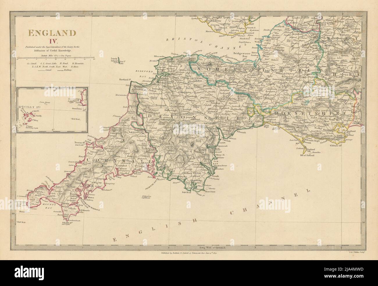
ENGLAND, W., South West; inset Scilly Isles. Artist/engraver/cartographer: Engraved by J & C Walker. Provenance: "Maps of the Society for the Diffusion of Useful Knowledge", published by Chapman & Hall, London, under the Superintendence of the Society for the Diffusion of Useful Knowledge [SDUK Atlas]. Type: Antique steel engraved map with original outline hand colouring (coloring). The map, engraved in 1830 at the dawn of the railway age, shows one of the earliest railways ever constructed: the Plymouth and Dartmoor Railway, a 4 ft 6 in (1, 372 mm) gauge railway, built with the intention of improving the moorland areas around Princetown. In fact granite quarries provided the dominant traffic. The railway was a toll railway (where independent carriers operated horse-drawn wagons and paid the company a toll). It had opened in 1823.