Schnellfilter:
Zedernmesa sandstein Stockfotos & Bilder
 Einen dramatischen Bogen aus Cedar Mesa Sandstein gesehen vom oberen Salt Creek Canyon im Needles District des Canyonlands National Park, Utah, USA Stockfotohttps://www.alamy.de/image-license-details/?v=1https://www.alamy.de/stockfoto-einen-dramatischen-bogen-aus-cedar-mesa-sandstein-gesehen-vom-oberen-salt-creek-canyon-im-needles-district-des-canyonlands-national-park-utah-usa-173140232.html
RFM1K63M–Einen dramatischen Bogen aus Cedar Mesa Sandstein gesehen vom oberen Salt Creek Canyon im Needles District des Canyonlands National Park, Utah, USA
 Sipapu Bridge über White Canyon im Herbst, Natural Bridges National Monument, Utah Stockfotohttps://www.alamy.de/image-license-details/?v=1https://www.alamy.de/sipapu-bridge-uber-white-canyon-im-herbst-natural-bridges-national-monument-utah-image355407275.html
RF2BJ65GY–Sipapu Bridge über White Canyon im Herbst, Natural Bridges National Monument, Utah
 Castle Butte, Cedar Mesa Sandsteinformation im Valley of the Gods, Bears Ears National Monument, Utah, USA Stockfotohttps://www.alamy.de/image-license-details/?v=1https://www.alamy.de/castle-butte-cedar-mesa-sandsteinformation-im-valley-of-the-gods-bears-ears-national-monument-utah-usa-image360925273.html
RF2BY5FT9–Castle Butte, Cedar Mesa Sandsteinformation im Valley of the Gods, Bears Ears National Monument, Utah, USA
 Nahezu horizontale Permian Cedar Mesa Sandstein und darüber liegende Trias-Jurassic Strata, Canyonlands National Park, SE Utah. North Six-Shooter Peka punctu Stockfotohttps://www.alamy.de/image-license-details/?v=1https://www.alamy.de/nahezu-horizontale-permian-cedar-mesa-sandstein-und-daruber-liegende-trias-jurassic-strata-canyonlands-national-park-se-utah-north-six-shooter-peka-punctu-image442798611.html
RF2GMB643–Nahezu horizontale Permian Cedar Mesa Sandstein und darüber liegende Trias-Jurassic Strata, Canyonlands National Park, SE Utah. North Six-Shooter Peka punctu
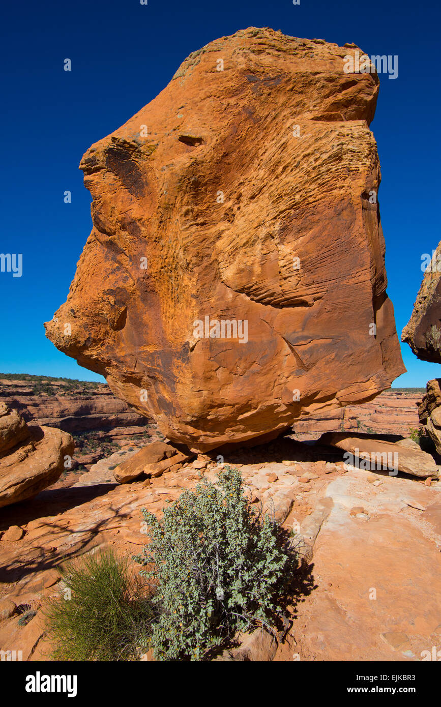 Cedar Mesa ausgeglichen Sandstein Felsen in der Nähe der Zitadelle Anasazi-Ruinen - Utah Stockfotohttps://www.alamy.de/image-license-details/?v=1https://www.alamy.de/stockfoto-cedar-mesa-ausgeglichen-sandstein-felsen-in-der-nahe-der-zitadelle-anasazi-ruinen-utah-80331639.html
RMEJKBR3–Cedar Mesa ausgeglichen Sandstein Felsen in der Nähe der Zitadelle Anasazi-Ruinen - Utah
 Blick auf das Tal mit Trail in der Insel im Himmel Bereich der Canyonlands National Park, Utah. Stockfotohttps://www.alamy.de/image-license-details/?v=1https://www.alamy.de/blick-auf-das-tal-mit-trail-in-der-insel-im-himmel-bereich-der-canyonlands-national-park-utah-image230906882.html
RMRBJM2A–Blick auf das Tal mit Trail in der Insel im Himmel Bereich der Canyonlands National Park, Utah.
 UT00623-00...UTAH - Morgenlicht an einem bewölkten Morgen im Valley of the Gods. Stockfotohttps://www.alamy.de/image-license-details/?v=1https://www.alamy.de/ut00623-00utah-morgenlicht-an-einem-bewolkten-morgen-im-valley-of-the-gods-image359374802.html
RM2BTJX6A–UT00623-00...UTAH - Morgenlicht an einem bewölkten Morgen im Valley of the Gods.
 USA, Utah, Natural Bridges National Monument, Owachomo Bridge besteht aus Cedar Mesa Sandstein. Stockfotohttps://www.alamy.de/image-license-details/?v=1https://www.alamy.de/usa-utah-natural-bridges-national-monument-owachomo-bridge-besteht-aus-cedar-mesa-sandstein-image233086317.html
RMRF5YY9–USA, Utah, Natural Bridges National Monument, Owachomo Bridge besteht aus Cedar Mesa Sandstein.
 Cedar Mesa Sandsteinformationen bei Sonnenaufgang im Needles District des Canyonlands National Park, Utah. Stockfotohttps://www.alamy.de/image-license-details/?v=1https://www.alamy.de/cedar-mesa-sandsteinformationen-bei-sonnenaufgang-im-needles-district-des-canyonlands-national-park-utah-image484915383.html
RM2K4WPEF–Cedar Mesa Sandsteinformationen bei Sonnenaufgang im Needles District des Canyonlands National Park, Utah.
 USA, Utah, Glen Canyon National Recreation Area, Cedar mesa Sandstein am Muley Point und Blick nach Osten in der Abenddämmerung mit dem nahe gelegenen butte und entfernten Raplee Ridge. Stockfotohttps://www.alamy.de/image-license-details/?v=1https://www.alamy.de/usa-utah-glen-canyon-national-recreation-area-cedar-mesa-sandstein-am-muley-point-und-blick-nach-osten-in-der-abenddammerung-mit-dem-nahe-gelegenen-butte-und-entfernten-raplee-ridge-image441657268.html
RM2GJF69T–USA, Utah, Glen Canyon National Recreation Area, Cedar mesa Sandstein am Muley Point und Blick nach Osten in der Abenddämmerung mit dem nahe gelegenen butte und entfernten Raplee Ridge.
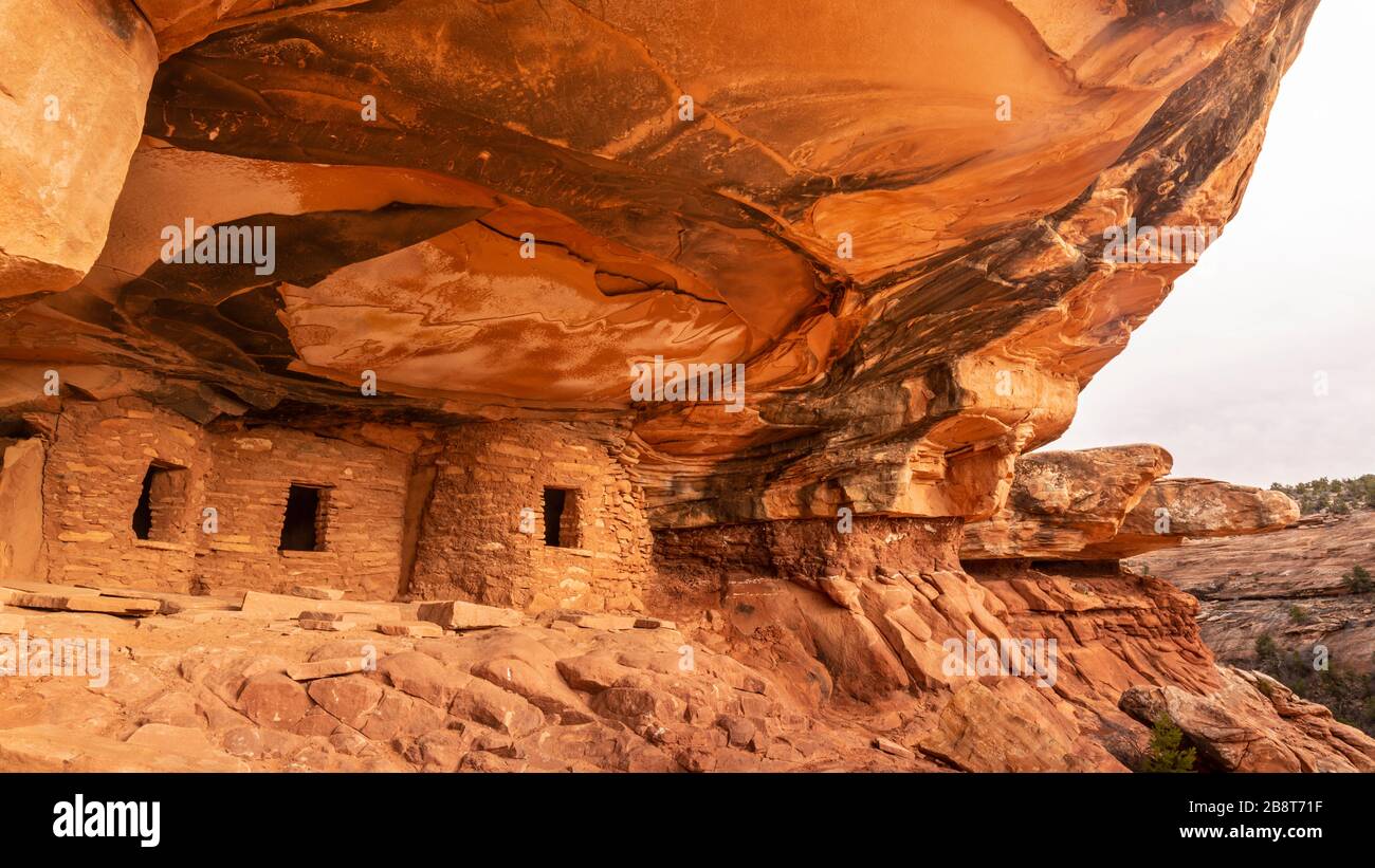 Kultige verfallene Dachruine im Road Canyon auf Cedar Mesa in Bears Ears National Monument, Utah. Stockfotohttps://www.alamy.de/image-license-details/?v=1https://www.alamy.de/kultige-verfallene-dachruine-im-road-canyon-auf-cedar-mesa-in-bears-ears-national-monument-utah-image349656987.html
RF2B8T71F–Kultige verfallene Dachruine im Road Canyon auf Cedar Mesa in Bears Ears National Monument, Utah.
 Sandsteinpfäste, Türme und Mesas im Valley of the Gods, Utah. Stockfotohttps://www.alamy.de/image-license-details/?v=1https://www.alamy.de/sandsteinpfaste-turme-und-mesas-im-valley-of-the-gods-utah-image456245955.html
RF2HE7PAB–Sandsteinpfäste, Türme und Mesas im Valley of the Gods, Utah.
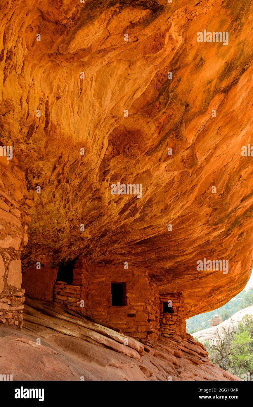 House on Fire, Puebloan Cliff Wohnung in Mule Canyon auf Cedar Mesa. Stockfotohttps://www.alamy.de/image-license-details/?v=1https://www.alamy.de/house-on-fire-puebloan-cliff-wohnung-in-mule-canyon-auf-cedar-mesa-image440131127.html
RF2GG1KMR–House on Fire, Puebloan Cliff Wohnung in Mule Canyon auf Cedar Mesa.
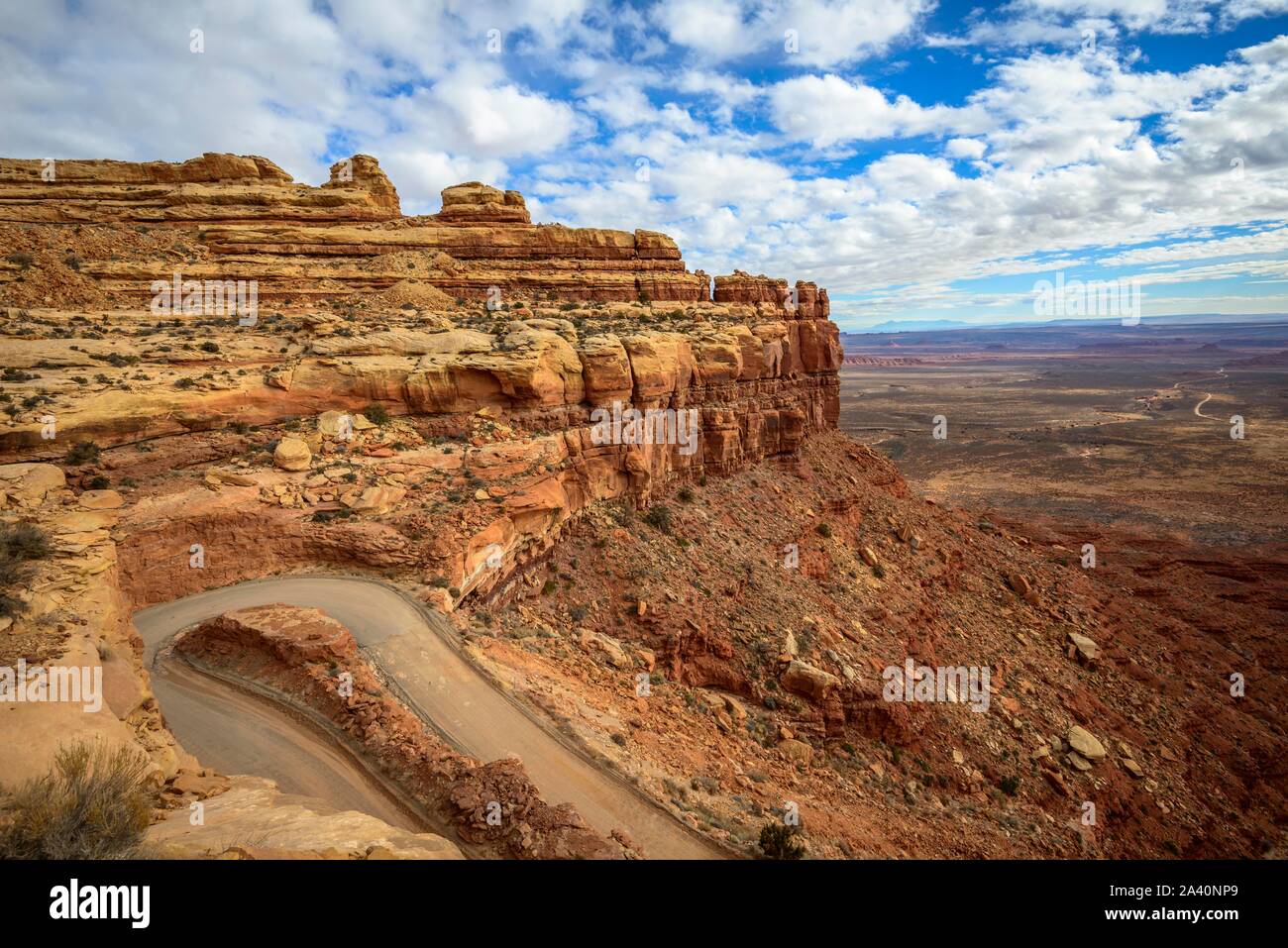 Moki Dugway führt in Serpentinen durch die Steilwand des Cedar Mesa, Blick auf das Tal der Götter, Bären Ohren National Monument, Utah State Stockfotohttps://www.alamy.de/image-license-details/?v=1https://www.alamy.de/moki-dugway-fuhrt-in-serpentinen-durch-die-steilwand-des-cedar-mesa-blick-auf-das-tal-der-gotter-baren-ohren-national-monument-utah-state-image329472705.html
RF2A40NP9–Moki Dugway führt in Serpentinen durch die Steilwand des Cedar Mesa, Blick auf das Tal der Götter, Bären Ohren National Monument, Utah State
 Dramatische Cedar Mesa Sandstein-Formationen von Elephant Hill, Utah Stockfotohttps://www.alamy.de/image-license-details/?v=1https://www.alamy.de/dramatische-cedar-mesa-sandstein-formationen-von-elephant-hill-utah-image1117899.html
RFAH0ECC–Dramatische Cedar Mesa Sandstein-Formationen von Elephant Hill, Utah
 Owachomo Natural Bridge im Natural Bridges National Monument, Utah Stockfotohttps://www.alamy.de/image-license-details/?v=1https://www.alamy.de/owachomo-natural-bridge-im-natural-bridges-national-monument-utah-image433651939.html
RM2G5EFD7–Owachomo Natural Bridge im Natural Bridges National Monument, Utah
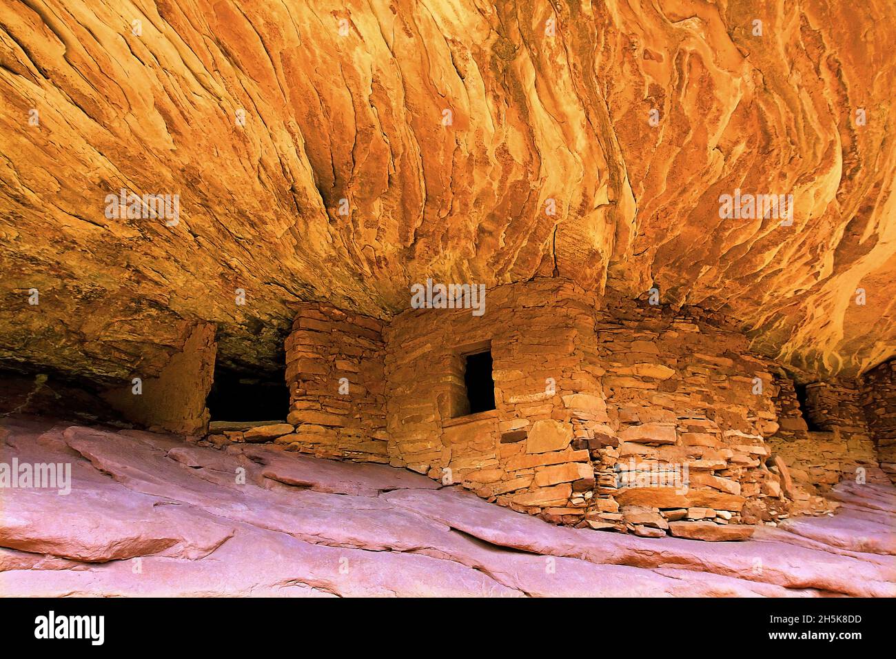 „House on Fire“-Ruinen der uralten Pueblos-Klippenhäuser, Steinstrukturen, die in die dramatischen, zerklüfteten adobe-Klippen in Cedar Mesa am S... Stockfotohttps://www.alamy.de/image-license-details/?v=1https://www.alamy.de/house-on-fire-ruinen-der-uralten-pueblos-klippenhauser-steinstrukturen-die-in-die-dramatischen-zerklufteten-adobe-klippen-in-cedar-mesa-am-s-image450966585.html
RF2H5K8DD–„House on Fire“-Ruinen der uralten Pueblos-Klippenhäuser, Steinstrukturen, die in die dramatischen, zerklüfteten adobe-Klippen in Cedar Mesa am S...
 Cedar Mesa Cliffs mit Moki Dugway, Utah Stockfotohttps://www.alamy.de/image-license-details/?v=1https://www.alamy.de/cedar-mesa-cliffs-mit-moki-dugway-utah-image467469654.html
RF2J4F28P–Cedar Mesa Cliffs mit Moki Dugway, Utah
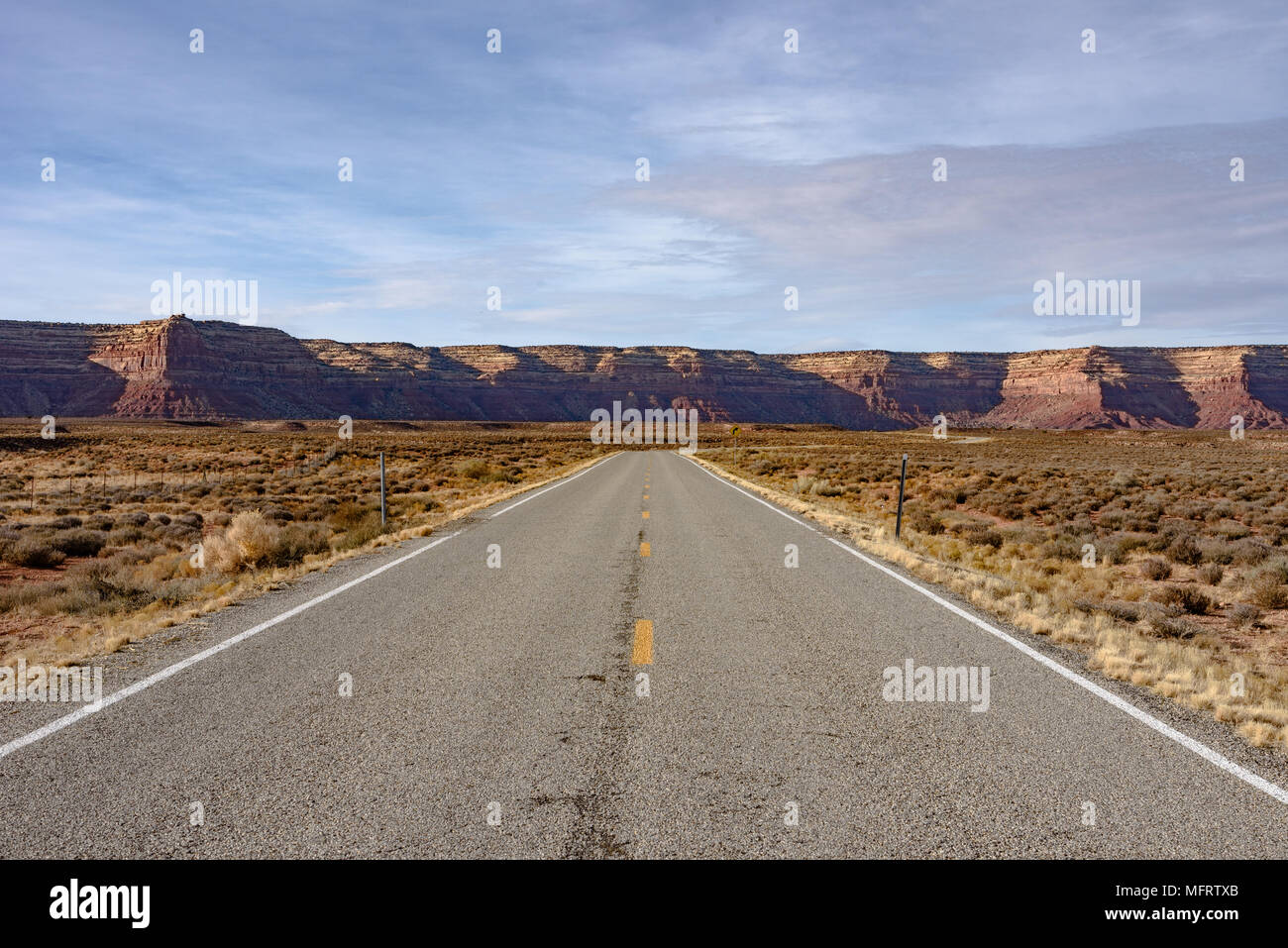 Die Straße, die zum Mokee/Moki Dugway und Cedar Mesa in Utah Stockfotohttps://www.alamy.de/image-license-details/?v=1https://www.alamy.de/die-strasse-die-zum-mokeemoki-dugway-und-cedar-mesa-in-utah-image181847971.html
RMMFRTXB–Die Straße, die zum Mokee/Moki Dugway und Cedar Mesa in Utah
 Backpacking Route durch einen Riss in einem Fin in Salt Creek Canyon im Needles District des Canyonlands National Park, Utah, USA Stockfotohttps://www.alamy.de/image-license-details/?v=1https://www.alamy.de/stockfoto-backpacking-route-durch-einen-riss-in-einem-fin-in-salt-creek-canyon-im-needles-district-des-canyonlands-national-park-utah-usa-173251069.html
RFM1T7E5–Backpacking Route durch einen Riss in einem Fin in Salt Creek Canyon im Needles District des Canyonlands National Park, Utah, USA
 Sipapu Bridge über White Canyon im Herbst, Natural Bridges National Monument, Utah Stockfotohttps://www.alamy.de/image-license-details/?v=1https://www.alamy.de/sipapu-bridge-uber-white-canyon-im-herbst-natural-bridges-national-monument-utah-image355406666.html
RF2BJ64R6–Sipapu Bridge über White Canyon im Herbst, Natural Bridges National Monument, Utah
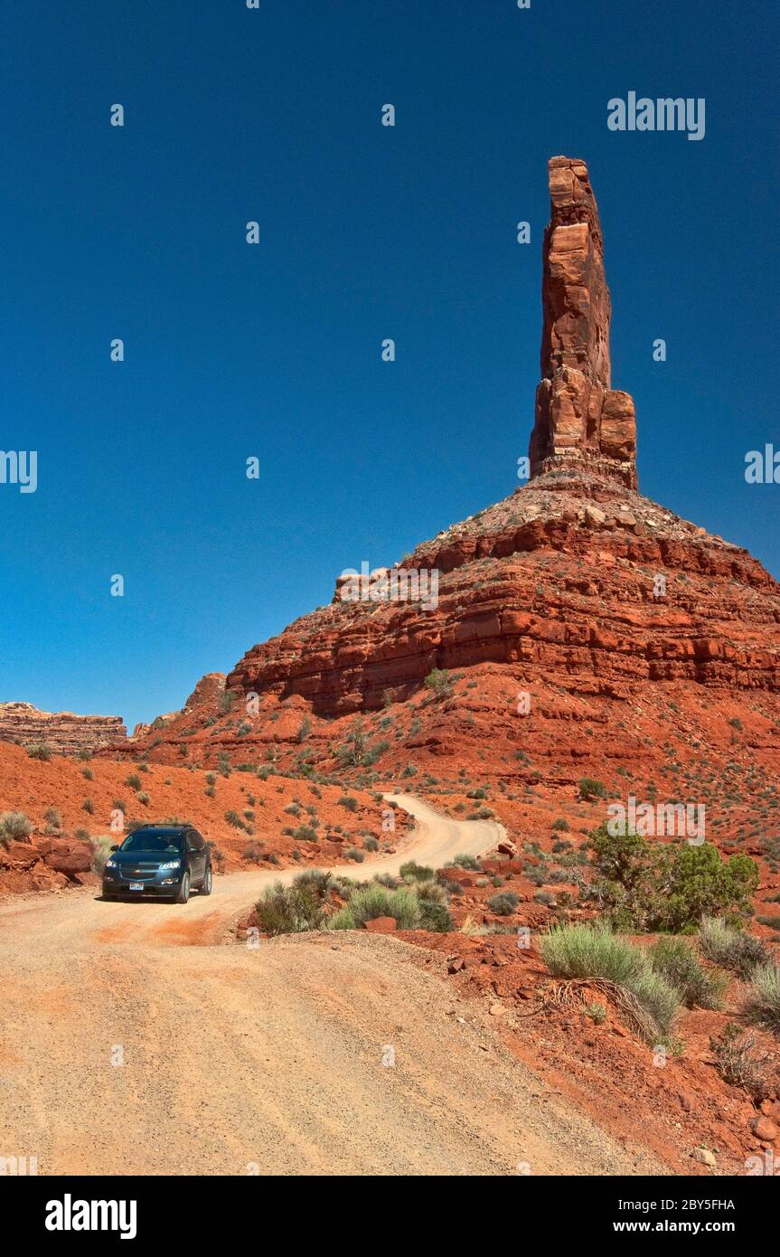 Fahrzeug auf unbefestigten Straßen, Castle Butte, Cedar Mesa Sandsteinformation im Valley of the Gods, Bears Ears National Monument, Utah, USA Stockfotohttps://www.alamy.de/image-license-details/?v=1https://www.alamy.de/fahrzeug-auf-unbefestigten-strassen-castle-butte-cedar-mesa-sandsteinformation-im-valley-of-the-gods-bears-ears-national-monument-utah-usa-image360925078.html
RF2BY5FHA–Fahrzeug auf unbefestigten Straßen, Castle Butte, Cedar Mesa Sandsteinformation im Valley of the Gods, Bears Ears National Monument, Utah, USA
 Nahezu horizontale Permian Cedar Mesa Sandstein und darüber liegende Trias-Jurassic Strata, Canyonlands National Park, SE Utah. North Six-Shooter Peka punctu Stockfotohttps://www.alamy.de/image-license-details/?v=1https://www.alamy.de/nahezu-horizontale-permian-cedar-mesa-sandstein-und-daruber-liegende-trias-jurassic-strata-canyonlands-national-park-se-utah-north-six-shooter-peka-punctu-image442798612.html
RF2GMB644–Nahezu horizontale Permian Cedar Mesa Sandstein und darüber liegende Trias-Jurassic Strata, Canyonlands National Park, SE Utah. North Six-Shooter Peka punctu
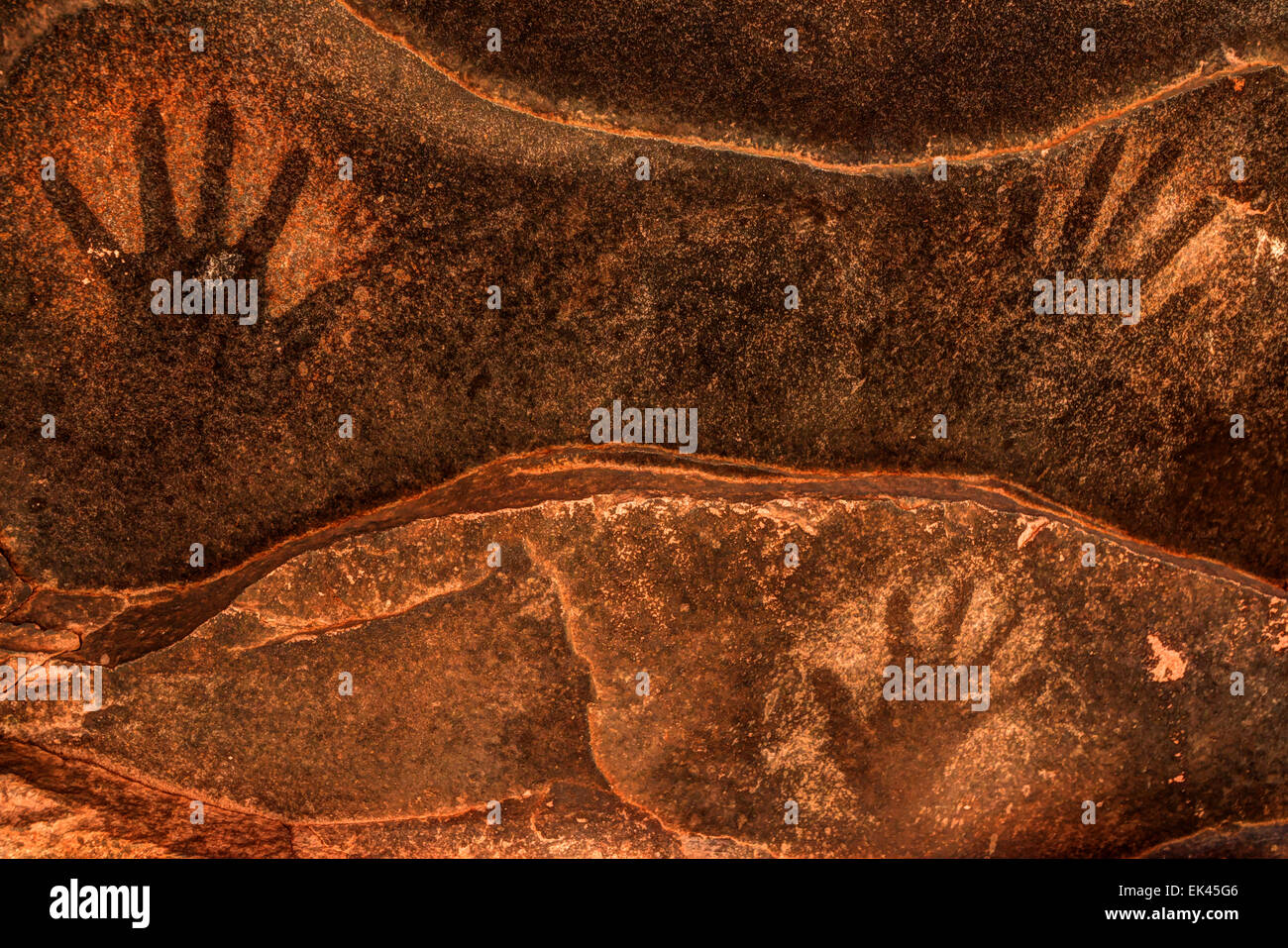 Alten anasazi Sandstein Handabzüge - Cedar Mesa - Utah Stockfotohttps://www.alamy.de/image-license-details/?v=1https://www.alamy.de/stockfoto-alten-anasazi-sandstein-handabzuge-cedar-mesa-utah-80612118.html
RMEK45G6–Alten anasazi Sandstein Handabzüge - Cedar Mesa - Utah
 Steile kurvenreiche Straße hinunter in ein Tal in der Insel im Himmel, Canyonlands National Park, Utah, USA. Stockfotohttps://www.alamy.de/image-license-details/?v=1https://www.alamy.de/steile-kurvenreiche-strasse-hinunter-in-ein-tal-in-der-insel-im-himmel-canyonlands-national-park-utah-usa-image230906833.html
RMRBJM0H–Steile kurvenreiche Straße hinunter in ein Tal in der Insel im Himmel, Canyonlands National Park, Utah, USA.
 UT00630-00...UTAH - farbenfroher Sandstein in perfekten Schichten vom Moki Dugway aus gesehen, einer Straße, die steil zum Kamm von Cedar Mesa führt. Stockfotohttps://www.alamy.de/image-license-details/?v=1https://www.alamy.de/ut00630-00utah-farbenfroher-sandstein-in-perfekten-schichten-vom-moki-dugway-aus-gesehen-einer-strasse-die-steil-zum-kamm-von-cedar-mesa-fuhrt-image359393450.html
RM2BTKP0A–UT00630-00...UTAH - farbenfroher Sandstein in perfekten Schichten vom Moki Dugway aus gesehen, einer Straße, die steil zum Kamm von Cedar Mesa führt.
 USA, Utah, Natural Bridges National Monument, Owachomo Bridge besteht aus Cedar Mesa Sandstein. Stockfotohttps://www.alamy.de/image-license-details/?v=1https://www.alamy.de/usa-utah-natural-bridges-national-monument-owachomo-bridge-besteht-aus-cedar-mesa-sandstein-image233086432.html
RMRF603C–USA, Utah, Natural Bridges National Monument, Owachomo Bridge besteht aus Cedar Mesa Sandstein.
 Cedar Mesa Sandsteinformationen bei Sonnenaufgang im Needles District des Canyonlands National Park, Utah. Stockfotohttps://www.alamy.de/image-license-details/?v=1https://www.alamy.de/cedar-mesa-sandsteinformationen-bei-sonnenaufgang-im-needles-district-des-canyonlands-national-park-utah-image484915331.html
RM2K4WPCK–Cedar Mesa Sandsteinformationen bei Sonnenaufgang im Needles District des Canyonlands National Park, Utah.
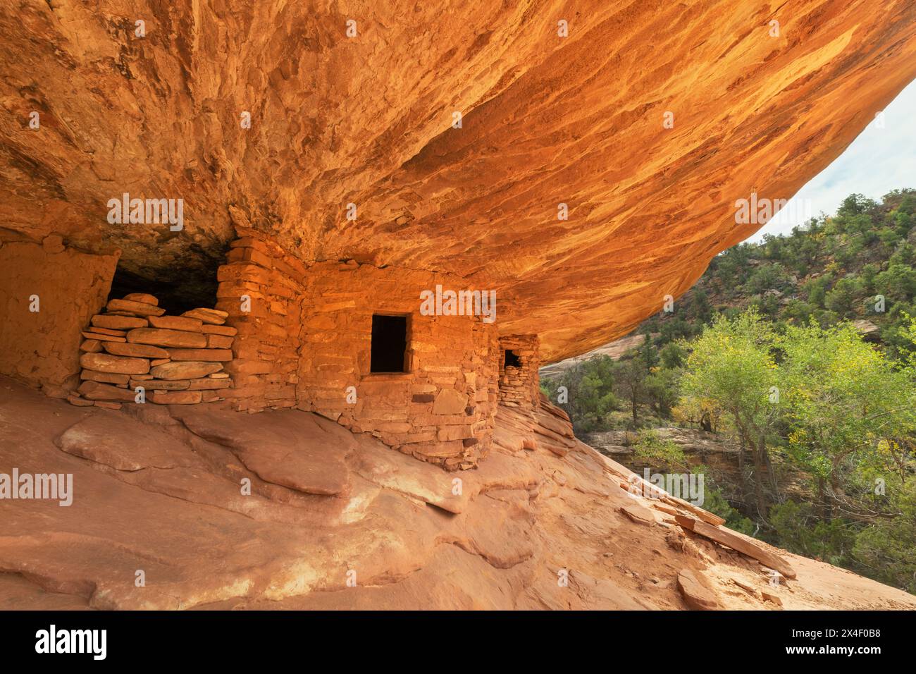 House on Fire Ruins Mule Canyon Cedar Mesa Bears Ears National Monument, Utah. Stockfotohttps://www.alamy.de/image-license-details/?v=1https://www.alamy.de/house-on-fire-ruins-mule-canyon-cedar-mesa-bears-ears-national-monument-utah-image605151100.html
RF2X4F0B8–House on Fire Ruins Mule Canyon Cedar Mesa Bears Ears National Monument, Utah.
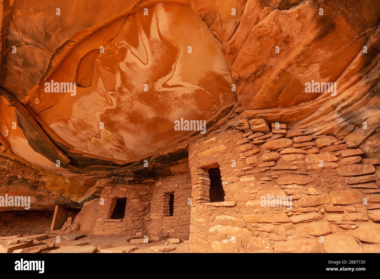 Kultige verfallene Dachruine im Road Canyon auf Cedar Mesa in Bears Ears National Monument, Utah. Stockfotohttps://www.alamy.de/image-license-details/?v=1https://www.alamy.de/kultige-verfallene-dachruine-im-road-canyon-auf-cedar-mesa-in-bears-ears-national-monument-utah-image349657000.html
RF2B8T720–Kultige verfallene Dachruine im Road Canyon auf Cedar Mesa in Bears Ears National Monument, Utah.
 Valley of the Gods, Utah. Stockfotohttps://www.alamy.de/image-license-details/?v=1https://www.alamy.de/valley-of-the-gods-utah-image456243480.html
RF2HE7K60–Valley of the Gods, Utah.
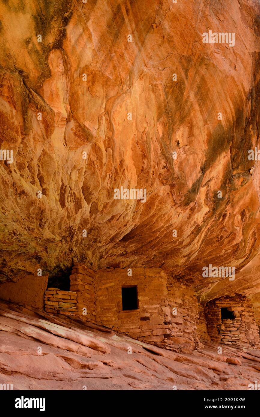 House on Fire, Puebloan Cliff Wohnung in Mule Canyon auf Cedar Mesa. Stockfotohttps://www.alamy.de/image-license-details/?v=1https://www.alamy.de/house-on-fire-puebloan-cliff-wohnung-in-mule-canyon-auf-cedar-mesa-image440131101.html
RF2GG1KKW–House on Fire, Puebloan Cliff Wohnung in Mule Canyon auf Cedar Mesa.
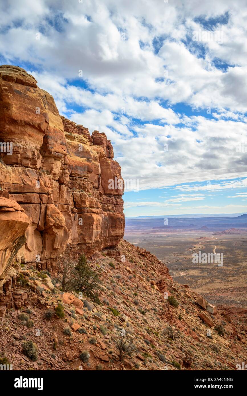 Cedar Mesa an Moki Dugway, Blick auf das Tal der Götter, Bären Ohren National Monument, Utah State Route 261, Utah, USA Stockfotohttps://www.alamy.de/image-license-details/?v=1https://www.alamy.de/cedar-mesa-an-moki-dugway-blick-auf-das-tal-der-gotter-baren-ohren-national-monument-utah-state-route-261-utah-usa-image329472684.html
RF2A40NNG–Cedar Mesa an Moki Dugway, Blick auf das Tal der Götter, Bären Ohren National Monument, Utah State Route 261, Utah, USA
 House on Fire Ruins Mule Canyon Cedar Mesa, Bears Ears National Monument, Utah. Stockfotohttps://www.alamy.de/image-license-details/?v=1https://www.alamy.de/house-on-fire-ruins-mule-canyon-cedar-mesa-bears-ears-national-monument-utah-image605100242.html
RF2X4CKEX–House on Fire Ruins Mule Canyon Cedar Mesa, Bears Ears National Monument, Utah.
 Owachomo Natural Bridge im Natural Bridges National Monument, Utah Stockfotohttps://www.alamy.de/image-license-details/?v=1https://www.alamy.de/owachomo-natural-bridge-im-natural-bridges-national-monument-utah-image433651918.html
RM2G5EFCE–Owachomo Natural Bridge im Natural Bridges National Monument, Utah
 Sandstein-Boulder auf Cedar Mesa, Southern Utah. Stockfotohttps://www.alamy.de/image-license-details/?v=1https://www.alamy.de/stockfoto-sandstein-boulder-auf-cedar-mesa-southern-utah-51668637.html
RMD01KTD–Sandstein-Boulder auf Cedar Mesa, Southern Utah.
 Grand-Canyon-Nationalpark USA - Desert View am Südrand. Zeigen Sie mit Cedar Mountain Mesa an. Stockfotohttps://www.alamy.de/image-license-details/?v=1https://www.alamy.de/stockfoto-grand-canyon-nationalpark-usa-desert-view-am-sudrand-zeigen-sie-mit-cedar-mountain-mesa-an-30712701.html
RFBNY2A5–Grand-Canyon-Nationalpark USA - Desert View am Südrand. Zeigen Sie mit Cedar Mountain Mesa an.
 Gefallenen Dach Ruine Ruinen indischen in North Fork des Mule Canyon, Cedar Mesa, Utah, USA. Stockfotohttps://www.alamy.de/image-license-details/?v=1https://www.alamy.de/stockfoto-gefallenen-dach-ruine-ruinen-indischen-in-north-fork-des-mule-canyon-cedar-mesa-utah-usa-84717902.html
RMEWR6FA–Gefallenen Dach Ruine Ruinen indischen in North Fork des Mule Canyon, Cedar Mesa, Utah, USA.
 Hochzeit Ring Arch in Salt Creek Canyon im Needles District des Canyonlands National Park, Utah, USA Stockfotohttps://www.alamy.de/image-license-details/?v=1https://www.alamy.de/stockfoto-hochzeit-ring-arch-in-salt-creek-canyon-im-needles-district-des-canyonlands-national-park-utah-usa-173251225.html
RMM1T7KN–Hochzeit Ring Arch in Salt Creek Canyon im Needles District des Canyonlands National Park, Utah, USA
 Sipapu Bridge über White Canyon im Herbst, Natural Bridges National Monument, Utah Stockfotohttps://www.alamy.de/image-license-details/?v=1https://www.alamy.de/sipapu-bridge-uber-white-canyon-im-herbst-natural-bridges-national-monument-utah-image355406154.html
RF2BJ644X–Sipapu Bridge über White Canyon im Herbst, Natural Bridges National Monument, Utah
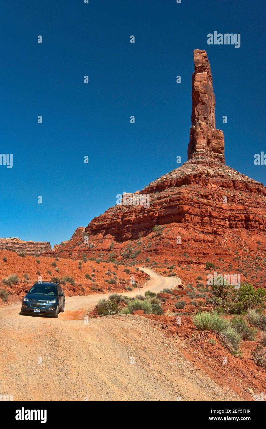 Fahrzeug auf unbefestigten Straßen, Castle Butte, Cedar Mesa Sandsteinformation im Valley of the Gods, Bears Ears National Monument, Utah, USA Stockfotohttps://www.alamy.de/image-license-details/?v=1https://www.alamy.de/fahrzeug-auf-unbefestigten-strassen-castle-butte-cedar-mesa-sandsteinformation-im-valley-of-the-gods-bears-ears-national-monument-utah-usa-image360925091.html
RF2BY5FHR–Fahrzeug auf unbefestigten Straßen, Castle Butte, Cedar Mesa Sandsteinformation im Valley of the Gods, Bears Ears National Monument, Utah, USA
 Blick auf die La Sal Berge vom Cedar Mesa Pleateau Stockfotohttps://www.alamy.de/image-license-details/?v=1https://www.alamy.de/blick-auf-die-la-sal-berge-vom-cedar-mesa-pleateau-image504828100.html
RF2M98WB0–Blick auf die La Sal Berge vom Cedar Mesa Pleateau
 Anasazi citadel Ruin - Cedar Mesa - Utah Stockfotohttps://www.alamy.de/image-license-details/?v=1https://www.alamy.de/stockfoto-anasazi-citadel-ruin-cedar-mesa-utah-80612123.html
RMEK45GB–Anasazi citadel Ruin - Cedar Mesa - Utah
 Blick auf Wanderer ihren Weg zu den Mesa Arch im Canyonlands National Park. Utah Wacholder auf dem Weg verstreut. Stockfotohttps://www.alamy.de/image-license-details/?v=1https://www.alamy.de/blick-auf-wanderer-ihren-weg-zu-den-mesa-arch-im-canyonlands-national-park-utah-wacholder-auf-dem-weg-verstreut-image230750702.html
RMRBBGTE–Blick auf Wanderer ihren Weg zu den Mesa Arch im Canyonlands National Park. Utah Wacholder auf dem Weg verstreut.
 UT00632-00...UTAH - geschichtete Sandsteinstraße entlang der Moki Dugway, eine steile, schmale, Schotterstraße, die bis zum Gipfel des Cedar Mesa steigt. Stockfotohttps://www.alamy.de/image-license-details/?v=1https://www.alamy.de/ut00632-00utah-geschichtete-sandsteinstrasse-entlang-der-moki-dugway-eine-steile-schmale-schotterstrasse-die-bis-zum-gipfel-des-cedar-mesa-steigt-image359393475.html
RM2BTKP17–UT00632-00...UTAH - geschichtete Sandsteinstraße entlang der Moki Dugway, eine steile, schmale, Schotterstraße, die bis zum Gipfel des Cedar Mesa steigt.
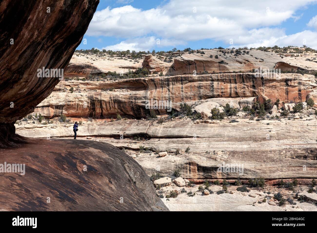 UT00550-00...UTAH - Blick über den White Canyon entlang des Sipapu Bridge Trail im Natural Bridges National Monument. Stockfotohttps://www.alamy.de/image-license-details/?v=1https://www.alamy.de/ut00550-00utah-blick-uber-den-white-canyon-entlang-des-sipapu-bridge-trail-im-natural-bridges-national-monument-image355011340.html
RM2BHG4GC–UT00550-00...UTAH - Blick über den White Canyon entlang des Sipapu Bridge Trail im Natural Bridges National Monument.
 Die Needles, Cedar Mesa Sandsteinspitzen im Needles District des Canyonlands National Park, Utah. Stockfotohttps://www.alamy.de/image-license-details/?v=1https://www.alamy.de/die-needles-cedar-mesa-sandsteinspitzen-im-needles-district-des-canyonlands-national-park-utah-image485837814.html
RM2K6BR2E–Die Needles, Cedar Mesa Sandsteinspitzen im Needles District des Canyonlands National Park, Utah.
 Falled Roof House Cedar Mesa Bears Ears National Monument, Utah. Stockfotohttps://www.alamy.de/image-license-details/?v=1https://www.alamy.de/falled-roof-house-cedar-mesa-bears-ears-national-monument-utah-image605151095.html
RF2X4F0B3–Falled Roof House Cedar Mesa Bears Ears National Monument, Utah.
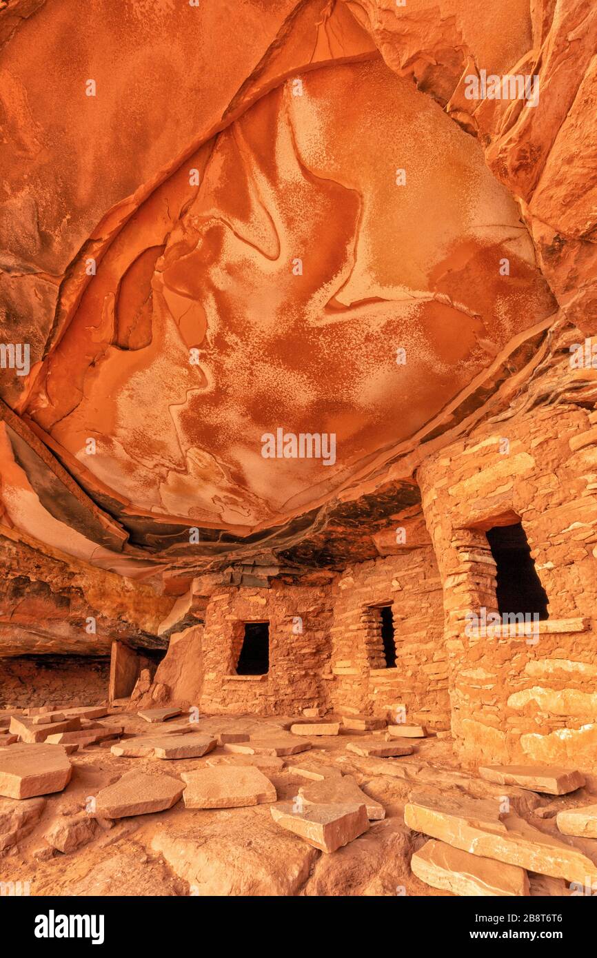 Kultige verfallene Dachruine im Road Canyon auf Cedar Mesa in Bears Ears National Monument, Utah. Stockfotohttps://www.alamy.de/image-license-details/?v=1https://www.alamy.de/kultige-verfallene-dachruine-im-road-canyon-auf-cedar-mesa-in-bears-ears-national-monument-utah-image349656838.html
RF2B8T6T6–Kultige verfallene Dachruine im Road Canyon auf Cedar Mesa in Bears Ears National Monument, Utah.
 De Gualle und seine Truppen Butte im Valley of the Gods, Utah. Stockfotohttps://www.alamy.de/image-license-details/?v=1https://www.alamy.de/de-gualle-und-seine-truppen-butte-im-valley-of-the-gods-utah-image568776062.html
RF2T19YJP–De Gualle und seine Truppen Butte im Valley of the Gods, Utah.
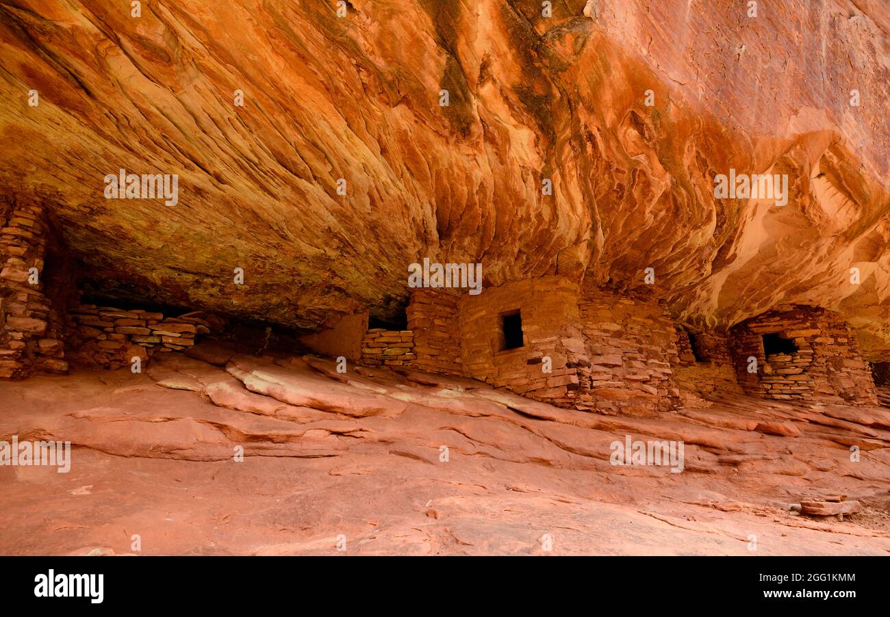 House on Fire, Puebloan Cliff Wohnung in Mule Canyon auf Cedar Mesa. Stockfotohttps://www.alamy.de/image-license-details/?v=1https://www.alamy.de/house-on-fire-puebloan-cliff-wohnung-in-mule-canyon-auf-cedar-mesa-image440131124.html
RM2GG1KMM–House on Fire, Puebloan Cliff Wohnung in Mule Canyon auf Cedar Mesa.
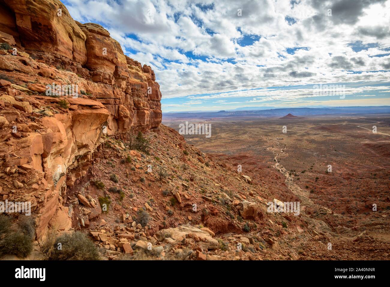 Cedar Mesa an Moki Dugway, Blick auf das Tal der Götter, Bären Ohren National Monument, Utah State Route 261, Utah, USA Stockfotohttps://www.alamy.de/image-license-details/?v=1https://www.alamy.de/cedar-mesa-an-moki-dugway-blick-auf-das-tal-der-gotter-baren-ohren-national-monument-utah-state-route-261-utah-usa-image329472691.html
RF2A40NNR–Cedar Mesa an Moki Dugway, Blick auf das Tal der Götter, Bären Ohren National Monument, Utah State Route 261, Utah, USA
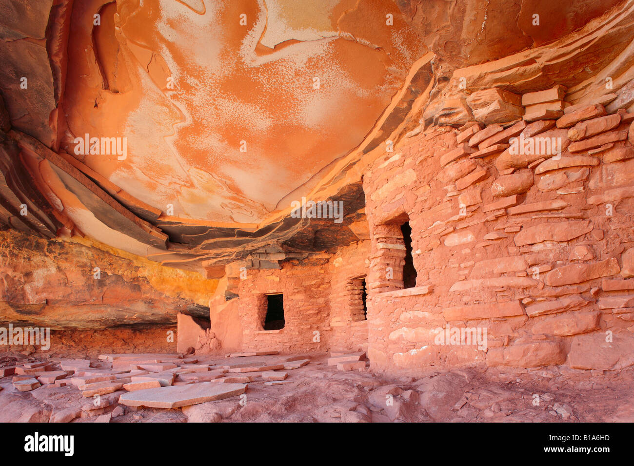 Anasazi-Ruinen in Road Canyon in Utah Stockfotohttps://www.alamy.de/image-license-details/?v=1https://www.alamy.de/stockfoto-anasazi-ruinen-in-road-canyon-in-utah-18049737.html
RMB1A6HD–Anasazi-Ruinen in Road Canyon in Utah
 Owachomo Natural Bridge unter dem Nachthimmel im Natural Bridges National Monument, Utah Stockfotohttps://www.alamy.de/image-license-details/?v=1https://www.alamy.de/owachomo-natural-bridge-unter-dem-nachthimmel-im-natural-bridges-national-monument-utah-image433651940.html
RM2G5EFD8–Owachomo Natural Bridge unter dem Nachthimmel im Natural Bridges National Monument, Utah
 Cedar Mesa auf der Westseite des Valley of the Gods in Utah vom Westhang des Bell Butte aus gesehen. Nordwestlich von Monument Valley und Mexican H Stockfotohttps://www.alamy.de/image-license-details/?v=1https://www.alamy.de/cedar-mesa-auf-der-westseite-des-valley-of-the-gods-in-utah-vom-westhang-des-bell-butte-aus-gesehen-nordwestlich-von-monument-valley-und-mexican-h-image556301385.html
RF2R91M2H–Cedar Mesa auf der Westseite des Valley of the Gods in Utah vom Westhang des Bell Butte aus gesehen. Nordwestlich von Monument Valley und Mexican H
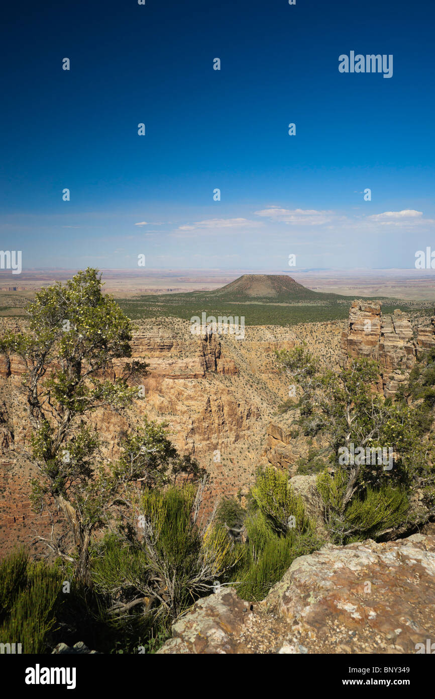 Grand-Canyon-Nationalpark USA - Desert View am Südrand. Zeigen Sie mit Cedar Mountain Mesa an. Stockfotohttps://www.alamy.de/image-license-details/?v=1https://www.alamy.de/stockfoto-grand-canyon-nationalpark-usa-desert-view-am-sudrand-zeigen-sie-mit-cedar-mountain-mesa-an-30713321.html
RFBNY349–Grand-Canyon-Nationalpark USA - Desert View am Südrand. Zeigen Sie mit Cedar Mountain Mesa an.
 Gefallenen Dach Ruine Ruinen indischen in North Fork des Mule Canyon, Cedar Mesa, Utah, USA. Stockfotohttps://www.alamy.de/image-license-details/?v=1https://www.alamy.de/stockfoto-gefallenen-dach-ruine-ruinen-indischen-in-north-fork-des-mule-canyon-cedar-mesa-utah-usa-84717898.html
RMEWR6F6–Gefallenen Dach Ruine Ruinen indischen in North Fork des Mule Canyon, Cedar Mesa, Utah, USA.
 Backpacking Route durch einen Riss in einem Fin in Salt Creek Canyon im Needles District des Canyonlands National Park, Utah, USA Stockfotohttps://www.alamy.de/image-license-details/?v=1https://www.alamy.de/stockfoto-backpacking-route-durch-einen-riss-in-einem-fin-in-salt-creek-canyon-im-needles-district-des-canyonlands-national-park-utah-usa-173251076.html
RFM1T7EC–Backpacking Route durch einen Riss in einem Fin in Salt Creek Canyon im Needles District des Canyonlands National Park, Utah, USA
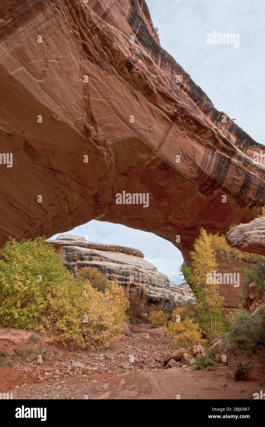 Kachina Brücke über den White Canyon im Herbst, Natural Bridges National Monument, Utah Stockfotohttps://www.alamy.de/image-license-details/?v=1https://www.alamy.de/kachina-brucke-uber-den-white-canyon-im-herbst-natural-bridges-national-monument-utah-image355410167.html
RF2BJ6987–Kachina Brücke über den White Canyon im Herbst, Natural Bridges National Monument, Utah
 Castle Butte, Cedar Mesa Sandsteinformation im Valley of the Gods, Bears Ears National Monument, Utah, USA Stockfotohttps://www.alamy.de/image-license-details/?v=1https://www.alamy.de/castle-butte-cedar-mesa-sandsteinformation-im-valley-of-the-gods-bears-ears-national-monument-utah-usa-image360924847.html
RF2BY5F93–Castle Butte, Cedar Mesa Sandsteinformation im Valley of the Gods, Bears Ears National Monument, Utah, USA
 Ein saisonaler Pool im Bullet Canyon: Cedar Mesa Area in Utah Stockfotohttps://www.alamy.de/image-license-details/?v=1https://www.alamy.de/ein-saisonaler-pool-im-bullet-canyon-cedar-mesa-area-in-utah-image547281027.html
RF2PPAPEY–Ein saisonaler Pool im Bullet Canyon: Cedar Mesa Area in Utah
 Gefallenen Dach Anasazi Ruinen - Cedar Mesa - Utah Stockfotohttps://www.alamy.de/image-license-details/?v=1https://www.alamy.de/stockfoto-gefallenen-dach-anasazi-ruinen-cedar-mesa-utah-80463183.html
RMEJWBH3–Gefallenen Dach Anasazi Ruinen - Cedar Mesa - Utah
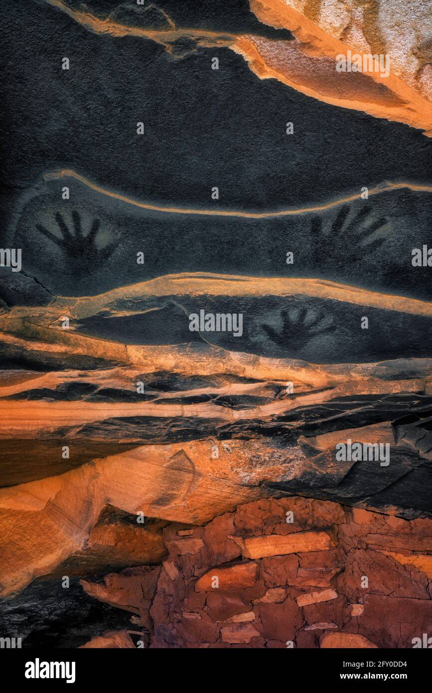 Uralte Piktografen-Handdrucke auf der Sandsteindecke über der Anasazi-Dachruine im Cedar Mesa Plateau im Südosten Utahs. Stockfotohttps://www.alamy.de/image-license-details/?v=1https://www.alamy.de/uralte-piktografen-handdrucke-auf-der-sandsteindecke-uber-der-anasazi-dachruine-im-cedar-mesa-plateau-im-sudosten-utahs-image429655104.html
RM2FY0DD4–Uralte Piktografen-Handdrucke auf der Sandsteindecke über der Anasazi-Dachruine im Cedar Mesa Plateau im Südosten Utahs.
 UT00633-00...UTAH - Moki Dugway, Highway 261, eine unbefestigte Straße, die steil zum Gipfel von Cedar Mesa abfährt. Stockfotohttps://www.alamy.de/image-license-details/?v=1https://www.alamy.de/ut00633-00utah-moki-dugway-highway-261-eine-unbefestigte-strasse-die-steil-zum-gipfel-von-cedar-mesa-abfahrt-image359393492.html
RM2BTKP1T–UT00633-00...UTAH - Moki Dugway, Highway 261, eine unbefestigte Straße, die steil zum Gipfel von Cedar Mesa abfährt.
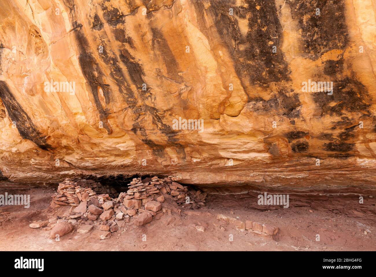 UT00549-00...UTAH - Struktur gebaut von den Vorfahren Puebloan Menschen entlang der Sipapu Bridge Trail in Natural Bridges National Monument. Stockfotohttps://www.alamy.de/image-license-details/?v=1https://www.alamy.de/ut00549-00utah-struktur-gebaut-von-den-vorfahren-puebloan-menschen-entlang-der-sipapu-bridge-trail-in-natural-bridges-national-monument-image355011316.html
RM2BHG4FG–UT00549-00...UTAH - Struktur gebaut von den Vorfahren Puebloan Menschen entlang der Sipapu Bridge Trail in Natural Bridges National Monument.
 Die Needles, Cedar Mesa Sandsteinspitzen im Needles District des Canyonlands National Park, Utah. Stockfotohttps://www.alamy.de/image-license-details/?v=1https://www.alamy.de/die-needles-cedar-mesa-sandsteinspitzen-im-needles-district-des-canyonlands-national-park-utah-image485837586.html
RM2K6BPPA–Die Needles, Cedar Mesa Sandsteinspitzen im Needles District des Canyonlands National Park, Utah.
 House on Fire Ruins Mule Canyon Cedar Mesa Bears Ears National Monument, Utah. Stockfotohttps://www.alamy.de/image-license-details/?v=1https://www.alamy.de/house-on-fire-ruins-mule-canyon-cedar-mesa-bears-ears-national-monument-utah-image605151097.html
RF2X4F0B5–House on Fire Ruins Mule Canyon Cedar Mesa Bears Ears National Monument, Utah.
 Kultige verfallene Dachruine im Road Canyon auf Cedar Mesa in Bears Ears National Monument, Utah. Stockfotohttps://www.alamy.de/image-license-details/?v=1https://www.alamy.de/kultige-verfallene-dachruine-im-road-canyon-auf-cedar-mesa-in-bears-ears-national-monument-utah-image349656799.html
RF2B8T6PR–Kultige verfallene Dachruine im Road Canyon auf Cedar Mesa in Bears Ears National Monument, Utah.
 Castle Butte und de Gaulle und seine Truppen Sandsteinformationen im Valley of the Gods, Utah. Stockfotohttps://www.alamy.de/image-license-details/?v=1https://www.alamy.de/castle-butte-und-de-gaulle-und-seine-truppen-sandsteinformationen-im-valley-of-the-gods-utah-image456368131.html
RF2HEDA5R–Castle Butte und de Gaulle und seine Truppen Sandsteinformationen im Valley of the Gods, Utah.
 Gefallene Dachruinen, eine alte Steinkammer, die unter einer massiven überhängenden Felsformation mit komplexen Rot- und Orangetönen errichtet wurde. Cedar Mesa, Utah Stockfotohttps://www.alamy.de/image-license-details/?v=1https://www.alamy.de/gefallene-dachruinen-eine-alte-steinkammer-die-unter-einer-massiven-uberhangenden-felsformation-mit-komplexen-rot-und-orangetonen-errichtet-wurde-cedar-mesa-utah-image622190019.html
RM2Y475M3–Gefallene Dachruinen, eine alte Steinkammer, die unter einer massiven überhängenden Felsformation mit komplexen Rot- und Orangetönen errichtet wurde. Cedar Mesa, Utah
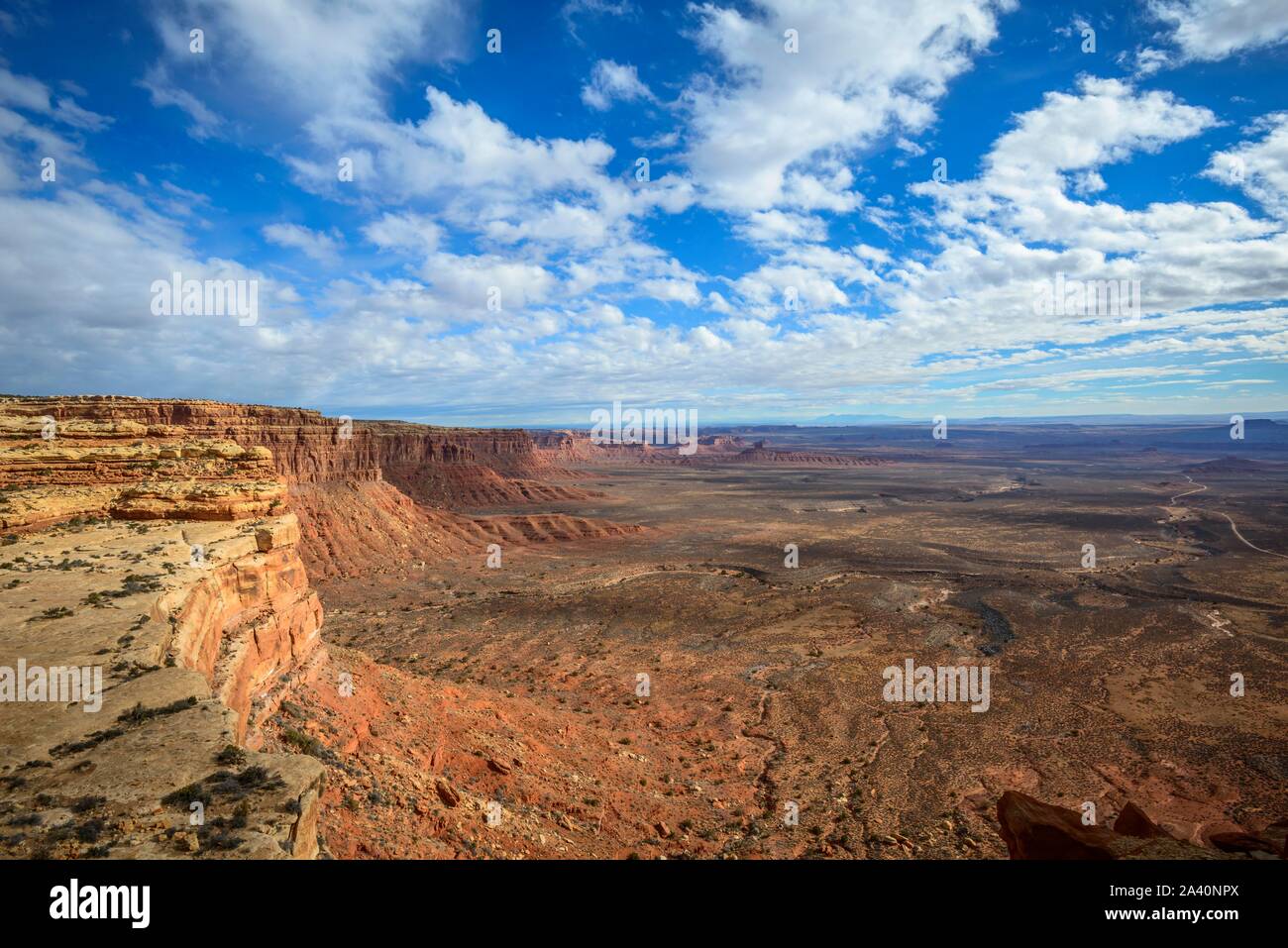 Cedar Mesa an Moki Dugway, Blick auf das Tal der Götter, Bären Ohren National Monument, Utah State Route 261, Utah, USA Stockfotohttps://www.alamy.de/image-license-details/?v=1https://www.alamy.de/cedar-mesa-an-moki-dugway-blick-auf-das-tal-der-gotter-baren-ohren-national-monument-utah-state-route-261-utah-usa-image329472722.html
RF2A40NPX–Cedar Mesa an Moki Dugway, Blick auf das Tal der Götter, Bären Ohren National Monument, Utah State Route 261, Utah, USA
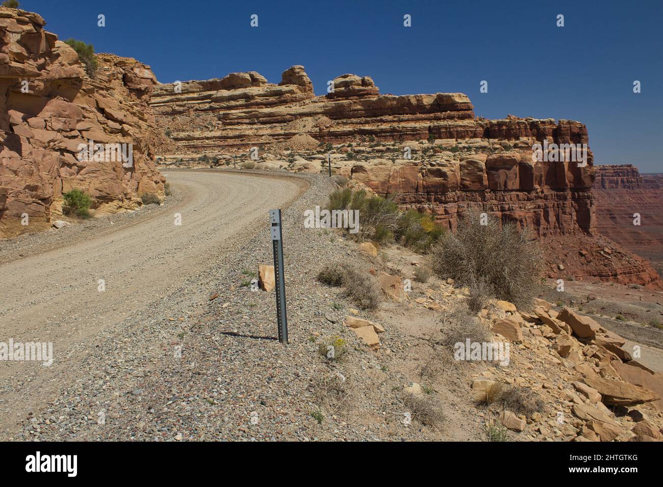 Moki Dugway in der Nähe von Mexican hat, San Juan County, Utah, USA Stockfotohttps://www.alamy.de/image-license-details/?v=1https://www.alamy.de/moki-dugway-in-der-nahe-von-mexican-hat-san-juan-county-utah-usa-image462591908.html
RF2HTGTKG–Moki Dugway in der Nähe von Mexican hat, San Juan County, Utah, USA
 Altes Cowboycamp und Artefakte entlang des collins Spring Trail in der Grand Gulch Gegend von Cedar mesa in der Nähe von blanding, utah Stockfotohttps://www.alamy.de/image-license-details/?v=1https://www.alamy.de/altes-cowboycamp-und-artefakte-entlang-des-collins-spring-trail-in-der-grand-gulch-gegend-von-cedar-mesa-in-der-nahe-von-blanding-utah-image560187479.html
RF2RFAMRK–Altes Cowboycamp und Artefakte entlang des collins Spring Trail in der Grand Gulch Gegend von Cedar mesa in der Nähe von blanding, utah
 "Flaming Decke Ruine, alten Anasazi Ruinen am Cedar Mesa, Utah, USA Stockfotohttps://www.alamy.de/image-license-details/?v=1https://www.alamy.de/stockfoto-flaming-decke-ruine-alten-anasazi-ruinen-am-cedar-mesa-utah-usa-19251404.html
RMB38YA4–"Flaming Decke Ruine, alten Anasazi Ruinen am Cedar Mesa, Utah, USA
 Anasazi Ruinen, Mule Canyon, Cedar Mesa, Colorado Plateau, Utah, USA Stockfotohttps://www.alamy.de/image-license-details/?v=1https://www.alamy.de/anasazi-ruinen-mule-canyon-cedar-mesa-colorado-plateau-utah-usa-image360982720.html
RM2BY8540–Anasazi Ruinen, Mule Canyon, Cedar Mesa, Colorado Plateau, Utah, USA
 Gefallenen Dach Ruine Ruinen indischen in North Fork des Mule Canyon, Cedar Mesa, Utah, USA. Stockfotohttps://www.alamy.de/image-license-details/?v=1https://www.alamy.de/stockfoto-gefallenen-dach-ruine-ruinen-indischen-in-north-fork-des-mule-canyon-cedar-mesa-utah-usa-84717905.html
RMEWR6FD–Gefallenen Dach Ruine Ruinen indischen in North Fork des Mule Canyon, Cedar Mesa, Utah, USA.
 Hochzeit Ring Arch in Salt Creek Canyon im Needles District des Canyonlands National Park, Utah, USA Stockfotohttps://www.alamy.de/image-license-details/?v=1https://www.alamy.de/stockfoto-hochzeit-ring-arch-in-salt-creek-canyon-im-needles-district-des-canyonlands-national-park-utah-usa-173251213.html
RMM1T7K9–Hochzeit Ring Arch in Salt Creek Canyon im Needles District des Canyonlands National Park, Utah, USA
 Kachina Brücke über den White Canyon im Herbst, Natural Bridges National Monument, Utah Stockfotohttps://www.alamy.de/image-license-details/?v=1https://www.alamy.de/kachina-brucke-uber-den-white-canyon-im-herbst-natural-bridges-national-monument-utah-image355409027.html
RF2BJ67RF–Kachina Brücke über den White Canyon im Herbst, Natural Bridges National Monument, Utah
 Castle Butte, Cedar Mesa Sandsteinformation im Valley of the Gods, Bears Ears National Monument, Utah, USA Stockfotohttps://www.alamy.de/image-license-details/?v=1https://www.alamy.de/castle-butte-cedar-mesa-sandsteinformation-im-valley-of-the-gods-bears-ears-national-monument-utah-usa-image360957786.html
RF2BY719E–Castle Butte, Cedar Mesa Sandsteinformation im Valley of the Gods, Bears Ears National Monument, Utah, USA
 Ein saisonaler Pool im Bullet Canyon: Cedar Mesa Area in Utah Stockfotohttps://www.alamy.de/image-license-details/?v=1https://www.alamy.de/ein-saisonaler-pool-im-bullet-canyon-cedar-mesa-area-in-utah-image547281033.html
RF2PPAPF5–Ein saisonaler Pool im Bullet Canyon: Cedar Mesa Area in Utah
 Haus am Feuer Anasazi indianischen Ruinen - Cedar Mesa - Utah Stockfotohttps://www.alamy.de/image-license-details/?v=1https://www.alamy.de/stockfoto-haus-am-feuer-anasazi-indianischen-ruinen-cedar-mesa-utah-80464341.html
RMEJWD2D–Haus am Feuer Anasazi indianischen Ruinen - Cedar Mesa - Utah
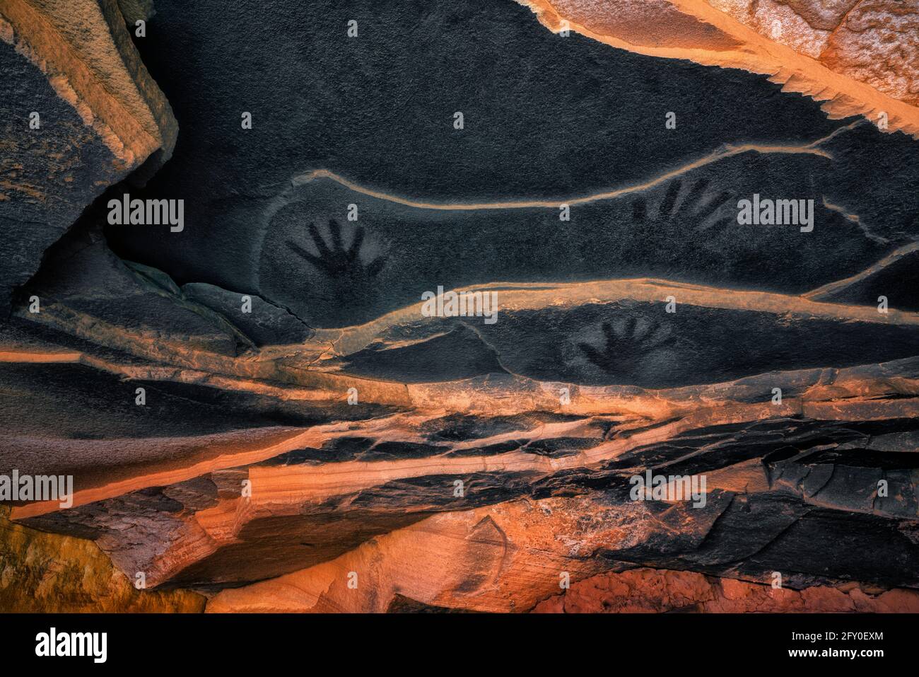 Uralte Piktografen-Handdrucke auf der Sandsteindecke über der Anasazi-Dachruine im Cedar Mesa Plateau im Südosten Utahs. Stockfotohttps://www.alamy.de/image-license-details/?v=1https://www.alamy.de/uralte-piktografen-handdrucke-auf-der-sandsteindecke-uber-der-anasazi-dachruine-im-cedar-mesa-plateau-im-sudosten-utahs-image429656268.html
RM2FY0EXM–Uralte Piktografen-Handdrucke auf der Sandsteindecke über der Anasazi-Dachruine im Cedar Mesa Plateau im Südosten Utahs.
 UT00631-00...UTAH - Hightway 261, der Moki Dugway, der um Klippen herum zum Gipfel des Cedar Mesa switchback. Stockfotohttps://www.alamy.de/image-license-details/?v=1https://www.alamy.de/ut00631-00utah-hightway-261-der-moki-dugway-der-um-klippen-herum-zum-gipfel-des-cedar-mesa-switchback-image359393462.html
RM2BTKP0P–UT00631-00...UTAH - Hightway 261, der Moki Dugway, der um Klippen herum zum Gipfel des Cedar Mesa switchback.
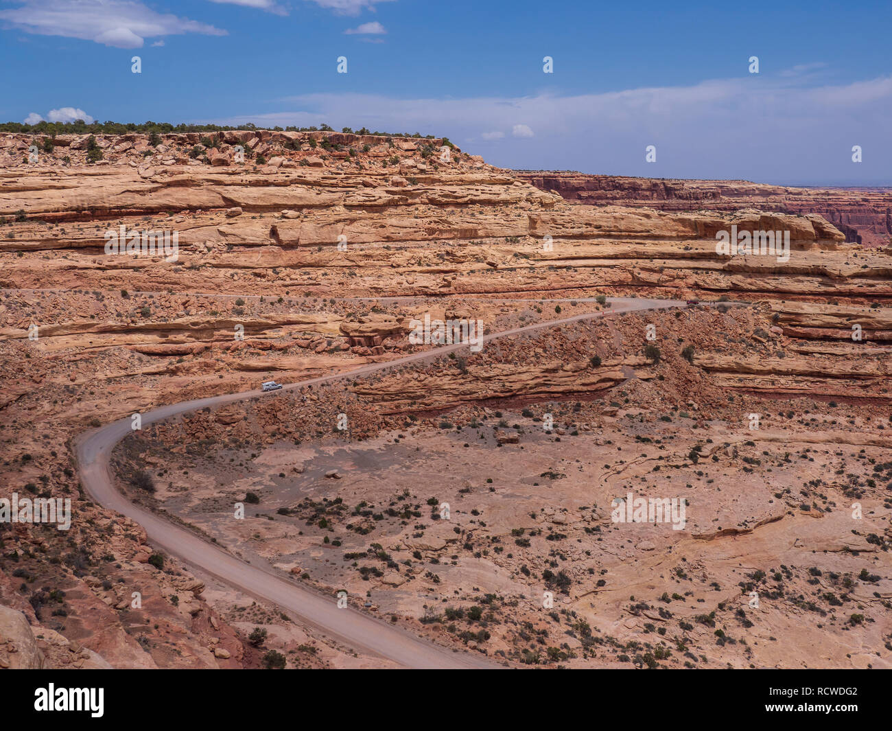 Blick von der Moki Dugway übersehen, Utah Highway 261 außerhalb der Täuschung, Utah. Stockfotohttps://www.alamy.de/image-license-details/?v=1https://www.alamy.de/blick-von-der-moki-dugway-ubersehen-utah-highway-261-ausserhalb-der-tauschung-utah-image231670098.html
RMRCWDG2–Blick von der Moki Dugway übersehen, Utah Highway 261 außerhalb der Täuschung, Utah.
 Die Needles, Cedar Mesa Sandsteinspitzen im Needles District des Canyonlands National Park, Utah. Stockfotohttps://www.alamy.de/image-license-details/?v=1https://www.alamy.de/die-needles-cedar-mesa-sandsteinspitzen-im-needles-district-des-canyonlands-national-park-utah-image485837603.html
RM2K6BPPY–Die Needles, Cedar Mesa Sandsteinspitzen im Needles District des Canyonlands National Park, Utah.
 Insel im Himmel Sicht im Canyonlands National Park, Utah. Stockfotohttps://www.alamy.de/image-license-details/?v=1https://www.alamy.de/insel-im-himmel-sicht-im-canyonlands-national-park-utah-image230906853.html
RMRBJM19–Insel im Himmel Sicht im Canyonlands National Park, Utah.
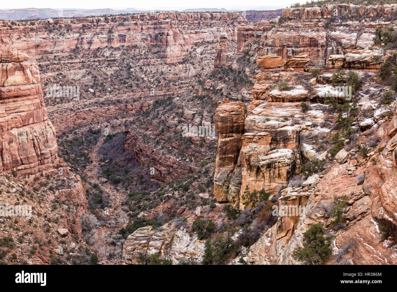 Bunte Mule Canyon in der Nähe der Höhle Turm-Ruinen in der Cedar Mesa-Abschnitt der neuen Bären Ohren National Monument. Stockfotohttps://www.alamy.de/image-license-details/?v=1https://www.alamy.de/stockfoto-bunte-mule-canyon-in-der-nahe-der-hohle-turm-ruinen-in-der-cedar-mesa-abschnitt-der-neuen-baren-ohren-national-monument-134681980.html
RFHR386M–Bunte Mule Canyon in der Nähe der Höhle Turm-Ruinen in der Cedar Mesa-Abschnitt der neuen Bären Ohren National Monument.
 Hahnbutte und Setting Hen Butte im Valley of the Gods, Utah. Stockfotohttps://www.alamy.de/image-license-details/?v=1https://www.alamy.de/hahnbutte-und-setting-hen-butte-im-valley-of-the-gods-utah-image456367593.html
RF2HED9EH–Hahnbutte und Setting Hen Butte im Valley of the Gods, Utah.
 Der Mokee/Moki Dugway verschlungen sich an der Seite eines Escarpments in Utah Stockfotohttps://www.alamy.de/image-license-details/?v=1https://www.alamy.de/der-mokeemoki-dugway-verschlungen-sich-an-der-seite-eines-escarpments-in-utah-image346826318.html
RM2B478E6–Der Mokee/Moki Dugway verschlungen sich an der Seite eines Escarpments in Utah
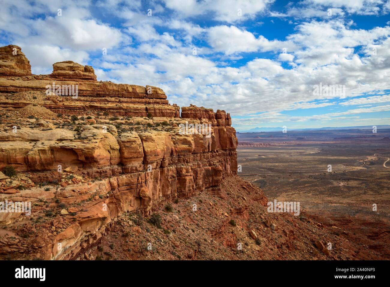 Cedar Mesa an Moki Dugway, Blick auf das Tal der Götter, Bären Ohren National Monument, Utah State Route 261, Utah, USA Stockfotohttps://www.alamy.de/image-license-details/?v=1https://www.alamy.de/cedar-mesa-an-moki-dugway-blick-auf-das-tal-der-gotter-baren-ohren-national-monument-utah-state-route-261-utah-usa-image329472699.html
RF2A40NP3–Cedar Mesa an Moki Dugway, Blick auf das Tal der Götter, Bären Ohren National Monument, Utah State Route 261, Utah, USA
 Moki Dugway in der Nähe von Mexican hat, San Juan County, Utah, USA Stockfotohttps://www.alamy.de/image-license-details/?v=1https://www.alamy.de/moki-dugway-in-der-nahe-von-mexican-hat-san-juan-county-utah-usa-image462591943.html
RF2HTGTMR–Moki Dugway in der Nähe von Mexican hat, San Juan County, Utah, USA
 Moki Rock am Moki Dugway, der Teil des Highway 261 in Utah ist, der sich vom Valley of the Gods und Cedar Mesa erhebt. Stockfotohttps://www.alamy.de/image-license-details/?v=1https://www.alamy.de/moki-rock-am-moki-dugway-der-teil-des-highway-261-in-utah-ist-der-sich-vom-valley-of-the-gods-und-cedar-mesa-erhebt-image556300660.html
RF2R91K4M–Moki Rock am Moki Dugway, der Teil des Highway 261 in Utah ist, der sich vom Valley of the Gods und Cedar Mesa erhebt.
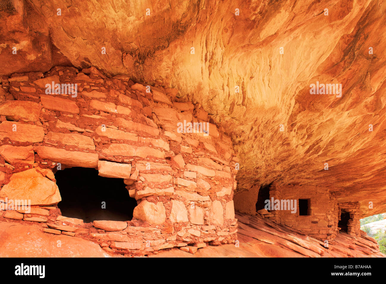 "Flaming Decke Ruine, alten Anasazi Ruinen am Cedar Mesa, Utah, USA Stockfotohttps://www.alamy.de/image-license-details/?v=1https://www.alamy.de/stockfoto-flaming-decke-ruine-alten-anasazi-ruinen-am-cedar-mesa-utah-usa-21746098.html
RMB7AHAA–"Flaming Decke Ruine, alten Anasazi Ruinen am Cedar Mesa, Utah, USA
 Nordamerika, Utah, Four Corners, Cedar Mesa, Mule Canyon, Anasazi Ruinen Stockfotohttps://www.alamy.de/image-license-details/?v=1https://www.alamy.de/nordamerika-utah-four-corners-cedar-mesa-mule-canyon-anasazi-ruinen-image360982390.html
RM2BY84M6–Nordamerika, Utah, Four Corners, Cedar Mesa, Mule Canyon, Anasazi Ruinen
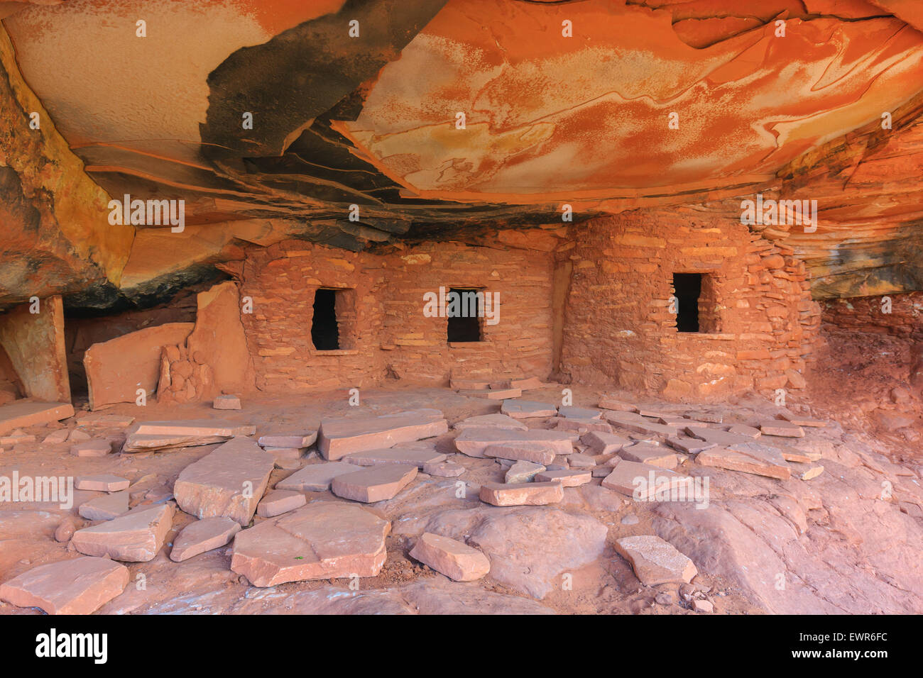 Gefallenen Dach Ruine Ruinen indischen in North Fork des Mule Canyon, Cedar Mesa, Utah, USA. Stockfotohttps://www.alamy.de/image-license-details/?v=1https://www.alamy.de/stockfoto-gefallenen-dach-ruine-ruinen-indischen-in-north-fork-des-mule-canyon-cedar-mesa-utah-usa-84717904.html
RMEWR6FC–Gefallenen Dach Ruine Ruinen indischen in North Fork des Mule Canyon, Cedar Mesa, Utah, USA.
 Hochzeit Ring Arch in Salt Creek Canyon im Needles District des Canyonlands National Park, Utah, USA Stockfotohttps://www.alamy.de/image-license-details/?v=1https://www.alamy.de/stockfoto-hochzeit-ring-arch-in-salt-creek-canyon-im-needles-district-des-canyonlands-national-park-utah-usa-173251219.html
RMM1T7KF–Hochzeit Ring Arch in Salt Creek Canyon im Needles District des Canyonlands National Park, Utah, USA
 Einstellung Hen Butte im Valley of the Gods, Utah Stockfotohttps://www.alamy.de/image-license-details/?v=1https://www.alamy.de/einstellung-hen-butte-im-valley-of-the-gods-utah-image356012306.html
RF2BK5N96–Einstellung Hen Butte im Valley of the Gods, Utah
 Castle Butte, Cedar Mesa Sandsteinformation im Valley of the Gods, Bears Ears National Monument, Utah, USA Stockfotohttps://www.alamy.de/image-license-details/?v=1https://www.alamy.de/castle-butte-cedar-mesa-sandsteinformation-im-valley-of-the-gods-bears-ears-national-monument-utah-usa-image360924858.html
RF2BY5F9E–Castle Butte, Cedar Mesa Sandsteinformation im Valley of the Gods, Bears Ears National Monument, Utah, USA
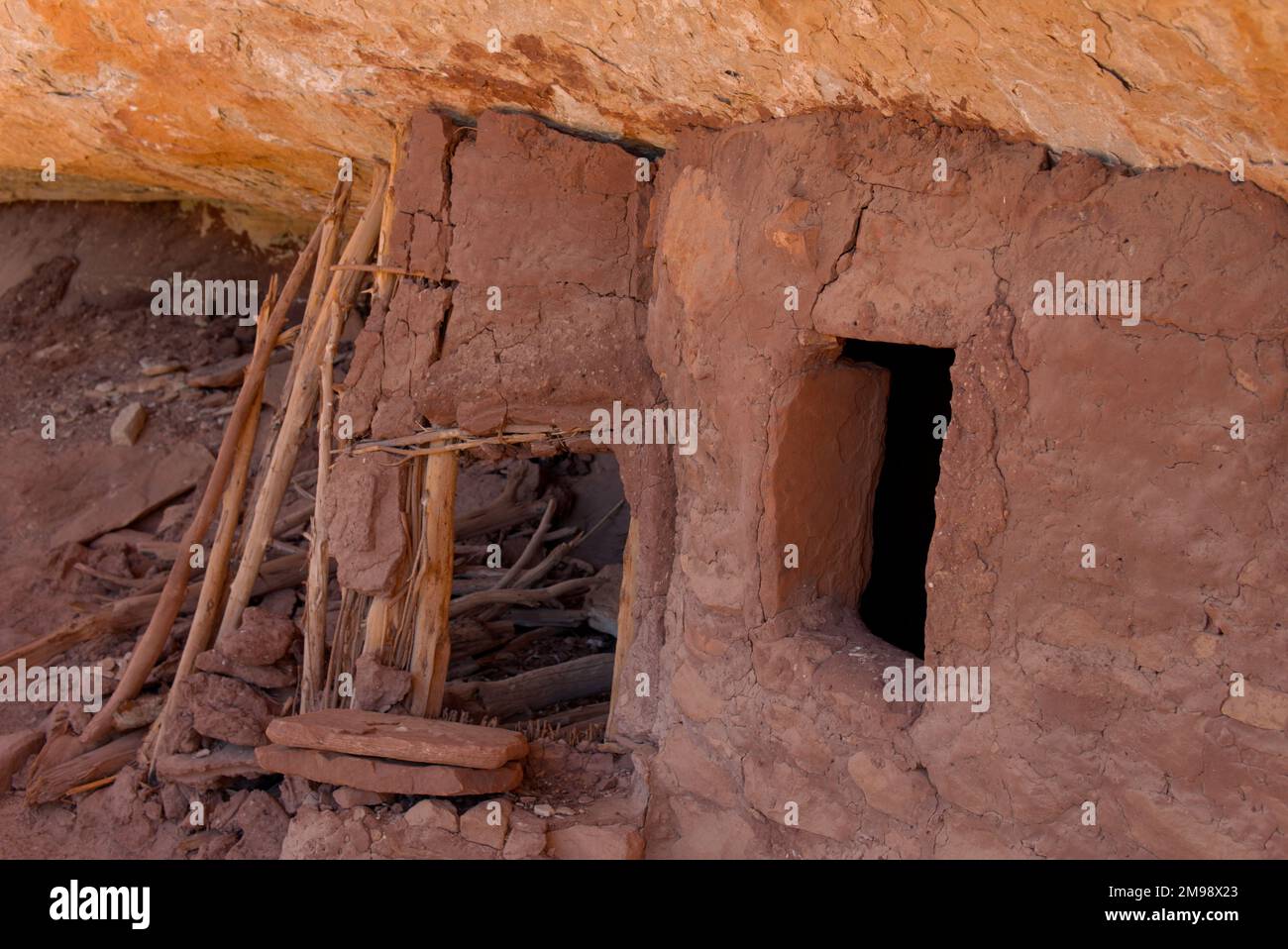 Eine kleine Ruine im McCloyd Canyon am Cedar Mesa, Bears Ears National Monument Stockfotohttps://www.alamy.de/image-license-details/?v=1https://www.alamy.de/eine-kleine-ruine-im-mccloyd-canyon-am-cedar-mesa-bears-ears-national-monument-image504828635.html
RF2M98X23–Eine kleine Ruine im McCloyd Canyon am Cedar Mesa, Bears Ears National Monument
 Puppenhaus Anasazi-Ruinen in der Nähe von Cedar Mesa im Südosten von Utah Stockfotohttps://www.alamy.de/image-license-details/?v=1https://www.alamy.de/stockfoto-puppenhaus-anasazi-ruinen-in-der-nahe-von-cedar-mesa-im-sudosten-von-utah-80331659.html
RMEJKBRR–Puppenhaus Anasazi-Ruinen in der Nähe von Cedar Mesa im Südosten von Utah