Schnellfilter:
Wr pidgeon Stockfotos & Bilder
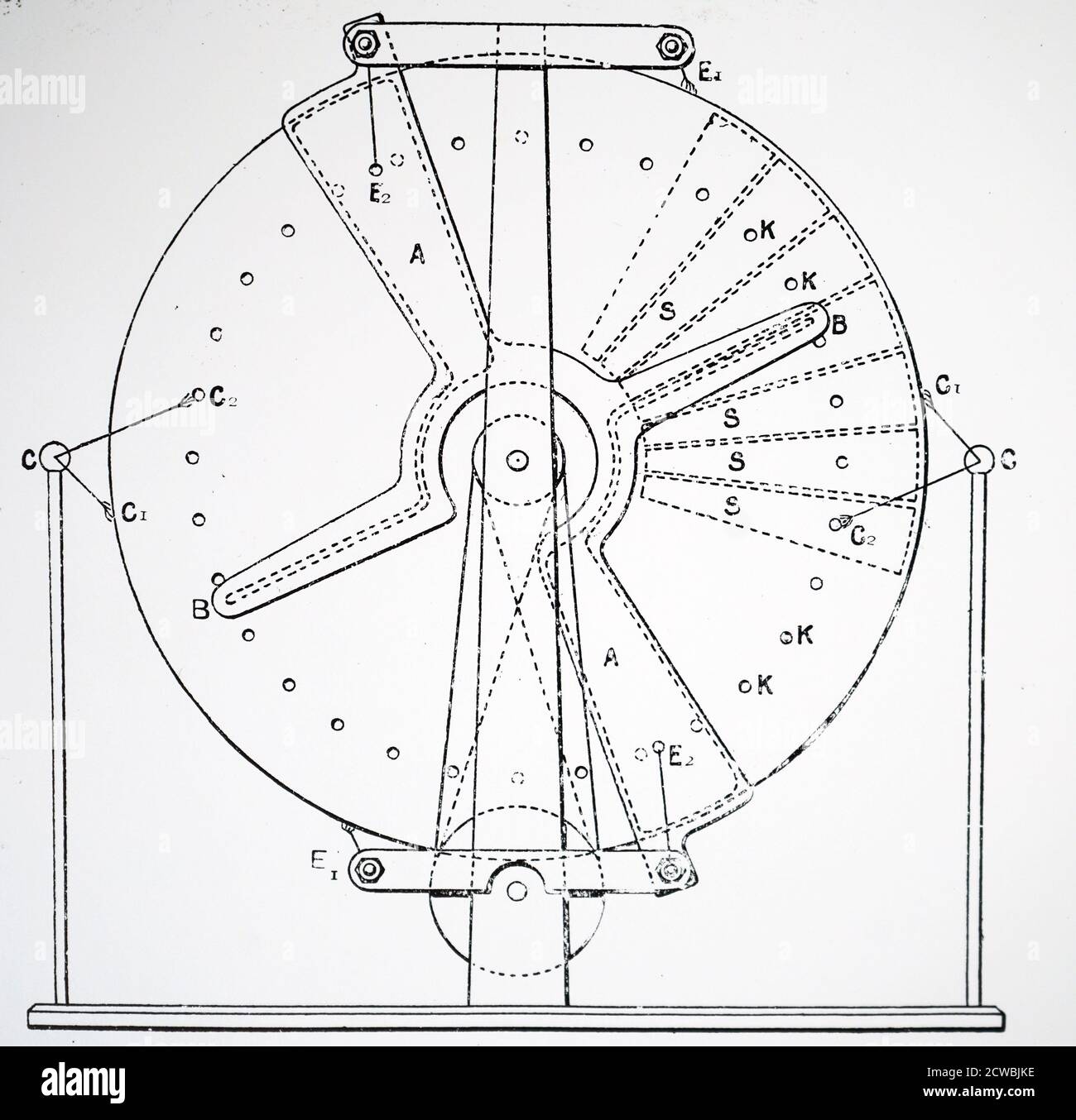 Gravur, die ein Diagramm der Vorderseite von W. R. Pidgeons statischer oder 'Einflussmaschine' darstellt. In dieser Maschine gab es jeweils drei Scheiben Stockfotohttps://www.alamy.de/image-license-details/?v=1https://www.alamy.de/gravur-die-ein-diagramm-der-vorderseite-von-w-r-pidgeons-statischer-oder-einflussmaschine-darstellt-in-dieser-maschine-gab-es-jeweils-drei-scheiben-image377040258.html
RM2CWBJKE–Gravur, die ein Diagramm der Vorderseite von W. R. Pidgeons statischer oder 'Einflussmaschine' darstellt. In dieser Maschine gab es jeweils drei Scheiben
 WALTER PIDGEON ROSALIND RUSSELL EDWARD ARNOLD DESIGN FOR SCANDAL (1941) Stockfotohttps://www.alamy.de/image-license-details/?v=1https://www.alamy.de/stockfoto-walter-pidgeon-rosalind-russell-edward-arnold-design-for-scandal-1941-30950787.html
RMBP9X17–WALTER PIDGEON ROSALIND RUSSELL EDWARD ARNOLD DESIGN FOR SCANDAL (1941)
 Royal Air Force in den Fernen Osten, 1941-1945. Piloten von Nr. 607 Squadron RAF, verlassen ihre Supermarine Spitfire Mark VIIIs der regen-getränkten Flugplatz bei Mingaladon, Birma zu überqueren, nach der Rückkehr von der Sortie gegen japanische Truppen und die Schiffahrt auf dem Sittang-fluß, (die Schlacht von Sittang-fluß Biegung). Sie sind (von links nach rechts): Flight Lieutenant D A Pidgeon der Tadworth, Surrey; Warrant Officer W G Yates von West Bridgford, Nottingham, und Flight Sergeant R H Whittle von Bracknell, Berkshire. Stockfotohttps://www.alamy.de/image-license-details/?v=1https://www.alamy.de/royal-air-force-in-den-fernen-osten-1941-1945-piloten-von-nr-607-squadron-raf-verlassen-ihre-supermarine-spitfire-mark-viiis-der-regen-getrankten-flugplatz-bei-mingaladon-birma-zu-uberqueren-nach-der-ruckkehr-von-der-sortie-gegen-japanische-truppen-und-die-schiffahrt-auf-dem-sittang-fluss-die-schlacht-von-sittang-fluss-biegung-sie-sind-von-links-nach-rechts-flight-lieutenant-d-a-pidgeon-der-tadworth-surrey-warrant-officer-w-g-yates-von-west-bridgford-nottingham-und-flight-sergeant-r-h-whittle-von-bracknell-berkshire-image568981864.html
RM2T1KA4T–Royal Air Force in den Fernen Osten, 1941-1945. Piloten von Nr. 607 Squadron RAF, verlassen ihre Supermarine Spitfire Mark VIIIs der regen-getränkten Flugplatz bei Mingaladon, Birma zu überqueren, nach der Rückkehr von der Sortie gegen japanische Truppen und die Schiffahrt auf dem Sittang-fluß, (die Schlacht von Sittang-fluß Biegung). Sie sind (von links nach rechts): Flight Lieutenant D A Pidgeon der Tadworth, Surrey; Warrant Officer W G Yates von West Bridgford, Nottingham, und Flight Sergeant R H Whittle von Bracknell, Berkshire.
 Platte 31: Begrenzt durch Harlem River, W. 166th Street, Hudson River... 1885 von Robinson, E. (Elisha) Stockfotohttps://www.alamy.de/image-license-details/?v=1https://www.alamy.de/platte-31-begrenzt-durch-harlem-river-w-166th-street-hudson-river-1885-von-robinson-e-elisha-image633126513.html
RM2YP1B95–Platte 31: Begrenzt durch Harlem River, W. 166th Street, Hudson River... 1885 von Robinson, E. (Elisha)
 Zweijahresbericht des Staates Hafen Kommissare für.. . 28091 VORSTAND DER STAATLICHEN HAFEN KOMMISSARE S. W. MEHERIN Präsident DR. CELESTINE J. SULLIVAN Kommissar JOS. A. MOORE Kommissar Offiziere Mark H. Tore.. Sekretär Joseph S. Cereghino Staatssekretär Frank G. White Chief Engineer H. E. Squire Assistant Ingenieur John A. Sullivan Chief Wharfinger A.R.PiDGEON - Betriebsleiter Belt Railroad INHALT Seite Kommissare und Beamte 2 Letter of Transmittal 5 DER HAFEN VON SAX FRANCISCO 7 BERICHT DES VORSTANDS DER STAAT HAFEN KOMMISSARE 9 BERICHT DES CHIEF ENGINEER 13 PwEPORT O Stockfotohttps://www.alamy.de/image-license-details/?v=1https://www.alamy.de/zweijahresbericht-des-staates-hafen-kommissare-fur-28091-vorstand-der-staatlichen-hafen-kommissare-s-w-meherin-prasident-dr-celestine-j-sullivan-kommissar-jos-a-moore-kommissar-offiziere-mark-h-tore-sekretar-joseph-s-cereghino-staatssekretar-frank-g-white-chief-engineer-h-e-squire-assistant-ingenieur-john-a-sullivan-chief-wharfinger-arpidgeon-betriebsleiter-belt-railroad-inhalt-seite-kommissare-und-beamte-2-letter-of-transmittal-5-der-hafen-von-sax-francisco-7-bericht-des-vorstands-der-staat-hafen-kommissare-9-bericht-des-chief-engineer-13-pweport-o-image338430384.html
RM2AJGRBC–Zweijahresbericht des Staates Hafen Kommissare für.. . 28091 VORSTAND DER STAATLICHEN HAFEN KOMMISSARE S. W. MEHERIN Präsident DR. CELESTINE J. SULLIVAN Kommissar JOS. A. MOORE Kommissar Offiziere Mark H. Tore.. Sekretär Joseph S. Cereghino Staatssekretär Frank G. White Chief Engineer H. E. Squire Assistant Ingenieur John A. Sullivan Chief Wharfinger A.R.PiDGEON - Betriebsleiter Belt Railroad INHALT Seite Kommissare und Beamte 2 Letter of Transmittal 5 DER HAFEN VON SAX FRANCISCO 7 BERICHT DES VORSTANDS DER STAAT HAFEN KOMMISSARE 9 BERICHT DES CHIEF ENGINEER 13 PwEPORT O
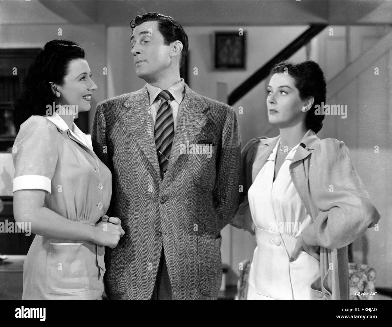 BARBARA JO ALLEN, WALTER PIDGEON, Rosalind Russell, DESIGN FÜR SKANDAL, 1941 Stockfotohttps://www.alamy.de/image-license-details/?v=1https://www.alamy.de/stockfoto-barbara-jo-allen-walter-pidgeon-rosalind-russell-design-fur-skandal-1941-136841221.html
RMHXHJAD–BARBARA JO ALLEN, WALTER PIDGEON, Rosalind Russell, DESIGN FÜR SKANDAL, 1941
 KÖNIGLICHE LUFTWAFFE IM FERNEN OSTEN, 1941-1945. - Piloten der No. 607 Squadron RAF verlassen ihre Supermarine Spitfire Mark VIIIs, um den regendurchnässten Flugplatz in Mingaladon, Burma, zu überqueren, nachdem sie von einem Kampf gegen japanische Truppen zurückgekehrt sind und auf dem Sittang-Fluss (die Schlacht von Sittang Bend) transportiert wurden. Sie sind (von links nach rechts): Flight Lieutenant D A Pidgeon of Tadworth, Surrey; Warrant Officer W G Yates of West Bridgford, Nottingham und Flight Sergeant R H Whittle of Bracknell, Berkshire Royal Air Force, Maintenance Unit, 67 Stockfotohttps://www.alamy.de/image-license-details/?v=1https://www.alamy.de/konigliche-luftwaffe-im-fernen-osten-1941-1945-piloten-der-no-607-squadron-raf-verlassen-ihre-supermarine-spitfire-mark-viiis-um-den-regendurchnassten-flugplatz-in-mingaladon-burma-zu-uberqueren-nachdem-sie-von-einem-kampf-gegen-japanische-truppen-zuruckgekehrt-sind-und-auf-dem-sittang-fluss-die-schlacht-von-sittang-bend-transportiert-wurden-sie-sind-von-links-nach-rechts-flight-lieutenant-d-a-pidgeon-of-tadworth-surrey-warrant-officer-w-g-yates-of-west-bridgford-nottingham-und-flight-sergeant-r-h-whittle-of-bracknell-berkshire-royal-air-force-maintenance-unit-67-image603932910.html
RM2X2FEGE–KÖNIGLICHE LUFTWAFFE IM FERNEN OSTEN, 1941-1945. - Piloten der No. 607 Squadron RAF verlassen ihre Supermarine Spitfire Mark VIIIs, um den regendurchnässten Flugplatz in Mingaladon, Burma, zu überqueren, nachdem sie von einem Kampf gegen japanische Truppen zurückgekehrt sind und auf dem Sittang-Fluss (die Schlacht von Sittang Bend) transportiert wurden. Sie sind (von links nach rechts): Flight Lieutenant D A Pidgeon of Tadworth, Surrey; Warrant Officer W G Yates of West Bridgford, Nottingham und Flight Sergeant R H Whittle of Bracknell, Berkshire Royal Air Force, Maintenance Unit, 67
 Karte begrenzt durch W. 130th St., 10th Ave., 12th Ave., Plate 4 1890 by Robinson, E. (Elisha) Stockfotohttps://www.alamy.de/image-license-details/?v=1https://www.alamy.de/karte-begrenzt-durch-w-130th-st-10th-ave-12th-ave-plate-4-1890-by-robinson-e-elisha-image633714858.html
RM2YR05NE–Karte begrenzt durch W. 130th St., 10th Ave., 12th Ave., Plate 4 1890 by Robinson, E. (Elisha)
 . Tagungen Papiere des Dominion von Kanada 1909. harte Alberton. 4, 5, 6 Ostsee 4. lberton 10 2 45 6050 0080 4047 60138 0024 80 Queens County. 107763 Guinea (10).> S0 Maggie E.C.... 100474 R. Beatrice 122082 [Meerblick: 92745 Überraschung 88518 W. F. Elizabeth Charlottetown. Lunenburg. .. Charlottetown. Sydney. Bovce Harding. . J. H. McLeod... Jonathan Delaney S. Pickering Frank Pidgeon... Thos. Doyle French River... 4 M 4 11 ... 3 Meerblick 3 French River... 4 Aurora.. 6 39 6049 6041 2035 2047 6054 40 ANGELN BOUNTIES 29 TAGUNGEN PAPIER Nr. 22 Liste der Schiffe, die in der Fischerei Bounty empfangen Stockfotohttps://www.alamy.de/image-license-details/?v=1https://www.alamy.de/tagungen-papiere-des-dominion-von-kanada-1909-harte-alberton-4-5-6-ostsee-4-lberton-10-2-45-6050-0080-4047-60138-0024-80-queens-county-107763-guinea-10gt-s0-maggie-ec-100474-r-beatrice-122082-meerblick-92745-uberraschung-88518-w-f-elizabeth-charlottetown-lunenburg-charlottetown-sydney-bovce-harding-j-h-mcleod-jonathan-delaney-s-pickering-frank-pidgeon-thos-doyle-french-river-4-m-4-11-3-meerblick-3-french-river-4-aurora-6-39-6049-6041-2035-2047-6054-40-angeln-bounties-29-tagungen-papier-nr-22-liste-der-schiffe-die-in-der-fischerei-bounty-empfangen-image337078836.html
RM2AGB7DT–. Tagungen Papiere des Dominion von Kanada 1909. harte Alberton. 4, 5, 6 Ostsee 4. lberton 10 2 45 6050 0080 4047 60138 0024 80 Queens County. 107763 Guinea (10).> S0 Maggie E.C.... 100474 R. Beatrice 122082 [Meerblick: 92745 Überraschung 88518 W. F. Elizabeth Charlottetown. Lunenburg. .. Charlottetown. Sydney. Bovce Harding. . J. H. McLeod... Jonathan Delaney S. Pickering Frank Pidgeon... Thos. Doyle French River... 4 M 4 11 ... 3 Meerblick 3 French River... 4 Aurora.. 6 39 6049 6041 2035 2047 6054 40 ANGELN BOUNTIES 29 TAGUNGEN PAPIER Nr. 22 Liste der Schiffe, die in der Fischerei Bounty empfangen
 Karte begrenzt durch 10th Ave., W. 114th St., Riverside Ave., Platte 1 1890 von Robinson, E. (Elisha) Stockfotohttps://www.alamy.de/image-license-details/?v=1https://www.alamy.de/karte-begrenzt-durch-10th-ave-w-114th-st-riverside-ave-platte-1-1890-von-robinson-e-elisha-image633714855.html
RM2YR05NB–Karte begrenzt durch 10th Ave., W. 114th St., Riverside Ave., Platte 1 1890 von Robinson, E. (Elisha)
 R. LPolk & Co. von Oklahoma und indischen Gegend Ortsverzeichnis und Branchenverzeichnis. adarko. O T PUMPEN UND WINDMÜHLEN. Skinner W .1 Enid, O T Hydro Pumpe es Mühle Co Hydro. O TBeckm.-M C I S: McAlester. Ich habe T-t^UNCHES UND SCHEREN. COLCORD W R MACHINERYCO, G04 - () 0 G W 5 TB (siehe p Gr> 2) Kansas Citv. Mo-RAG TEPPICH MNFRS. SAPPENFIELD G M, 1623-1625 Norton AV (siehe p G51) Kansas Oitv. Mo-Lumpen. DIGGS SAMUEL, 811 Hickory (SICKERN 47) Kansas City. Mo-Bahn liefert. MANOGUE - PIDGEON IRON CO (siehe Backbone, links oben Linien und p 9) Memphis, Tenn =:^ RANCH landet. MISSOURI, KANSAS und OKLA-HOMA TNAESTiMEXT CO, Stockfotohttps://www.alamy.de/image-license-details/?v=1https://www.alamy.de/r-lpolk-co-von-oklahoma-und-indischen-gegend-ortsverzeichnis-und-branchenverzeichnis-adarko-o-t-pumpen-und-windmuhlen-skinner-w-1-enid-o-t-hydro-pumpe-es-muhle-co-hydro-o-tbeckm-m-c-i-s-mcalester-ich-habe-t-tunches-und-scheren-colcord-w-r-machineryco-g04-0-g-w-5-tb-siehe-p-grgt-2-kansas-citv-mo-rag-teppich-mnfrs-sappenfield-g-m-1623-1625-norton-av-siehe-p-g51-kansas-oitv-mo-lumpen-diggs-samuel-811-hickory-sickern-47-kansas-city-mo-bahn-liefert-manogue-pidgeon-iron-co-siehe-backbone-links-oben-linien-und-p-9-memphis-tenn-=-ranch-landet-missouri-kansas-und-okla-homa-tnaestimext-co-image340025861.html
RM2AN5ECN–R. LPolk & Co. von Oklahoma und indischen Gegend Ortsverzeichnis und Branchenverzeichnis. adarko. O T PUMPEN UND WINDMÜHLEN. Skinner W .1 Enid, O T Hydro Pumpe es Mühle Co Hydro. O TBeckm.-M C I S: McAlester. Ich habe T-t^UNCHES UND SCHEREN. COLCORD W R MACHINERYCO, G04 - () 0 G W 5 TB (siehe p Gr> 2) Kansas Citv. Mo-RAG TEPPICH MNFRS. SAPPENFIELD G M, 1623-1625 Norton AV (siehe p G51) Kansas Oitv. Mo-Lumpen. DIGGS SAMUEL, 811 Hickory (SICKERN 47) Kansas City. Mo-Bahn liefert. MANOGUE - PIDGEON IRON CO (siehe Backbone, links oben Linien und p 9) Memphis, Tenn =:^ RANCH landet. MISSOURI, KANSAS und OKLA-HOMA TNAESTiMEXT CO,
 Karte begrenzt durch W. 122nd St., 10th Ave., Riverside Ave., Plate 2 1890 von Robinson, E. (Elisha) Stockfotohttps://www.alamy.de/image-license-details/?v=1https://www.alamy.de/karte-begrenzt-durch-w-122nd-st-10th-ave-riverside-ave-plate-2-1890-von-robinson-e-elisha-image633714856.html
RM2YR05NC–Karte begrenzt durch W. 122nd St., 10th Ave., Riverside Ave., Plate 2 1890 von Robinson, E. (Elisha)
 Eine kurze Geschichte der britischen Malschule . C. Gow; C. Green; TowneleyGreen; E. J. Gregory; James Hardy; EdwardHargitt; Edwin Hayes, R.H.A.; Hubert Herkomer, A.R.A.; Harry Hine; H. G. Hine; C. E. Hollo-way; J. A. Houston, R.S.A.; Harry Johnson;W. K. Keeling; G. G. Kilburne; Sir CouttsLindsay, Bart.; James D.Linton; Seymour Lucas;W. Lucas; H. Maplestone; Walter W. May; P.Mitchell; J. Mogford; J. H. Mole; James Orrock;R. Kyrke Penson; J. G. Philp; H. C. Pidgeon; Hen. B. Roberts; John Sherrin; William Simpson;F. J. Skill; William Small; Chas. J. Staniland;H. J. Stock; J. Syer; JohnTen Stockfotohttps://www.alamy.de/image-license-details/?v=1https://www.alamy.de/eine-kurze-geschichte-der-britischen-malschule-c-gow-c-green-towneleygreen-e-j-gregory-james-hardy-edwardhargitt-edwin-hayes-rha-hubert-herkomer-ara-harry-hine-h-g-hine-c-e-hollo-way-j-a-houston-rsa-harry-johnsonw-k-keeling-g-g-kilburne-sir-couttslindsay-bart-james-dlinton-seymour-lucasw-lucas-h-maplestone-walter-w-may-pmitchell-j-mogford-j-h-mole-james-orrockr-kyrke-penson-j-g-philp-h-c-pidgeon-hen-b-roberts-john-sherrin-william-simpsonf-j-skill-william-small-chas-j-stanilandh-j-stock-j-syer-johnten-image339970441.html
RM2AN2YND–Eine kurze Geschichte der britischen Malschule . C. Gow; C. Green; TowneleyGreen; E. J. Gregory; James Hardy; EdwardHargitt; Edwin Hayes, R.H.A.; Hubert Herkomer, A.R.A.; Harry Hine; H. G. Hine; C. E. Hollo-way; J. A. Houston, R.S.A.; Harry Johnson;W. K. Keeling; G. G. Kilburne; Sir CouttsLindsay, Bart.; James D.Linton; Seymour Lucas;W. Lucas; H. Maplestone; Walter W. May; P.Mitchell; J. Mogford; J. H. Mole; James Orrock;R. Kyrke Penson; J. G. Philp; H. C. Pidgeon; Hen. B. Roberts; John Sherrin; William Simpson;F. J. Skill; William Small; Chas. J. Staniland;H. J. Stock; J. Syer; JohnTen
 Karte begrenzt von W. 130th St., 8th Ave., 10th Ave., Plate 10 1890 von Robinson, E. (Elisha) Stockfotohttps://www.alamy.de/image-license-details/?v=1https://www.alamy.de/karte-begrenzt-von-w-130th-st-8th-ave-10th-ave-plate-10-1890-von-robinson-e-elisha-image633714866.html
RM2YR05NP–Karte begrenzt von W. 130th St., 8th Ave., 10th Ave., Plate 10 1890 von Robinson, E. (Elisha)
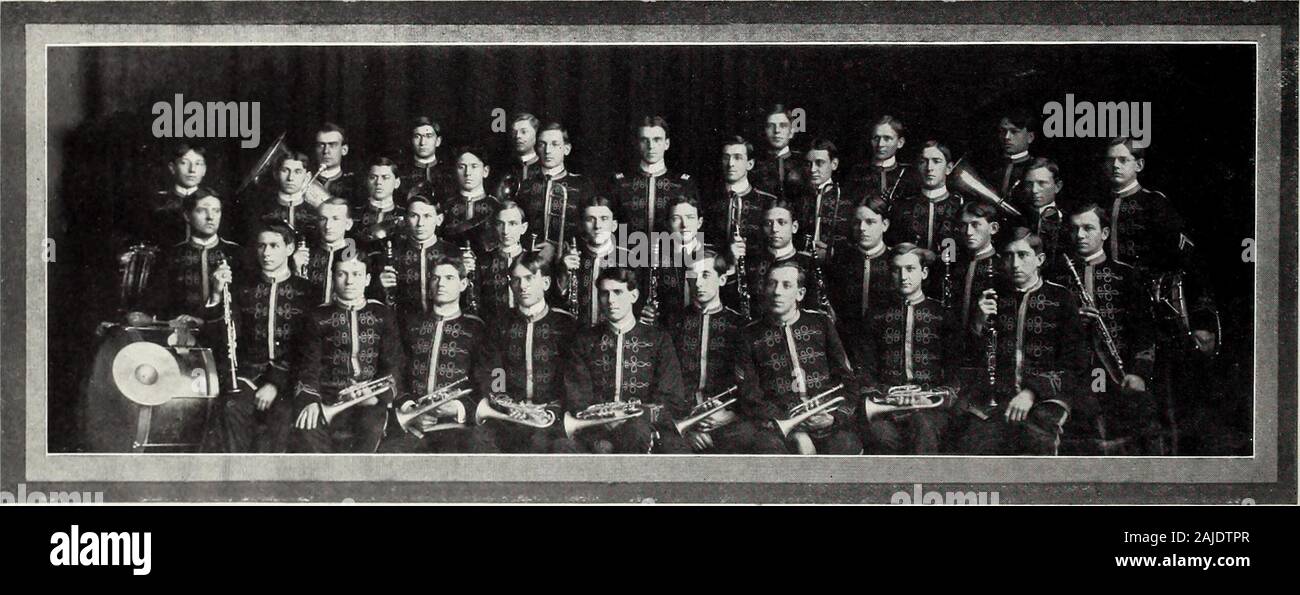 Purdue Ablagerungen. Die Purdue band P urd ue Band, 1904-1905 E. A. Gaston, Kapitän Brownie Smith, zweite Lüge 1111 uanl KORNETT KLARINETTEN POSAUNEN F. F. Mason, 08 S. S. Emrick, 08! •. F. Rlackburn. 06 M. B. Bogarte, 08 S. F. Roberts, 08 C. W. Rost. 08 A.W. Conner, 07 N. F. Arbuckle, 06 R. M. Robinson. 08 S. L. Clark, 08 F. FF Fipinsky, 08 R.1. Smith. 06 FI. L. in Thompson, 07 G. C. Keck, 07 J. F. Pidgeon. 06 R. R. Lukens, 08 E.E. Schultz, 08 Il. A. in der lM-enc! Ich. 06 O. L. Arbuckle, 06 E. V. Cook, 06 S. E. Parker, 08 J., wenn Carninc, 08 S. E. Hoop, 05 BAhlTOXr. S ALTOS D. Batman, 08! •,! Mwnic Smith. 0. ^E. Stockfotohttps://www.alamy.de/image-license-details/?v=1https://www.alamy.de/purdue-ablagerungen-die-purdue-band-p-urd-ue-band-1904-1905-e-a-gaston-kapitan-brownie-smith-zweite-luge-1111-uanl-kornett-klarinetten-posaunen-f-f-mason-08-s-s-emrick-08!-f-rlackburn-06-m-b-bogarte-08-s-f-roberts-08-c-w-rost-08-aw-conner-07-n-f-arbuckle-06-r-m-robinson-08-s-l-clark-08-f-ff-fipinsky-08-r1-smith-06-fi-l-in-thompson-07-g-c-keck-07-j-f-pidgeon-06-r-r-lukens-08-ee-schultz-08-il-a-in-der-lm-enc!-ich-06-o-l-arbuckle-06-e-v-cook-06-s-e-parker-08-j-wenn-carninc-08-s-e-hoop-05-bahltoxr-s-altos-d-batman-08!-!-mwnic-smith-0-e-image338365631.html
RM2AJDTPR–Purdue Ablagerungen. Die Purdue band P urd ue Band, 1904-1905 E. A. Gaston, Kapitän Brownie Smith, zweite Lüge 1111 uanl KORNETT KLARINETTEN POSAUNEN F. F. Mason, 08 S. S. Emrick, 08! •. F. Rlackburn. 06 M. B. Bogarte, 08 S. F. Roberts, 08 C. W. Rost. 08 A.W. Conner, 07 N. F. Arbuckle, 06 R. M. Robinson. 08 S. L. Clark, 08 F. FF Fipinsky, 08 R.1. Smith. 06 FI. L. in Thompson, 07 G. C. Keck, 07 J. F. Pidgeon. 06 R. R. Lukens, 08 E.E. Schultz, 08 Il. A. in der lM-enc! Ich. 06 O. L. Arbuckle, 06 E. V. Cook, 06 S. E. Parker, 08 J., wenn Carninc, 08 S. E. Hoop, 05 BAhlTOXr. S ALTOS D. Batman, 08! •,! Mwnic Smith. 0. ^E.
![Plate 25 [Karte begrenzt durch Hudson River, W. 14th St., Hudson St., Perry St.] 1893 durch Robinson, E. (Elisha) Stockfoto Plate 25 [Karte begrenzt durch Hudson River, W. 14th St., Hudson St., Perry St.] 1893 durch Robinson, E. (Elisha) Stockfoto](https://c8.alamy.com/compde/2yr066g/plate-25-karte-begrenzt-durch-hudson-river-w-14th-st-hudson-st-perry-st-1893-durch-robinson-e-elisha-2yr066g.jpg) Plate 25 [Karte begrenzt durch Hudson River, W. 14th St., Hudson St., Perry St.] 1893 durch Robinson, E. (Elisha) Stockfotohttps://www.alamy.de/image-license-details/?v=1https://www.alamy.de/plate-25-karte-begrenzt-durch-hudson-river-w-14th-st-hudson-st-perry-st-1893-durch-robinson-e-elisha-image633715224.html
Plate 25 [Karte begrenzt durch Hudson River, W. 14th St., Hudson St., Perry St.] 1893 durch Robinson, E. (Elisha) Stockfotohttps://www.alamy.de/image-license-details/?v=1https://www.alamy.de/plate-25-karte-begrenzt-durch-hudson-river-w-14th-st-hudson-st-perry-st-1893-durch-robinson-e-elisha-image633715224.htmlRM2YR066G–Plate 25 [Karte begrenzt durch Hudson River, W. 14th St., Hudson St., Perry St.] 1893 durch Robinson, E. (Elisha)
 Purdue Ablagerungen. Die Purdue band P urd ue Band, 1904-1905 E. A. Gaston, Kapitän Brownie Smith, zweite Lüge 1111 uanl KORNETT KLARINETTEN POSAUNEN F. F. Mason, 08 S. S. Emrick, 08! •. F. Rlackburn. 06 M. B. Bogarte, 08 S. F. Roberts, 08 C. W. Rost. 08 A.W. Conner, 07 N. F. Arbuckle, 06 R. M. Robinson. 08 S. L. Clark, 08 F. FF Fipinsky, 08 R.1. Smith. 06 FI. L. in Thompson, 07 G. C. Keck, 07 J. F. Pidgeon. 06 R. R. Lukens, 08 E.E. Schultz, 08 Il. A. in der lM-enc! Ich. 06 O. L. Arbuckle, 06 E. V. Cook, 06 S. E. Parker, 08 J., wenn Carninc, 08 S. E. Hoop, 05 BAhlTOXr. S ALTOS D. Batman, 08! •,! Mwnic Smith. 0. ^E. Stockfotohttps://www.alamy.de/image-license-details/?v=1https://www.alamy.de/purdue-ablagerungen-die-purdue-band-p-urd-ue-band-1904-1905-e-a-gaston-kapitan-brownie-smith-zweite-luge-1111-uanl-kornett-klarinetten-posaunen-f-f-mason-08-s-s-emrick-08!-f-rlackburn-06-m-b-bogarte-08-s-f-roberts-08-c-w-rost-08-aw-conner-07-n-f-arbuckle-06-r-m-robinson-08-s-l-clark-08-f-ff-fipinsky-08-r1-smith-06-fi-l-in-thompson-07-g-c-keck-07-j-f-pidgeon-06-r-r-lukens-08-ee-schultz-08-il-a-in-der-lm-enc!-ich-06-o-l-arbuckle-06-e-v-cook-06-s-e-parker-08-j-wenn-carninc-08-s-e-hoop-05-bahltoxr-s-altos-d-batman-08!-!-mwnic-smith-0-e-image338365497.html
RM2AJDTJ1–Purdue Ablagerungen. Die Purdue band P urd ue Band, 1904-1905 E. A. Gaston, Kapitän Brownie Smith, zweite Lüge 1111 uanl KORNETT KLARINETTEN POSAUNEN F. F. Mason, 08 S. S. Emrick, 08! •. F. Rlackburn. 06 M. B. Bogarte, 08 S. F. Roberts, 08 C. W. Rost. 08 A.W. Conner, 07 N. F. Arbuckle, 06 R. M. Robinson. 08 S. L. Clark, 08 F. FF Fipinsky, 08 R.1. Smith. 06 FI. L. in Thompson, 07 G. C. Keck, 07 J. F. Pidgeon. 06 R. R. Lukens, 08 E.E. Schultz, 08 Il. A. in der lM-enc! Ich. 06 O. L. Arbuckle, 06 E. V. Cook, 06 S. E. Parker, 08 J., wenn Carninc, 08 S. E. Hoop, 05 BAhlTOXr. S ALTOS D. Batman, 08! •,! Mwnic Smith. 0. ^E.
![Plate 15 [Karte begrenzt von W. Houston St., Crosby St., Grand St., Varick St.] 1893 von Robinson, E. (Elisha) Stockfoto Plate 15 [Karte begrenzt von W. Houston St., Crosby St., Grand St., Varick St.] 1893 von Robinson, E. (Elisha) Stockfoto](https://c8.alamy.com/compde/2yr0664/plate-15-karte-begrenzt-von-w-houston-st-crosby-st-grand-st-varick-st-1893-von-robinson-e-elisha-2yr0664.jpg) Plate 15 [Karte begrenzt von W. Houston St., Crosby St., Grand St., Varick St.] 1893 von Robinson, E. (Elisha) Stockfotohttps://www.alamy.de/image-license-details/?v=1https://www.alamy.de/plate-15-karte-begrenzt-von-w-houston-st-crosby-st-grand-st-varick-st-1893-von-robinson-e-elisha-image633715212.html
Plate 15 [Karte begrenzt von W. Houston St., Crosby St., Grand St., Varick St.] 1893 von Robinson, E. (Elisha) Stockfotohttps://www.alamy.de/image-license-details/?v=1https://www.alamy.de/plate-15-karte-begrenzt-von-w-houston-st-crosby-st-grand-st-varick-st-1893-von-robinson-e-elisha-image633715212.htmlRM2YR0664–Plate 15 [Karte begrenzt von W. Houston St., Crosby St., Grand St., Varick St.] 1893 von Robinson, E. (Elisha)
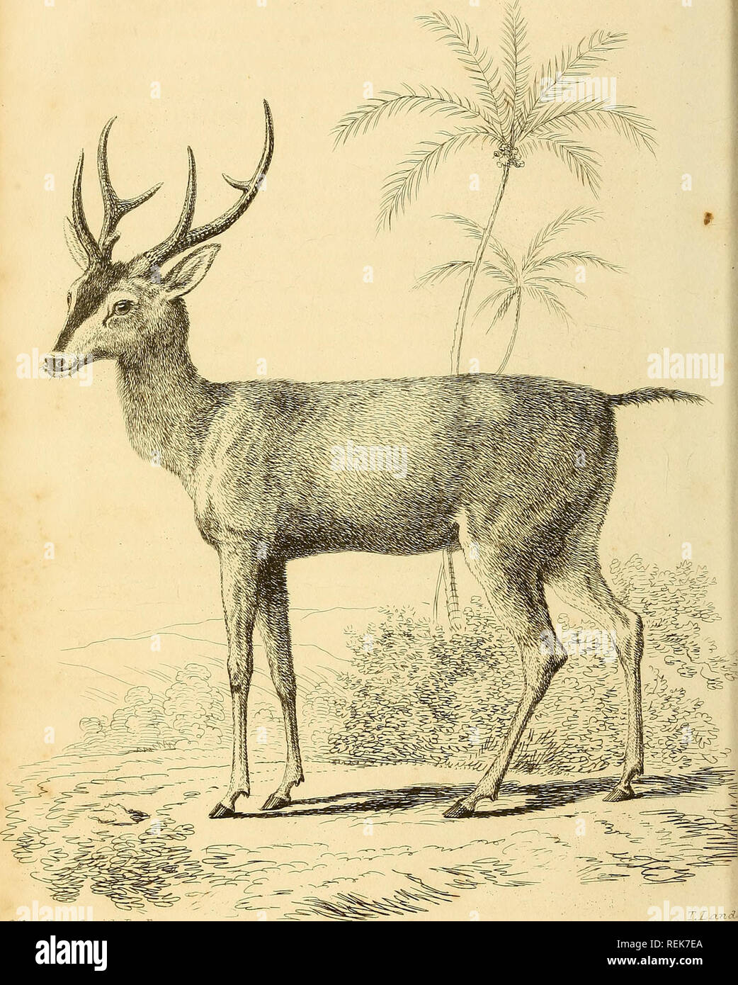 . Die Klasse Mammalia. Säugetiere. /. JfcnrnZton Simth £ s, d. h. l? Paris Mus lETy^A © W TWB M. AMJAMJ &Amp; M. C.3 £ AMIAWNUTS. I> esrn Lo? idonriib'Lis 7 icdIyCB.: r:: U. n, c-Rij-:. Bitte beachten Sie, dass diese Bilder sind von der gescannten Seite Bilder, die digital für die Lesbarkeit verbessert haben mögen - Färbung und Aussehen dieser Abbildungen können nicht perfekt dem Original ähneln. extrahiert. Cuvier, Georges, Baron, 1769-1832; Griffith, Edward, 1790-1858; Pidgeon, Edward; Smith, Charles Hamilton, Landseer, Thomas, 1795-1880, Kranke; Basire, James, 1769-1835, Stecher; Bradley, T., Stecher; Clowes Stockfotohttps://www.alamy.de/image-license-details/?v=1https://www.alamy.de/die-klasse-mammalia-saugetiere-jfcnrnzton-simth-s-d-h-l-paris-mus-letya-w-twb-m-amjamj-amp-m-c3-amiawnuts-igt-esrn-lo-idonriiblis-7-icdiycb-r-u-n-c-rij-bitte-beachten-sie-dass-diese-bilder-sind-von-der-gescannten-seite-bilder-die-digital-fur-die-lesbarkeit-verbessert-haben-mogen-farbung-und-aussehen-dieser-abbildungen-konnen-nicht-perfekt-dem-original-ahneln-extrahiert-cuvier-georges-baron-1769-1832-griffith-edward-1790-1858-pidgeon-edward-smith-charles-hamilton-landseer-thomas-1795-1880-kranke-basire-james-1769-1835-stecher-bradley-t-stecher-clowes-image232762946.html
RMREK7EA–. Die Klasse Mammalia. Säugetiere. /. JfcnrnZton Simth £ s, d. h. l? Paris Mus lETy^A © W TWB M. AMJAMJ &Amp; M. C.3 £ AMIAWNUTS. I> esrn Lo? idonriib'Lis 7 icdIyCB.: r:: U. n, c-Rij-:. Bitte beachten Sie, dass diese Bilder sind von der gescannten Seite Bilder, die digital für die Lesbarkeit verbessert haben mögen - Färbung und Aussehen dieser Abbildungen können nicht perfekt dem Original ähneln. extrahiert. Cuvier, Georges, Baron, 1769-1832; Griffith, Edward, 1790-1858; Pidgeon, Edward; Smith, Charles Hamilton, Landseer, Thomas, 1795-1880, Kranke; Basire, James, 1769-1835, Stecher; Bradley, T., Stecher; Clowes
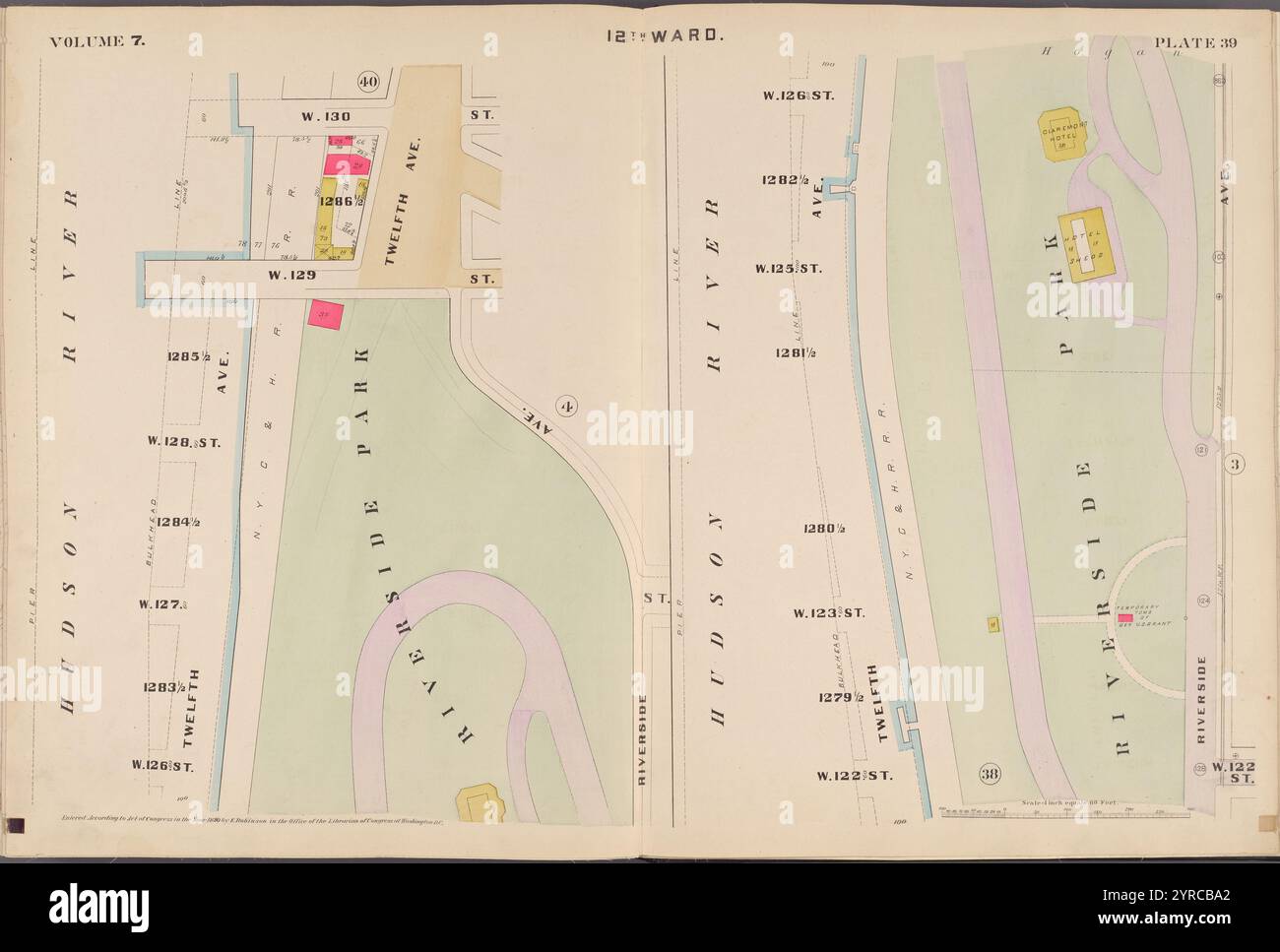 Karte begrenzt von W. 130th St., W. 126th St., Riverside Park, Hudson River, Plate 39 1890 von Robinson, E. (Elisha) Stockfotohttps://www.alamy.de/image-license-details/?v=1https://www.alamy.de/karte-begrenzt-von-w-130th-st-w-126th-st-riverside-park-hudson-river-plate-39-1890-von-robinson-e-elisha-image633982666.html
RM2YRCBA2–Karte begrenzt von W. 130th St., W. 126th St., Riverside Park, Hudson River, Plate 39 1890 von Robinson, E. (Elisha)
 . Die Klasse Mammalia. Säugetiere. Til IP^ fflSCSr MWglE& W3 M. PY& mje U^JL. : Bei IB, A.. Mrnth/;&. r ClumqtlSn. Â: Es S.&. WJattaJcer Jkfj-y.. Bitte beachten Sie, dass diese Bilder sind von der gescannten Seite Bilder, die digital für die Lesbarkeit verbessert haben mögen - Färbung und Aussehen dieser Abbildungen können nicht perfekt dem Original ähneln. extrahiert. Cuvier, Georges, Baron, 1769-1832; Griffith, Edward, 1790-1858; Pidgeon, Edward; Smith, Charles Hamilton, Landseer, Thomas, 1795-1880, Kranke; Basire, James, 1769-1835, Stecher; Bradley, T., Stecher; Clowes, Willi Stockfotohttps://www.alamy.de/image-license-details/?v=1https://www.alamy.de/die-klasse-mammalia-saugetiere-til-ip-fflscsr-mwgleamp-w3-m-pyamp-mje-ujl-bei-ib-a-mrnthamp-r-clumqtlsn-es-samp-wjattajcer-jkfj-y-bitte-beachten-sie-dass-diese-bilder-sind-von-der-gescannten-seite-bilder-die-digital-fur-die-lesbarkeit-verbessert-haben-mogen-farbung-und-aussehen-dieser-abbildungen-konnen-nicht-perfekt-dem-original-ahneln-extrahiert-cuvier-georges-baron-1769-1832-griffith-edward-1790-1858-pidgeon-edward-smith-charles-hamilton-landseer-thomas-1795-1880-kranke-basire-james-1769-1835-stecher-bradley-t-stecher-clowes-willi-image232763145.html
RMREK7ND–. Die Klasse Mammalia. Säugetiere. Til IP^ fflSCSr MWglE& W3 M. PY& mje U^JL. : Bei IB, A.. Mrnth/;&. r ClumqtlSn. Â: Es S.&. WJattaJcer Jkfj-y.. Bitte beachten Sie, dass diese Bilder sind von der gescannten Seite Bilder, die digital für die Lesbarkeit verbessert haben mögen - Färbung und Aussehen dieser Abbildungen können nicht perfekt dem Original ähneln. extrahiert. Cuvier, Georges, Baron, 1769-1832; Griffith, Edward, 1790-1858; Pidgeon, Edward; Smith, Charles Hamilton, Landseer, Thomas, 1795-1880, Kranke; Basire, James, 1769-1835, Stecher; Bradley, T., Stecher; Clowes, Willi
 Karte begrenzt durch W. 106th St., 10th Ave., W. 102nd St., Riverside Ave., Plate 5 1889 von Robinson, E. (Elisha) Stockfotohttps://www.alamy.de/image-license-details/?v=1https://www.alamy.de/karte-begrenzt-durch-w-106th-st-10th-ave-w-102nd-st-riverside-ave-plate-5-1889-von-robinson-e-elisha-image633982780.html
RM2YRCBE4–Karte begrenzt durch W. 106th St., 10th Ave., W. 102nd St., Riverside Ave., Plate 5 1889 von Robinson, E. (Elisha)
 . Die Klasse Mammalia. Säugetiere. , Ijjji 1. "R5=3 â â:! © w KQ 1 1 X 1 N  £ 0& l-n Fc@^SI/; N B*H ein. Bitte beachten Sie, dass diese Bilder sind von der gescannten Seite Bilder, die digital für die Lesbarkeit verbessert haben mögen - Färbung und Aussehen dieser Abbildungen können nicht perfekt dem Original ähneln. extrahiert. Cuvier, Georges, Baron, 1769-1832; Griffith, Edward, 1790-1858; Pidgeon, Edward; Smith, Charles Hamilton, Landseer, Thomas, 1795-1880, Kranke; Basire, James, 1769-1835, Stecher; Bradley, T., Stecher; Clowes, William, 1779-1847, Drucker. London: Gedruckt für Geo. B. in der Whi Stockfotohttps://www.alamy.de/image-license-details/?v=1https://www.alamy.de/die-klasse-mammalia-saugetiere-ijjji-1-r5=3-!-w-kq-1-1-x-1-n-0amp-l-n-fc@si-n-bh-ein-bitte-beachten-sie-dass-diese-bilder-sind-von-der-gescannten-seite-bilder-die-digital-fur-die-lesbarkeit-verbessert-haben-mogen-farbung-und-aussehen-dieser-abbildungen-konnen-nicht-perfekt-dem-original-ahneln-extrahiert-cuvier-georges-baron-1769-1832-griffith-edward-1790-1858-pidgeon-edward-smith-charles-hamilton-landseer-thomas-1795-1880-kranke-basire-james-1769-1835-stecher-bradley-t-stecher-clowes-william-1779-1847-drucker-london-gedruckt-fur-geo-b-in-der-whi-image232762671.html
RMREK74F–. Die Klasse Mammalia. Säugetiere. , Ijjji 1. "R5=3 â â:! © w KQ 1 1 X 1 N  £ 0& l-n Fc@^SI/; N B*H ein. Bitte beachten Sie, dass diese Bilder sind von der gescannten Seite Bilder, die digital für die Lesbarkeit verbessert haben mögen - Färbung und Aussehen dieser Abbildungen können nicht perfekt dem Original ähneln. extrahiert. Cuvier, Georges, Baron, 1769-1832; Griffith, Edward, 1790-1858; Pidgeon, Edward; Smith, Charles Hamilton, Landseer, Thomas, 1795-1880, Kranke; Basire, James, 1769-1835, Stecher; Bradley, T., Stecher; Clowes, William, 1779-1847, Drucker. London: Gedruckt für Geo. B. in der Whi
 Karte begrenzt von W. 118th St., Lenox Ave., W. 114th St., 8th Ave., Platte 13 1890 von Robinson, E. (Elisha) Stockfotohttps://www.alamy.de/image-license-details/?v=1https://www.alamy.de/karte-begrenzt-von-w-118th-st-lenox-ave-w-114th-st-8th-ave-platte-13-1890-von-robinson-e-elisha-image633982665.html
RM2YRCBA1–Karte begrenzt von W. 118th St., Lenox Ave., W. 114th St., 8th Ave., Platte 13 1890 von Robinson, E. (Elisha)
 . Die Klasse Mammalia. Säugetiere. v |. Bis eine IP IE DURCH A. OK WHIL 1 E) © WH M H A = 1 P5 I1 EINEN TJL,. 4 PEBJEJL â Cwv. Zmdan JPtibUshed hv G. JB¢. WHiG &Amp; JC& r 4.9.2.1#g. 6'.. Bitte beachten Sie, dass diese Bilder sind von der gescannten Seite Bilder, die digital für die Lesbarkeit verbessert haben mögen - Färbung und Aussehen dieser Abbildungen können nicht perfekt dem Original ähneln. extrahiert. Cuvier, Georges, Baron, 1769-1832; Griffith, Edward, 1790-1858; Pidgeon, Edward; Smith, Charles Hamilton, Landseer, Thomas, 1795-1880, Kranke; Basire, James, 1769-1835, Stecher; Bradley, T., Stecher; Clowes, W Stockfotohttps://www.alamy.de/image-license-details/?v=1https://www.alamy.de/die-klasse-mammalia-saugetiere-v-bis-eine-ip-ie-durch-a-ok-whil-1-e-wh-m-h-a-=-1-p5-i1-einen-tjl-4-pebjejl-cwv-zmdan-jptibushed-hv-g-jb-whig-amp-jcamp-r-4921g-6-bitte-beachten-sie-dass-diese-bilder-sind-von-der-gescannten-seite-bilder-die-digital-fur-die-lesbarkeit-verbessert-haben-mogen-farbung-und-aussehen-dieser-abbildungen-konnen-nicht-perfekt-dem-original-ahneln-extrahiert-cuvier-georges-baron-1769-1832-griffith-edward-1790-1858-pidgeon-edward-smith-charles-hamilton-landseer-thomas-1795-1880-kranke-basire-james-1769-1835-stecher-bradley-t-stecher-clowes-w-image232762586.html
RMREK71E–. Die Klasse Mammalia. Säugetiere. v |. Bis eine IP IE DURCH A. OK WHIL 1 E) © WH M H A = 1 P5 I1 EINEN TJL,. 4 PEBJEJL â Cwv. Zmdan JPtibUshed hv G. JB¢. WHiG &Amp; JC& r 4.9.2.1#g. 6'.. Bitte beachten Sie, dass diese Bilder sind von der gescannten Seite Bilder, die digital für die Lesbarkeit verbessert haben mögen - Färbung und Aussehen dieser Abbildungen können nicht perfekt dem Original ähneln. extrahiert. Cuvier, Georges, Baron, 1769-1832; Griffith, Edward, 1790-1858; Pidgeon, Edward; Smith, Charles Hamilton, Landseer, Thomas, 1795-1880, Kranke; Basire, James, 1769-1835, Stecher; Bradley, T., Stecher; Clowes, W
 Karte begrenzt von W. 94th St., 10th Ave., W. 90thSt., Riverside Ave., Plate 2 1889 von Robinson, E. (Elisha) Stockfotohttps://www.alamy.de/image-license-details/?v=1https://www.alamy.de/karte-begrenzt-von-w-94th-st-10th-ave-w-90thst-riverside-ave-plate-2-1889-von-robinson-e-elisha-image633715364.html
RM2YR06BG–Karte begrenzt von W. 94th St., 10th Ave., W. 90thSt., Riverside Ave., Plate 2 1889 von Robinson, E. (Elisha)
 Platte 14: Begrenzt durch W. 40th Street, Sixth Avenue, W. 27th Street und Twelfth Avenue 1885 durch Robinson, E. (Elisha) Stockfotohttps://www.alamy.de/image-license-details/?v=1https://www.alamy.de/platte-14-begrenzt-durch-w-40th-street-sixth-avenue-w-27th-street-und-twelfth-avenue-1885-durch-robinson-e-elisha-image633126508.html
RM2YP1B90–Platte 14: Begrenzt durch W. 40th Street, Sixth Avenue, W. 27th Street und Twelfth Avenue 1885 durch Robinson, E. (Elisha)
![Plate 8 [Karte begrenzt durch Grand St., Bowery, Worth St., W. Broadway, S. 5th Ave.] 1893 durch Robinson, E. (Elisha) Stockfoto Plate 8 [Karte begrenzt durch Grand St., Bowery, Worth St., W. Broadway, S. 5th Ave.] 1893 durch Robinson, E. (Elisha) Stockfoto](https://c8.alamy.com/compde/2yr065n/plate-8-karte-begrenzt-durch-grand-st-bowery-worth-st-w-broadway-s-5th-ave-1893-durch-robinson-e-elisha-2yr065n.jpg) Plate 8 [Karte begrenzt durch Grand St., Bowery, Worth St., W. Broadway, S. 5th Ave.] 1893 durch Robinson, E. (Elisha) Stockfotohttps://www.alamy.de/image-license-details/?v=1https://www.alamy.de/plate-8-karte-begrenzt-durch-grand-st-bowery-worth-st-w-broadway-s-5th-ave-1893-durch-robinson-e-elisha-image633715201.html
Plate 8 [Karte begrenzt durch Grand St., Bowery, Worth St., W. Broadway, S. 5th Ave.] 1893 durch Robinson, E. (Elisha) Stockfotohttps://www.alamy.de/image-license-details/?v=1https://www.alamy.de/plate-8-karte-begrenzt-durch-grand-st-bowery-worth-st-w-broadway-s-5th-ave-1893-durch-robinson-e-elisha-image633715201.htmlRM2YR065N–Plate 8 [Karte begrenzt durch Grand St., Bowery, Worth St., W. Broadway, S. 5th Ave.] 1893 durch Robinson, E. (Elisha)
 Karte begrenzt von W. 94th St., Central Park W., W. 90thSt., 10th Ave., Plate 9 1889 von Robinson, E. (Elisha) Stockfotohttps://www.alamy.de/image-license-details/?v=1https://www.alamy.de/karte-begrenzt-von-w-94th-st-central-park-w-w-90thst-10th-ave-plate-9-1889-von-robinson-e-elisha-image633715371.html
RM2YR06BR–Karte begrenzt von W. 94th St., Central Park W., W. 90thSt., 10th Ave., Plate 9 1889 von Robinson, E. (Elisha)
 Karte begrenzt durch W. 138th St., 10th Ave., W. 134th St., 12th Ave., Plate 6 1890 von Robinson, E. (Elisha) Stockfotohttps://www.alamy.de/image-license-details/?v=1https://www.alamy.de/karte-begrenzt-durch-w-138th-st-10th-ave-w-134th-st-12th-ave-plate-6-1890-von-robinson-e-elisha-image633714861.html
RM2YR05NH–Karte begrenzt durch W. 138th St., 10th Ave., W. 134th St., 12th Ave., Plate 6 1890 von Robinson, E. (Elisha)
 Karte begrenzt von W. 126th St., Madison Ave., W. 122nd St., Lenox Ave., Plate 21 1890 von Robinson, E. (Elisha) Stockfotohttps://www.alamy.de/image-license-details/?v=1https://www.alamy.de/karte-begrenzt-von-w-126th-st-madison-ave-w-122nd-st-lenox-ave-plate-21-1890-von-robinson-e-elisha-image633715024.html
RM2YR05YC–Karte begrenzt von W. 126th St., Madison Ave., W. 122nd St., Lenox Ave., Plate 21 1890 von Robinson, E. (Elisha)
 Karte begrenzt von W. 138th St., 12th Ave., W. 134th St., Hudson River, Plate 40 1890 von Robinson, E. (Elisha) Stockfotohttps://www.alamy.de/image-license-details/?v=1https://www.alamy.de/karte-begrenzt-von-w-138th-st-12th-ave-w-134th-st-hudson-river-plate-40-1890-von-robinson-e-elisha-image633715042.html
RM2YR0602–Karte begrenzt von W. 138th St., 12th Ave., W. 134th St., Hudson River, Plate 40 1890 von Robinson, E. (Elisha)
 Karte begrenzt durch W. 114th St., Madison Ave., W. 110th St., Lenox Ave., Platte 16 1889 von Robinson, E. (Elisha) Stockfotohttps://www.alamy.de/image-license-details/?v=1https://www.alamy.de/karte-begrenzt-durch-w-114th-st-madison-ave-w-110th-st-lenox-ave-platte-16-1889-von-robinson-e-elisha-image633715379.html
RM2YR06C3–Karte begrenzt durch W. 114th St., Madison Ave., W. 110th St., Lenox Ave., Platte 16 1889 von Robinson, E. (Elisha)
 Karte begrenzt von W. 122nd St., W. 118th St., Riverside Park, Hudson River, Plate 38 1890 von Robinson, E. (Elisha) Stockfotohttps://www.alamy.de/image-license-details/?v=1https://www.alamy.de/karte-begrenzt-von-w-122nd-st-w-118th-st-riverside-park-hudson-river-plate-38-1890-von-robinson-e-elisha-image633715041.html
RM2YR0601–Karte begrenzt von W. 122nd St., W. 118th St., Riverside Park, Hudson River, Plate 38 1890 von Robinson, E. (Elisha)
 Karte begrenzt von W. 138th St., Madison Ave., W. 134th St., Lenox Ave., Plate 24 1890 von Robinson, E. (Elisha) Stockfotohttps://www.alamy.de/image-license-details/?v=1https://www.alamy.de/karte-begrenzt-von-w-138th-st-madison-ave-w-134th-st-lenox-ave-plate-24-1890-von-robinson-e-elisha-image633715027.html
RM2YR05YF–Karte begrenzt von W. 138th St., Madison Ave., W. 134th St., Lenox Ave., Plate 24 1890 von Robinson, E. (Elisha)
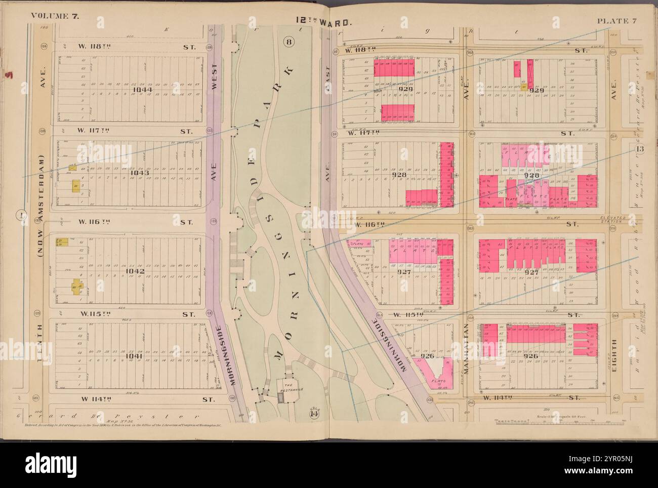 Karte begrenzt durch W. 118th St., 8th Ave., W. 114th St., 10th Ave., Plate 7 1890 von Robinson, E. (Elisha) Stockfotohttps://www.alamy.de/image-license-details/?v=1https://www.alamy.de/karte-begrenzt-durch-w-118th-st-8th-ave-w-114th-st-10th-ave-plate-7-1890-von-robinson-e-elisha-image633714862.html
RM2YR05NJ–Karte begrenzt durch W. 118th St., 8th Ave., W. 114th St., 10th Ave., Plate 7 1890 von Robinson, E. (Elisha)
 Karte begrenzt durch W. 122nd St., Lenox Ave., W. 118th St., 8th Ave., Platte 14 1890 von Robinson, E. (Elisha) Stockfotohttps://www.alamy.de/image-license-details/?v=1https://www.alamy.de/karte-begrenzt-durch-w-122nd-st-lenox-ave-w-118th-st-8th-ave-platte-14-1890-von-robinson-e-elisha-image633714893.html
RM2YR05PN–Karte begrenzt durch W. 122nd St., Lenox Ave., W. 118th St., 8th Ave., Platte 14 1890 von Robinson, E. (Elisha)
 Karte begrenzt von W. 114th St., Lenox Ave., W. 110th St., 8th Ave., Platte 15 1889 von Robinson, E. (Elisha) Stockfotohttps://www.alamy.de/image-license-details/?v=1https://www.alamy.de/karte-begrenzt-von-w-114th-st-lenox-ave-w-110th-st-8th-ave-platte-15-1889-von-robinson-e-elisha-image633715377.html
RM2YR06C1–Karte begrenzt von W. 114th St., Lenox Ave., W. 110th St., 8th Ave., Platte 15 1889 von Robinson, E. (Elisha)
 Karte begrenzt durch W. 126th St., 8th Ave., W. 122nd St., 10th Ave., Platte 9 1890 von Robinson, E. (Elisha) Stockfotohttps://www.alamy.de/image-license-details/?v=1https://www.alamy.de/karte-begrenzt-durch-w-126th-st-8th-ave-w-122nd-st-10th-ave-platte-9-1890-von-robinson-e-elisha-image633714865.html
RM2YR05NN–Karte begrenzt durch W. 126th St., 8th Ave., W. 122nd St., 10th Ave., Platte 9 1890 von Robinson, E. (Elisha)
 Karte begrenzt von W. 90th St., Lexington Ave., E. 86th St., 5th Ave., Plate 17 1889 von Robinson, E. (Elisha) Stockfotohttps://www.alamy.de/image-license-details/?v=1https://www.alamy.de/karte-begrenzt-von-w-90th-st-lexington-ave-e-86th-st-5th-ave-plate-17-1889-von-robinson-e-elisha-image633715380.html
RM2YR06C4–Karte begrenzt von W. 90th St., Lexington Ave., E. 86th St., 5th Ave., Plate 17 1889 von Robinson, E. (Elisha)
 Karte begrenzt durch W. 130th St., Lenox Ave., W. 126th St., 8th Ave., Platte 16 1890 von Robinson, E. (Elisha) Stockfotohttps://www.alamy.de/image-license-details/?v=1https://www.alamy.de/karte-begrenzt-durch-w-130th-st-lenox-ave-w-126th-st-8th-ave-platte-16-1890-von-robinson-e-elisha-image633714992.html
RM2YR05X8–Karte begrenzt durch W. 130th St., Lenox Ave., W. 126th St., 8th Ave., Platte 16 1890 von Robinson, E. (Elisha)
 Karte begrenzt durch W. 134th St., 10th Ave., W. 130th St., 12th Ave., Platte 5 1890 durch Robinson, E. (Elisha) Stockfotohttps://www.alamy.de/image-license-details/?v=1https://www.alamy.de/karte-begrenzt-durch-w-134th-st-10th-ave-w-130th-st-12th-ave-platte-5-1890-durch-robinson-e-elisha-image633714859.html
RM2YR05NF–Karte begrenzt durch W. 134th St., 10th Ave., W. 130th St., 12th Ave., Platte 5 1890 durch Robinson, E. (Elisha)
 Karte begrenzt von W. 114th St., 10th Ave., W. 110th St., Riverside Ave., Plate 7 1889 von Robinson, E. (Elisha) Stockfotohttps://www.alamy.de/image-license-details/?v=1https://www.alamy.de/karte-begrenzt-von-w-114th-st-10th-ave-w-110th-st-riverside-ave-plate-7-1889-von-robinson-e-elisha-image633715369.html
RM2YR06BN–Karte begrenzt von W. 114th St., 10th Ave., W. 110th St., Riverside Ave., Plate 7 1889 von Robinson, E. (Elisha)
 Karte begrenzt durch W. 98th St., 10th Ave., W. 94th St., Riverside Ave., Plate 3 1889 von Robinson, E. (Elisha) Stockfotohttps://www.alamy.de/image-license-details/?v=1https://www.alamy.de/karte-begrenzt-durch-w-98th-st-10th-ave-w-94th-st-riverside-ave-plate-3-1889-von-robinson-e-elisha-image633715365.html
RM2YR06BH–Karte begrenzt durch W. 98th St., 10th Ave., W. 94th St., Riverside Ave., Plate 3 1889 von Robinson, E. (Elisha)
 Karte begrenzt von W. 126th St., Lenox Ave., W. 122nd St., 8th Ave., Platte 15 1890 von Robinson, E. (Elisha) Stockfotohttps://www.alamy.de/image-license-details/?v=1https://www.alamy.de/karte-begrenzt-von-w-126th-st-lenox-ave-w-122nd-st-8th-ave-platte-15-1890-von-robinson-e-elisha-image633714965.html
RM2YR05W9–Karte begrenzt von W. 126th St., Lenox Ave., W. 122nd St., 8th Ave., Platte 15 1890 von Robinson, E. (Elisha)
 Karte begrenzt von E. 118th St., Madison Ave., W. 114th St., Lenox Ave., Platte 19 1890 von Robinson, E. (Elisha) Stockfotohttps://www.alamy.de/image-license-details/?v=1https://www.alamy.de/karte-begrenzt-von-e-118th-st-madison-ave-w-114th-st-lenox-ave-platte-19-1890-von-robinson-e-elisha-image633715022.html
RM2YR05YA–Karte begrenzt von E. 118th St., Madison Ave., W. 114th St., Lenox Ave., Platte 19 1890 von Robinson, E. (Elisha)
 Karte begrenzt von W. 134th St., Madison Ave., W. 130th St., Lenox Ave., Plate 23 1890 von Robinson, E. (Elisha) Stockfotohttps://www.alamy.de/image-license-details/?v=1https://www.alamy.de/karte-begrenzt-von-w-134th-st-madison-ave-w-130th-st-lenox-ave-plate-23-1890-von-robinson-e-elisha-image633715026.html
RM2YR05YE–Karte begrenzt von W. 134th St., Madison Ave., W. 130th St., Lenox Ave., Plate 23 1890 von Robinson, E. (Elisha)
 Karte begrenzt durch W. 90th St., 10th Ave., W. 86th St., Riverside Ave., Platte 1 1889 durch Robinson, E. (Elisha) Stockfotohttps://www.alamy.de/image-license-details/?v=1https://www.alamy.de/karte-begrenzt-durch-w-90th-st-10th-ave-w-86th-st-riverside-ave-platte-1-1889-durch-robinson-e-elisha-image633715363.html
RM2YR06BF–Karte begrenzt durch W. 90th St., 10th Ave., W. 86th St., Riverside Ave., Platte 1 1889 durch Robinson, E. (Elisha)
 Karte begrenzt durch W. 134th St., Lenox Ave., W. 130th St., 8th Ave., Platte 17 1890 durch Robinson, E. (Elisha) Stockfotohttps://www.alamy.de/image-license-details/?v=1https://www.alamy.de/karte-begrenzt-durch-w-134th-st-lenox-ave-w-130th-st-8th-ave-platte-17-1890-durch-robinson-e-elisha-image633715019.html
RM2YR05Y7–Karte begrenzt durch W. 134th St., Lenox Ave., W. 130th St., 8th Ave., Platte 17 1890 durch Robinson, E. (Elisha)
 Karte begrenzt durch W. 122nd St., 8th Ave., W. 118th St., 10th Ave., Plate 8 1890 von Robinson, E. (Elisha) Stockfotohttps://www.alamy.de/image-license-details/?v=1https://www.alamy.de/karte-begrenzt-durch-w-122nd-st-8th-ave-w-118th-st-10th-ave-plate-8-1890-von-robinson-e-elisha-image633714864.html
RM2YR05NM–Karte begrenzt durch W. 122nd St., 8th Ave., W. 118th St., 10th Ave., Plate 8 1890 von Robinson, E. (Elisha)
 Karte begrenzt durch W. 126th St., 10th Ave., W. 122nd St., Riverside Ave., Plate 3 1890 von Robinson, E. (Elisha) Stockfotohttps://www.alamy.de/image-license-details/?v=1https://www.alamy.de/karte-begrenzt-durch-w-126th-st-10th-ave-w-122nd-st-riverside-ave-plate-3-1890-von-robinson-e-elisha-image633714857.html
RM2YR05ND–Karte begrenzt durch W. 126th St., 10th Ave., W. 122nd St., Riverside Ave., Plate 3 1890 von Robinson, E. (Elisha)
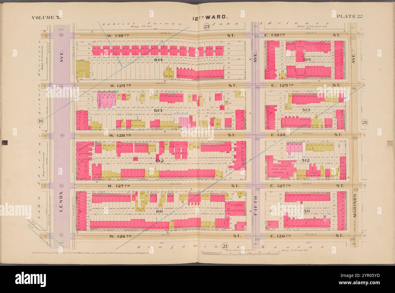 Karte begrenzt durch W. 130th St., Madison Ave., W. 126th St., Lenox Ave., Plate 22 1890 von Robinson, E. (Elisha) Stockfotohttps://www.alamy.de/image-license-details/?v=1https://www.alamy.de/karte-begrenzt-durch-w-130th-st-madison-ave-w-126th-st-lenox-ave-plate-22-1890-von-robinson-e-elisha-image633715025.html
RM2YR05YD–Karte begrenzt durch W. 130th St., Madison Ave., W. 126th St., Lenox Ave., Plate 22 1890 von Robinson, E. (Elisha)
 Karte begrenzt von W. 138th St., Lenox Ave., W. 134th St., 8th Ave., Platte 18 1890 von Robinson, E. (Elisha) Stockfotohttps://www.alamy.de/image-license-details/?v=1https://www.alamy.de/karte-begrenzt-von-w-138th-st-lenox-ave-w-134th-st-8th-ave-platte-18-1890-von-robinson-e-elisha-image633715020.html
RM2YR05Y8–Karte begrenzt von W. 138th St., Lenox Ave., W. 134th St., 8th Ave., Platte 18 1890 von Robinson, E. (Elisha)
 Karte begrenzt von W. 102nd St., 10th Ave., W. 98th St., Riverside Ave., Plate 4 1889 von Robinson, E. (Elisha) Stockfotohttps://www.alamy.de/image-license-details/?v=1https://www.alamy.de/karte-begrenzt-von-w-102nd-st-10th-ave-w-98th-st-riverside-ave-plate-4-1889-von-robinson-e-elisha-image633715367.html
RM2YR06BK–Karte begrenzt von W. 102nd St., 10th Ave., W. 98th St., Riverside Ave., Plate 4 1889 von Robinson, E. (Elisha)
 Karte begrenzt durch W. 122nd St., Madison Ave., W. 118th St., Lenox Ave., Platte 20 1890 durch Robinson, E. (Elisha) Stockfotohttps://www.alamy.de/image-license-details/?v=1https://www.alamy.de/karte-begrenzt-durch-w-122nd-st-madison-ave-w-118th-st-lenox-ave-platte-20-1890-durch-robinson-e-elisha-image633715023.html
RM2YR05YB–Karte begrenzt durch W. 122nd St., Madison Ave., W. 118th St., Lenox Ave., Platte 20 1890 durch Robinson, E. (Elisha)
 Karte begrenzt von W. 110th St., 10th Ave., W. 106th St., Riverside Ave., Plate 6 1889 von Robinson, E. (Elisha) Stockfotohttps://www.alamy.de/image-license-details/?v=1https://www.alamy.de/karte-begrenzt-von-w-110th-st-10th-ave-w-106th-st-riverside-ave-plate-6-1889-von-robinson-e-elisha-image633715368.html
RM2YR06BM–Karte begrenzt von W. 110th St., 10th Ave., W. 106th St., Riverside Ave., Plate 6 1889 von Robinson, E. (Elisha)
 Karte begrenzt durch W. 98th St., Central Park W., W. 94th St., 10th Ave., Plate 10 1889 von Robinson, E. (Elisha) Stockfotohttps://www.alamy.de/image-license-details/?v=1https://www.alamy.de/karte-begrenzt-durch-w-98th-st-central-park-w-w-94th-st-10th-ave-plate-10-1889-von-robinson-e-elisha-image633982782.html
RM2YRCBE6–Karte begrenzt durch W. 98th St., Central Park W., W. 94th St., 10th Ave., Plate 10 1889 von Robinson, E. (Elisha)
 Karte begrenzt durch W. 134th St., 8th Ave., W. 130th St., 10th Ave., Platte 11 1890 durch Robinson, E. (Elisha) Stockfotohttps://www.alamy.de/image-license-details/?v=1https://www.alamy.de/karte-begrenzt-durch-w-134th-st-8th-ave-w-130th-st-10th-ave-platte-11-1890-durch-robinson-e-elisha-image633714868.html
RM2YR05NT–Karte begrenzt durch W. 134th St., 8th Ave., W. 130th St., 10th Ave., Platte 11 1890 durch Robinson, E. (Elisha)
 Karte begrenzt durch W. 138th St., 8th Ave., W. 134th St., 10th Ave., Platte 12 1890 durch Robinson, E. (Elisha) Stockfotohttps://www.alamy.de/image-license-details/?v=1https://www.alamy.de/karte-begrenzt-durch-w-138th-st-8th-ave-w-134th-st-10th-ave-platte-12-1890-durch-robinson-e-elisha-image633714869.html
RM2YR05NW–Karte begrenzt durch W. 138th St., 8th Ave., W. 134th St., 10th Ave., Platte 12 1890 durch Robinson, E. (Elisha)
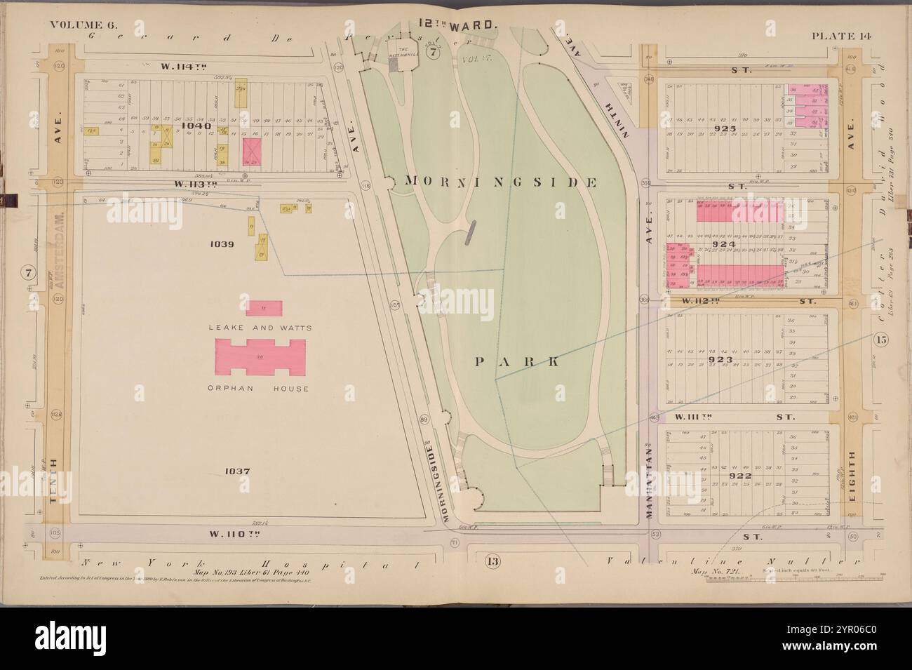 Karte begrenzt durch W. 114th St., 8th Ave., W. 110th St., 10th Ave., Platte 14 1889 durch Robinson, E. (Elisha) Stockfotohttps://www.alamy.de/image-license-details/?v=1https://www.alamy.de/karte-begrenzt-durch-w-114th-st-8th-ave-w-110th-st-10th-ave-platte-14-1889-durch-robinson-e-elisha-image633715376.html
RM2YR06C0–Karte begrenzt durch W. 114th St., 8th Ave., W. 110th St., 10th Ave., Platte 14 1889 durch Robinson, E. (Elisha)
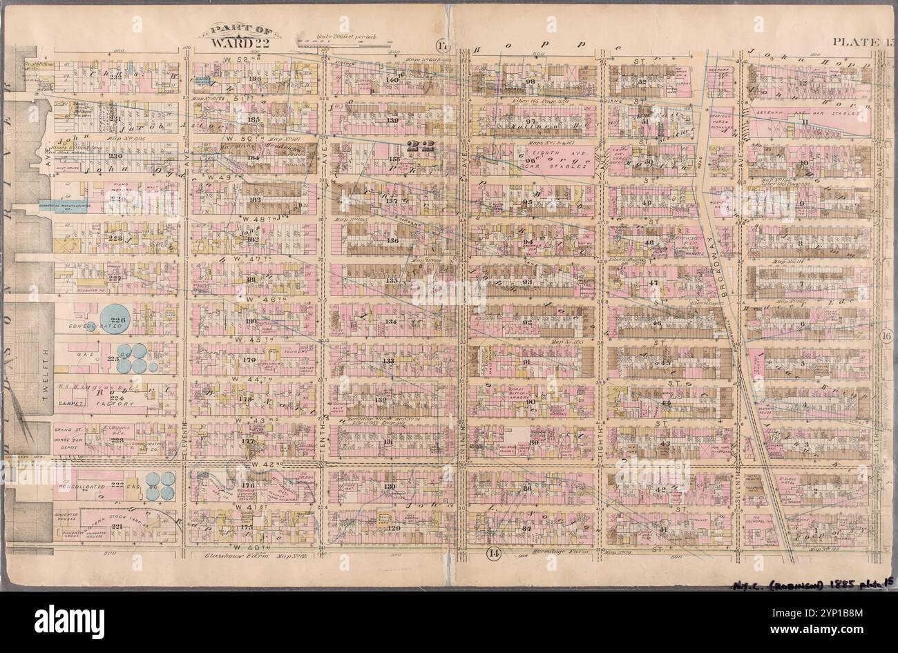 Platte 15: Begrenzt durch W. 52nd Street, Sixth Avenue, W. 40th Street und (Hudson River) Twelfth Avenue 1885 durch Robinson, E. (Elisha) Stockfotohttps://www.alamy.de/image-license-details/?v=1https://www.alamy.de/platte-15-begrenzt-durch-w-52nd-street-sixth-avenue-w-40th-street-und-hudson-river-twelfth-avenue-1885-durch-robinson-e-elisha-image633126500.html
RM2YP1B8M–Platte 15: Begrenzt durch W. 52nd Street, Sixth Avenue, W. 40th Street und (Hudson River) Twelfth Avenue 1885 durch Robinson, E. (Elisha)
 Karte begrenzt durch W. 90th St., Central Park W., W. 86th St., 10th Ave., Platte 8 1889 durch Robinson, E. (Elisha) Stockfotohttps://www.alamy.de/image-license-details/?v=1https://www.alamy.de/karte-begrenzt-durch-w-90th-st-central-park-w-w-86th-st-10th-ave-platte-8-1889-durch-robinson-e-elisha-image633715370.html
RM2YR06BP–Karte begrenzt durch W. 90th St., Central Park W., W. 86th St., 10th Ave., Platte 8 1889 durch Robinson, E. (Elisha)
 Karte begrenzt von W. 110th St., Central Park W., W. 106th St., 10th St., Plate 13 1889 von Robinson, E. (Elisha) Stockfotohttps://www.alamy.de/image-license-details/?v=1https://www.alamy.de/karte-begrenzt-von-w-110th-st-central-park-w-w-106th-st-10th-st-plate-13-1889-von-robinson-e-elisha-image633715375.html
RM2YR06BY–Karte begrenzt von W. 110th St., Central Park W., W. 106th St., 10th St., Plate 13 1889 von Robinson, E. (Elisha)
 Karte begrenzt durch W. 106th St., Central Park W., W. 102nd St., 10th Ave., Platte 12 1889 durch Robinson, E. (Elisha) Stockfotohttps://www.alamy.de/image-license-details/?v=1https://www.alamy.de/karte-begrenzt-durch-w-106th-st-central-park-w-w-102nd-st-10th-ave-platte-12-1889-durch-robinson-e-elisha-image633715373.html
RM2YR06BW–Karte begrenzt durch W. 106th St., Central Park W., W. 102nd St., 10th Ave., Platte 12 1889 durch Robinson, E. (Elisha)
 Karte begrenzt durch W. 102nd St., Central Park W., W. 98th St., 10th Ave., Platte 11 1889 durch Robinson, E. (Elisha) Stockfotohttps://www.alamy.de/image-license-details/?v=1https://www.alamy.de/karte-begrenzt-durch-w-102nd-st-central-park-w-w-98th-st-10th-ave-platte-11-1889-durch-robinson-e-elisha-image633715372.html
RM2YR06BT–Karte begrenzt durch W. 102nd St., Central Park W., W. 98th St., 10th Ave., Platte 11 1889 durch Robinson, E. (Elisha)
![Plate 23 [Karte begrenzt durch W. 14th St., 4th Ave., Astor PL., Waverly PL., 6th Ave.] 1893 von Robinson, E. (Elisha) Stockfoto Plate 23 [Karte begrenzt durch W. 14th St., 4th Ave., Astor PL., Waverly PL., 6th Ave.] 1893 von Robinson, E. (Elisha) Stockfoto](https://c8.alamy.com/compde/2yr066d/plate-23-karte-begrenzt-durch-w-14th-st-4th-ave-astor-pl-waverly-pl-6th-ave-1893-von-robinson-e-elisha-2yr066d.jpg) Plate 23 [Karte begrenzt durch W. 14th St., 4th Ave., Astor PL., Waverly PL., 6th Ave.] 1893 von Robinson, E. (Elisha) Stockfotohttps://www.alamy.de/image-license-details/?v=1https://www.alamy.de/plate-23-karte-begrenzt-durch-w-14th-st-4th-ave-astor-pl-waverly-pl-6th-ave-1893-von-robinson-e-elisha-image633715221.html
Plate 23 [Karte begrenzt durch W. 14th St., 4th Ave., Astor PL., Waverly PL., 6th Ave.] 1893 von Robinson, E. (Elisha) Stockfotohttps://www.alamy.de/image-license-details/?v=1https://www.alamy.de/plate-23-karte-begrenzt-durch-w-14th-st-4th-ave-astor-pl-waverly-pl-6th-ave-1893-von-robinson-e-elisha-image633715221.htmlRM2YR066D–Plate 23 [Karte begrenzt durch W. 14th St., 4th Ave., Astor PL., Waverly PL., 6th Ave.] 1893 von Robinson, E. (Elisha)
![Plate 24 [Karte begrenzt durch W. 14th St., 6th Ave., Washington PL., W. 10th St., Hudson St.] 1893 durch Robinson, E. (Elisha) Stockfoto Plate 24 [Karte begrenzt durch W. 14th St., 6th Ave., Washington PL., W. 10th St., Hudson St.] 1893 durch Robinson, E. (Elisha) Stockfoto](https://c8.alamy.com/compde/2yr066e/plate-24-karte-begrenzt-durch-w-14th-st-6th-ave-washington-pl-w-10th-st-hudson-st-1893-durch-robinson-e-elisha-2yr066e.jpg) Plate 24 [Karte begrenzt durch W. 14th St., 6th Ave., Washington PL., W. 10th St., Hudson St.] 1893 durch Robinson, E. (Elisha) Stockfotohttps://www.alamy.de/image-license-details/?v=1https://www.alamy.de/plate-24-karte-begrenzt-durch-w-14th-st-6th-ave-washington-pl-w-10th-st-hudson-st-1893-durch-robinson-e-elisha-image633715222.html
Plate 24 [Karte begrenzt durch W. 14th St., 6th Ave., Washington PL., W. 10th St., Hudson St.] 1893 durch Robinson, E. (Elisha) Stockfotohttps://www.alamy.de/image-license-details/?v=1https://www.alamy.de/plate-24-karte-begrenzt-durch-w-14th-st-6th-ave-washington-pl-w-10th-st-hudson-st-1893-durch-robinson-e-elisha-image633715222.htmlRM2YR066E–Plate 24 [Karte begrenzt durch W. 14th St., 6th Ave., Washington PL., W. 10th St., Hudson St.] 1893 durch Robinson, E. (Elisha)
 Karte begrenzt durch W. 102nd St., W. 98th St., Riverside Park, W. 94th St., Hudson River, Platte 41 1889 von Robinson, E. (Elisha) Stockfotohttps://www.alamy.de/image-license-details/?v=1https://www.alamy.de/karte-begrenzt-durch-w-102nd-st-w-98th-st-riverside-park-w-94th-st-hudson-river-platte-41-1889-von-robinson-e-elisha-image633715551.html
RM2YR06J7–Karte begrenzt durch W. 102nd St., W. 98th St., Riverside Park, W. 94th St., Hudson River, Platte 41 1889 von Robinson, E. (Elisha)
 Karte begrenzt durch W. 94th St., W. 90th St., Riverside Park, W. 86th St., Hudson River, Platte 40 1889 von Robinson, E. (Elisha) Stockfotohttps://www.alamy.de/image-license-details/?v=1https://www.alamy.de/karte-begrenzt-durch-w-94th-st-w-90th-st-riverside-park-w-86th-st-hudson-river-platte-40-1889-von-robinson-e-elisha-image633715549.html
RM2YR06J5–Karte begrenzt durch W. 94th St., W. 90th St., Riverside Park, W. 86th St., Hudson River, Platte 40 1889 von Robinson, E. (Elisha)
 Karte begrenzt durch W. 114th St., Harlem River, E. 90th St., W. 110th St., Hudson River, Platte 39 1889 von Robinson, E. (Elisha) Stockfotohttps://www.alamy.de/image-license-details/?v=1https://www.alamy.de/karte-begrenzt-durch-w-114th-st-harlem-river-e-90th-st-w-110th-st-hudson-river-platte-39-1889-von-robinson-e-elisha-image633715548.html
RM2YR06J4–Karte begrenzt durch W. 114th St., Harlem River, E. 90th St., W. 110th St., Hudson River, Platte 39 1889 von Robinson, E. (Elisha)
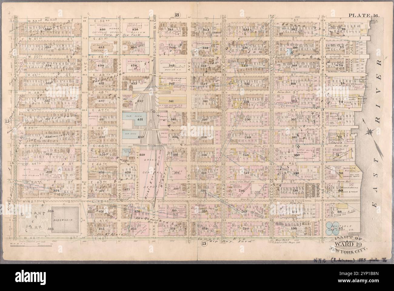 Platte 16: Begrenzt durch W. 52nd Street, E. 52nd Street, (East River) First Avenue, E. 40th Street und Sixth Avenue 1885 durch Robinson, E. (Elisha) Stockfotohttps://www.alamy.de/image-license-details/?v=1https://www.alamy.de/platte-16-begrenzt-durch-w-52nd-street-e-52nd-street-east-river-first-avenue-e-40th-street-und-sixth-avenue-1885-durch-robinson-e-elisha-image633126501.html
RM2YP1B8N–Platte 16: Begrenzt durch W. 52nd Street, E. 52nd Street, (East River) First Avenue, E. 40th Street und Sixth Avenue 1885 durch Robinson, E. (Elisha)
 Platte 23: Begrenzt durch W. 77th Street, Eighth Avenue (Central Park), W. 84th Street und (Hudson River) Twelfth Avenue 1885 durch Robinson, E. (Elisha) Stockfotohttps://www.alamy.de/image-license-details/?v=1https://www.alamy.de/platte-23-begrenzt-durch-w-77th-street-eighth-avenue-central-park-w-84th-street-und-hudson-river-twelfth-avenue-1885-durch-robinson-e-elisha-image633126476.html
RM2YP1B7T–Platte 23: Begrenzt durch W. 77th Street, Eighth Avenue (Central Park), W. 84th Street und (Hudson River) Twelfth Avenue 1885 durch Robinson, E. (Elisha)
![Plate 7 [Karte begrenzt durch Hudson River, Vestry St., Watts St., S. 5th Ave., W. Broadway, Reade St.] 1893 von Robinson, E. (Elisha) Stockfoto Plate 7 [Karte begrenzt durch Hudson River, Vestry St., Watts St., S. 5th Ave., W. Broadway, Reade St.] 1893 von Robinson, E. (Elisha) Stockfoto](https://c8.alamy.com/compde/2yr065j/plate-7-karte-begrenzt-durch-hudson-river-vestry-st-watts-st-s-5th-ave-w-broadway-reade-st-1893-von-robinson-e-elisha-2yr065j.jpg) Plate 7 [Karte begrenzt durch Hudson River, Vestry St., Watts St., S. 5th Ave., W. Broadway, Reade St.] 1893 von Robinson, E. (Elisha) Stockfotohttps://www.alamy.de/image-license-details/?v=1https://www.alamy.de/plate-7-karte-begrenzt-durch-hudson-river-vestry-st-watts-st-s-5th-ave-w-broadway-reade-st-1893-von-robinson-e-elisha-image633715198.html
Plate 7 [Karte begrenzt durch Hudson River, Vestry St., Watts St., S. 5th Ave., W. Broadway, Reade St.] 1893 von Robinson, E. (Elisha) Stockfotohttps://www.alamy.de/image-license-details/?v=1https://www.alamy.de/plate-7-karte-begrenzt-durch-hudson-river-vestry-st-watts-st-s-5th-ave-w-broadway-reade-st-1893-von-robinson-e-elisha-image633715198.htmlRM2YR065J–Plate 7 [Karte begrenzt durch Hudson River, Vestry St., Watts St., S. 5th Ave., W. Broadway, Reade St.] 1893 von Robinson, E. (Elisha)
 Karte begrenzt durch W. 106th St., W. 110th St., Riverside Park, W. 106th St., W. 102nd St., Hudson River, Plate 42 1889 von Robinson, E. (Elisha) Stockfotohttps://www.alamy.de/image-license-details/?v=1https://www.alamy.de/karte-begrenzt-durch-w-106th-st-w-110th-st-riverside-park-w-106th-st-w-102nd-st-hudson-river-plate-42-1889-von-robinson-e-elisha-image633715552.html
RM2YR06J8–Karte begrenzt durch W. 106th St., W. 110th St., Riverside Park, W. 106th St., W. 102nd St., Hudson River, Plate 42 1889 von Robinson, E. (Elisha)
![Plate 18 [Karte begrenzt durch Waverly Place, Astor Place, Bowery, 4th Ave., E. Houston St., W. Houston St., Mac Dougal St.] 1893 von Robinson, E. (Elisha) Stockfoto Plate 18 [Karte begrenzt durch Waverly Place, Astor Place, Bowery, 4th Ave., E. Houston St., W. Houston St., Mac Dougal St.] 1893 von Robinson, E. (Elisha) Stockfoto](https://c8.alamy.com/compde/2yr0667/plate-18-karte-begrenzt-durch-waverly-place-astor-place-bowery-4th-ave-e-houston-st-w-houston-st-mac-dougal-st-1893-von-robinson-e-elisha-2yr0667.jpg) Plate 18 [Karte begrenzt durch Waverly Place, Astor Place, Bowery, 4th Ave., E. Houston St., W. Houston St., Mac Dougal St.] 1893 von Robinson, E. (Elisha) Stockfotohttps://www.alamy.de/image-license-details/?v=1https://www.alamy.de/plate-18-karte-begrenzt-durch-waverly-place-astor-place-bowery-4th-ave-e-houston-st-w-houston-st-mac-dougal-st-1893-von-robinson-e-elisha-image633715215.html
Plate 18 [Karte begrenzt durch Waverly Place, Astor Place, Bowery, 4th Ave., E. Houston St., W. Houston St., Mac Dougal St.] 1893 von Robinson, E. (Elisha) Stockfotohttps://www.alamy.de/image-license-details/?v=1https://www.alamy.de/plate-18-karte-begrenzt-durch-waverly-place-astor-place-bowery-4th-ave-e-houston-st-w-houston-st-mac-dougal-st-1893-von-robinson-e-elisha-image633715215.htmlRM2YR0667–Plate 18 [Karte begrenzt durch Waverly Place, Astor Place, Bowery, 4th Ave., E. Houston St., W. Houston St., Mac Dougal St.] 1893 von Robinson, E. (Elisha)
 Platte 18: Begrenzt durch E. 64th Street, Avenue A, E. 52nd Street, W. 52nd Street, Sixth Avenue, W. 59th Street und Fifth Avenue 1885 von Robinson, E. (Elisha) Stockfotohttps://www.alamy.de/image-license-details/?v=1https://www.alamy.de/platte-18-begrenzt-durch-e-64th-street-avenue-a-e-52nd-street-w-52nd-street-sixth-avenue-w-59th-street-und-fifth-avenue-1885-von-robinson-e-elisha-image633126477.html
RM2YP1B7W–Platte 18: Begrenzt durch E. 64th Street, Avenue A, E. 52nd Street, W. 52nd Street, Sixth Avenue, W. 59th Street und Fifth Avenue 1885 von Robinson, E. (Elisha)
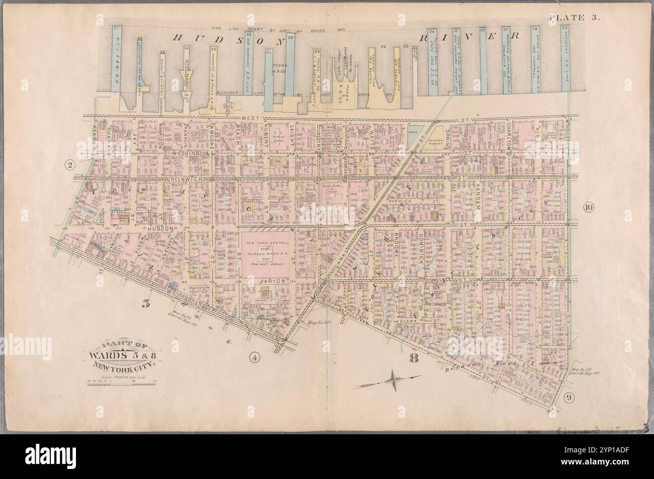 Platte 3: Begrenzt durch West Street (Hudson River, Piers 21-39), W. Houston Street, Sullivan Street, Canal Street, W. Broadway und Reade Street 1885 von Robinson, E. (Elisha) Stockfotohttps://www.alamy.de/image-license-details/?v=1https://www.alamy.de/platte-3-begrenzt-durch-west-street-hudson-river-piers-21-39-w-houston-street-sullivan-street-canal-street-w-broadway-und-reade-street-1885-von-robinson-e-elisha-image633125851.html
RM2YP1ADF–Platte 3: Begrenzt durch West Street (Hudson River, Piers 21-39), W. Houston Street, Sullivan Street, Canal Street, W. Broadway und Reade Street 1885 von Robinson, E. (Elisha)
 Platte 11: Begrenzt durch W. 27th Street, Sixth Avenue, W. 14th Street und (Hudson River Bulkhead Line, Piers 50-56) 13th Avenue 1885 durch Robinson, E. (Elisha) Stockfotohttps://www.alamy.de/image-license-details/?v=1https://www.alamy.de/platte-11-begrenzt-durch-w-27th-street-sixth-avenue-w-14th-street-und-hudson-river-bulkhead-line-piers-50-56-13th-avenue-1885-durch-robinson-e-elisha-image633126436.html
RM2YP1B6C–Platte 11: Begrenzt durch W. 27th Street, Sixth Avenue, W. 14th Street und (Hudson River Bulkhead Line, Piers 50-56) 13th Avenue 1885 durch Robinson, E. (Elisha)
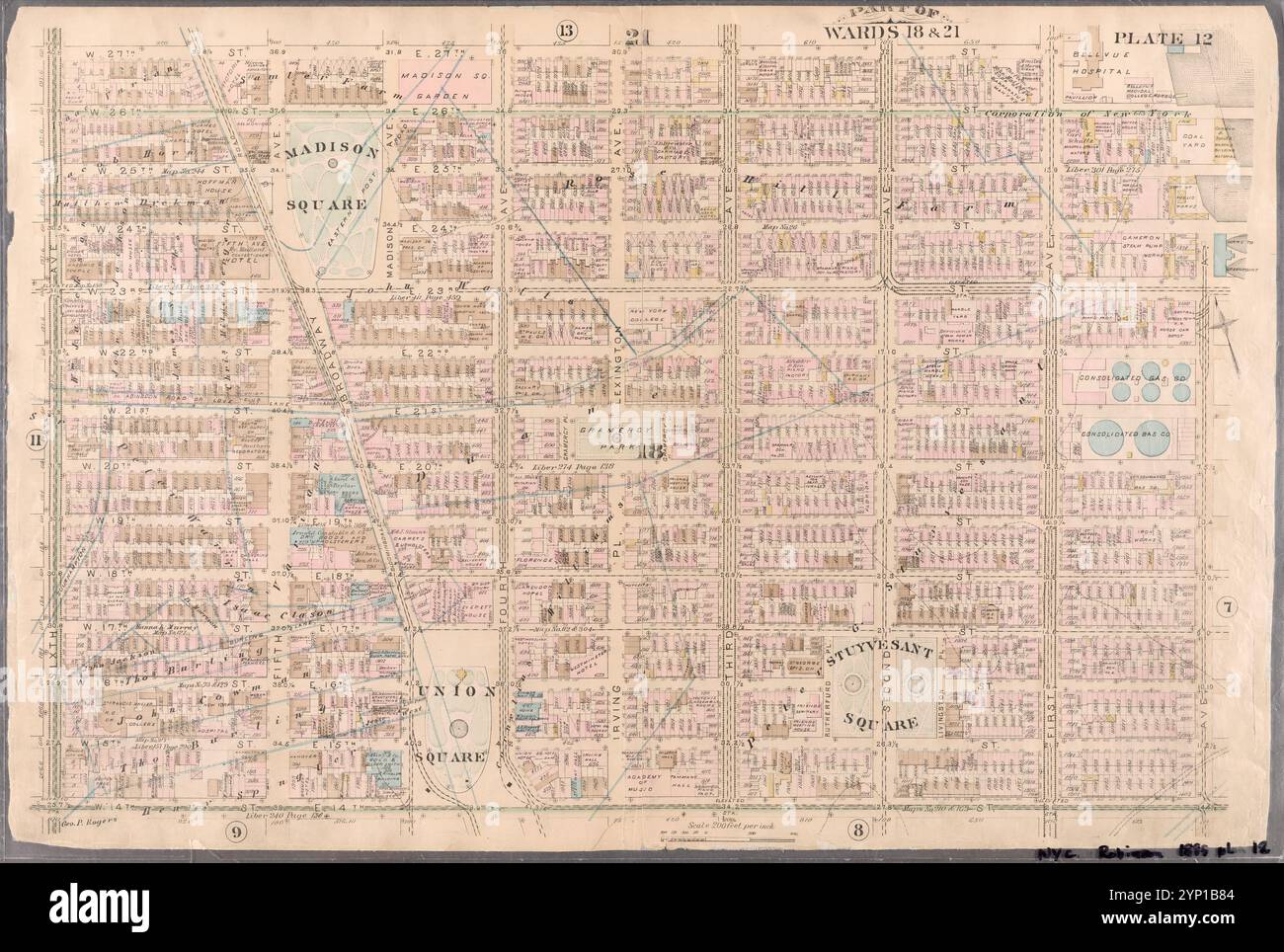 Platte 12: Begrenzt durch W. 27th Street, E. 27th Street, First Avenue, E. 26th Street, Avenue A, E. 14th Street und Sixth Avenue 1885 von Robinson, E. (Elisha) Stockfotohttps://www.alamy.de/image-license-details/?v=1https://www.alamy.de/platte-12-begrenzt-durch-w-27th-street-e-27th-street-first-avenue-e-26th-street-avenue-a-e-14th-street-und-sixth-avenue-1885-von-robinson-e-elisha-image633126484.html
RM2YP1B84–Platte 12: Begrenzt durch W. 27th Street, E. 27th Street, First Avenue, E. 26th Street, Avenue A, E. 14th Street und Sixth Avenue 1885 von Robinson, E. (Elisha)
 Platte 13: Begrenzt durch W. 40th Street, E. 40th Street, First Avenue (Harlem River, Lumber Yards), E. 27th Street, W. 27th Street und Sixth Avenue 1885 durch Robinson, E. (Elisha) Stockfotohttps://www.alamy.de/image-license-details/?v=1https://www.alamy.de/platte-13-begrenzt-durch-w-40th-street-e-40th-street-first-avenue-harlem-river-lumber-yards-e-27th-street-w-27th-street-und-sixth-avenue-1885-durch-robinson-e-elisha-image633126496.html
RM2YP1B8G–Platte 13: Begrenzt durch W. 40th Street, E. 40th Street, First Avenue (Harlem River, Lumber Yards), E. 27th Street, W. 27th Street und Sixth Avenue 1885 durch Robinson, E. (Elisha)
 Platte 27: Begrenzt durch Eighth Avenue, W. 129th Street, Fifth Avenue, W. 124th Street, Madison Avenue, W. 120th Street, Fifth Avenue und W. 110th Street 1885 von Robinson, E. (Elisha) Stockfotohttps://www.alamy.de/image-license-details/?v=1https://www.alamy.de/platte-27-begrenzt-durch-eighth-avenue-w-129th-street-fifth-avenue-w-124th-street-madison-avenue-w-120th-street-fifth-avenue-und-w-110th-street-1885-von-robinson-e-elisha-image633126506.html
RM2YP1B8X–Platte 27: Begrenzt durch Eighth Avenue, W. 129th Street, Fifth Avenue, W. 124th Street, Madison Avenue, W. 120th Street, Fifth Avenue und W. 110th Street 1885 von Robinson, E. (Elisha)
 Platte 29: W. 147th Street, Exterior Street (Harlem River), Lexington Avenue, E. 128th Street, Fifth Avenue, W. 129th Street und (Hudson River) Twelfth Avenue 1885 by Robinson, E. (Elisha) Stockfotohttps://www.alamy.de/image-license-details/?v=1https://www.alamy.de/platte-29-w-147th-street-exterior-street-harlem-river-lexington-avenue-e-128th-street-fifth-avenue-w-129th-street-und-hudson-river-twelfth-avenue-1885-by-robinson-e-elisha-image633126510.html
RM2YP1B92–Platte 29: W. 147th Street, Exterior Street (Harlem River), Lexington Avenue, E. 128th Street, Fifth Avenue, W. 129th Street und (Hudson River) Twelfth Avenue 1885 by Robinson, E. (Elisha)
 Platte 4: West Broadway, Canal Street, Sullivan Street, W. Houston Street, Bowery Street, New Bowery Square, New Chambers Street, Chambers Street, Broadway und Reade Street 1885 von Robinson, E. (Elisha) Stockfotohttps://www.alamy.de/image-license-details/?v=1https://www.alamy.de/platte-4-west-broadway-canal-street-sullivan-street-w-houston-street-bowery-street-new-bowery-square-new-chambers-street-chambers-street-broadway-und-reade-street-1885-von-robinson-e-elisha-image633417123.html
RM2YPEJ03–Platte 4: West Broadway, Canal Street, Sullivan Street, W. Houston Street, Bowery Street, New Bowery Square, New Chambers Street, Chambers Street, Broadway und Reade Street 1885 von Robinson, E. (Elisha)
 Platte 17: Begrenzt durch W. 64th Street, Eighth Avenue, W. 59th Street (Central Park), Sixth Avenue, W. 52nd Street und (Hudson River) Twelfth Avenue 1885 durch Robinson, E. (Elisha) Stockfotohttps://www.alamy.de/image-license-details/?v=1https://www.alamy.de/platte-17-begrenzt-durch-w-64th-street-eighth-avenue-w-59th-street-central-park-sixth-avenue-w-52nd-street-und-hudson-river-twelfth-avenue-1885-durch-robinson-e-elisha-image633126338.html
RM2YP1B2X–Platte 17: Begrenzt durch W. 64th Street, Eighth Avenue, W. 59th Street (Central Park), Sixth Avenue, W. 52nd Street und (Hudson River) Twelfth Avenue 1885 durch Robinson, E. (Elisha)
 Platte 24: Begrenzt durch Twelfth Avenue (Hudson River), W. 96th Street, Central Park West (Eighth Avenue), W. 80th Street, Ninth Avenue und W. 77th Street. 1885 von Robinson, E. (Elisha) Stockfotohttps://www.alamy.de/image-license-details/?v=1https://www.alamy.de/platte-24-begrenzt-durch-twelfth-avenue-hudson-river-w-96th-street-central-park-west-eighth-avenue-w-80th-street-ninth-avenue-und-w-77th-street-1885-von-robinson-e-elisha-image633126494.html
RM2YP1B8E–Platte 24: Begrenzt durch Twelfth Avenue (Hudson River), W. 96th Street, Central Park West (Eighth Avenue), W. 80th Street, Ninth Avenue und W. 77th Street. 1885 von Robinson, E. (Elisha)
 Platte 30: Begrenzt durch W. 166th Street, Croton Aqueduct, Edgecomb Road, W. 155th Street, Exterior Street (Harlem River), W. 147th Street und (Hudson River) Eleventh Avenue 1885 durch Robinson, E. (Elisha) Stockfotohttps://www.alamy.de/image-license-details/?v=1https://www.alamy.de/platte-30-begrenzt-durch-w-166th-street-croton-aqueduct-edgecomb-road-w-155th-street-exterior-street-harlem-river-w-147th-street-und-hudson-river-eleventh-avenue-1885-durch-robinson-e-elisha-image633126512.html
RM2YP1B94–Platte 30: Begrenzt durch W. 166th Street, Croton Aqueduct, Edgecomb Road, W. 155th Street, Exterior Street (Harlem River), W. 147th Street und (Hudson River) Eleventh Avenue 1885 durch Robinson, E. (Elisha)
 Platte 25: Begrenzt durch Hudson River (Twelfth Avenue), W. 116th Street, Boulevard, 113rd Street, Tenth Avenue, W. 116th Street, Eighth Avenue, Central Park West und W. 96th Street. 1885 von Robinson, E. (Elisha) Stockfotohttps://www.alamy.de/image-license-details/?v=1https://www.alamy.de/platte-25-begrenzt-durch-hudson-river-twelfth-avenue-w-116th-street-boulevard-113rd-street-tenth-avenue-w-116th-street-eighth-avenue-central-park-west-und-w-96th-street-1885-von-robinson-e-elisha-image633126503.html
RM2YP1B8R–Platte 25: Begrenzt durch Hudson River (Twelfth Avenue), W. 116th Street, Boulevard, 113rd Street, Tenth Avenue, W. 116th Street, Eighth Avenue, Central Park West und W. 96th Street. 1885 von Robinson, E. (Elisha)
 Platte 28: Begrenzt durch W. 129th Street, (Eighth Avenue) West Channel, W. 116th Street, Tenth Avenue, W. 120th Street, Boulevard, W. 116th Street und (Hudson River) Twelfth Avenue 1885 von Robinson, E. (Elisha) Stockfotohttps://www.alamy.de/image-license-details/?v=1https://www.alamy.de/platte-28-begrenzt-durch-w-129th-street-eighth-avenue-west-channel-w-116th-street-tenth-avenue-w-120th-street-boulevard-w-116th-street-und-hudson-river-twelfth-avenue-1885-von-robinson-e-elisha-image633126507.html
RM2YP1B8Y–Platte 28: Begrenzt durch W. 129th Street, (Eighth Avenue) West Channel, W. 116th Street, Tenth Avenue, W. 120th Street, Boulevard, W. 116th Street und (Hudson River) Twelfth Avenue 1885 von Robinson, E. (Elisha)
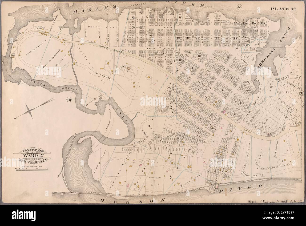 Platte 32: Begrenzt durch Harlem River, W. 120th Street, Tenth Avenue, Dyckman Street, Naegle Street, Ellwood Street, Kings Bridge Road, Inwood Street, Hudson River und Spuyten Duyvil Creek 1885 von Robinson, E. (Elisha) Stockfotohttps://www.alamy.de/image-license-details/?v=1https://www.alamy.de/platte-32-begrenzt-durch-harlem-river-w-120th-street-tenth-avenue-dyckman-street-naegle-street-ellwood-street-kings-bridge-road-inwood-street-hudson-river-und-spuyten-duyvil-creek-1885-von-robinson-e-elisha-image633126515.html
RM2YP1B97–Platte 32: Begrenzt durch Harlem River, W. 120th Street, Tenth Avenue, Dyckman Street, Naegle Street, Ellwood Street, Kings Bridge Road, Inwood Street, Hudson River und Spuyten Duyvil Creek 1885 von Robinson, E. (Elisha)
 Platte 9: Begrenzt durch Fourth Avenue, Bowery, E. Houston Street, W. Houston Street, Hancock Street, Bleecker Street, Sixth Avenue, W. Fourth Street, Grove Street, Waverly Place, Perry Street, Greenwich Avenue, Seventh Avenue und Fourteenth Street 1885 von Robinson, E. (Elisha) Stockfotohttps://www.alamy.de/image-license-details/?v=1https://www.alamy.de/platte-9-begrenzt-durch-fourth-avenue-bowery-e-houston-street-w-houston-street-hancock-street-bleecker-street-sixth-avenue-w-fourth-street-grove-street-waverly-place-perry-street-greenwich-avenue-seventh-avenue-und-fourteenth-street-1885-von-robinson-e-elisha-image633126146.html
RM2YP1AT2–Platte 9: Begrenzt durch Fourth Avenue, Bowery, E. Houston Street, W. Houston Street, Hancock Street, Bleecker Street, Sixth Avenue, W. Fourth Street, Grove Street, Waverly Place, Perry Street, Greenwich Avenue, Seventh Avenue und Fourteenth Street 1885 von Robinson, E. (Elisha)
![Platte 10: Begrenzt durch West Street (Hudson River, Piers 39-47), W. 11th Street, 13th Avenue (Hudson River, Piers [52?]-59), W. 14th Street, 7th Avenue, Greenwich Avenue, Perry Street, Waverly Place, Christopher Street, W. 4th Street, 6th Avenue, Bleecker Street, Cottage Place und W. Houston Street 1885 von Robinson, E. (Elisha) Stockfoto Platte 10: Begrenzt durch West Street (Hudson River, Piers 39-47), W. 11th Street, 13th Avenue (Hudson River, Piers [52?]-59), W. 14th Street, 7th Avenue, Greenwich Avenue, Perry Street, Waverly Place, Christopher Street, W. 4th Street, 6th Avenue, Bleecker Street, Cottage Place und W. Houston Street 1885 von Robinson, E. (Elisha) Stockfoto](https://c8.alamy.com/compde/2yp1axf/platte-10-begrenzt-durch-west-street-hudson-river-piers-39-47-w-11th-street-13th-avenue-hudson-river-piers-52-59-w-14th-street-7th-avenue-greenwich-avenue-perry-street-waverly-place-christopher-street-w-4th-street-6th-avenue-bleecker-street-cottage-place-und-w-houston-street-1885-von-robinson-e-elisha-2yp1axf.jpg) Platte 10: Begrenzt durch West Street (Hudson River, Piers 39-47), W. 11th Street, 13th Avenue (Hudson River, Piers [52?]-59), W. 14th Street, 7th Avenue, Greenwich Avenue, Perry Street, Waverly Place, Christopher Street, W. 4th Street, 6th Avenue, Bleecker Street, Cottage Place und W. Houston Street 1885 von Robinson, E. (Elisha) Stockfotohttps://www.alamy.de/image-license-details/?v=1https://www.alamy.de/platte-10-begrenzt-durch-west-street-hudson-river-piers-39-47-w-11th-street-13th-avenue-hudson-river-piers-52-59-w-14th-street-7th-avenue-greenwich-avenue-perry-street-waverly-place-christopher-street-w-4th-street-6th-avenue-bleecker-street-cottage-place-und-w-houston-street-1885-von-robinson-e-elisha-image633126215.html
Platte 10: Begrenzt durch West Street (Hudson River, Piers 39-47), W. 11th Street, 13th Avenue (Hudson River, Piers [52?]-59), W. 14th Street, 7th Avenue, Greenwich Avenue, Perry Street, Waverly Place, Christopher Street, W. 4th Street, 6th Avenue, Bleecker Street, Cottage Place und W. Houston Street 1885 von Robinson, E. (Elisha) Stockfotohttps://www.alamy.de/image-license-details/?v=1https://www.alamy.de/platte-10-begrenzt-durch-west-street-hudson-river-piers-39-47-w-11th-street-13th-avenue-hudson-river-piers-52-59-w-14th-street-7th-avenue-greenwich-avenue-perry-street-waverly-place-christopher-street-w-4th-street-6th-avenue-bleecker-street-cottage-place-und-w-houston-street-1885-von-robinson-e-elisha-image633126215.htmlRM2YP1AXF–Platte 10: Begrenzt durch West Street (Hudson River, Piers 39-47), W. 11th Street, 13th Avenue (Hudson River, Piers [52?]-59), W. 14th Street, 7th Avenue, Greenwich Avenue, Perry Street, Waverly Place, Christopher Street, W. 4th Street, 6th Avenue, Bleecker Street, Cottage Place und W. Houston Street 1885 von Robinson, E. (Elisha)