Staffordshire moorlandschaften Schwarz-Weiß-Archivfotos
(54)staffordshire moorlandschaften-Stockvideoclips ansehenStaffordshire moorlandschaften Schwarz-Weiß-Archivfotos
 50 Farbtönen von Weiß, Biddulph, Staffordshire, Großbritannien Stockfotohttps://www.alamy.de/image-license-details/?v=1https://www.alamy.de/50-farbtonen-von-weiss-biddulph-staffordshire-grossbritannien-image233307425.html
RMRFG201–50 Farbtönen von Weiß, Biddulph, Staffordshire, Großbritannien
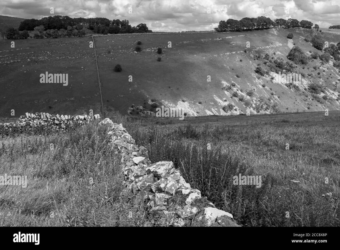 Blick über Wolfescote Dale von Alstonefield, Peak District National Park, Staffordshire Stockfotohttps://www.alamy.de/image-license-details/?v=1https://www.alamy.de/blick-uber-wolfescote-dale-von-alstonefield-peak-district-national-park-staffordshire-image368989846.html
RM2CC8X8P–Blick über Wolfescote Dale von Alstonefield, Peak District National Park, Staffordshire
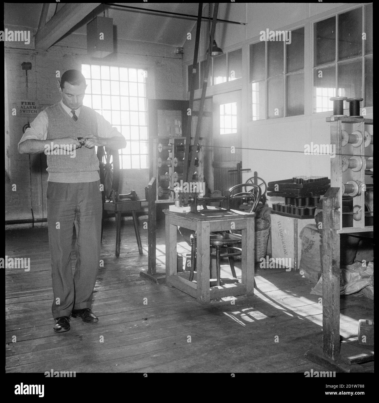 Ein Mann, der eine Rolle Seide von Hand in Bentley und Whittles Wellington Silk Mills, Strangman Street, Leek, Staffordshire Moorlands, Staffordshire, Großbritannien, wickelt. Stockfotohttps://www.alamy.de/image-license-details/?v=1https://www.alamy.de/ein-mann-der-eine-rolle-seide-von-hand-in-bentley-und-whittles-wellington-silk-mills-strangman-street-leek-staffordshire-moorlands-staffordshire-grossbritannien-wickelt-image379797272.html
RM2D1W788–Ein Mann, der eine Rolle Seide von Hand in Bentley und Whittles Wellington Silk Mills, Strangman Street, Leek, Staffordshire Moorlands, Staffordshire, Großbritannien, wickelt.
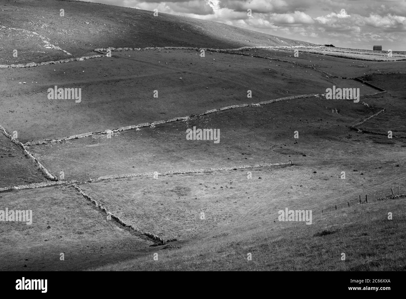 Sonnenflecken auf Feldern, die von Trockenmauern umrandet sind, Narrowdale, Peak District National Park, Staffordshire Stockfotohttps://www.alamy.de/image-license-details/?v=1https://www.alamy.de/sonnenflecken-auf-feldern-die-von-trockenmauern-umrandet-sind-narrowdale-peak-district-national-park-staffordshire-image365258498.html
RM2C66XXA–Sonnenflecken auf Feldern, die von Trockenmauern umrandet sind, Narrowdale, Peak District National Park, Staffordshire
 Eine Frau, die eine Garnverdoppelungsmaschine in den Räumlichkeiten von Bentley und Whittles, Seidenherstellern, in Wellington Mills, Strangman Street, Leek, Staffordshire Moorlands, Staffordshire, Großbritannien, betreibt. Stockfotohttps://www.alamy.de/image-license-details/?v=1https://www.alamy.de/eine-frau-die-eine-garnverdoppelungsmaschine-in-den-raumlichkeiten-von-bentley-und-whittles-seidenherstellern-in-wellington-mills-strangman-street-leek-staffordshire-moorlands-staffordshire-grossbritannien-betreibt-image379797279.html
RM2D1W78F–Eine Frau, die eine Garnverdoppelungsmaschine in den Räumlichkeiten von Bentley und Whittles, Seidenherstellern, in Wellington Mills, Strangman Street, Leek, Staffordshire Moorlands, Staffordshire, Großbritannien, betreibt.
 Die Hinterwellen, Peak District, Staffordshire, England, UK Stockfotohttps://www.alamy.de/image-license-details/?v=1https://www.alamy.de/die-hinterwellen-peak-district-staffordshire-england-uk-image184665128.html
RMMMC674–Die Hinterwellen, Peak District, Staffordshire, England, UK
 Blick über das Rudyard Reservoir, in der Nähe von Leek Town, Staffordshire, England, Großbritannien Stockfotohttps://www.alamy.de/image-license-details/?v=1https://www.alamy.de/blick-uber-das-rudyard-reservoir-in-der-nahe-von-leek-town-staffordshire-england-grossbritannien-image567729413.html
RF2RYJ8JD–Blick über das Rudyard Reservoir, in der Nähe von Leek Town, Staffordshire, England, Großbritannien
 Grindon Moor, Peak District, Staffordshire, England, UK Stockfotohttps://www.alamy.de/image-license-details/?v=1https://www.alamy.de/grindon-moor-peak-district-staffordshire-england-uk-image187524898.html
RMMW2DWP–Grindon Moor, Peak District, Staffordshire, England, UK
 11/16 Im Peak Wildlife Park in den Staffordshire Moorlands bei Leek zeigt Ein Zebra seine Beherrschung der Tarnkunst. Alle Rechte Vorbehalten Stockfotohttps://www.alamy.de/image-license-details/?v=1https://www.alamy.de/1116-im-peak-wildlife-park-in-den-staffordshire-moorlands-bei-leek-zeigt-ein-zebra-seine-beherrschung-der-tarnkunst-alle-rechte-vorbehalten-image599125730.html
RM2WPMEYE–11/16 Im Peak Wildlife Park in den Staffordshire Moorlands bei Leek zeigt Ein Zebra seine Beherrschung der Tarnkunst. Alle Rechte Vorbehalten
 Ramshaw Felsen, Peak District, Staffordshire, England, UK Stockfotohttps://www.alamy.de/image-license-details/?v=1https://www.alamy.de/ramshaw-felsen-peak-district-staffordshire-england-uk-image184665184.html
RMMMC694–Ramshaw Felsen, Peak District, Staffordshire, England, UK
 Dramatische felsige Landschaft bei Ramshaw Felsen im Peak District National Park, Staffordshire, England. Stockfotohttps://www.alamy.de/image-license-details/?v=1https://www.alamy.de/dramatische-felsige-landschaft-bei-ramshaw-felsen-im-peak-district-national-park-staffordshire-england-image152685897.html
RFJTBCBN–Dramatische felsige Landschaft bei Ramshaw Felsen im Peak District National Park, Staffordshire, England.
 Staffordshire Mauren Stockfotohttps://www.alamy.de/image-license-details/?v=1https://www.alamy.de/stockfoto-staffordshire-mauren-59289497.html
RMDCCTA1–Staffordshire Mauren
 Cotton Dell, Oakamoor, Staffordshire Stockfotohttps://www.alamy.de/image-license-details/?v=1https://www.alamy.de/cotton-dell-oakamoor-staffordshire-image607718523.html
RM2X8KY4Y–Cotton Dell, Oakamoor, Staffordshire
 Feld Scheune in der Nähe von wetton Stockfotohttps://www.alamy.de/image-license-details/?v=1https://www.alamy.de/feld-scheune-in-der-nahe-von-wetton-image182444649.html
RFMGR209–Feld Scheune in der Nähe von wetton
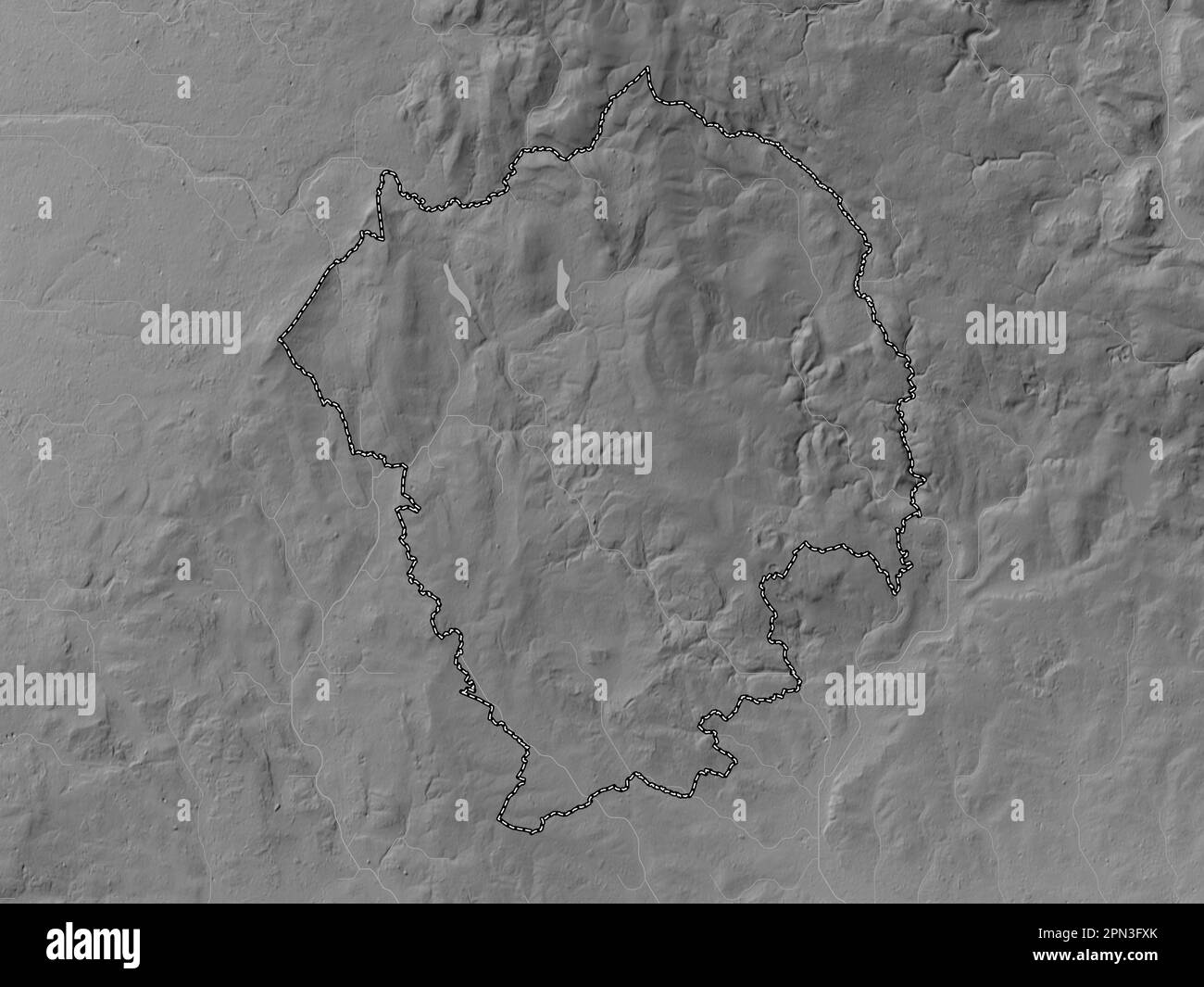 Staffordshire Moorlands, nicht städtischer Bezirk von England - Großbritannien. Grauskala-Höhenkarte mit Seen und Flüssen Stockfotohttps://www.alamy.de/image-license-details/?v=1https://www.alamy.de/staffordshire-moorlands-nicht-stadtischer-bezirk-von-england-grossbritannien-grauskala-hohenkarte-mit-seen-und-flussen-image546507547.html
RF2PN3FXK–Staffordshire Moorlands, nicht städtischer Bezirk von England - Großbritannien. Grauskala-Höhenkarte mit Seen und Flüssen
 Mow Cop Zierburg Torheit von Randle Wilbraham von Rode Hall gebaut Stockfotohttps://www.alamy.de/image-license-details/?v=1https://www.alamy.de/mow-cop-zierburg-torheit-von-randle-wilbraham-von-rode-hall-gebaut-image463056065.html
RM2HWA0MH–Mow Cop Zierburg Torheit von Randle Wilbraham von Rode Hall gebaut
 Die berühmten Kakerlaken in der weltberühmten Peak District National Park über Lauch und Tittesworth Behälter Stockfotohttps://www.alamy.de/image-license-details/?v=1https://www.alamy.de/die-beruhmten-kakerlaken-in-der-weltberuhmten-peak-district-national-park-uber-lauch-und-tittesworth-behalter-image223213399.html
RFPY46Y3–Die berühmten Kakerlaken in der weltberühmten Peak District National Park über Lauch und Tittesworth Behälter
 Staffordshire Moorlands nicht-Metropolregion (Vereinigtes Königreich von Großbritannien und Nordirland, zeremonielle Grafschaft Staffordshire oder Stäbe, en Stock Vektorhttps://www.alamy.de/image-license-details/?v=1https://www.alamy.de/staffordshire-moorlands-nicht-metropolregion-vereinigtes-konigreich-von-grossbritannien-und-nordirland-zeremonielle-grafschaft-staffordshire-oder-stabe-en-image544201960.html
RF2PHAF48–Staffordshire Moorlands nicht-Metropolregion (Vereinigtes Königreich von Großbritannien und Nordirland, zeremonielle Grafschaft Staffordshire oder Stäbe, en
 Ein kleiner Junge mit Autismus, ADHS, Asperger-syndrom Besuche der berühmten Kakerlaken im Derbyshire Peak District National Park, England, Großbritannien Stockfotohttps://www.alamy.de/image-license-details/?v=1https://www.alamy.de/ein-kleiner-junge-mit-autismus-adhs-asperger-syndrom-besuche-der-beruhmten-kakerlaken-im-derbyshire-peak-district-national-park-england-grossbritannien-image331038721.html
RF2A6G37D–Ein kleiner Junge mit Autismus, ADHS, Asperger-syndrom Besuche der berühmten Kakerlaken im Derbyshire Peak District National Park, England, Großbritannien
 Sonnenflecken auf Feldern, die von Trockenmauern umrandet sind, Narrowdale, Peak District National Park, Staffordshire Stockfotohttps://www.alamy.de/image-license-details/?v=1https://www.alamy.de/sonnenflecken-auf-feldern-die-von-trockenmauern-umrandet-sind-narrowdale-peak-district-national-park-staffordshire-image365258523.html
RM2C66XY7–Sonnenflecken auf Feldern, die von Trockenmauern umrandet sind, Narrowdale, Peak District National Park, Staffordshire
 Dove Valley in der Nähe von Milldale, Peak District National Park, Derbyshire Stockfotohttps://www.alamy.de/image-license-details/?v=1https://www.alamy.de/dove-valley-in-der-nahe-von-milldale-peak-district-national-park-derbyshire-image369064178.html
RM2CCC93E–Dove Valley in der Nähe von Milldale, Peak District National Park, Derbyshire
 Blick über das Rudyard Reservoir, in der Nähe von Leek Town, Staffordshire, England, Großbritannien Stockfotohttps://www.alamy.de/image-license-details/?v=1https://www.alamy.de/blick-uber-das-rudyard-reservoir-in-der-nahe-von-leek-town-staffordshire-england-grossbritannien-image567729797.html
RF2RYJ945–Blick über das Rudyard Reservoir, in der Nähe von Leek Town, Staffordshire, England, Großbritannien
 Nummerierte Schafe, Ecton Hill, Peak District National Park, Staffordshire Stockfotohttps://www.alamy.de/image-license-details/?v=1https://www.alamy.de/nummerierte-schafe-ecton-hill-peak-district-national-park-staffordshire-image449543809.html
RM2H3ADM1–Nummerierte Schafe, Ecton Hill, Peak District National Park, Staffordshire
 Ramshaw Felsen, Peak District, Staffordshire, England, UK Stockfotohttps://www.alamy.de/image-license-details/?v=1https://www.alamy.de/ramshaw-felsen-peak-district-staffordshire-england-uk-image187524893.html
RMMW2DWH–Ramshaw Felsen, Peak District, Staffordshire, England, UK
 Dramatische felsige Landschaft bei Ramshaw Felsen im Peak District National Park, Staffordshire, England. Stockfotohttps://www.alamy.de/image-license-details/?v=1https://www.alamy.de/dramatische-felsige-landschaft-bei-ramshaw-felsen-im-peak-district-national-park-staffordshire-england-image152685907.html
RFJTBCC3–Dramatische felsige Landschaft bei Ramshaw Felsen im Peak District National Park, Staffordshire, England.
 Pike Pool in der River Dove in Beresford Dale, Peak District National Park, Derbyshire/Staffordshire Stockfotohttps://www.alamy.de/image-license-details/?v=1https://www.alamy.de/pike-pool-in-der-river-dove-in-beresford-dale-peak-district-national-park-derbyshirestaffordshire-image454366628.html
RM2HB657G–Pike Pool in der River Dove in Beresford Dale, Peak District National Park, Derbyshire/Staffordshire
 Staffordshire Moorlands, nicht städtischer Bezirk von England - Großbritannien. Bilevel-Höhenkarte mit Seen und Flüssen Stockfotohttps://www.alamy.de/image-license-details/?v=1https://www.alamy.de/staffordshire-moorlands-nicht-stadtischer-bezirk-von-england-grossbritannien-bilevel-hohenkarte-mit-seen-und-flussen-image546507545.html
RF2PN3FXH–Staffordshire Moorlands, nicht städtischer Bezirk von England - Großbritannien. Bilevel-Höhenkarte mit Seen und Flüssen
 Mow Cop Zierburg Torheit von Randle Wilbraham von Rode Hall gebaut Stockfotohttps://www.alamy.de/image-license-details/?v=1https://www.alamy.de/mow-cop-zierburg-torheit-von-randle-wilbraham-von-rode-hall-gebaut-image463056301.html
RM2HWA111–Mow Cop Zierburg Torheit von Randle Wilbraham von Rode Hall gebaut
 Blick über das Rudyard Reservoir, in der Nähe von Leek Town, Staffordshire, England, Großbritannien Stockfotohttps://www.alamy.de/image-license-details/?v=1https://www.alamy.de/blick-uber-das-rudyard-reservoir-in-der-nahe-von-leek-town-staffordshire-england-grossbritannien-image567729329.html
RF2RYJ8FD–Blick über das Rudyard Reservoir, in der Nähe von Leek Town, Staffordshire, England, Großbritannien
 Die Hinterwellen, Peak District, Staffordshire, England, UK Stockfotohttps://www.alamy.de/image-license-details/?v=1https://www.alamy.de/die-hinterwellen-peak-district-staffordshire-england-uk-image187524894.html
RMMW2DWJ–Die Hinterwellen, Peak District, Staffordshire, England, UK
 Staffordshire Moorlands, nicht städtischer Bezirk von England - Großbritannien. Bilevel-Höhenkarte mit Seen und Flüssen. Lage der Zusatzgeräte an der Ecke Stockfotohttps://www.alamy.de/image-license-details/?v=1https://www.alamy.de/staffordshire-moorlands-nicht-stadtischer-bezirk-von-england-grossbritannien-bilevel-hohenkarte-mit-seen-und-flussen-lage-der-zusatzgerate-an-der-ecke-image546507540.html
RF2PN3FXC–Staffordshire Moorlands, nicht städtischer Bezirk von England - Großbritannien. Bilevel-Höhenkarte mit Seen und Flüssen. Lage der Zusatzgeräte an der Ecke
 Mow Cop Zierburg Torheit von Randle Wilbraham von Rode Hall gebaut Stockfotohttps://www.alamy.de/image-license-details/?v=1https://www.alamy.de/mow-cop-zierburg-torheit-von-randle-wilbraham-von-rode-hall-gebaut-image463056412.html
RM2HWA150–Mow Cop Zierburg Torheit von Randle Wilbraham von Rode Hall gebaut
 Blick über das Rudyard Reservoir, in der Nähe von Leek Town, Staffordshire, England, Großbritannien Stockfotohttps://www.alamy.de/image-license-details/?v=1https://www.alamy.de/blick-uber-das-rudyard-reservoir-in-der-nahe-von-leek-town-staffordshire-england-grossbritannien-image567730440.html
RM2RYJ9Y4–Blick über das Rudyard Reservoir, in der Nähe von Leek Town, Staffordshire, England, Großbritannien
 Staffordshire Moorlands, nicht städtischer Bezirk von England - Großbritannien. Grauskala-Höhenkarte mit Seen und Flüssen. Zusätzliche Lage in der Ecke Stockfotohttps://www.alamy.de/image-license-details/?v=1https://www.alamy.de/staffordshire-moorlands-nicht-stadtischer-bezirk-von-england-grossbritannien-grauskala-hohenkarte-mit-seen-und-flussen-zusatzliche-lage-in-der-ecke-image546507548.html
RF2PN3FXM–Staffordshire Moorlands, nicht städtischer Bezirk von England - Großbritannien. Grauskala-Höhenkarte mit Seen und Flüssen. Zusätzliche Lage in der Ecke
 Mow Cop Zierburg Torheit von Randle Wilbraham von Rode Hall gebaut Stockfotohttps://www.alamy.de/image-license-details/?v=1https://www.alamy.de/mow-cop-zierburg-torheit-von-randle-wilbraham-von-rode-hall-gebaut-image463054545.html
RM2HW9XP9–Mow Cop Zierburg Torheit von Randle Wilbraham von Rode Hall gebaut
 Blick über das Rudyard Reservoir, in der Nähe von Leek Town, Staffordshire, England, Großbritannien Stockfotohttps://www.alamy.de/image-license-details/?v=1https://www.alamy.de/blick-uber-das-rudyard-reservoir-in-der-nahe-von-leek-town-staffordshire-england-grossbritannien-image567729730.html
RM2RYJ91P–Blick über das Rudyard Reservoir, in der Nähe von Leek Town, Staffordshire, England, Großbritannien
 Staffordshire Moorlands, nicht städtischer Bezirk von England - Großbritannien. Bilevel-Höhenkarte mit Seen und Flüssen. Standorte von Großstädten Stockfotohttps://www.alamy.de/image-license-details/?v=1https://www.alamy.de/staffordshire-moorlands-nicht-stadtischer-bezirk-von-england-grossbritannien-bilevel-hohenkarte-mit-seen-und-flussen-standorte-von-grossstadten-image546507487.html
RF2PN3FTF–Staffordshire Moorlands, nicht städtischer Bezirk von England - Großbritannien. Bilevel-Höhenkarte mit Seen und Flüssen. Standorte von Großstädten
 Mow Cop Zierburg Torheit von Randle Wilbraham von Rode Hall gebaut Stockfotohttps://www.alamy.de/image-license-details/?v=1https://www.alamy.de/mow-cop-zierburg-torheit-von-randle-wilbraham-von-rode-hall-gebaut-image463056509.html
RM2HWA18D–Mow Cop Zierburg Torheit von Randle Wilbraham von Rode Hall gebaut
 Blick über das Tittesworth Reservoir, in der Nähe von Leek Town, Staffordshire, England, Großbritannien Stockfotohttps://www.alamy.de/image-license-details/?v=1https://www.alamy.de/blick-uber-das-tittesworth-reservoir-in-der-nahe-von-leek-town-staffordshire-england-grossbritannien-image567729416.html
RM2RYJ8JG–Blick über das Tittesworth Reservoir, in der Nähe von Leek Town, Staffordshire, England, Großbritannien
 Staffordshire Moorlands, nicht städtischer Bezirk von England - Großbritannien. Grauskala-Höhenkarte mit Seen und Flüssen. Standorte und Namen von m Stockfotohttps://www.alamy.de/image-license-details/?v=1https://www.alamy.de/staffordshire-moorlands-nicht-stadtischer-bezirk-von-england-grossbritannien-grauskala-hohenkarte-mit-seen-und-flussen-standorte-und-namen-von-m-image546507546.html
RF2PN3FXJ–Staffordshire Moorlands, nicht städtischer Bezirk von England - Großbritannien. Grauskala-Höhenkarte mit Seen und Flüssen. Standorte und Namen von m
 Mow Cop Zierburg Torheit von Randle Wilbraham von Rode Hall gebaut Stockfotohttps://www.alamy.de/image-license-details/?v=1https://www.alamy.de/mow-cop-zierburg-torheit-von-randle-wilbraham-von-rode-hall-gebaut-image463056057.html
RM2HWA0M9–Mow Cop Zierburg Torheit von Randle Wilbraham von Rode Hall gebaut
 Blick über das Tittesworth Reservoir, in der Nähe von Leek Town, Staffordshire, England, Großbritannien Stockfotohttps://www.alamy.de/image-license-details/?v=1https://www.alamy.de/blick-uber-das-tittesworth-reservoir-in-der-nahe-von-leek-town-staffordshire-england-grossbritannien-image567730376.html
RF2RYJ9TT–Blick über das Tittesworth Reservoir, in der Nähe von Leek Town, Staffordshire, England, Großbritannien
 Staffordshire Moorlands, nicht städtischer Bezirk von England - Großbritannien. Grauskala-Höhenkarte mit Seen und Flüssen. Orte der wichtigsten Citie Stockfotohttps://www.alamy.de/image-license-details/?v=1https://www.alamy.de/staffordshire-moorlands-nicht-stadtischer-bezirk-von-england-grossbritannien-grauskala-hohenkarte-mit-seen-und-flussen-orte-der-wichtigsten-citie-image546507544.html
RF2PN3FXG–Staffordshire Moorlands, nicht städtischer Bezirk von England - Großbritannien. Grauskala-Höhenkarte mit Seen und Flüssen. Orte der wichtigsten Citie
 Mow Cop Zierburg Torheit von Randle Wilbraham von Rode Hall gebaut Stockfotohttps://www.alamy.de/image-license-details/?v=1https://www.alamy.de/mow-cop-zierburg-torheit-von-randle-wilbraham-von-rode-hall-gebaut-image463056206.html
RM2HWA0WJ–Mow Cop Zierburg Torheit von Randle Wilbraham von Rode Hall gebaut
 River Dane und Wasserfälle am Three Shires Head, dem Treffpunkt der Countys Cheshire, Derbyshire und Staffordshire, England, Großbritannien Stockfotohttps://www.alamy.de/image-license-details/?v=1https://www.alamy.de/river-dane-und-wasserfalle-am-three-shires-head-dem-treffpunkt-der-countys-cheshire-derbyshire-und-staffordshire-england-grossbritannien-image567730494.html
RF2RYJA12–River Dane und Wasserfälle am Three Shires Head, dem Treffpunkt der Countys Cheshire, Derbyshire und Staffordshire, England, Großbritannien
 Staffordshire Moorlands, nicht städtischer Bezirk von England - Großbritannien. Bilevel-Höhenkarte mit Seen und Flüssen. Standorte und Namen von Belegen Stockfotohttps://www.alamy.de/image-license-details/?v=1https://www.alamy.de/staffordshire-moorlands-nicht-stadtischer-bezirk-von-england-grossbritannien-bilevel-hohenkarte-mit-seen-und-flussen-standorte-und-namen-von-belegen-image546507553.html
RF2PN3FXW–Staffordshire Moorlands, nicht städtischer Bezirk von England - Großbritannien. Bilevel-Höhenkarte mit Seen und Flüssen. Standorte und Namen von Belegen
 River Dane und Wasserfälle am Three Shires Head, dem Treffpunkt der Countys Cheshire, Derbyshire und Staffordshire, England, Großbritannien Stockfotohttps://www.alamy.de/image-license-details/?v=1https://www.alamy.de/river-dane-und-wasserfalle-am-three-shires-head-dem-treffpunkt-der-countys-cheshire-derbyshire-und-staffordshire-england-grossbritannien-image567730519.html
RF2RYJA1Y–River Dane und Wasserfälle am Three Shires Head, dem Treffpunkt der Countys Cheshire, Derbyshire und Staffordshire, England, Großbritannien
 River Dane und Wasserfälle am Three Shires Head, dem Treffpunkt der Countys Cheshire, Derbyshire und Staffordshire, England, Großbritannien Stockfotohttps://www.alamy.de/image-license-details/?v=1https://www.alamy.de/river-dane-und-wasserfalle-am-three-shires-head-dem-treffpunkt-der-countys-cheshire-derbyshire-und-staffordshire-england-grossbritannien-image567730423.html
RF2RYJ9XF–River Dane und Wasserfälle am Three Shires Head, dem Treffpunkt der Countys Cheshire, Derbyshire und Staffordshire, England, Großbritannien
 River Dane und Wasserfälle am Three Shires Head, dem Treffpunkt der Countys Cheshire, Derbyshire und Staffordshire, England, Großbritannien Stockfotohttps://www.alamy.de/image-license-details/?v=1https://www.alamy.de/river-dane-und-wasserfalle-am-three-shires-head-dem-treffpunkt-der-countys-cheshire-derbyshire-und-staffordshire-england-grossbritannien-image567730456.html
RM2RYJ9YM–River Dane und Wasserfälle am Three Shires Head, dem Treffpunkt der Countys Cheshire, Derbyshire und Staffordshire, England, Großbritannien
 River Dane und Wasserfälle am Three Shires Head, dem Treffpunkt der Countys Cheshire, Derbyshire und Staffordshire, England, Großbritannien Stockfotohttps://www.alamy.de/image-license-details/?v=1https://www.alamy.de/river-dane-und-wasserfalle-am-three-shires-head-dem-treffpunkt-der-countys-cheshire-derbyshire-und-staffordshire-england-grossbritannien-image567730365.html
RF2RYJ9TD–River Dane und Wasserfälle am Three Shires Head, dem Treffpunkt der Countys Cheshire, Derbyshire und Staffordshire, England, Großbritannien
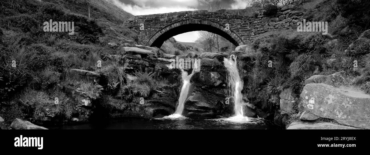 River Dane und Wasserfälle am Three Shires Head, dem Treffpunkt der Countys Cheshire, Derbyshire und Staffordshire, England, Großbritannien Stockfotohttps://www.alamy.de/image-license-details/?v=1https://www.alamy.de/river-dane-und-wasserfalle-am-three-shires-head-dem-treffpunkt-der-countys-cheshire-derbyshire-und-staffordshire-england-grossbritannien-image567729314.html
RF2RYJ8EX–River Dane und Wasserfälle am Three Shires Head, dem Treffpunkt der Countys Cheshire, Derbyshire und Staffordshire, England, Großbritannien
 River Dane und Wasserfälle am Three Shires Head, dem Treffpunkt der Countys Cheshire, Derbyshire und Staffordshire, England, Großbritannien Stockfotohttps://www.alamy.de/image-license-details/?v=1https://www.alamy.de/river-dane-und-wasserfalle-am-three-shires-head-dem-treffpunkt-der-countys-cheshire-derbyshire-und-staffordshire-england-grossbritannien-image567730272.html
RM2RYJ9N4–River Dane und Wasserfälle am Three Shires Head, dem Treffpunkt der Countys Cheshire, Derbyshire und Staffordshire, England, Großbritannien
 River Dane und Wasserfälle am Three Shires Head, dem Treffpunkt der Countys Cheshire, Derbyshire und Staffordshire, England, Großbritannien Stockfotohttps://www.alamy.de/image-license-details/?v=1https://www.alamy.de/river-dane-und-wasserfalle-am-three-shires-head-dem-treffpunkt-der-countys-cheshire-derbyshire-und-staffordshire-england-grossbritannien-image567729312.html
RM2RYJ8ET–River Dane und Wasserfälle am Three Shires Head, dem Treffpunkt der Countys Cheshire, Derbyshire und Staffordshire, England, Großbritannien
 Blick über das Tittesworth Reservoir, in der Nähe von Leek Town, Staffordshire, England, Großbritannien Stockfotohttps://www.alamy.de/image-license-details/?v=1https://www.alamy.de/blick-uber-das-tittesworth-reservoir-in-der-nahe-von-leek-town-staffordshire-england-grossbritannien-image567729330.html
RM2RYJ8FE–Blick über das Tittesworth Reservoir, in der Nähe von Leek Town, Staffordshire, England, Großbritannien