Schnellfilter:
Minnehaha county Stockfotos & Bilder
 Die Fälle, die den Namen der Stadt - Sioux Falls, South Dakota geben. Stockfotohttps://www.alamy.de/image-license-details/?v=1https://www.alamy.de/die-falle-die-den-namen-der-stadt-sioux-falls-south-dakota-geben-image446370847.html
RF2GX5XFY–Die Fälle, die den Namen der Stadt - Sioux Falls, South Dakota geben.
 Northern Parula September 3rd, 2012 Minnehaha County, South Dakota Stockfotohttps://www.alamy.de/image-license-details/?v=1https://www.alamy.de/northern-parula-september-3rd-2012-minnehaha-county-south-dakota-image213740735.html
RFPBMMDK–Northern Parula September 3rd, 2012 Minnehaha County, South Dakota
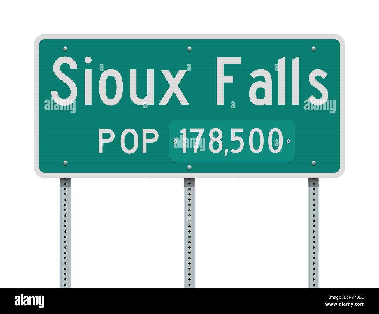 Vector Illustration der Sioux Falls Eingabe grüne Schild mit Bevölkerung Informationen Stock Vektorhttps://www.alamy.de/image-license-details/?v=1https://www.alamy.de/vector-illustration-der-sioux-falls-eingabe-grune-schild-mit-bevolkerung-informationen-image240493105.html
RFRY7BBD–Vector Illustration der Sioux Falls Eingabe grüne Schild mit Bevölkerung Informationen
 Savannah Spatz 1. Oktober 2008 Minnehaha County, South Dakota Stockfotohttps://www.alamy.de/image-license-details/?v=1https://www.alamy.de/savannah-spatz-1-oktober-2008-minnehaha-county-south-dakota-image213560782.html
RFPBCEXP–Savannah Spatz 1. Oktober 2008 Minnehaha County, South Dakota
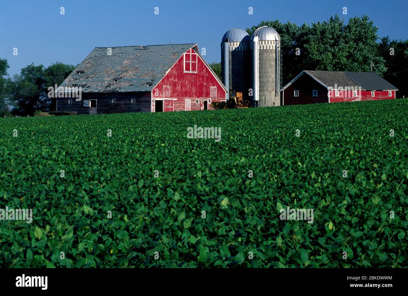 Farm, Minnehaha County, South Dakota Stockfotohttps://www.alamy.de/image-license-details/?v=1https://www.alamy.de/farm-minnehaha-county-south-dakota-image356191520.html
RF2BKDWWM–Farm, Minnehaha County, South Dakota
 Wilson's Phalarope am 6. Mai 2017 Minnehaha County, South Dakota Stockfotohttps://www.alamy.de/image-license-details/?v=1https://www.alamy.de/wilsons-phalarope-am-6-mai-2017-minnehaha-county-south-dakota-image213580812.html
RFPBDCE4–Wilson's Phalarope am 6. Mai 2017 Minnehaha County, South Dakota
 Wunderschöne Herbstfarben bei Minnehaha Falls in Lakemont, Georgia, in der Nähe des Lake Rabum. (USA) Stockfotohttps://www.alamy.de/image-license-details/?v=1https://www.alamy.de/wunderschone-herbstfarben-bei-minnehaha-falls-in-lakemont-georgia-in-der-nahe-des-lake-rabum-usa-image451604399.html
RM2H6MA0F–Wunderschöne Herbstfarben bei Minnehaha Falls in Lakemont, Georgia, in der Nähe des Lake Rabum. (USA)
 Minnehaha Falls, Rabun County, Georgia on Falls Creek. Stockfotohttps://www.alamy.de/image-license-details/?v=1https://www.alamy.de/minnehaha-falls-rabun-county-georgia-on-falls-creek-image438073527.html
RF2GCKY73–Minnehaha Falls, Rabun County, Georgia on Falls Creek.
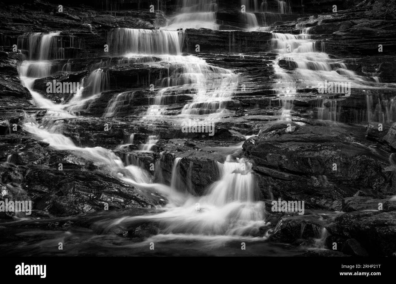 Minnehaha Falls – Rabun County, Georgia. Seidiges Wasser fällt über die Gesteinsschichten der Minnehaha Falls. Stockfotohttps://www.alamy.de/image-license-details/?v=1https://www.alamy.de/minnehaha-falls-rabun-county-georgia-seidiges-wasser-fallt-uber-die-gesteinsschichten-der-minnehaha-falls-image561665492.html
RM2RHP21T–Minnehaha Falls – Rabun County, Georgia. Seidiges Wasser fällt über die Gesteinsschichten der Minnehaha Falls.
 South Dakota, US-Bundesstaat, unterteilt in 66 Countys, mehrfarbige politische Karte mit Hauptstadt Pierre, Grenzen und County-Namen. Stockfotohttps://www.alamy.de/image-license-details/?v=1https://www.alamy.de/south-dakota-us-bundesstaat-unterteilt-in-66-countys-mehrfarbige-politische-karte-mit-hauptstadt-pierre-grenzen-und-county-namen-image619708433.html
RF2Y064C1–South Dakota, US-Bundesstaat, unterteilt in 66 Countys, mehrfarbige politische Karte mit Hauptstadt Pierre, Grenzen und County-Namen.
 Minnehaha Falls, Chattahoochee National Forest - Rabun County, Georgia. Minnehaha fließt nach den jüngsten Frühlingsregen stark. Stockfotohttps://www.alamy.de/image-license-details/?v=1https://www.alamy.de/minnehaha-falls-chattahoochee-national-forest-rabun-county-georgia-minnehaha-fliesst-nach-den-jungsten-fruhlingsregen-stark-image418069875.html
RM2F84MAY–Minnehaha Falls, Chattahoochee National Forest - Rabun County, Georgia. Minnehaha fließt nach den jüngsten Frühlingsregen stark.
 South Dakota, US-Bundesstaat, unterteilt in 66 Countys, politische Karte mit Grenzen und Countys. Bundesstaat im Norden der Zentralregion der USA. Stockfotohttps://www.alamy.de/image-license-details/?v=1https://www.alamy.de/south-dakota-us-bundesstaat-unterteilt-in-66-countys-politische-karte-mit-grenzen-und-countys-bundesstaat-im-norden-der-zentralregion-der-usa-image616144887.html
RF2XPBR2F–South Dakota, US-Bundesstaat, unterteilt in 66 Countys, politische Karte mit Grenzen und Countys. Bundesstaat im Norden der Zentralregion der USA.
 Minnehaha Park am Ufer des Minnehaha Creek und Brücke in Minneapolis minnesota Stockfotohttps://www.alamy.de/image-license-details/?v=1https://www.alamy.de/stockfoto-minnehaha-park-am-ufer-des-minnehaha-creek-und-brucke-in-minneapolis-minnesota-70125610.html
RFE22DX2–Minnehaha Park am Ufer des Minnehaha Creek und Brücke in Minneapolis minnesota
 South Dakota, US-Bundesstaat, unterteilt in 66 Countys, graue politische Karte mit Grenzen und County-Namen. Bundesstaat im Norden der Zentralregion der USA. Stockfotohttps://www.alamy.de/image-license-details/?v=1https://www.alamy.de/south-dakota-us-bundesstaat-unterteilt-in-66-countys-graue-politische-karte-mit-grenzen-und-county-namen-bundesstaat-im-norden-der-zentralregion-der-usa-image616243089.html
RF2XPG89N–South Dakota, US-Bundesstaat, unterteilt in 66 Countys, graue politische Karte mit Grenzen und County-Namen. Bundesstaat im Norden der Zentralregion der USA.
 Minnehaha Falls, Rabun County, Georgia Stockfotohttps://www.alamy.de/image-license-details/?v=1https://www.alamy.de/minnehaha-falls-rabun-county-georgia-image208830568.html
RFP3N1EG–Minnehaha Falls, Rabun County, Georgia
 Minnehaha Creek im friedlichen unteren Teil des Minnehaha Parks - Minneapolis, Minnesota - Minnehaha Creek ist ein Nebenfluss des Mississippi River Stockfotohttps://www.alamy.de/image-license-details/?v=1https://www.alamy.de/minnehaha-creek-im-friedlichen-unteren-teil-des-minnehaha-parks-minneapolis-minnesota-minnehaha-creek-ist-ein-nebenfluss-des-mississippi-river-image424917155.html
RF2FK8J4K–Minnehaha Creek im friedlichen unteren Teil des Minnehaha Parks - Minneapolis, Minnesota - Minnehaha Creek ist ein Nebenfluss des Mississippi River
 South Dakota County Karten Stock Vektorhttps://www.alamy.de/image-license-details/?v=1https://www.alamy.de/south-dakota-county-karten-image360965574.html
RF2BY7B7J–South Dakota County Karten
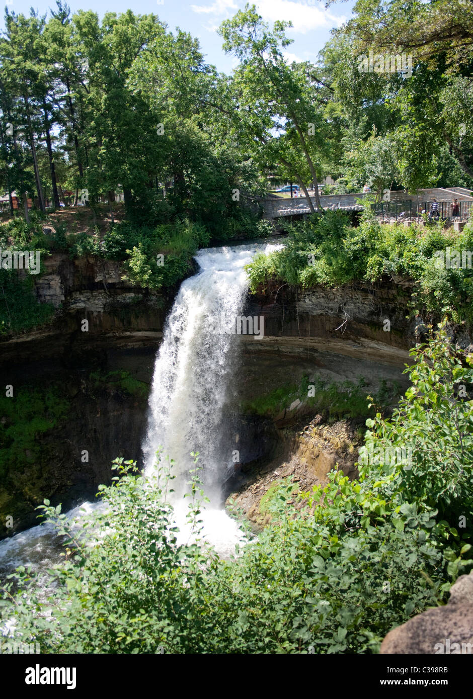 Minnehaha Fälle. Minneapolis Minnesota MN USA Stockfotohttps://www.alamy.de/image-license-details/?v=1https://www.alamy.de/stockfoto-minnehaha-falle-minneapolis-minnesota-mn-usa-36469199.html
RMC398RB–Minnehaha Fälle. Minneapolis Minnesota MN USA
 Minnehaha Falls ist eine Reihe von Kaskaden auf Falls Creek in Rabun County, Georgia. Der Wasserfall senkt sich etwa 100 Meter Stockfotohttps://www.alamy.de/image-license-details/?v=1https://www.alamy.de/minnehaha-falls-ist-eine-reihe-von-kaskaden-auf-falls-creek-in-rabun-county-georgia-der-wasserfall-senkt-sich-etwa-100-meter-image416451532.html
RF2F5F050–Minnehaha Falls ist eine Reihe von Kaskaden auf Falls Creek in Rabun County, Georgia. Der Wasserfall senkt sich etwa 100 Meter
 Gärten und historischen Haus in Minneapolis' Minnehaha park Stockfotohttps://www.alamy.de/image-license-details/?v=1https://www.alamy.de/garten-und-historischen-haus-in-minneapolis-minnehaha-park-image65720328.html
RFDPWPXG–Gärten und historischen Haus in Minneapolis' Minnehaha park
 Minnehaha Falls ist eine Reihe von Kaskaden auf Falls Creek in Rabun County, Georgia. Der Wasserfall fällt etwa 100 Meter über abgestufte Felsen. Stockfotohttps://www.alamy.de/image-license-details/?v=1https://www.alamy.de/minnehaha-falls-ist-eine-reihe-von-kaskaden-auf-falls-creek-in-rabun-county-georgia-der-wasserfall-fallt-etwa-100-meter-uber-abgestufte-felsen-image416451650.html
RF2F5F096–Minnehaha Falls ist eine Reihe von Kaskaden auf Falls Creek in Rabun County, Georgia. Der Wasserfall fällt etwa 100 Meter über abgestufte Felsen.
 an den Ufern des Minnehaha Creek im Minnehaha Park von Minneapolis minnesota Stockfotohttps://www.alamy.de/image-license-details/?v=1https://www.alamy.de/stockfoto-an-den-ufern-des-minnehaha-creek-im-minnehaha-park-von-minneapolis-minnesota-41275298.html
RFCB471P–an den Ufern des Minnehaha Creek im Minnehaha Park von Minneapolis minnesota
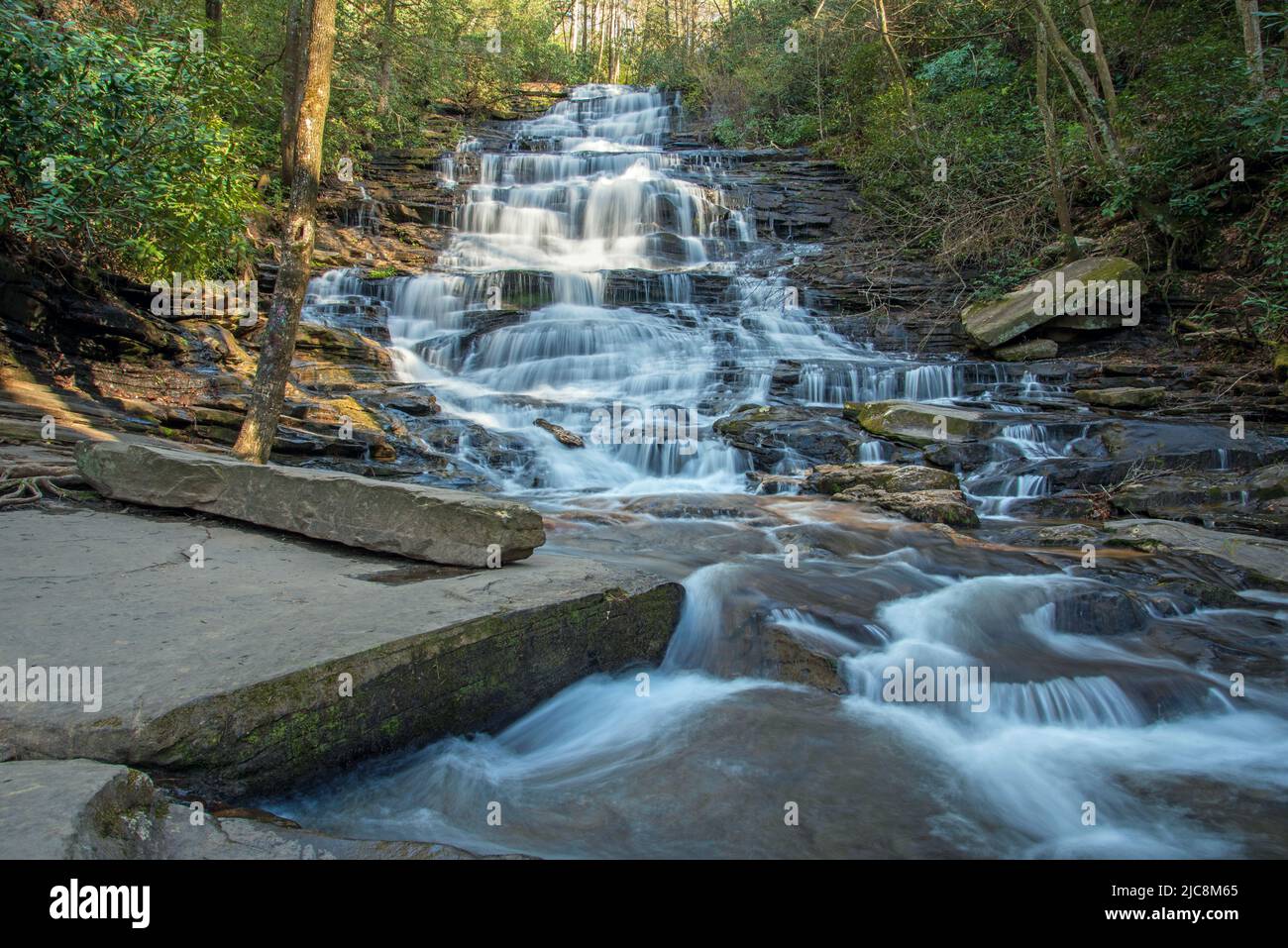 Minnehaha Falls im Norden von Georgia. Stockfotohttps://www.alamy.de/image-license-details/?v=1https://www.alamy.de/minnehaha-falls-im-norden-von-georgia-image472247277.html
RF2JC8M65–Minnehaha Falls im Norden von Georgia.
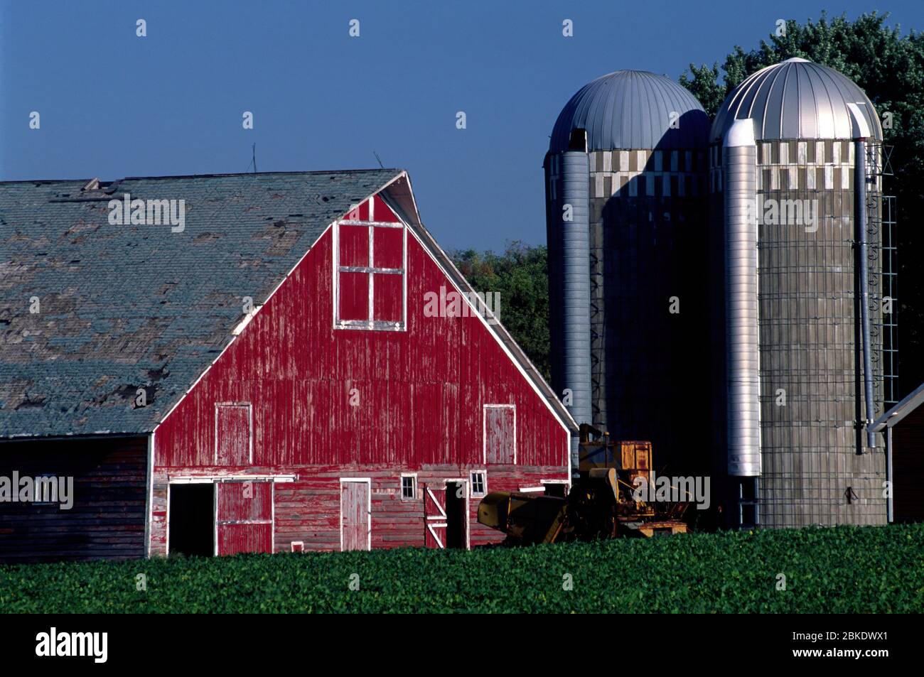 Farm, Minnehaha County, South Dakota Stockfotohttps://www.alamy.de/image-license-details/?v=1https://www.alamy.de/farm-minnehaha-county-south-dakota-image356191529.html
RF2BKDWX1–Farm, Minnehaha County, South Dakota
 Wilson's Phalarope am 6. Mai 2017 Minnehaha County, South Dakota Stockfotohttps://www.alamy.de/image-license-details/?v=1https://www.alamy.de/wilsons-phalarope-am-6-mai-2017-minnehaha-county-south-dakota-image213580808.html
RFPBDCE0–Wilson's Phalarope am 6. Mai 2017 Minnehaha County, South Dakota
 Minnehaha Falls im Chattahoochee National Forest in der Nähe von Lake Rabun in Lakemont, Georgia. (USA) Stockfotohttps://www.alamy.de/image-license-details/?v=1https://www.alamy.de/minnehaha-falls-im-chattahoochee-national-forest-in-der-nahe-von-lake-rabun-in-lakemont-georgia-usa-image450459090.html
RM2H4T54J–Minnehaha Falls im Chattahoochee National Forest in der Nähe von Lake Rabun in Lakemont, Georgia. (USA)
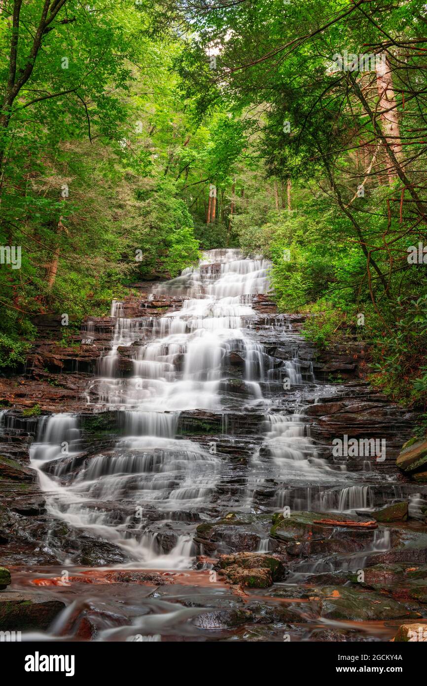 Minnehaha Falls, Rabun County, Georgia on Falls Creek. Stockfotohttps://www.alamy.de/image-license-details/?v=1https://www.alamy.de/minnehaha-falls-rabun-county-georgia-on-falls-creek-image438073450.html
RF2GCKY4A–Minnehaha Falls, Rabun County, Georgia on Falls Creek.
 Exponierte Wurzeln entlang des Pfades zu Minnehaha Falls nahe Lake Rabun in den Blue Ridge Mountains in Georgia bei Lakemont, Georgia. (USA) Stockfotohttps://www.alamy.de/image-license-details/?v=1https://www.alamy.de/exponierte-wurzeln-entlang-des-pfades-zu-minnehaha-falls-nahe-lake-rabun-in-den-blue-ridge-mountains-in-georgia-bei-lakemont-georgia-usa-image363398259.html
RM2C36657–Exponierte Wurzeln entlang des Pfades zu Minnehaha Falls nahe Lake Rabun in den Blue Ridge Mountains in Georgia bei Lakemont, Georgia. (USA)
 Die Fälle, die den Namen der Stadt - Sioux Falls, South Dakota geben. Stockfotohttps://www.alamy.de/image-license-details/?v=1https://www.alamy.de/die-falle-die-den-namen-der-stadt-sioux-falls-south-dakota-geben-image331320817.html
RF2A70Y29–Die Fälle, die den Namen der Stadt - Sioux Falls, South Dakota geben.
 Wasserfällen zwischen goldenen Herbstblättern auf Falls Creek unterhalb der Minnehaha Falls in der Nähe des Lake Rabun in Lakemont, Georgia. (USA) Stockfotohttps://www.alamy.de/image-license-details/?v=1https://www.alamy.de/wasserfallen-zwischen-goldenen-herbstblattern-auf-falls-creek-unterhalb-der-minnehaha-falls-in-der-nahe-des-lake-rabun-in-lakemont-georgia-usa-image450484612.html
RM2H4W9M4–Wasserfällen zwischen goldenen Herbstblättern auf Falls Creek unterhalb der Minnehaha Falls in der Nähe des Lake Rabun in Lakemont, Georgia. (USA)
 Minnehaha Falls, Chatthoochee National Forest - Rabun County, Georgia. Falls Branch fließt über die Schichten von Roack bei Minnehaha Falls. Stockfotohttps://www.alamy.de/image-license-details/?v=1https://www.alamy.de/minnehaha-falls-chatthoochee-national-forest-rabun-county-georgia-falls-branch-fliesst-uber-die-schichten-von-roack-bei-minnehaha-falls-image424894548.html
RM2FK7H98–Minnehaha Falls, Chatthoochee National Forest - Rabun County, Georgia. Falls Branch fließt über die Schichten von Roack bei Minnehaha Falls.
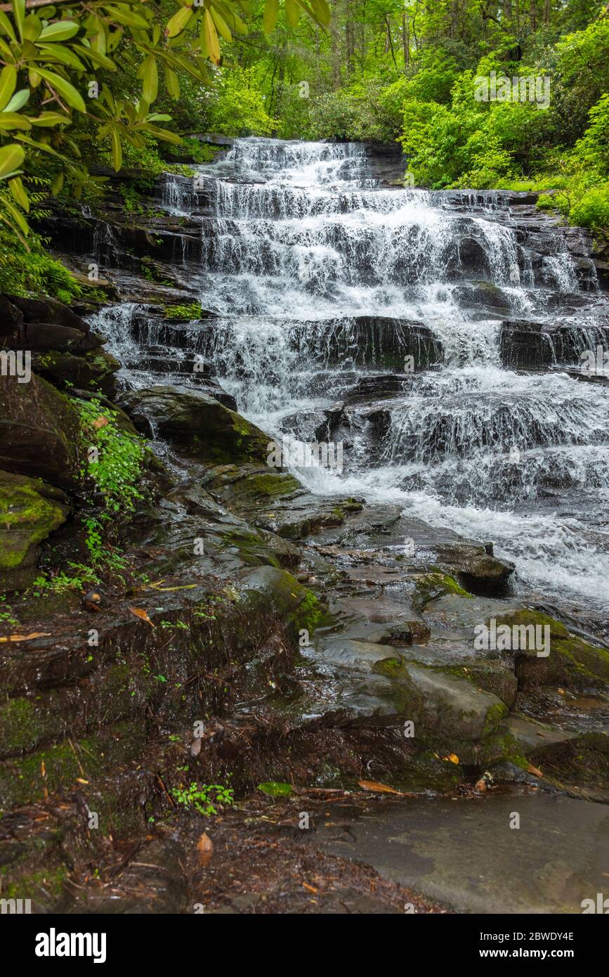 Minnehaha Falls im Chattahoochee National Forest in der Nähe von Lake Rabun in Lakemont, Georgia. (USA) Stockfotohttps://www.alamy.de/image-license-details/?v=1https://www.alamy.de/minnehaha-falls-im-chattahoochee-national-forest-in-der-nahe-von-lake-rabun-in-lakemont-georgia-usa-image359880430.html
RM2BWDY4E–Minnehaha Falls im Chattahoochee National Forest in der Nähe von Lake Rabun in Lakemont, Georgia. (USA)
 Luftaufnahme der fällt in Sioux Falls, South Dakota und die KÖNIGIN-BIENE Mühle. Stockfotohttps://www.alamy.de/image-license-details/?v=1https://www.alamy.de/luftaufnahme-der-fallt-in-sioux-falls-south-dakota-und-die-konigin-biene-muhle-image264659233.html
RFWAG7FD–Luftaufnahme der fällt in Sioux Falls, South Dakota und die KÖNIGIN-BIENE Mühle.
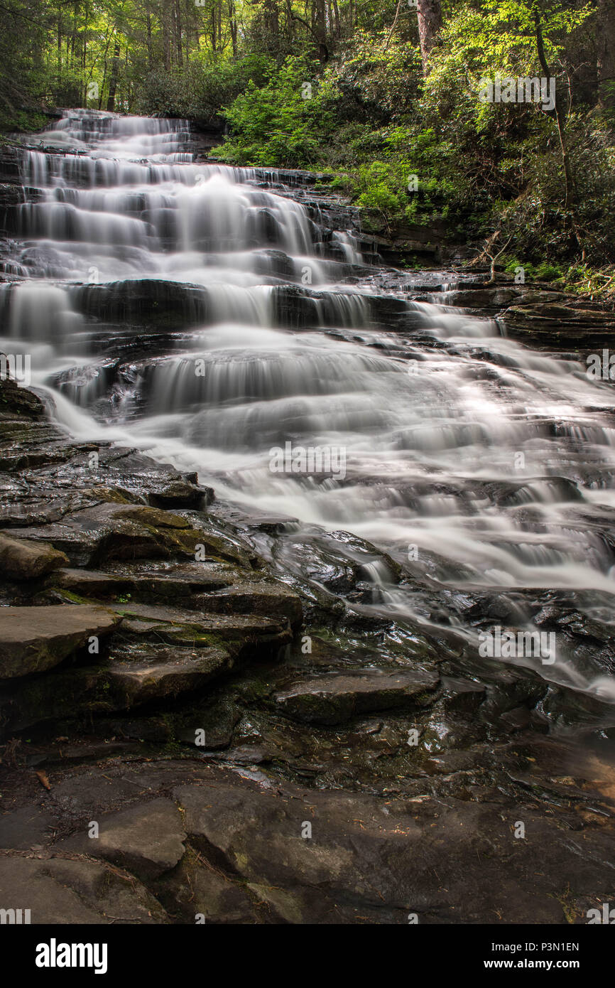 Minnehaha Falls, Rabun County, Georgia Stockfotohttps://www.alamy.de/image-license-details/?v=1https://www.alamy.de/minnehaha-falls-rabun-county-georgia-image208830573.html
RFP3N1EN–Minnehaha Falls, Rabun County, Georgia
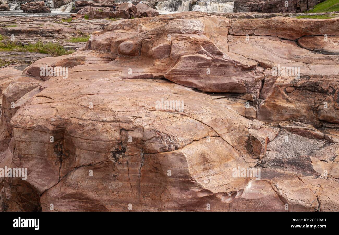 Sioux Falls, SD, USA - 2. Juni 2008: Nahaufnahme eines großen braunen Felsens an einer Kaskade von Wasserfällen. Etwas schäumendes Wasser im Rücken. Polierte Abnutzung auf der Oberfläche Clea Stockfotohttps://www.alamy.de/image-license-details/?v=1https://www.alamy.de/sioux-falls-sd-usa-2-juni-2008-nahaufnahme-eines-grossen-braunen-felsens-an-einer-kaskade-von-wasserfallen-etwas-schaumendes-wasser-im-rucken-polierte-abnutzung-auf-der-oberflache-clea-image435831385.html
RF2G91RAH–Sioux Falls, SD, USA - 2. Juni 2008: Nahaufnahme eines großen braunen Felsens an einer Kaskade von Wasserfällen. Etwas schäumendes Wasser im Rücken. Polierte Abnutzung auf der Oberfläche Clea
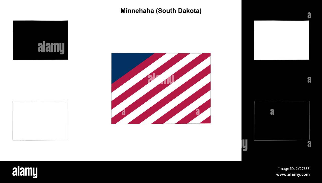 Minnehaha County (South Dakota) Umrisskarten Set Stock Vektorhttps://www.alamy.de/image-license-details/?v=1https://www.alamy.de/minnehaha-county-south-dakota-umrisskarten-set-image620962902.html
RF2Y278EE–Minnehaha County (South Dakota) Umrisskarten Set
 Kinder im Alter von 10 gekleidet und für Norwegen Tag Minnehaha Park tanzen. Minneapolis Minnesota MN USA Stockfotohttps://www.alamy.de/image-license-details/?v=1https://www.alamy.de/stockfoto-kinder-im-alter-von-10-gekleidet-und-fur-norwegen-tag-minnehaha-park-tanzen-minneapolis-minnesota-mn-usa-36469285.html
RMC398XD–Kinder im Alter von 10 gekleidet und für Norwegen Tag Minnehaha Park tanzen. Minneapolis Minnesota MN USA
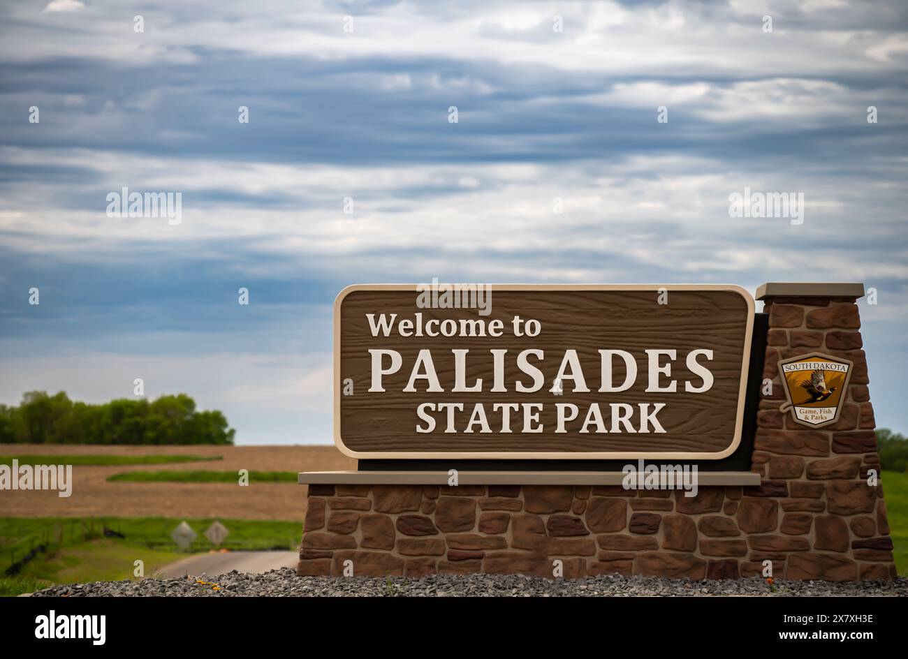 Minnehaha County, South Dakota, USA - 5.19.2024: Wegweiser zum Palisades State Park Stockfotohttps://www.alamy.de/image-license-details/?v=1https://www.alamy.de/minnehaha-county-south-dakota-usa-5192024-wegweiser-zum-palisades-state-park-image607249650.html
RF2X7XH3E–Minnehaha County, South Dakota, USA - 5.19.2024: Wegweiser zum Palisades State Park
 Philander Prescott Marker American Sioux Falls City Park South Dakota in den USA US-Fotografie Niemand horizontal Hi-res Stockfotohttps://www.alamy.de/image-license-details/?v=1https://www.alamy.de/stockfoto-philander-prescott-marker-american-sioux-falls-city-park-south-dakota-in-den-usa-us-fotografie-niemand-horizontal-hi-res-43391525.html
RMCEGJ99–Philander Prescott Marker American Sioux Falls City Park South Dakota in den USA US-Fotografie Niemand horizontal Hi-res
 USA, South Dakota, Sioux Falls, Old Minnehaha, County Courthouse – eine Vektorgrafik für Reisen Stock Vektorhttps://www.alamy.de/image-license-details/?v=1https://www.alamy.de/usa-south-dakota-sioux-falls-old-minnehaha-county-courthouse-eine-vektorgrafik-fur-reisen-image544435600.html
RF2PHN54G–USA, South Dakota, Sioux Falls, Old Minnehaha, County Courthouse – eine Vektorgrafik für Reisen
 über Minnehaha Fälle von Minnehaha park in Minneapolis Minnesota Stockfotohttps://www.alamy.de/image-license-details/?v=1https://www.alamy.de/stockfoto-uber-minnehaha-falle-von-minnehaha-park-in-minneapolis-minnesota-41327973.html
RFCB6J71–über Minnehaha Fälle von Minnehaha park in Minneapolis Minnesota
 Minnehaha Falls im Norden von Georgia. Stockfotohttps://www.alamy.de/image-license-details/?v=1https://www.alamy.de/minnehaha-falls-im-norden-von-georgia-image472247267.html
RF2JC8M5R–Minnehaha Falls im Norden von Georgia.
 Ein verblassenes Business-Wandgemälde, das für Danko's Dairy est auf einer Ziegelwand gemalt wurde. 1947 in der Longfellow Nachbarschaft von Minneapolis, Minnesota Stockfotohttps://www.alamy.de/image-license-details/?v=1https://www.alamy.de/ein-verblassenes-business-wandgemalde-das-fur-dankos-dairy-est-auf-einer-ziegelwand-gemalt-wurde-1947-in-der-longfellow-nachbarschaft-von-minneapolis-minnesota-image385364736.html
RF2DAXTJ8–Ein verblassenes Business-Wandgemälde, das für Danko's Dairy est auf einer Ziegelwand gemalt wurde. 1947 in der Longfellow Nachbarschaft von Minneapolis, Minnesota
 Wilson's Phalarope am 6. Mai 2017 Minnehaha County, South Dakota Stockfotohttps://www.alamy.de/image-license-details/?v=1https://www.alamy.de/wilsons-phalarope-am-6-mai-2017-minnehaha-county-south-dakota-image213580811.html
RFPBDCE3–Wilson's Phalarope am 6. Mai 2017 Minnehaha County, South Dakota
 Karte von Minnehaha in South Dakota Stockfotohttps://www.alamy.de/image-license-details/?v=1https://www.alamy.de/karte-von-minnehaha-in-south-dakota-image402448237.html
RF2EAN2R9–Karte von Minnehaha in South Dakota
 Grasshopper Sparrow Juli 22., 2008 Minnehaha County, South Dakota Stockfotohttps://www.alamy.de/image-license-details/?v=1https://www.alamy.de/grasshopper-sparrow-juli-22-2008-minnehaha-county-south-dakota-image213560679.html
RFPBCER3–Grasshopper Sparrow Juli 22., 2008 Minnehaha County, South Dakota
 Minnehaha Falls, Rabun County, Georgia on Falls Creek. Stockfotohttps://www.alamy.de/image-license-details/?v=1https://www.alamy.de/minnehaha-falls-rabun-county-georgia-on-falls-creek-image438073437.html
RF2GCKY3W–Minnehaha Falls, Rabun County, Georgia on Falls Creek.
 Hochland sandpiper Juli 20, 2008 Minnehaha County, South Dakota Stockfotohttps://www.alamy.de/image-license-details/?v=1https://www.alamy.de/hochland-sandpiper-juli-20-2008-minnehaha-county-south-dakota-image213580770.html
RFPBDCCJ–Hochland sandpiper Juli 20, 2008 Minnehaha County, South Dakota
 Die Fälle, die ihren Namen der Stadt geben - Sioux Falls, South Dakota. Stockfotohttps://www.alamy.de/image-license-details/?v=1https://www.alamy.de/stockfoto-die-falle-die-ihren-namen-der-stadt-geben-sioux-falls-south-dakota-167059856.html
RFKKP6FC–Die Fälle, die ihren Namen der Stadt geben - Sioux Falls, South Dakota.
 Minnehaha Falls, Chatthoochee National Forest - Rabun County, Georgia. Geschwungene Felsformationen führen dazu, dass das Wasser über die abgestuften Schichten von Min fließt Stockfotohttps://www.alamy.de/image-license-details/?v=1https://www.alamy.de/minnehaha-falls-chatthoochee-national-forest-rabun-county-georgia-geschwungene-felsformationen-fuhren-dazu-dass-das-wasser-uber-die-abgestuften-schichten-von-min-fliesst-image424894753.html
RM2FK7HGH–Minnehaha Falls, Chatthoochee National Forest - Rabun County, Georgia. Geschwungene Felsformationen führen dazu, dass das Wasser über die abgestuften Schichten von Min fließt
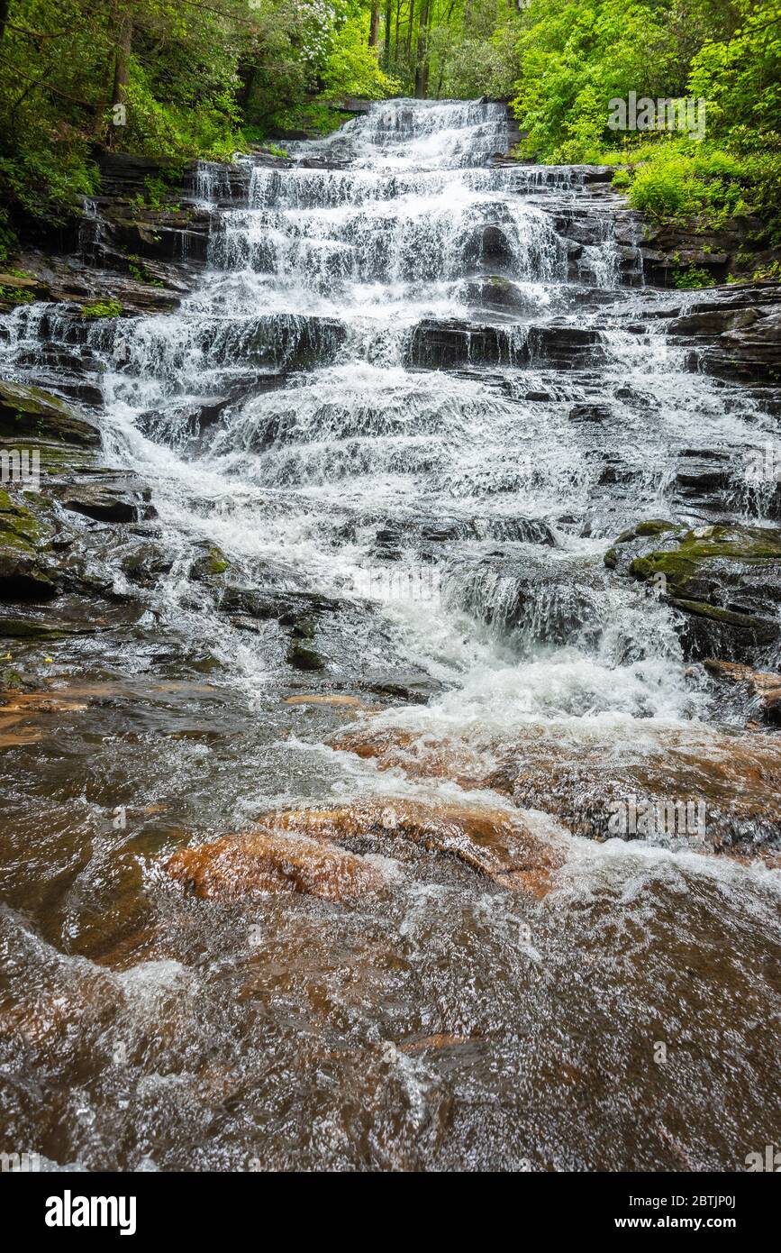 Minnehaha Falls im Chattahoochee National Forest in der Nähe von Lake Rabun in Lakemont, Georgia. (USA) Stockfotohttps://www.alamy.de/image-license-details/?v=1https://www.alamy.de/minnehaha-falls-im-chattahoochee-national-forest-in-der-nahe-von-lake-rabun-in-lakemont-georgia-usa-image359371506.html
RM2BTJP0J–Minnehaha Falls im Chattahoochee National Forest in der Nähe von Lake Rabun in Lakemont, Georgia. (USA)
 Minnehaha Falls, Rabun County, Georgia. Nebliger Herbst morgen im Minnehaha Falls, mit Laub in der unteren Bildschirmzeile angezeigt. Minnehaha Falls sind auf Fa Stockfotohttps://www.alamy.de/image-license-details/?v=1https://www.alamy.de/minnehaha-falls-rabun-county-georgia-nebliger-herbst-morgen-im-minnehaha-falls-mit-laub-in-der-unteren-bildschirmzeile-angezeigt-minnehaha-falls-sind-auf-fa-image340494662.html
RM2ANXTBJ–Minnehaha Falls, Rabun County, Georgia. Nebliger Herbst morgen im Minnehaha Falls, mit Laub in der unteren Bildschirmzeile angezeigt. Minnehaha Falls sind auf Fa
 Minnehaha Falls, Rabun County, Georgia Stockfotohttps://www.alamy.de/image-license-details/?v=1https://www.alamy.de/minnehaha-falls-rabun-county-georgia-image208830571.html
RFP3N1EK–Minnehaha Falls, Rabun County, Georgia
 Luftaufnahme der fällt in Sioux Falls, South Dakota. Stockfotohttps://www.alamy.de/image-license-details/?v=1https://www.alamy.de/luftaufnahme-der-fallt-in-sioux-falls-south-dakota-image264659088.html
RFWAG7A8–Luftaufnahme der fällt in Sioux Falls, South Dakota.
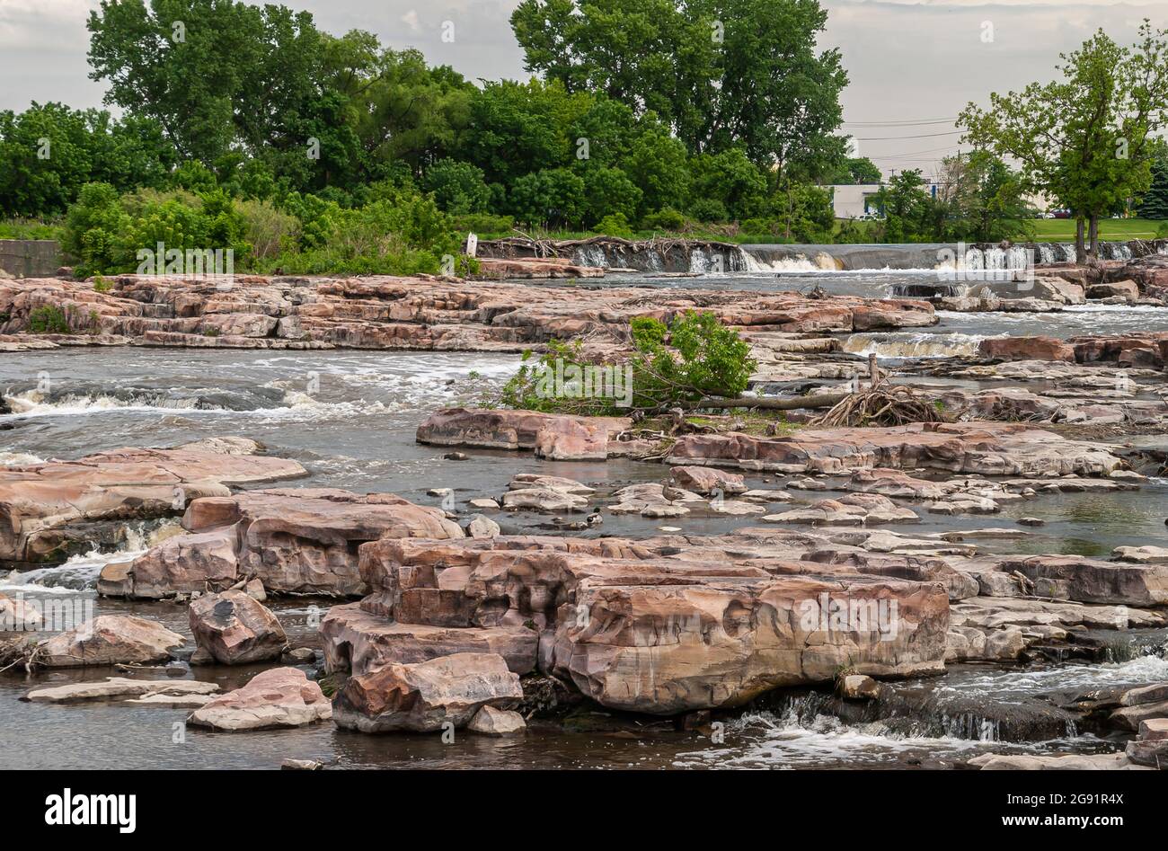 Sioux Falls, SD, USA - 2. Juni 2008: Konzentrieren Sie sich auf die Kaskade von Wasserfällen über beigefarbene Felsen mit etwas grünem Laub im Rücken. Stockfotohttps://www.alamy.de/image-license-details/?v=1https://www.alamy.de/sioux-falls-sd-usa-2-juni-2008-konzentrieren-sie-sich-auf-die-kaskade-von-wasserfallen-uber-beigefarbene-felsen-mit-etwas-grunem-laub-im-rucken-image435831226.html
RF2G91R4X–Sioux Falls, SD, USA - 2. Juni 2008: Konzentrieren Sie sich auf die Kaskade von Wasserfällen über beigefarbene Felsen mit etwas grünem Laub im Rücken.
 Der Autor hält seine Bücher am Tag Norwegen im Minnehaha Park. Minneapolis Minnesota MN USA Stockfotohttps://www.alamy.de/image-license-details/?v=1https://www.alamy.de/stockfoto-der-autor-halt-seine-bucher-am-tag-norwegen-im-minnehaha-park-minneapolis-minnesota-mn-usa-36469183.html
RMC398PR–Der Autor hält seine Bücher am Tag Norwegen im Minnehaha Park. Minneapolis Minnesota MN USA
 Minnehaha County, South Dakota, USA - 5.19.2024: Wegweiser zum Palisades State Park Stockfotohttps://www.alamy.de/image-license-details/?v=1https://www.alamy.de/minnehaha-county-south-dakota-usa-5192024-wegweiser-zum-palisades-state-park-image607561346.html
RF2X8CPKE–Minnehaha County, South Dakota, USA - 5.19.2024: Wegweiser zum Palisades State Park
 South Dakota County-Karte Stock Vektorhttps://www.alamy.de/image-license-details/?v=1https://www.alamy.de/south-dakota-county-karte-image360961589.html
RF2BY7659–South Dakota County-Karte
 Sioux Falls Park im Winter mit gefrorenem Wasserfall und Schneebedeckung. Stockfotohttps://www.alamy.de/image-license-details/?v=1https://www.alamy.de/sioux-falls-park-im-winter-mit-gefrorenem-wasserfall-und-schneebedeckung-image503792102.html
RF2M7HKY2–Sioux Falls Park im Winter mit gefrorenem Wasserfall und Schneebedeckung.
 Rauschenden Wasser Der minnehaha Creek an minnehaha fällt in Minneapolis Minnesota Stockfotohttps://www.alamy.de/image-license-details/?v=1https://www.alamy.de/stockfoto-rauschenden-wasser-der-minnehaha-creek-an-minnehaha-fallt-in-minneapolis-minnesota-38049292.html
RFC5W878–Rauschenden Wasser Der minnehaha Creek an minnehaha fällt in Minneapolis Minnesota
 Geschichte der Minnehaha County, South Dakota. Mit einem Konto der Siedlungen, Wachstum, Entwicklung und Ressourcen... Synopse der öffentlichen Aufzeichnungen, Biographische Skizzen.. : Bailey, Dana Reed, 1833 Stockfotohttps://www.alamy.de/image-license-details/?v=1https://www.alamy.de/geschichte-der-minnehaha-county-south-dakota-mit-einem-konto-der-siedlungen-wachstum-entwicklung-und-ressourcen-synopse-der-offentlichen-aufzeichnungen-biographische-skizzen-bailey-dana-reed-1833-image261419123.html
RMW58JN7–Geschichte der Minnehaha County, South Dakota. Mit einem Konto der Siedlungen, Wachstum, Entwicklung und Ressourcen... Synopse der öffentlichen Aufzeichnungen, Biographische Skizzen.. : Bailey, Dana Reed, 1833
 Henry Wadsworth Longfellow House Replik im Minnehaha Park in Minneapolis Minnesota Stockfotohttps://www.alamy.de/image-license-details/?v=1https://www.alamy.de/stockfoto-henry-wadsworth-longfellow-house-replik-im-minnehaha-park-in-minneapolis-minnesota-38049254.html
RFC5W85X–Henry Wadsworth Longfellow House Replik im Minnehaha Park in Minneapolis Minnesota
 Wasser des Minnehaha Creek im Minnehaha Park überfüllt ihre Banken und läuft unter Viadukt Stockfotohttps://www.alamy.de/image-license-details/?v=1https://www.alamy.de/stockfoto-wasser-des-minnehaha-creek-im-minnehaha-park-uberfullt-ihre-banken-und-lauft-unter-viadukt-41295938.html
RFCB55AX–Wasser des Minnehaha Creek im Minnehaha Park überfüllt ihre Banken und läuft unter Viadukt
 Hartford, Minnehaha County, USA, Vereinigte Staaten, South Dakota, n 43 37' 22'', S 96 56' 33'', Karte, Cartascapes Map, veröffentlicht 2024. Erkunden Sie Cartascapes, eine Karte, die die vielfältigen Landschaften, Kulturen und Ökosysteme der Erde enthüllt. Reisen Sie durch Zeit und Raum und entdecken Sie die Verflechtungen der Vergangenheit, Gegenwart und Zukunft unseres Planeten. Stockfotohttps://www.alamy.de/image-license-details/?v=1https://www.alamy.de/hartford-minnehaha-county-usa-vereinigte-staaten-south-dakota-n-43-37-22-s-96-56-33-karte-cartascapes-map-veroffentlicht-2024-erkunden-sie-cartascapes-eine-karte-die-die-vielfaltigen-landschaften-kulturen-und-okosysteme-der-erde-enthullt-reisen-sie-durch-zeit-und-raum-und-entdecken-sie-die-verflechtungen-der-vergangenheit-gegenwart-und-zukunft-unseres-planeten-image621315293.html
RM2Y2R9YW–Hartford, Minnehaha County, USA, Vereinigte Staaten, South Dakota, n 43 37' 22'', S 96 56' 33'', Karte, Cartascapes Map, veröffentlicht 2024. Erkunden Sie Cartascapes, eine Karte, die die vielfältigen Landschaften, Kulturen und Ökosysteme der Erde enthüllt. Reisen Sie durch Zeit und Raum und entdecken Sie die Verflechtungen der Vergangenheit, Gegenwart und Zukunft unseres Planeten.
 Minnehaha Falls, Rabun County, Georgia On Falls Branch. Stockfotohttps://www.alamy.de/image-license-details/?v=1https://www.alamy.de/minnehaha-falls-rabun-county-georgia-on-falls-branch-image376875399.html
RF2CW44BK–Minnehaha Falls, Rabun County, Georgia On Falls Branch.
 Hochland sandpiper Juli 20, 2008 Minnehaha County, South Dakota Stockfotohttps://www.alamy.de/image-license-details/?v=1https://www.alamy.de/hochland-sandpiper-juli-20-2008-minnehaha-county-south-dakota-image213580769.html
RFPBDCCH–Hochland sandpiper Juli 20, 2008 Minnehaha County, South Dakota
 historischen Heimat Replik von Longfellow House im Minnehaha Park Minneapolis minnesota Stockfotohttps://www.alamy.de/image-license-details/?v=1https://www.alamy.de/historischen-heimat-replik-von-longfellow-house-im-minnehaha-park-minneapolis-minnesota-image65720448.html
RFDPWR2T–historischen Heimat Replik von Longfellow House im Minnehaha Park Minneapolis minnesota
 Die Fälle, die ihren Namen der Stadt geben - Sioux Falls, South Dakota. Stockfotohttps://www.alamy.de/image-license-details/?v=1https://www.alamy.de/stockfoto-die-falle-die-ihren-namen-der-stadt-geben-sioux-falls-south-dakota-167059865.html
RFKKP6FN–Die Fälle, die ihren Namen der Stadt geben - Sioux Falls, South Dakota.
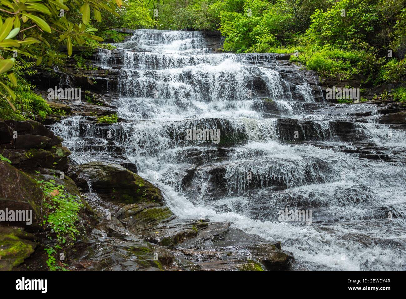 Minnehaha Falls im Chattahoochee National Forest in der Nähe von Lake Rabun in Lakemont, Georgia. (USA) Stockfotohttps://www.alamy.de/image-license-details/?v=1https://www.alamy.de/minnehaha-falls-im-chattahoochee-national-forest-in-der-nahe-von-lake-rabun-in-lakemont-georgia-usa-image359880439.html
RM2BWDY4R–Minnehaha Falls im Chattahoochee National Forest in der Nähe von Lake Rabun in Lakemont, Georgia. (USA)
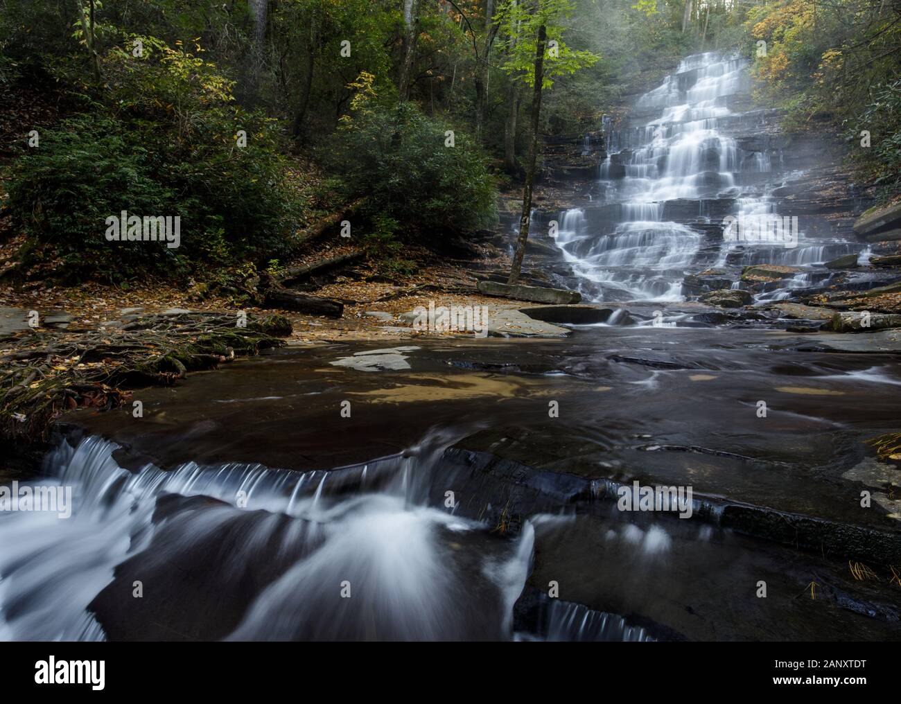 Minnehaha Falls, Rabun County, Georgia. Herbst Farbe und Nebel am schönen Minnehaha Falls. Minnehaha Falls sind auf fällt Zweig zwischen seinen oberlauf Stockfotohttps://www.alamy.de/image-license-details/?v=1https://www.alamy.de/minnehaha-falls-rabun-county-georgia-herbst-farbe-und-nebel-am-schonen-minnehaha-falls-minnehaha-falls-sind-auf-fallt-zweig-zwischen-seinen-oberlauf-image340494724.html
RM2ANXTDT–Minnehaha Falls, Rabun County, Georgia. Herbst Farbe und Nebel am schönen Minnehaha Falls. Minnehaha Falls sind auf fällt Zweig zwischen seinen oberlauf
 Mellette und Minnehaha County, State of South Dakota (U.S. County, United States of America, USA, U.S., US) Kartenvektordarstellung, Skizze m Stock Vektorhttps://www.alamy.de/image-license-details/?v=1https://www.alamy.de/mellette-und-minnehaha-county-state-of-south-dakota-us-county-united-states-of-america-usa-us-us-kartenvektordarstellung-skizze-m-image415846675.html
RF2F4FCJY–Mellette und Minnehaha County, State of South Dakota (U.S. County, United States of America, USA, U.S., US) Kartenvektordarstellung, Skizze m
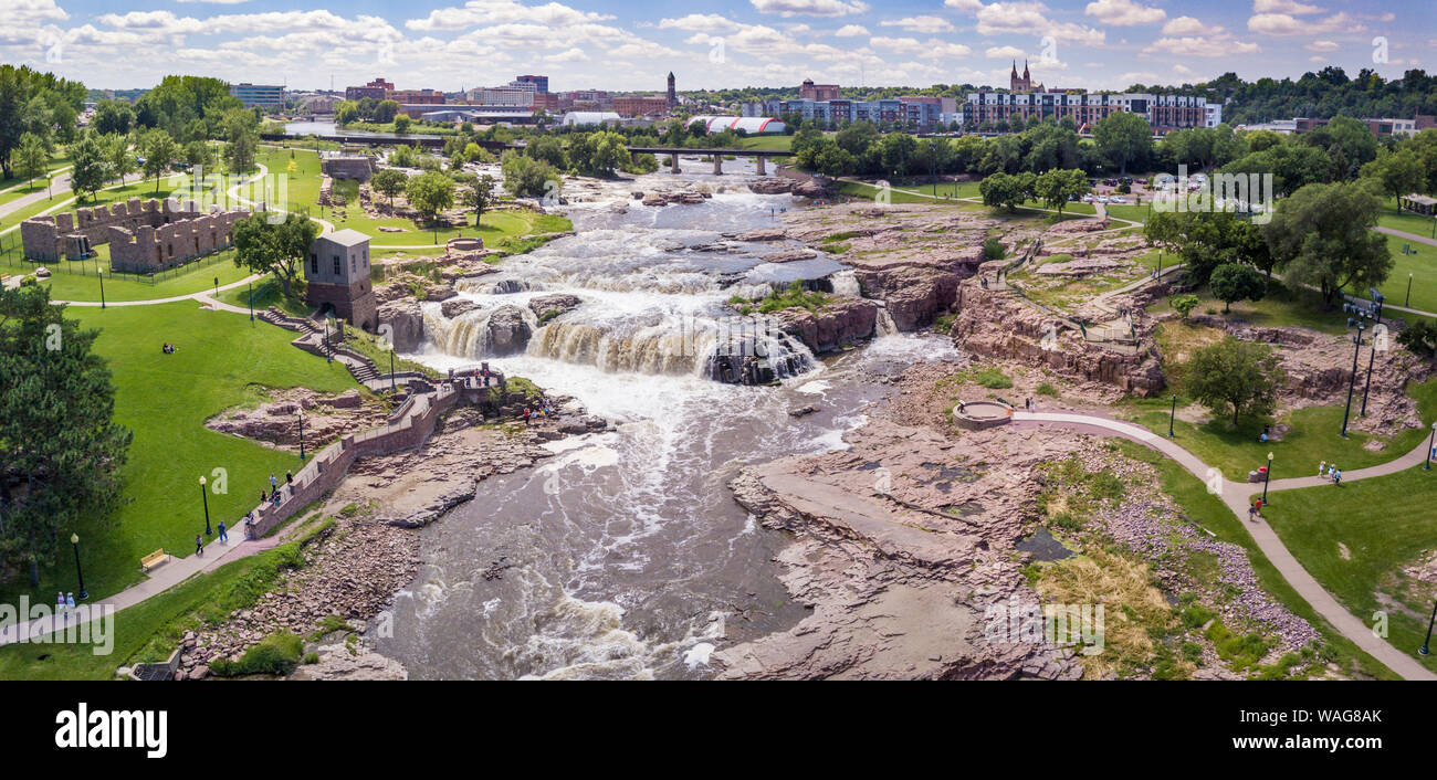 Antenne Panorama der fällt in Sioux Falls, South Dakota und Falls Park. Stockfotohttps://www.alamy.de/image-license-details/?v=1https://www.alamy.de/antenne-panorama-der-fallt-in-sioux-falls-south-dakota-und-falls-park-image264659883.html
RFWAG8AK–Antenne Panorama der fällt in Sioux Falls, South Dakota und Falls Park.
 Sioux Falls, SD, USA - 2. Juni 2008: Nahaufnahme von braun-schwarzem Gestein, der von einem Wasserüberlauf verschont wird, durch das spritzende weiße Wasser fließt. Stockfotohttps://www.alamy.de/image-license-details/?v=1https://www.alamy.de/sioux-falls-sd-usa-2-juni-2008-nahaufnahme-von-braun-schwarzem-gestein-der-von-einem-wasseruberlauf-verschont-wird-durch-das-spritzende-weisse-wasser-fliesst-image435831449.html
RF2G91RCW–Sioux Falls, SD, USA - 2. Juni 2008: Nahaufnahme von braun-schwarzem Gestein, der von einem Wasserüberlauf verschont wird, durch das spritzende weiße Wasser fließt.
 Junge 5 Jahre mit norwegischen Helm und Schwert in Norwegen Tag im Minnehaha Park. Minneapolis Minnesota MN USA Stockfotohttps://www.alamy.de/image-license-details/?v=1https://www.alamy.de/stockfoto-junge-5-jahre-mit-norwegischen-helm-und-schwert-in-norwegen-tag-im-minnehaha-park-minneapolis-minnesota-mn-usa-36469228.html
RMC398TC–Junge 5 Jahre mit norwegischen Helm und Schwert in Norwegen Tag im Minnehaha Park. Minneapolis Minnesota MN USA
 USA, South Dakota, Sioux Falls, Old Minnehaha, County Courthouse – eine Vektorgrafik für Reisen Stock Vektorhttps://www.alamy.de/image-license-details/?v=1https://www.alamy.de/usa-south-dakota-sioux-falls-old-minnehaha-county-courthouse-eine-vektorgrafik-fur-reisen-image544870050.html
RF2PJCY8J–USA, South Dakota, Sioux Falls, Old Minnehaha, County Courthouse – eine Vektorgrafik für Reisen
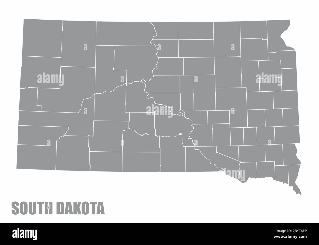 South Dakota County-Karte Stock Vektorhttps://www.alamy.de/image-license-details/?v=1https://www.alamy.de/south-dakota-county-karte-image360961854.html
RF2BY76EP–South Dakota County-Karte
 Sioux Falls Park im Winter mit gefrorenem Wasserfall und Schneebedeckung. Stockfotohttps://www.alamy.de/image-license-details/?v=1https://www.alamy.de/sioux-falls-park-im-winter-mit-gefrorenem-wasserfall-und-schneebedeckung-image504840348.html
RF2M99D0C–Sioux Falls Park im Winter mit gefrorenem Wasserfall und Schneebedeckung.
 Karte von Minnehaha in South Dakota Stockfotohttps://www.alamy.de/image-license-details/?v=1https://www.alamy.de/karte-von-minnehaha-in-south-dakota-image443788177.html
RF2GP089N–Karte von Minnehaha in South Dakota
 Minnehaha fällt Minneapolis Minnesota umgeben mit Bäumen bedeckt in Frost mit gefrorenen Wasserfällen. Stockfotohttps://www.alamy.de/image-license-details/?v=1https://www.alamy.de/minnehaha-fallt-minneapolis-minnesota-umgeben-mit-baumen-bedeckt-in-frost-mit-gefrorenen-wasserfallen-image8962877.html
RMAP5TKE–Minnehaha fällt Minneapolis Minnesota umgeben mit Bäumen bedeckt in Frost mit gefrorenen Wasserfällen.
 Karte von Minnehaha County, South Dakota Stockfotohttps://www.alamy.de/image-license-details/?v=1https://www.alamy.de/karte-von-minnehaha-county-south-dakota-image398184418.html
RM2E3PT82–Karte von Minnehaha County, South Dakota
 SITE MAP HERVORHEBUNG DER HISTORISCHEN GRENZEN, bedeutende Gebäude; gepunktete Linie zeigt die Position der AMBULANZ HINAUS - Sioux Falls Veterans Administration Medical und regionalen Office Center, 2501 West 22, Sioux Falls, Minnehaha County, SD; US-Veterans Affairs; Schemmel, Ronald F, Fotograf; Tupek, Karen Rönne, Historiker Stockfotohttps://www.alamy.de/image-license-details/?v=1https://www.alamy.de/site-map-hervorhebung-der-historischen-grenzen-bedeutende-gebaude-gepunktete-linie-zeigt-die-position-der-ambulanz-hinaus-sioux-falls-veterans-administration-medical-und-regionalen-office-center-2501-west-22-sioux-falls-minnehaha-county-sd-us-veterans-affairs-schemmel-ronald-f-fotograf-tupek-karen-ronne-historiker-image256706972.html
RMTWJ0A4–SITE MAP HERVORHEBUNG DER HISTORISCHEN GRENZEN, bedeutende Gebäude; gepunktete Linie zeigt die Position der AMBULANZ HINAUS - Sioux Falls Veterans Administration Medical und regionalen Office Center, 2501 West 22, Sioux Falls, Minnehaha County, SD; US-Veterans Affairs; Schemmel, Ronald F, Fotograf; Tupek, Karen Rönne, Historiker
 Karte von Minnehaha in South Dakota Stockfotohttps://www.alamy.de/image-license-details/?v=1https://www.alamy.de/karte-von-minnehaha-in-south-dakota-image365483674.html
RF2C6H64A–Karte von Minnehaha in South Dakota
 Garretson, Minnehaha County, USA, Vereinigte Staaten, South Dakota, n 43 43' 2'', S 96 30' 10'', Karte, Cartascapes Map, veröffentlicht 2024. Erkunden Sie Cartascapes, eine Karte, die die vielfältigen Landschaften, Kulturen und Ökosysteme der Erde enthüllt. Reisen Sie durch Zeit und Raum und entdecken Sie die Verflechtungen der Vergangenheit, Gegenwart und Zukunft unseres Planeten. Stockfotohttps://www.alamy.de/image-license-details/?v=1https://www.alamy.de/garretson-minnehaha-county-usa-vereinigte-staaten-south-dakota-n-43-43-2-s-96-30-10-karte-cartascapes-map-veroffentlicht-2024-erkunden-sie-cartascapes-eine-karte-die-die-vielfaltigen-landschaften-kulturen-und-okosysteme-der-erde-enthullt-reisen-sie-durch-zeit-und-raum-und-entdecken-sie-die-verflechtungen-der-vergangenheit-gegenwart-und-zukunft-unseres-planeten-image621451164.html
RM2Y31F8C–Garretson, Minnehaha County, USA, Vereinigte Staaten, South Dakota, n 43 43' 2'', S 96 30' 10'', Karte, Cartascapes Map, veröffentlicht 2024. Erkunden Sie Cartascapes, eine Karte, die die vielfältigen Landschaften, Kulturen und Ökosysteme der Erde enthüllt. Reisen Sie durch Zeit und Raum und entdecken Sie die Verflechtungen der Vergangenheit, Gegenwart und Zukunft unseres Planeten.
 Minnehaha Falls, Rabun County, Georgia on Falls Creek. Stockfotohttps://www.alamy.de/image-license-details/?v=1https://www.alamy.de/minnehaha-falls-rabun-county-georgia-on-falls-creek-image377300740.html
RF2CWREXC–Minnehaha Falls, Rabun County, Georgia on Falls Creek.
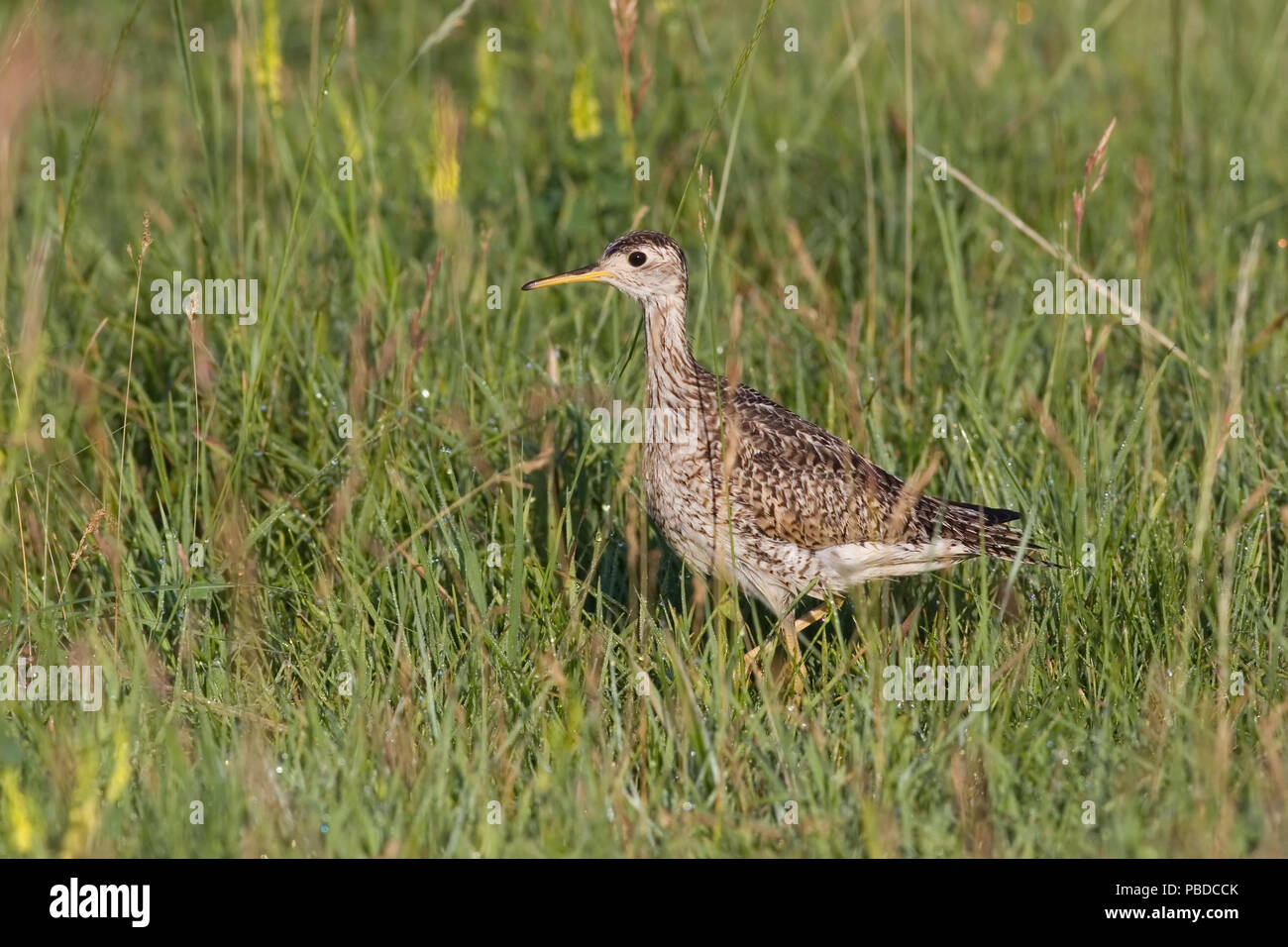 Hochland sandpiper Juli 20, 2008 Minnehaha County, South Dakota Stockfotohttps://www.alamy.de/image-license-details/?v=1https://www.alamy.de/hochland-sandpiper-juli-20-2008-minnehaha-county-south-dakota-image213580771.html
RFPBDCCK–Hochland sandpiper Juli 20, 2008 Minnehaha County, South Dakota
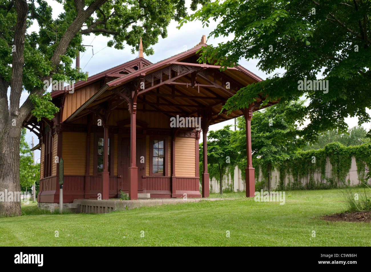 Minnehaha Depot restauriert früher Milwaukee Straße Depot Gebäude an Minnehaha Park von Minneapolis Minnesota Stockfotohttps://www.alamy.de/image-license-details/?v=1https://www.alamy.de/stockfoto-minnehaha-depot-restauriert-fruher-milwaukee-strasse-depot-gebaude-an-minnehaha-park-von-minneapolis-minnesota-38049273.html
RFC5W86H–Minnehaha Depot restauriert früher Milwaukee Straße Depot Gebäude an Minnehaha Park von Minneapolis Minnesota
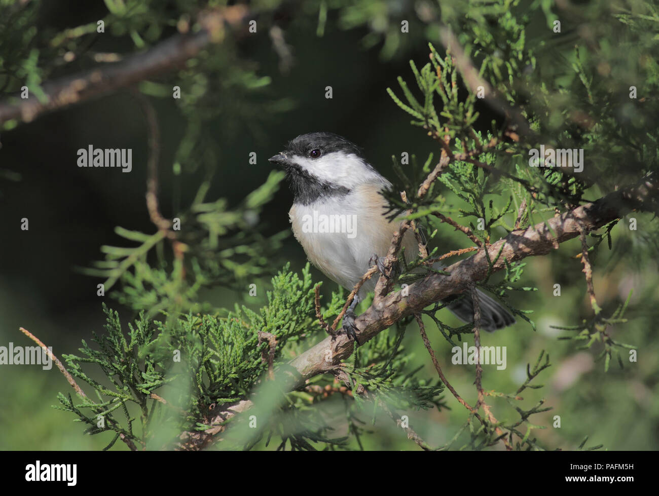 Black-capped chickadee September 4th, 2011 Minnehaha County, SD Stockfotohttps://www.alamy.de/image-license-details/?v=1https://www.alamy.de/black-capped-chickadee-september-4th-2011-minnehaha-county-sd-image213016093.html
RFPAFM5H–Black-capped chickadee September 4th, 2011 Minnehaha County, SD
 Minnehaha Falls Trail Eingang Schild im Chattahoochee National Forest in der Nähe von Lake Rabun in Lakemont, Georgia. (USA) Stockfotohttps://www.alamy.de/image-license-details/?v=1https://www.alamy.de/minnehaha-falls-trail-eingang-schild-im-chattahoochee-national-forest-in-der-nahe-von-lake-rabun-in-lakemont-georgia-usa-image359371501.html
RM2BTJP0D–Minnehaha Falls Trail Eingang Schild im Chattahoochee National Forest in der Nähe von Lake Rabun in Lakemont, Georgia. (USA)
 Grasshopper Sparrow Juli 20, 2008 Minnehaha County, South Dakota Stockfotohttps://www.alamy.de/image-license-details/?v=1https://www.alamy.de/grasshopper-sparrow-juli-20-2008-minnehaha-county-south-dakota-image213560677.html
RFPBCER1–Grasshopper Sparrow Juli 20, 2008 Minnehaha County, South Dakota
 Minnehaha Falls, Rabun County, Georgia. Nebelscheinwerfer Verkleidung der oberen Ebenen der Minnehaha Falls. Minnehaha Falls sind auf fällt Zweig zwischen seinem Quellgebiet Stockfotohttps://www.alamy.de/image-license-details/?v=1https://www.alamy.de/minnehaha-falls-rabun-county-georgia-nebelscheinwerfer-verkleidung-der-oberen-ebenen-der-minnehaha-falls-minnehaha-falls-sind-auf-fallt-zweig-zwischen-seinem-quellgebiet-image340494590.html
RM2ANXT92–Minnehaha Falls, Rabun County, Georgia. Nebelscheinwerfer Verkleidung der oberen Ebenen der Minnehaha Falls. Minnehaha Falls sind auf fällt Zweig zwischen seinem Quellgebiet
 Grasshopper Sparrow Juli 22., 2008 Minnehaha County, South Dakota Stockfotohttps://www.alamy.de/image-license-details/?v=1https://www.alamy.de/grasshopper-sparrow-juli-22-2008-minnehaha-county-south-dakota-image213560680.html
RFPBCER4–Grasshopper Sparrow Juli 22., 2008 Minnehaha County, South Dakota
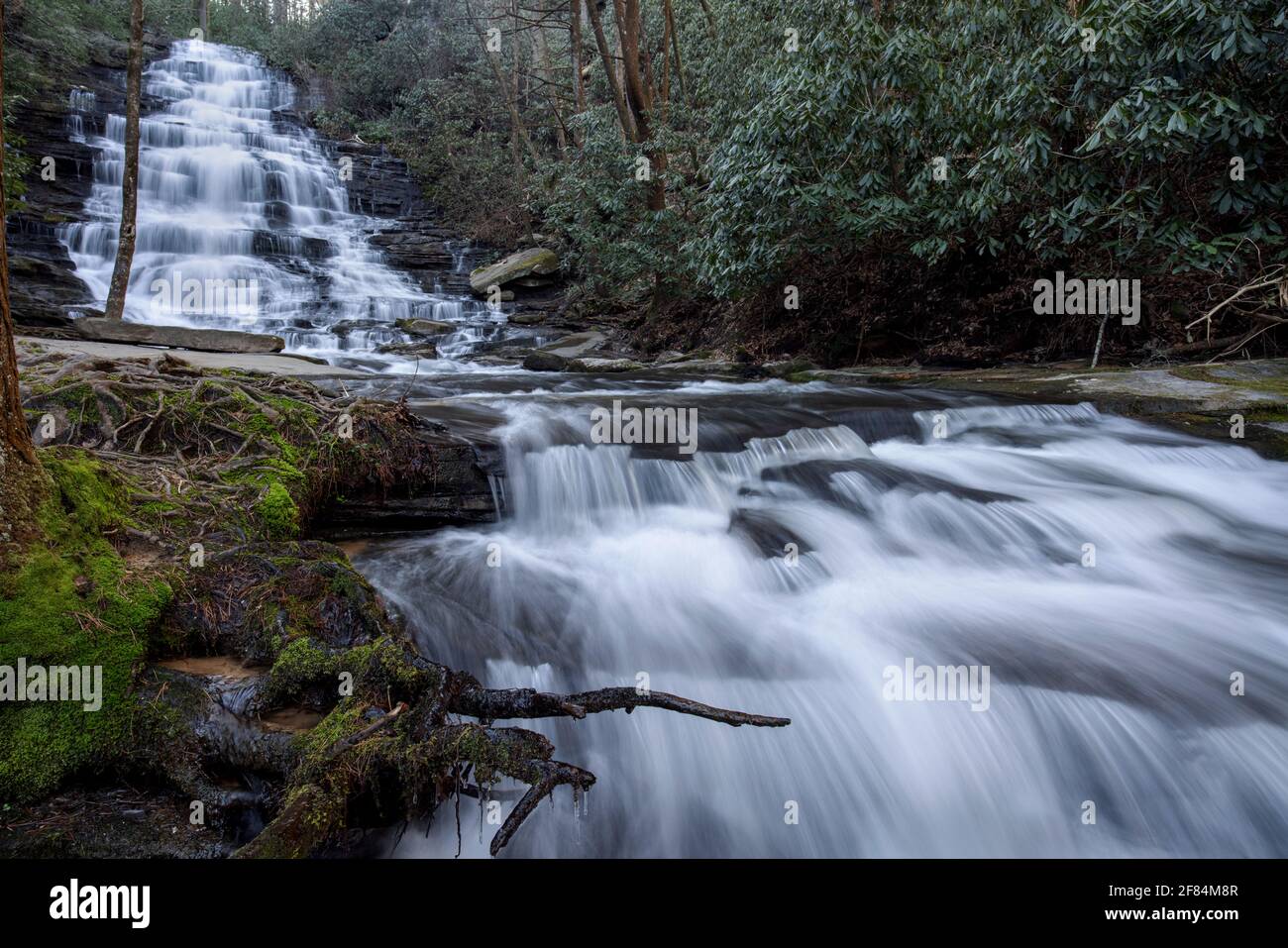 Minnehaha Falls, Chattahoochee National Forest - Rabun County, Georgia. Falls Branch fließt über Minnehaha Falls und geht weiter den Berg im Ohr hinunter Stockfotohttps://www.alamy.de/image-license-details/?v=1https://www.alamy.de/minnehaha-falls-chattahoochee-national-forest-rabun-county-georgia-falls-branch-fliesst-uber-minnehaha-falls-und-geht-weiter-den-berg-im-ohr-hinunter-image418069815.html
RM2F84M8R–Minnehaha Falls, Chattahoochee National Forest - Rabun County, Georgia. Falls Branch fließt über Minnehaha Falls und geht weiter den Berg im Ohr hinunter
 Juvenile Cliff Swallow Juli 24th, 2008 Minnehaha County, South Dakota Stockfotohttps://www.alamy.de/image-license-details/?v=1https://www.alamy.de/juvenile-cliff-swallow-juli-24th-2008-minnehaha-county-south-dakota-image212083194.html
RFP9167P–Juvenile Cliff Swallow Juli 24th, 2008 Minnehaha County, South Dakota
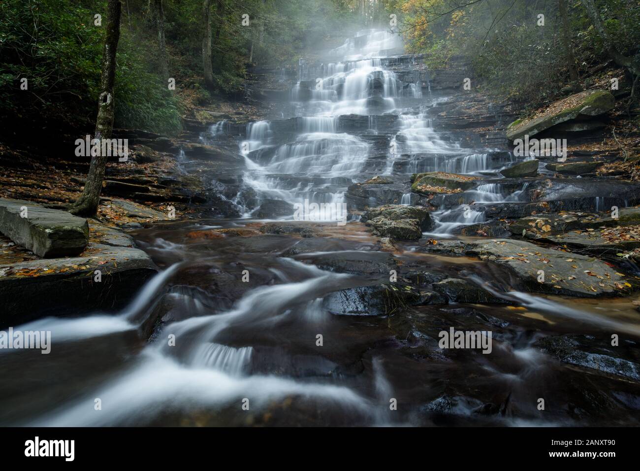 Minnehaha Falls, Rabun County, Georgia. Herbst morgen Nebel um Minnehaha Falls. Minnehaha Falls sind auf fällt Zweig zwischen seinem Quellgebiet auf Stockfotohttps://www.alamy.de/image-license-details/?v=1https://www.alamy.de/minnehaha-falls-rabun-county-georgia-herbst-morgen-nebel-um-minnehaha-falls-minnehaha-falls-sind-auf-fallt-zweig-zwischen-seinem-quellgebiet-auf-image340494588.html
RM2ANXT90–Minnehaha Falls, Rabun County, Georgia. Herbst morgen Nebel um Minnehaha Falls. Minnehaha Falls sind auf fällt Zweig zwischen seinem Quellgebiet auf
 Minnehaha Creek und Wald bedeckt mit frischen Schnee im Winter in Minneapolis Minnesota Stockfotohttps://www.alamy.de/image-license-details/?v=1https://www.alamy.de/minnehaha-creek-und-wald-bedeckt-mit-frischen-schnee-im-winter-in-minneapolis-minnesota-image242802510.html
RFT30H26–Minnehaha Creek und Wald bedeckt mit frischen Schnee im Winter in Minneapolis Minnesota
 Die Fälle, die ihren Namen der Stadt geben - Sioux Falls, South Dakota. Stockfotohttps://www.alamy.de/image-license-details/?v=1https://www.alamy.de/stockfoto-die-falle-die-ihren-namen-der-stadt-geben-sioux-falls-south-dakota-167059889.html
RFKKP6GH–Die Fälle, die ihren Namen der Stadt geben - Sioux Falls, South Dakota.
 Niedrige Luftaufnahme der Wasserfall in Sioux Falls, South Dakota der größten Stadt. Stockfotohttps://www.alamy.de/image-license-details/?v=1https://www.alamy.de/niedrige-luftaufnahme-der-wasserfall-in-sioux-falls-south-dakota-der-grossten-stadt-image264652586.html
RFWAFY22–Niedrige Luftaufnahme der Wasserfall in Sioux Falls, South Dakota der größten Stadt.
 Sioux Falls, SD, USA - 2. Juni 2008: Nahaufnahme eines weißen schäumenden Wasserfalls in der Kaskade von ihnen über braun-beige Felsen, im grünen Park unter der Luft Stockfotohttps://www.alamy.de/image-license-details/?v=1https://www.alamy.de/sioux-falls-sd-usa-2-juni-2008-nahaufnahme-eines-weissen-schaumenden-wasserfalls-in-der-kaskade-von-ihnen-uber-braun-beige-felsen-im-grunen-park-unter-der-luft-image435831283.html
RF2G91R6Y–Sioux Falls, SD, USA - 2. Juni 2008: Nahaufnahme eines weißen schäumenden Wasserfalls in der Kaskade von ihnen über braun-beige Felsen, im grünen Park unter der Luft
 Mann mit großen weißen Bart im Kostüm auf Norwegen Tag im Minnehaha Park. Minneapolis Minnesota MN USA Stockfotohttps://www.alamy.de/image-license-details/?v=1https://www.alamy.de/stockfoto-mann-mit-grossen-weissen-bart-im-kostum-auf-norwegen-tag-im-minnehaha-park-minneapolis-minnesota-mn-usa-36469192.html
RMC398R4–Mann mit großen weißen Bart im Kostüm auf Norwegen Tag im Minnehaha Park. Minneapolis Minnesota MN USA