Schnellfilter:
Geologie trail Stockfotos & Bilder
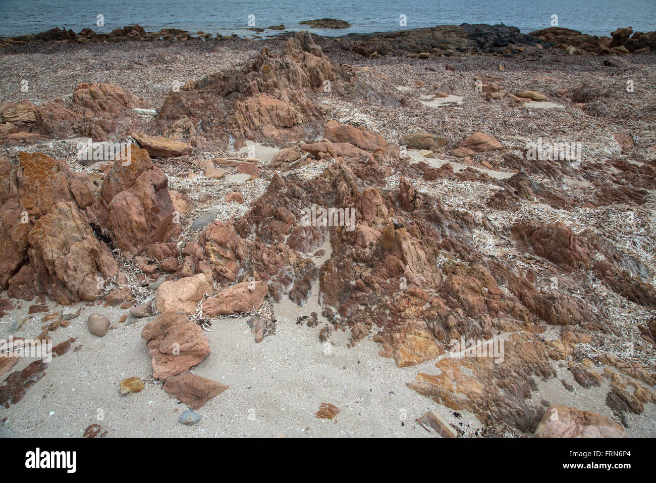 vulkanische Felsen am Strand mit Sand und Algen und Wasserlinie, Geologie trail Port Victoria Australien Stockfotohttps://www.alamy.de/image-license-details/?v=1https://www.alamy.de/stockfoto-vulkanische-felsen-am-strand-mit-sand-und-algen-und-wasserlinie-geologie-trail-port-victoria-australien-100655244.html
RFFRN6P4–vulkanische Felsen am Strand mit Sand und Algen und Wasserlinie, Geologie trail Port Victoria Australien
 Chevin Geologie Trail Marker mit Blick auf Otley West Yorkshire England Stockfotohttps://www.alamy.de/image-license-details/?v=1https://www.alamy.de/stockfoto-chevin-geologie-trail-marker-mit-blick-auf-otley-west-yorkshire-england-72564294.html
RME61GDX–Chevin Geologie Trail Marker mit Blick auf Otley West Yorkshire England
 Frau mit Blick auf den Gletschersee, Geologiepfad nach Skalafellsjoekull, Hornafjoerour, Austurland, Island Stockfotohttps://www.alamy.de/image-license-details/?v=1https://www.alamy.de/frau-mit-blick-auf-den-gletschersee-geologiepfad-nach-skalafellsjoekull-hornafjoerour-austurland-island-image436206067.html
RF2G9JW83–Frau mit Blick auf den Gletschersee, Geologiepfad nach Skalafellsjoekull, Hornafjoerour, Austurland, Island
 Der Sedgewick Geology Trail entlang des Flusses Clough bei Sedbergh in Cumbria, England. Stockfotohttps://www.alamy.de/image-license-details/?v=1https://www.alamy.de/der-sedgewick-geology-trail-entlang-des-flusses-clough-bei-sedbergh-in-cumbria-england-image631028583.html
RF2YJHRB3–Der Sedgewick Geology Trail entlang des Flusses Clough bei Sedbergh in Cumbria, England.
 Anzeigen von einem Höhepunkt in Chevin Forest Park mit Blick auf Otley, mit einem Geologie-Trail Steinbildhauen im Vordergrund. Stockfotohttps://www.alamy.de/image-license-details/?v=1https://www.alamy.de/stockfoto-anzeigen-von-einem-hohepunkt-in-chevin-forest-park-mit-blick-auf-otley-mit-einem-geologie-trail-steinbildhauen-im-vordergrund-93996068.html
RMFCWTXC–Anzeigen von einem Höhepunkt in Chevin Forest Park mit Blick auf Otley, mit einem Geologie-Trail Steinbildhauen im Vordergrund.
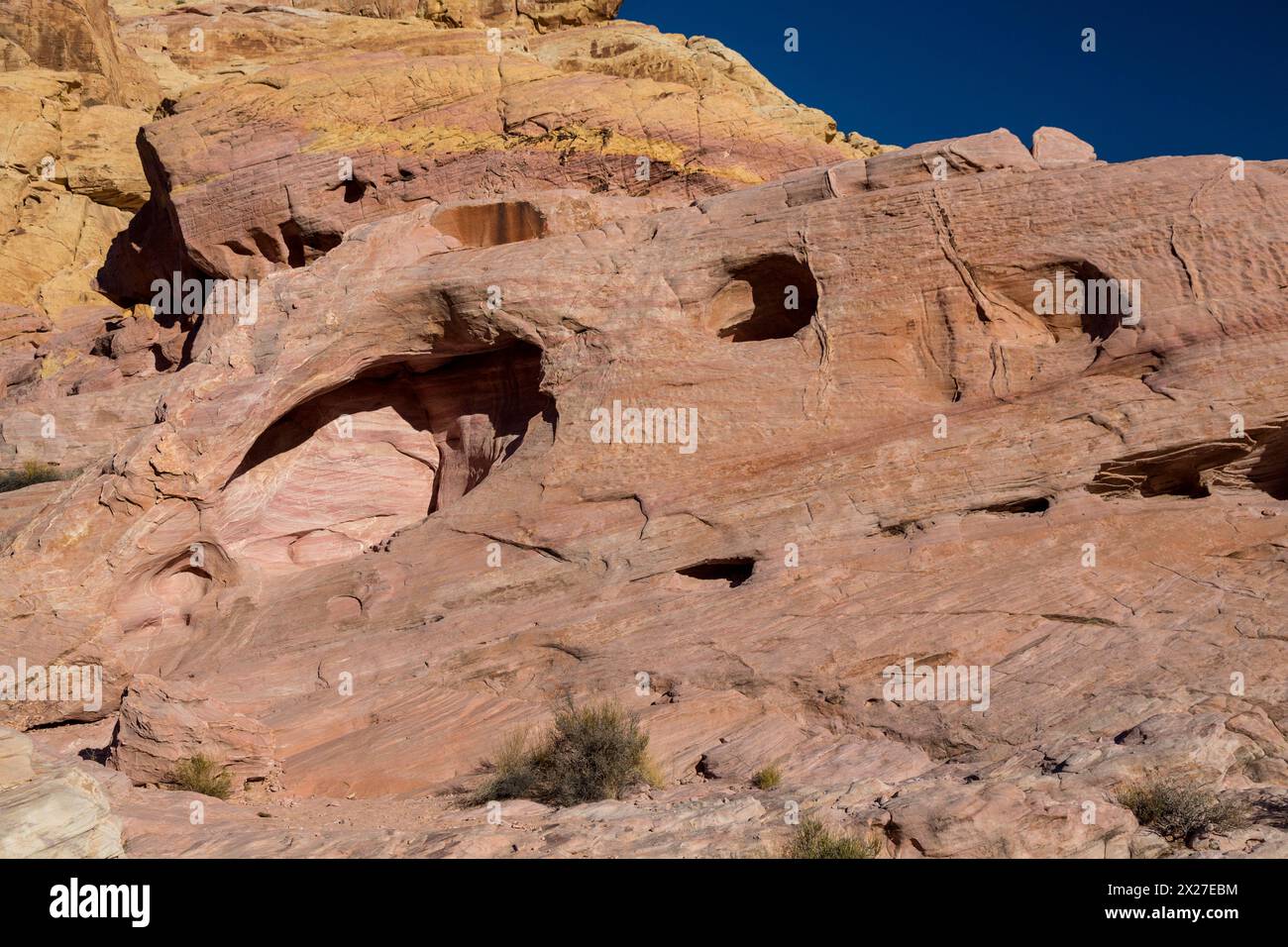 Valley of Fire, Nevada. Wind-Erosion entlang der weißen Kuppeln. Stockfotohttps://www.alamy.de/image-license-details/?v=1https://www.alamy.de/valley-of-fire-nevada-wind-erosion-entlang-der-weissen-kuppeln-image603757160.html
RM2X27EBM–Valley of Fire, Nevada. Wind-Erosion entlang der weißen Kuppeln.
 Agave Pflanze und Felsen Zinnen am Hailstone Trail in Chiricahua National Monument, Arizona, USA Stockfotohttps://www.alamy.de/image-license-details/?v=1https://www.alamy.de/agave-pflanze-und-felsen-zinnen-am-hailstone-trail-in-chiricahua-national-monument-arizona-usa-image368998697.html
RF2CC99GW–Agave Pflanze und Felsen Zinnen am Hailstone Trail in Chiricahua National Monument, Arizona, USA
 Shafer Trail, ein 34-Meile hin-und Rückfahrt von Moab. Canyonlands National Park in der Nähe von Moab, Utah, USA Stockfotohttps://www.alamy.de/image-license-details/?v=1https://www.alamy.de/stockfoto-shafer-trail-ein-34-meile-hin-und-ruckfahrt-von-moab-canyonlands-national-park-in-der-nahe-von-moab-utah-usa-27586954.html
RMBGTKCA–Shafer Trail, ein 34-Meile hin-und Rückfahrt von Moab. Canyonlands National Park in der Nähe von Moab, Utah, USA
 Wilpena Pound im Flinders Ranges National Park of South Australia. Panoramablick vom Razorback Lookout auf ein Geologie-Trail. Stockfotohttps://www.alamy.de/image-license-details/?v=1https://www.alamy.de/stockfoto-wilpena-pound-im-flinders-ranges-national-park-of-south-australia-panoramablick-vom-razorback-lookout-auf-ein-geologie-trail-100666038.html
RFFRNMFJ–Wilpena Pound im Flinders Ranges National Park of South Australia. Panoramablick vom Razorback Lookout auf ein Geologie-Trail.
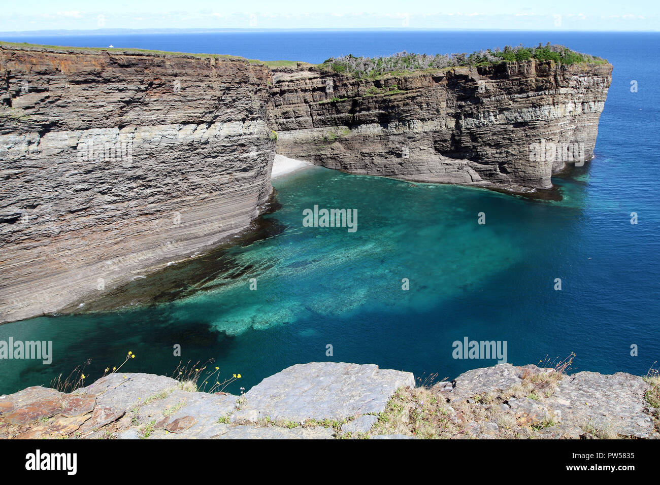 Blick auf Klippen entlang der George Nomore Wanderweg Stockfotohttps://www.alamy.de/image-license-details/?v=1https://www.alamy.de/blick-auf-klippen-entlang-der-george-nomore-wanderweg-image222006937.html
RFPW5835–Blick auf Klippen entlang der George Nomore Wanderweg
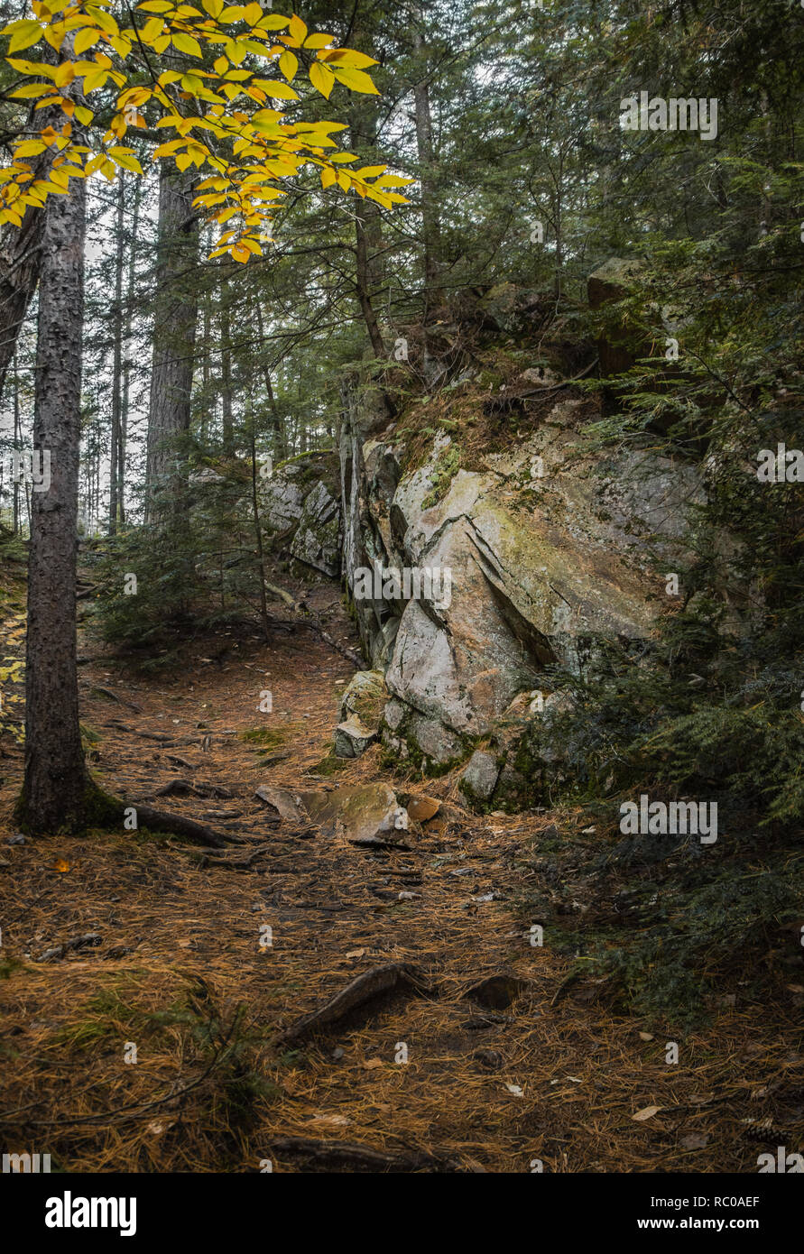 Riesige Gletscherfelsen und Herbstlaub auf dem Algonquin Park Trail Stockfotohttps://www.alamy.de/image-license-details/?v=1https://www.alamy.de/riesige-gletscherfelsen-und-herbstlaub-auf-dem-algonquin-park-trail-image231118903.html
RFRC0AEF–Riesige Gletscherfelsen und Herbstlaub auf dem Algonquin Park Trail
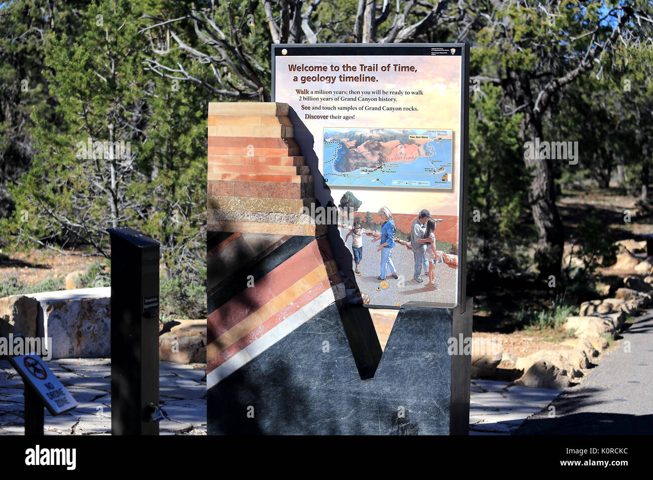 Grand-Canyon-Nationalpark Arizona USA Stockfotohttps://www.alamy.de/image-license-details/?v=1https://www.alamy.de/grand-canyon-nationalpark-arizona-usa-image155408160.html
RMK0RCKC–Grand-Canyon-Nationalpark Arizona USA
 Luftaufnahme der Burr Trail Road von oben über den Circle Cliffs, Chinle Hills unten, Grand staicase Escalante National Monument, Utah Stockfotohttps://www.alamy.de/image-license-details/?v=1https://www.alamy.de/luftaufnahme-der-burr-trail-road-von-oben-uber-den-circle-cliffs-chinle-hills-unten-grand-staicase-escalante-national-monument-utah-image426547200.html
RF2FNXW8G–Luftaufnahme der Burr Trail Road von oben über den Circle Cliffs, Chinle Hills unten, Grand staicase Escalante National Monument, Utah
 Lake Toma, Oberalp, Wandern in den Schweizer Bergen Wanderweg Stockfotohttps://www.alamy.de/image-license-details/?v=1https://www.alamy.de/lake-toma-oberalp-wandern-in-den-schweizer-bergen-wanderweg-image559224814.html
RF2RDPTXP–Lake Toma, Oberalp, Wandern in den Schweizer Bergen Wanderweg
 Ein schmaler Pfad führt im Herbst unter einem Felsvorsprung in einem Park im Nordosten von Ohio vorbei Stockfotohttps://www.alamy.de/image-license-details/?v=1https://www.alamy.de/ein-schmaler-pfad-fuhrt-im-herbst-unter-einem-felsvorsprung-in-einem-park-im-nordosten-von-ohio-vorbei-image596587037.html
RF2WJGTRW–Ein schmaler Pfad führt im Herbst unter einem Felsvorsprung in einem Park im Nordosten von Ohio vorbei
 Die tiefe Felsenschlucht von Mascarat mit seinen drei Brücken, in der Nähe von Calpe, Bendorm, Costa Blanca, Spanien Stockfotohttps://www.alamy.de/image-license-details/?v=1https://www.alamy.de/die-tiefe-felsenschlucht-von-mascarat-mit-seinen-drei-brucken-in-der-nahe-von-calpe-bendorm-costa-blanca-spanien-image401360282.html
RF2E8YF3P–Die tiefe Felsenschlucht von Mascarat mit seinen drei Brücken, in der Nähe von Calpe, Bendorm, Costa Blanca, Spanien
 Touristischen Wanderweg im Nationalpark Plitvicer Seen, Kroatien, Europa Stockfotohttps://www.alamy.de/image-license-details/?v=1https://www.alamy.de/stockfoto-touristischen-wanderweg-im-nationalpark-plitvicer-seen-kroatien-europa-91268372.html
RMF8DHMM–Touristischen Wanderweg im Nationalpark Plitvicer Seen, Kroatien, Europa
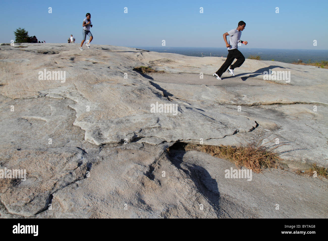 Atlanta Georgia, Stone Mountain Park, Quarzmonzonit, monadnock, Geologie, Gipfel, Fels, schwarzer Mann, Männer, Frau, Frauen, Laufen, Fitness, Wandern, Trail, Down Stockfotohttps://www.alamy.de/image-license-details/?v=1https://www.alamy.de/stockfoto-atlanta-georgia-stone-mountain-park-quarzmonzonit-monadnock-geologie-gipfel-fels-schwarzer-mann-manner-frau-frauen-laufen-fitness-wandern-trail-down-33968040.html
RMBY7AG8–Atlanta Georgia, Stone Mountain Park, Quarzmonzonit, monadnock, Geologie, Gipfel, Fels, schwarzer Mann, Männer, Frau, Frauen, Laufen, Fitness, Wandern, Trail, Down
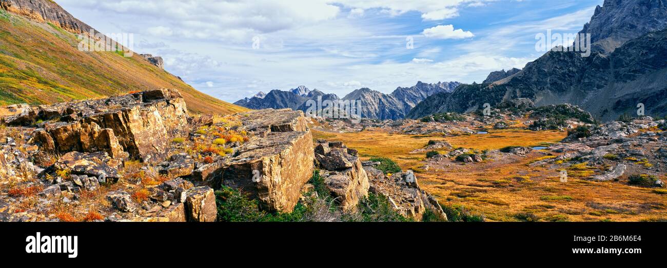 Felsformationen in einem Canyon, South Fork Cascade Canyon Trail, Grand Teton National Park, Wyoming, USA Stockfotohttps://www.alamy.de/image-license-details/?v=1https://www.alamy.de/felsformationen-in-einem-canyon-south-fork-cascade-canyon-trail-grand-teton-national-park-wyoming-usa-image348339436.html
RM2B6M6E4–Felsformationen in einem Canyon, South Fork Cascade Canyon Trail, Grand Teton National Park, Wyoming, USA
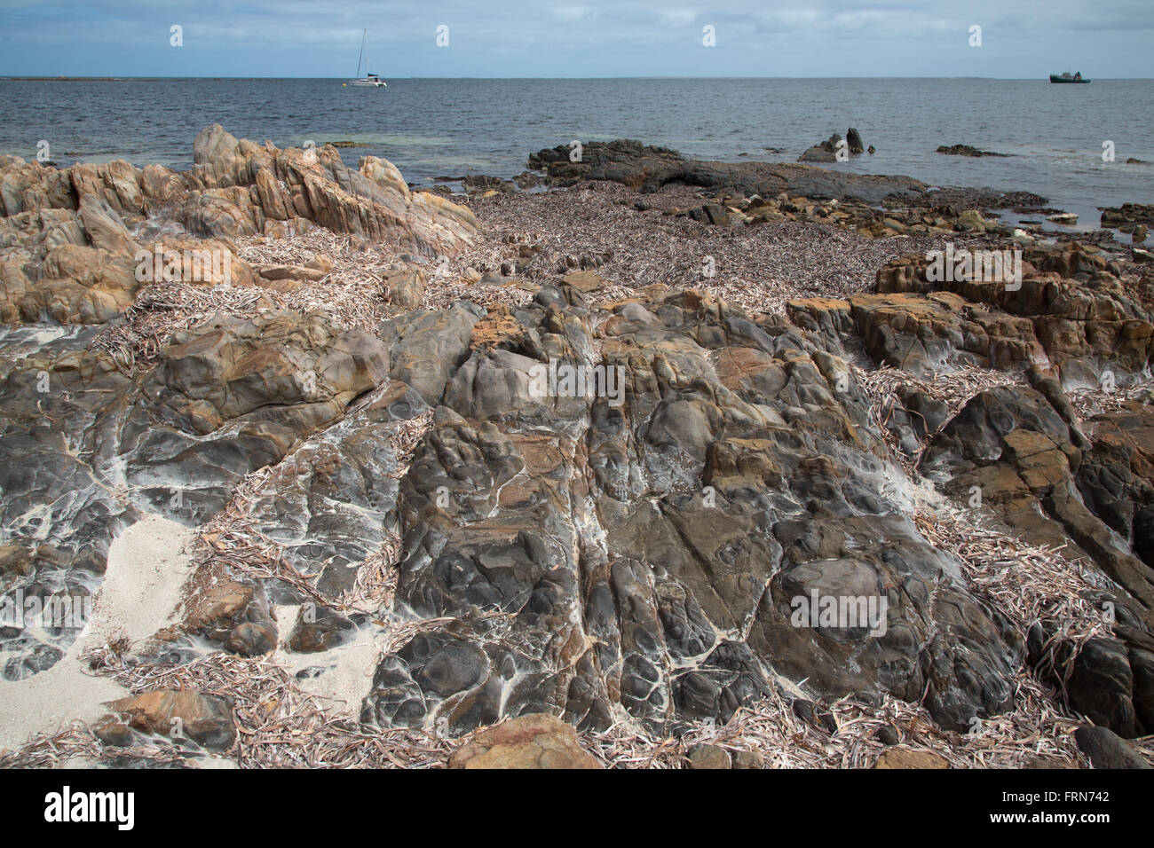 vulkanische Felsen am Strand mit Sand und Algen und Schiffe auf dem Wasser, Geologie Trail Port Victoria Australien Stockfotohttps://www.alamy.de/image-license-details/?v=1https://www.alamy.de/stockfoto-vulkanische-felsen-am-strand-mit-sand-und-algen-und-schiffe-auf-dem-wasser-geologie-trail-port-victoria-australien-100655522.html
RFFRN742–vulkanische Felsen am Strand mit Sand und Algen und Schiffe auf dem Wasser, Geologie Trail Port Victoria Australien
 Sandstein Klippen entlang der Hemlock Bridge Trail, Hocking Hills State Park, Logan, Ohio, USA. Stockfotohttps://www.alamy.de/image-license-details/?v=1https://www.alamy.de/stockfoto-sandstein-klippen-entlang-der-hemlock-bridge-trail-hocking-hills-state-park-logan-ohio-usa-168558658.html
RMKP6E82–Sandstein Klippen entlang der Hemlock Bridge Trail, Hocking Hills State Park, Logan, Ohio, USA.
 Geologiepfad nach Skalafellsjoekull, Hornafjoerour, Austurland, Island Stockfotohttps://www.alamy.de/image-license-details/?v=1https://www.alamy.de/geologiepfad-nach-skalafellsjoekull-hornafjoerour-austurland-island-image436206063.html
RF2G9JW7Y–Geologiepfad nach Skalafellsjoekull, Hornafjoerour, Austurland, Island
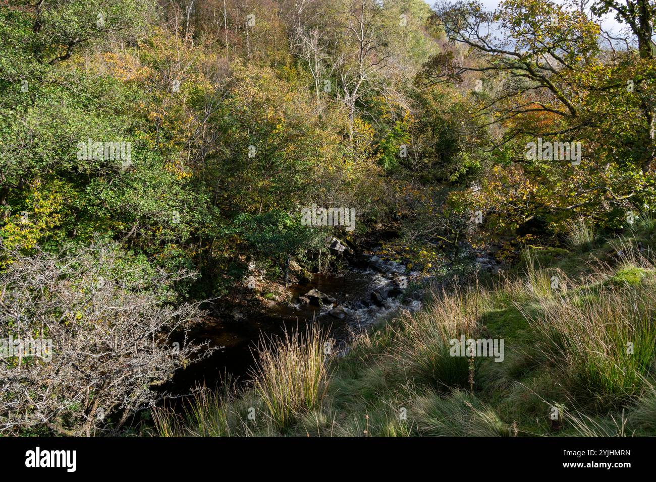 Der Sedgewick Geology Trail entlang des Flusses Clough bei Sedbergh in Cumbria, England. Stockfotohttps://www.alamy.de/image-license-details/?v=1https://www.alamy.de/der-sedgewick-geology-trail-entlang-des-flusses-clough-bei-sedbergh-in-cumbria-england-image631026585.html
RF2YJHMRN–Der Sedgewick Geology Trail entlang des Flusses Clough bei Sedbergh in Cumbria, England.
 Ein Mann an einem Felsen auf dem lecken Wash Trail im südlichen Utah USA Stockfotohttps://www.alamy.de/image-license-details/?v=1https://www.alamy.de/stockfoto-ein-mann-an-einem-felsen-auf-dem-lecken-wash-trail-im-sudlichen-utah-usa-49395109.html
RMCTA3Y1–Ein Mann an einem Felsen auf dem lecken Wash Trail im südlichen Utah USA
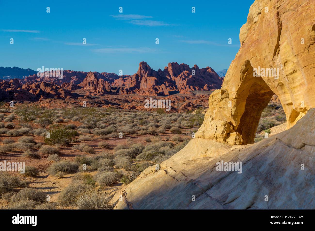 Valley of Fire, Nevada. Landschaftlich durch Loch in der Wand entlang weißen Kuppeln. Stockfotohttps://www.alamy.de/image-license-details/?v=1https://www.alamy.de/valley-of-fire-nevada-landschaftlich-durch-loch-in-der-wand-entlang-weissen-kuppeln-image603757165.html
RM2X27EBW–Valley of Fire, Nevada. Landschaftlich durch Loch in der Wand entlang weißen Kuppeln.
 Gewöhnliche Sotol (Desert Spoon) Pflanze und Felsspinnacles am Hailstone Trail im Chiricahua National Monument, Arizona, USA Stockfotohttps://www.alamy.de/image-license-details/?v=1https://www.alamy.de/gewohnliche-sotol-desert-spoon-pflanze-und-felsspinnacles-am-hailstone-trail-im-chiricahua-national-monument-arizona-usa-image368998783.html
RF2CC99KY–Gewöhnliche Sotol (Desert Spoon) Pflanze und Felsspinnacles am Hailstone Trail im Chiricahua National Monument, Arizona, USA
![Blue Mesa Trail im Petrified Forest National Park, Arizona, USA [Keine Model-Releases; nur redaktionelle Lizenzierung] Stockfoto Blue Mesa Trail im Petrified Forest National Park, Arizona, USA [Keine Model-Releases; nur redaktionelle Lizenzierung] Stockfoto](https://c8.alamy.com/compde/2kdmktd/blue-mesa-trail-im-petrified-forest-national-park-arizona-usa-keine-model-releases-nur-redaktionelle-lizenzierung-2kdmktd.jpg) Blue Mesa Trail im Petrified Forest National Park, Arizona, USA [Keine Model-Releases; nur redaktionelle Lizenzierung] Stockfotohttps://www.alamy.de/image-license-details/?v=1https://www.alamy.de/blue-mesa-trail-im-petrified-forest-national-park-arizona-usa-keine-model-releases-nur-redaktionelle-lizenzierung-image490335453.html
Blue Mesa Trail im Petrified Forest National Park, Arizona, USA [Keine Model-Releases; nur redaktionelle Lizenzierung] Stockfotohttps://www.alamy.de/image-license-details/?v=1https://www.alamy.de/blue-mesa-trail-im-petrified-forest-national-park-arizona-usa-keine-model-releases-nur-redaktionelle-lizenzierung-image490335453.htmlRM2KDMKTD–Blue Mesa Trail im Petrified Forest National Park, Arizona, USA [Keine Model-Releases; nur redaktionelle Lizenzierung]
 Grand Canyon National Park, Arizona - The Bright Angel Trail führt zu Indian Gardens, in den Grand Canyon. Stockfotohttps://www.alamy.de/image-license-details/?v=1https://www.alamy.de/stockfoto-grand-canyon-national-park-arizona-the-bright-angel-trail-fuhrt-zu-indian-gardens-in-den-grand-canyon-141520509.html
RMJ66PRW–Grand Canyon National Park, Arizona - The Bright Angel Trail führt zu Indian Gardens, in den Grand Canyon.
 Wildblumen wachsen auf einem trockenen sandigen Hügel im Ferry Swale Canyon bei Page Arizona. Stockfotohttps://www.alamy.de/image-license-details/?v=1https://www.alamy.de/wildblumen-wachsen-auf-einem-trockenen-sandigen-hugel-im-ferry-swale-canyon-bei-page-arizona-image550909303.html
RF2R082C7–Wildblumen wachsen auf einem trockenen sandigen Hügel im Ferry Swale Canyon bei Page Arizona.
 Bryce Canyon National Park, Peekaboo Trail, Utah, USA, Nordamerika Stockfotohttps://www.alamy.de/image-license-details/?v=1https://www.alamy.de/bryce-canyon-national-park-peekaboo-trail-utah-usa-nordamerika-image255705669.html
RMTT0B59–Bryce Canyon National Park, Peekaboo Trail, Utah, USA, Nordamerika
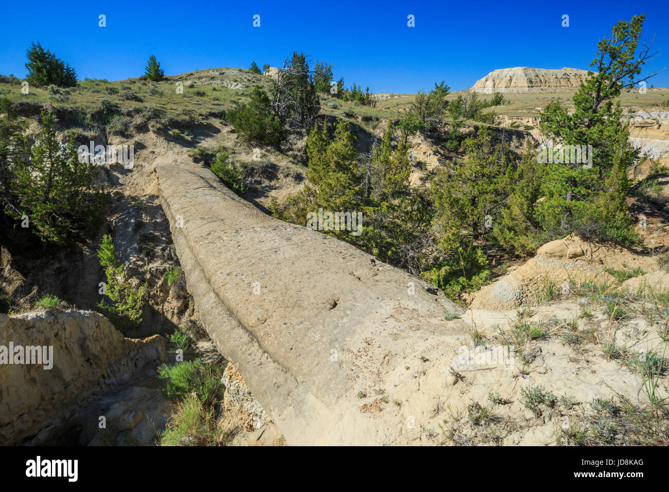 natürliche Brücke in den Badlands von Terry entlang der Calypso-Trail in der Nähe von Terry, montana Stockfotohttps://www.alamy.de/image-license-details/?v=1https://www.alamy.de/stockfoto-naturliche-brucke-in-den-badlands-von-terry-entlang-der-calypso-trail-in-der-nahe-von-terry-montana-145864280.html
RMJD8KAG–natürliche Brücke in den Badlands von Terry entlang der Calypso-Trail in der Nähe von Terry, montana
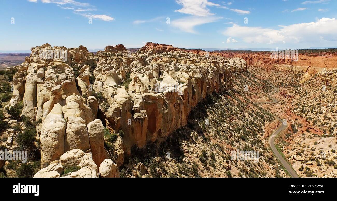 Luftaufnahme der Burr Trail Road von den Circle Cliffs, Grand staicase Escalante National Monument, Utah Stockfotohttps://www.alamy.de/image-license-details/?v=1https://www.alamy.de/luftaufnahme-der-burr-trail-road-von-den-circle-cliffs-grand-staicase-escalante-national-monument-utah-image426547198.html
RF2FNXW8E–Luftaufnahme der Burr Trail Road von den Circle Cliffs, Grand staicase Escalante National Monument, Utah
 Sunset Point entlang der Rim Trail ist eine beliebte Suche Ort für herrliche Aussicht auf die bemerkenswerte Felsformationen im Bryce Canyon National Park in Utah. Stockfotohttps://www.alamy.de/image-license-details/?v=1https://www.alamy.de/stockfoto-sunset-point-entlang-der-rim-trail-ist-eine-beliebte-suche-ort-fur-herrliche-aussicht-auf-die-bemerkenswerte-felsformationen-im-bryce-canyon-national-park-in-utah-56649233.html
RMD84GJW–Sunset Point entlang der Rim Trail ist eine beliebte Suche Ort für herrliche Aussicht auf die bemerkenswerte Felsformationen im Bryce Canyon National Park in Utah.
 Ökologische Folge Hinweisschild auf dem Naturlehrpfad an Panola Mountain State Park in der Nähe von Atlanta, Georgia. (USA) Stockfotohttps://www.alamy.de/image-license-details/?v=1https://www.alamy.de/okologische-folge-hinweisschild-auf-dem-naturlehrpfad-an-panola-mountain-state-park-in-der-nahe-von-atlanta-georgia-usa-image337820546.html
RM2AHH1FE–Ökologische Folge Hinweisschild auf dem Naturlehrpfad an Panola Mountain State Park in der Nähe von Atlanta, Georgia. (USA)
 Die tiefe Felsenschlucht von Mascarat mit seinen drei Brücken, in der Nähe von Calpe, Bendorm, Costa Blanca, Spanien Stockfotohttps://www.alamy.de/image-license-details/?v=1https://www.alamy.de/die-tiefe-felsenschlucht-von-mascarat-mit-seinen-drei-brucken-in-der-nahe-von-calpe-bendorm-costa-blanca-spanien-image401357660.html
RF2E8YBP4–Die tiefe Felsenschlucht von Mascarat mit seinen drei Brücken, in der Nähe von Calpe, Bendorm, Costa Blanca, Spanien
 Interpretationboard, Hagerman Fossil Beds National Monument, Idaho Stockfotohttps://www.alamy.de/image-license-details/?v=1https://www.alamy.de/interpretationboard-hagerman-fossil-beds-national-monument-idaho-image468888676.html
RF2J6RM84–Interpretationboard, Hagerman Fossil Beds National Monument, Idaho
 Unbefestigte Wanderweg durch die Wüste führt zu einer großen Felsformation. Stockfotohttps://www.alamy.de/image-license-details/?v=1https://www.alamy.de/unbefestigte-wanderweg-durch-die-wuste-fuhrt-zu-einer-grossen-felsformation-image462692618.html
RF2HTND4A–Unbefestigte Wanderweg durch die Wüste führt zu einer großen Felsformation.
 Pink Jeep Tours, Fahrzeuge. Sedona - Estados Unidos - Julho de 2015. Stockfotohttps://www.alamy.de/image-license-details/?v=1https://www.alamy.de/pink-jeep-tours-fahrzeuge-sedona-estados-unidos-julho-de-2015-image450712598.html
RF2H57MEE–Pink Jeep Tours, Fahrzeuge. Sedona - Estados Unidos - Julho de 2015.
 Detail aus vulkanischem Gestein, Geologie Trail Port Victoria Australien Stockfotohttps://www.alamy.de/image-license-details/?v=1https://www.alamy.de/stockfoto-detail-aus-vulkanischem-gestein-geologie-trail-port-victoria-australien-100655581.html
RFFRN765–Detail aus vulkanischem Gestein, Geologie Trail Port Victoria Australien
 Sandstein Klippen entlang der Hemlock Bridge Trail, Hocking Hills State Park, Logan, Ohio, USA. Stockfotohttps://www.alamy.de/image-license-details/?v=1https://www.alamy.de/stockfoto-sandstein-klippen-entlang-der-hemlock-bridge-trail-hocking-hills-state-park-logan-ohio-usa-168558648.html
RMKP6E7M–Sandstein Klippen entlang der Hemlock Bridge Trail, Hocking Hills State Park, Logan, Ohio, USA.
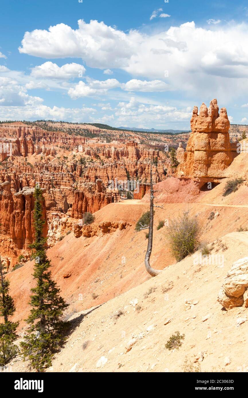 Geologie, Erosionslandschaft, Rand des Paunsaugunt-Plateaus, Sandsteinpyramiden, Hoodoos, Blick vom Peekaboo Loop Trail nahe Bryce Point, Bryce Stockfotohttps://www.alamy.de/image-license-details/?v=1https://www.alamy.de/geologie-erosionslandschaft-rand-des-paunsaugunt-plateaus-sandsteinpyramiden-hoodoos-blick-vom-peekaboo-loop-trail-nahe-bryce-point-bryce-image363266497.html
RF2C3063D–Geologie, Erosionslandschaft, Rand des Paunsaugunt-Plateaus, Sandsteinpyramiden, Hoodoos, Blick vom Peekaboo Loop Trail nahe Bryce Point, Bryce
 Der Sedgewick Geology Trail entlang des Flusses Clough bei Sedbergh in Cumbria, England. Stockfotohttps://www.alamy.de/image-license-details/?v=1https://www.alamy.de/der-sedgewick-geology-trail-entlang-des-flusses-clough-bei-sedbergh-in-cumbria-england-image631029586.html
RF2YJHTJX–Der Sedgewick Geology Trail entlang des Flusses Clough bei Sedbergh in Cumbria, England.
 Auf dem Sand vor Double O Arch im Arches National Park Deadwood Stockfotohttps://www.alamy.de/image-license-details/?v=1https://www.alamy.de/stockfoto-auf-dem-sand-vor-double-o-arch-im-arches-national-park-deadwood-166060065.html
RFKJ4K8H–Auf dem Sand vor Double O Arch im Arches National Park Deadwood
 Big Bend National Park. Geologische Schicht gesehen von verlorenen Mine Trail. Stockfotohttps://www.alamy.de/image-license-details/?v=1https://www.alamy.de/big-bend-national-park-geologische-schicht-gesehen-von-verlorenen-mine-trail-image336403228.html
RM2AF8DN0–Big Bend National Park. Geologische Schicht gesehen von verlorenen Mine Trail.
 Felsnadeln am Hailstone Trail im Chiricahua National Monument, Arizona, USA Stockfotohttps://www.alamy.de/image-license-details/?v=1https://www.alamy.de/felsnadeln-am-hailstone-trail-im-chiricahua-national-monument-arizona-usa-image368998625.html
RF2CC99E9–Felsnadeln am Hailstone Trail im Chiricahua National Monument, Arizona, USA
![Blue Mesa Trail im Petrified Forest National Park, Arizona, USA [Keine Model-Releases; nur redaktionelle Lizenzierung] Stockfoto Blue Mesa Trail im Petrified Forest National Park, Arizona, USA [Keine Model-Releases; nur redaktionelle Lizenzierung] Stockfoto](https://c8.alamy.com/compde/2kdmkgt/blue-mesa-trail-im-petrified-forest-national-park-arizona-usa-keine-model-releases-nur-redaktionelle-lizenzierung-2kdmkgt.jpg) Blue Mesa Trail im Petrified Forest National Park, Arizona, USA [Keine Model-Releases; nur redaktionelle Lizenzierung] Stockfotohttps://www.alamy.de/image-license-details/?v=1https://www.alamy.de/blue-mesa-trail-im-petrified-forest-national-park-arizona-usa-keine-model-releases-nur-redaktionelle-lizenzierung-image490335240.html
Blue Mesa Trail im Petrified Forest National Park, Arizona, USA [Keine Model-Releases; nur redaktionelle Lizenzierung] Stockfotohttps://www.alamy.de/image-license-details/?v=1https://www.alamy.de/blue-mesa-trail-im-petrified-forest-national-park-arizona-usa-keine-model-releases-nur-redaktionelle-lizenzierung-image490335240.htmlRM2KDMKGT–Blue Mesa Trail im Petrified Forest National Park, Arizona, USA [Keine Model-Releases; nur redaktionelle Lizenzierung]
 Rocky Mountains Trail. Geologisches Konzept. Entlastungsstein Stockfotohttps://www.alamy.de/image-license-details/?v=1https://www.alamy.de/rocky-mountains-trail-geologisches-konzept-entlastungsstein-image483430329.html
RF2K2E48W–Rocky Mountains Trail. Geologisches Konzept. Entlastungsstein
 Die alten Ruinen von Jacobs Pool unter dem Vermilion Cliffs National Monument Arizona. Die Ruinen stammen aus dem Jahr 1951. Stockfotohttps://www.alamy.de/image-license-details/?v=1https://www.alamy.de/die-alten-ruinen-von-jacobs-pool-unter-dem-vermilion-cliffs-national-monument-arizona-die-ruinen-stammen-aus-dem-jahr-1951-image550909486.html
RF2R082JP–Die alten Ruinen von Jacobs Pool unter dem Vermilion Cliffs National Monument Arizona. Die Ruinen stammen aus dem Jahr 1951.
 Bryce Canyon National Park, Peekaboo Trail, Utah, USA, Nordamerika Stockfotohttps://www.alamy.de/image-license-details/?v=1https://www.alamy.de/bryce-canyon-national-park-peekaboo-trail-utah-usa-nordamerika-image255705078.html
RMTT0AC6–Bryce Canyon National Park, Peekaboo Trail, Utah, USA, Nordamerika
 Mann und Frau beim Lesen des Informationstafels auf dem Holzkirchen Geology Trail, Holzkirchen Geo-Lehrpfad, Oberbayern, Bayern, Deutschland Stockfotohttps://www.alamy.de/image-license-details/?v=1https://www.alamy.de/mann-und-frau-beim-lesen-des-informationstafels-auf-dem-holzkirchen-geology-trail-holzkirchen-geo-lehrpfad-oberbayern-bayern-deutschland-image552330821.html
RM2R2GRGN–Mann und Frau beim Lesen des Informationstafels auf dem Holzkirchen Geology Trail, Holzkirchen Geo-Lehrpfad, Oberbayern, Bayern, Deutschland
 Löcher in erodierten Kaibab Kalkstein- und Sandsteinschluchten, Cathedral Wash Trail, Glen Canyon, Vermilion Cliffs, Arizona, USA Stockfotohttps://www.alamy.de/image-license-details/?v=1https://www.alamy.de/locher-in-erodierten-kaibab-kalkstein-und-sandsteinschluchten-cathedral-wash-trail-glen-canyon-vermilion-cliffs-arizona-usa-image616271020.html
RM2XPHFY8–Löcher in erodierten Kaibab Kalkstein- und Sandsteinschluchten, Cathedral Wash Trail, Glen Canyon, Vermilion Cliffs, Arizona, USA
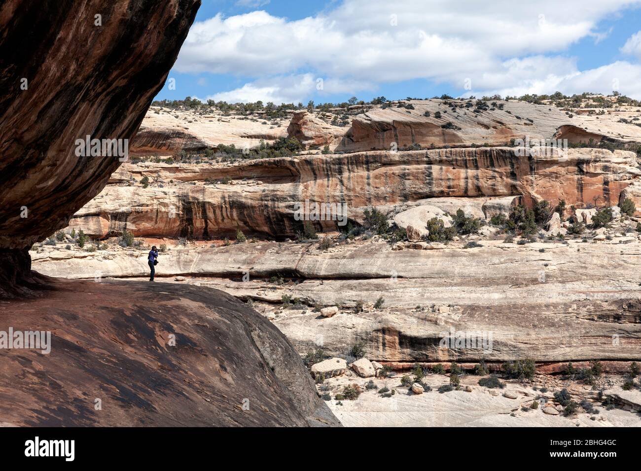 UT00550-00...UTAH - Blick über den White Canyon entlang des Sipapu Bridge Trail im Natural Bridges National Monument. Stockfotohttps://www.alamy.de/image-license-details/?v=1https://www.alamy.de/ut00550-00utah-blick-uber-den-white-canyon-entlang-des-sipapu-bridge-trail-im-natural-bridges-national-monument-image355011340.html
RM2BHG4GC–UT00550-00...UTAH - Blick über den White Canyon entlang des Sipapu Bridge Trail im Natural Bridges National Monument.
 Grand Canyon National Park, Arizona - Serpentinen auf der Bright Angel Trail, am oberen Rand des Grand Canyon. Stockfotohttps://www.alamy.de/image-license-details/?v=1https://www.alamy.de/stockfoto-grand-canyon-national-park-arizona-serpentinen-auf-der-bright-angel-trail-am-oberen-rand-des-grand-canyon-141520491.html
RMJ66PR7–Grand Canyon National Park, Arizona - Serpentinen auf der Bright Angel Trail, am oberen Rand des Grand Canyon.
 Die tiefe Felsenschlucht von Mascarat mit seinen drei Brücken, in der Nähe von Calpe, Bendorm, Costa Blanca, Spanien Stockfotohttps://www.alamy.de/image-license-details/?v=1https://www.alamy.de/die-tiefe-felsenschlucht-von-mascarat-mit-seinen-drei-brucken-in-der-nahe-von-calpe-bendorm-costa-blanca-spanien-image401357089.html
RF2E8YB1N–Die tiefe Felsenschlucht von Mascarat mit seinen drei Brücken, in der Nähe von Calpe, Bendorm, Costa Blanca, Spanien
 Interpretationboard, Hagerman Fossil Beds National Monument, Idaho Stockfotohttps://www.alamy.de/image-license-details/?v=1https://www.alamy.de/interpretationboard-hagerman-fossil-beds-national-monument-idaho-image468888666.html
RF2J6RM7P–Interpretationboard, Hagerman Fossil Beds National Monument, Idaho
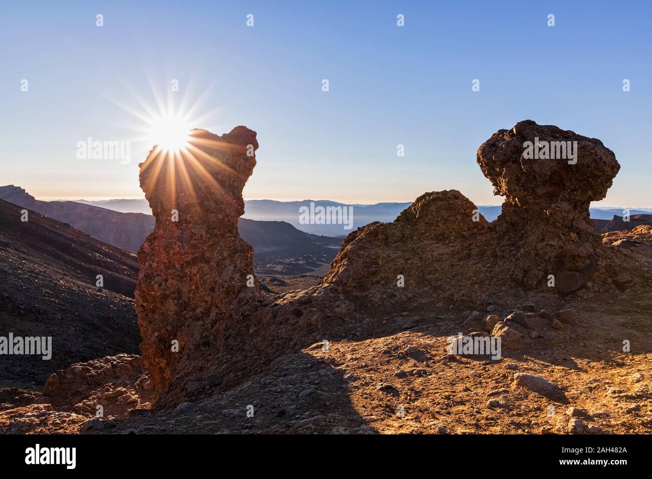 Neuseeland, Ozeanien, North Island, Tongariro National Park, North Insel vulkanischen Plateau, Tongariro Alpine Crossing Trail, Lava Felsen bei Sonnenaufgang Stockfotohttps://www.alamy.de/image-license-details/?v=1https://www.alamy.de/neuseeland-ozeanien-north-island-tongariro-national-park-north-insel-vulkanischen-plateau-tongariro-alpine-crossing-trail-lava-felsen-bei-sonnenaufgang-image337540290.html
RF2AH482A–Neuseeland, Ozeanien, North Island, Tongariro National Park, North Insel vulkanischen Plateau, Tongariro Alpine Crossing Trail, Lava Felsen bei Sonnenaufgang
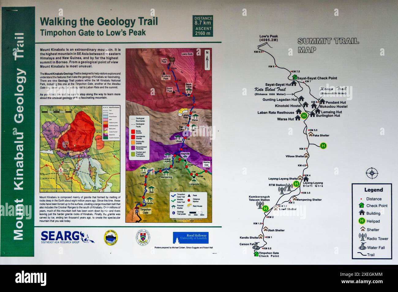 Geologische Karten und Wanderwege im Kinabalu Park. Sabah, Borneo, Malaysia. Stockfotohttps://www.alamy.de/image-license-details/?v=1https://www.alamy.de/geologische-karten-und-wanderwege-im-kinabalu-park-sabah-borneo-malaysia-image611334772.html
RM2XEGKMM–Geologische Karten und Wanderwege im Kinabalu Park. Sabah, Borneo, Malaysia.
 Detail aus vulkanischem Gestein, Geologie Trail Port Victoria Australien Stockfotohttps://www.alamy.de/image-license-details/?v=1https://www.alamy.de/stockfoto-detail-aus-vulkanischem-gestein-geologie-trail-port-victoria-australien-100655548.html
RFFRN750–Detail aus vulkanischem Gestein, Geologie Trail Port Victoria Australien
 Sandstein Klippen entlang der Hemlock Bridge Trail, Hocking Hills State Park, Logan, Ohio, USA. Stockfotohttps://www.alamy.de/image-license-details/?v=1https://www.alamy.de/stockfoto-sandstein-klippen-entlang-der-hemlock-bridge-trail-hocking-hills-state-park-logan-ohio-usa-168558639.html
RMKP6E7B–Sandstein Klippen entlang der Hemlock Bridge Trail, Hocking Hills State Park, Logan, Ohio, USA.
 Historischer Anklammerpfad entlang der Kocher, Kuenzelsau, Kocher Tal, Geologie, Wanderweg, Hohenlohe, Heilbronn-Franken, Baden-Württemberg, Deutschland Stockfotohttps://www.alamy.de/image-license-details/?v=1https://www.alamy.de/historischer-anklammerpfad-entlang-der-kocher-kuenzelsau-kocher-tal-geologie-wanderweg-hohenlohe-heilbronn-franken-baden-wurttemberg-deutschland-image574603277.html
RM2TARC9H–Historischer Anklammerpfad entlang der Kocher, Kuenzelsau, Kocher Tal, Geologie, Wanderweg, Hohenlohe, Heilbronn-Franken, Baden-Württemberg, Deutschland
 Der Sedgewick Geology Trail entlang des Flusses Clough bei Sedbergh in Cumbria, England. Stockfotohttps://www.alamy.de/image-license-details/?v=1https://www.alamy.de/der-sedgewick-geology-trail-entlang-des-flusses-clough-bei-sedbergh-in-cumbria-england-image631029938.html
RF2YJHW3E–Der Sedgewick Geology Trail entlang des Flusses Clough bei Sedbergh in Cumbria, England.
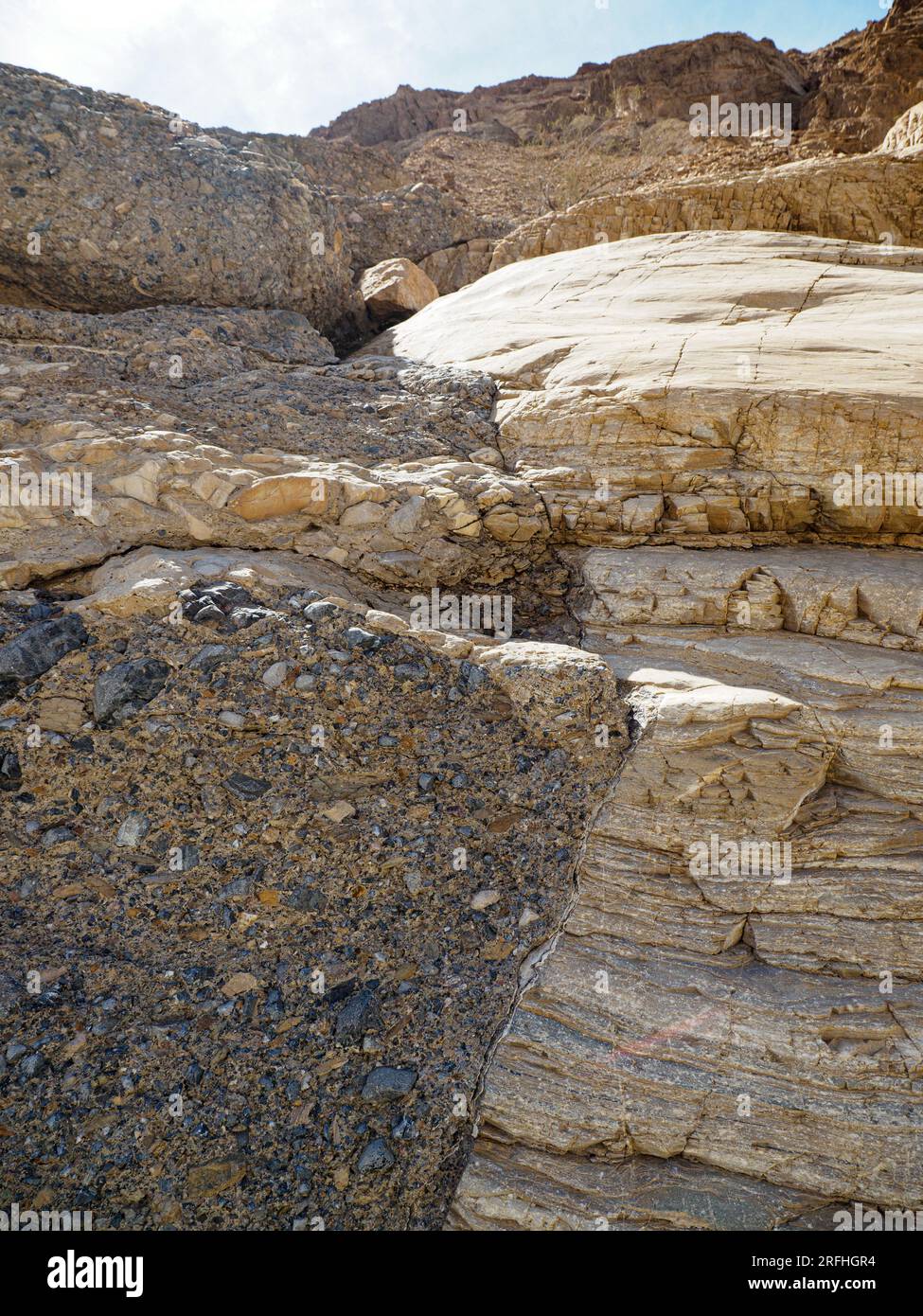 Der Mosaic Canyon Trail im Death Valley National Park, Kalifornien, USA, ist ein konglomerates und gestreiftes Felsdetail. Stockfotohttps://www.alamy.de/image-license-details/?v=1https://www.alamy.de/der-mosaic-canyon-trail-im-death-valley-national-park-kalifornien-usa-ist-ein-konglomerates-und-gestreiftes-felsdetail-image560337992.html
RM2RFHGR4–Der Mosaic Canyon Trail im Death Valley National Park, Kalifornien, USA, ist ein konglomerates und gestreiftes Felsdetail.
 Valley of Fire, Nevada. Geologische Kräfte; Stein zerbrechen. Weißen Kuppeln Trail. Stockfotohttps://www.alamy.de/image-license-details/?v=1https://www.alamy.de/valley-of-fire-nevada-geologische-krafte-stein-zerbrechen-weissen-kuppeln-trail-image603756778.html
RM2X27DX2–Valley of Fire, Nevada. Geologische Kräfte; Stein zerbrechen. Weißen Kuppeln Trail.
 Utah Yucca, Sandsage am Hidden Pinyon Trail im Snow Canyon State Park, Utah, USA Stockfotohttps://www.alamy.de/image-license-details/?v=1https://www.alamy.de/utah-yucca-sandsage-am-hidden-pinyon-trail-im-snow-canyon-state-park-utah-usa-image344601235.html
RF2B0HXAY–Utah Yucca, Sandsage am Hidden Pinyon Trail im Snow Canyon State Park, Utah, USA
![Blue Mesa Trail im Petrified Forest National Park, Arizona, USA [Keine Model-Releases; nur redaktionelle Lizenzierung] Stockfoto Blue Mesa Trail im Petrified Forest National Park, Arizona, USA [Keine Model-Releases; nur redaktionelle Lizenzierung] Stockfoto](https://c8.alamy.com/compde/2kdmkfw/blue-mesa-trail-im-petrified-forest-national-park-arizona-usa-keine-model-releases-nur-redaktionelle-lizenzierung-2kdmkfw.jpg) Blue Mesa Trail im Petrified Forest National Park, Arizona, USA [Keine Model-Releases; nur redaktionelle Lizenzierung] Stockfotohttps://www.alamy.de/image-license-details/?v=1https://www.alamy.de/blue-mesa-trail-im-petrified-forest-national-park-arizona-usa-keine-model-releases-nur-redaktionelle-lizenzierung-image490335213.html
Blue Mesa Trail im Petrified Forest National Park, Arizona, USA [Keine Model-Releases; nur redaktionelle Lizenzierung] Stockfotohttps://www.alamy.de/image-license-details/?v=1https://www.alamy.de/blue-mesa-trail-im-petrified-forest-national-park-arizona-usa-keine-model-releases-nur-redaktionelle-lizenzierung-image490335213.htmlRM2KDMKFW–Blue Mesa Trail im Petrified Forest National Park, Arizona, USA [Keine Model-Releases; nur redaktionelle Lizenzierung]
 Fossil Trail, mit Reproduktion Bradysaurus Skelett, Karoo Nationalpark Rest Camp, Western Cape, Südafrika, September 2017 Stockfotohttps://www.alamy.de/image-license-details/?v=1https://www.alamy.de/stockfoto-fossil-trail-mit-reproduktion-bradysaurus-skelett-karoo-nationalpark-rest-camp-western-cape-sudafrika-september-2017-170422540.html
RMKW7BK8–Fossil Trail, mit Reproduktion Bradysaurus Skelett, Karoo Nationalpark Rest Camp, Western Cape, Südafrika, September 2017
 Blick auf den Badger Canyon mit dem Vermilion Cliffs National Monument of Arizona im Hintergrund. Dieser Canyon mündet in den Colorado River. Stockfotohttps://www.alamy.de/image-license-details/?v=1https://www.alamy.de/blick-auf-den-badger-canyon-mit-dem-vermilion-cliffs-national-monument-of-arizona-im-hintergrund-dieser-canyon-mundet-in-den-colorado-river-image550911378.html
RF2R0852A–Blick auf den Badger Canyon mit dem Vermilion Cliffs National Monument of Arizona im Hintergrund. Dieser Canyon mündet in den Colorado River.
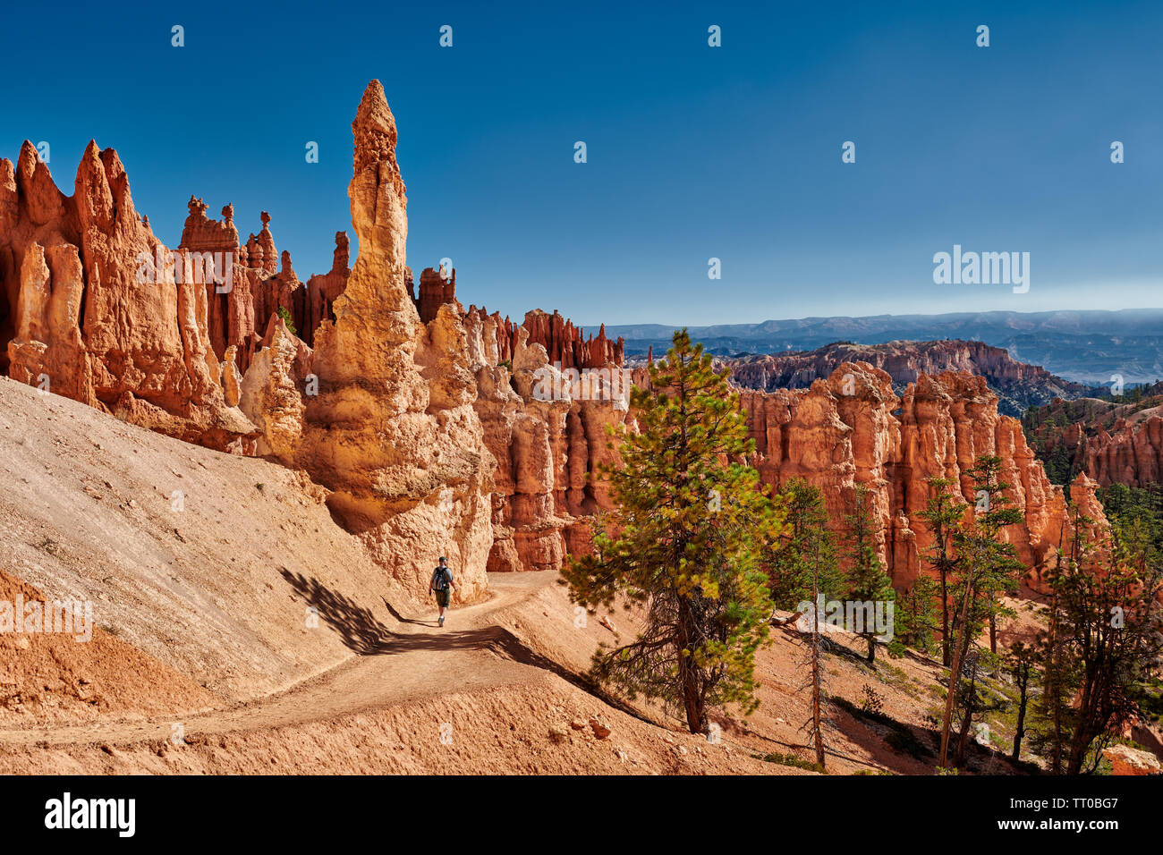 Bryce Canyon National Park, Peekaboo Trail, Utah, USA, Nordamerika Stockfotohttps://www.alamy.de/image-license-details/?v=1https://www.alamy.de/bryce-canyon-national-park-peekaboo-trail-utah-usa-nordamerika-image255705975.html
RMTT0BG7–Bryce Canyon National Park, Peekaboo Trail, Utah, USA, Nordamerika
 Felsformationen aus Sandstein auf Mäuse Tank Trail Tal des Feuers Staatspark Nevada, usa Stockfotohttps://www.alamy.de/image-license-details/?v=1https://www.alamy.de/stockfoto-felsformationen-aus-sandstein-auf-mause-tank-trail-tal-des-feuers-staatspark-nevada-usa-52961655.html
RMD24H3K–Felsformationen aus Sandstein auf Mäuse Tank Trail Tal des Feuers Staatspark Nevada, usa
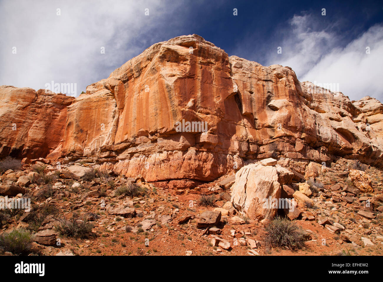 Burr Trail Sandstein Stockfotohttps://www.alamy.de/image-license-details/?v=1https://www.alamy.de/stockfoto-burr-trail-sandstein-78446174.html
RFEFHEW2–Burr Trail Sandstein
 WA 17002-00 ... WASHINGTON - Sunrise entlang der Deadhorse Creek Trail im Mount Rainier National Park. Stockfotohttps://www.alamy.de/image-license-details/?v=1https://www.alamy.de/wa-17002-00-washington-sunrise-entlang-der-deadhorse-creek-trail-im-mount-rainier-national-park-image223822709.html
RMR04045–WA 17002-00 ... WASHINGTON - Sunrise entlang der Deadhorse Creek Trail im Mount Rainier National Park.
 Grand Canyon National Park, Arizona - Serpentinen auf der Bright Angel Trail, am oberen Rand des Grand Canyon. Stockfotohttps://www.alamy.de/image-license-details/?v=1https://www.alamy.de/stockfoto-grand-canyon-national-park-arizona-serpentinen-auf-der-bright-angel-trail-am-oberen-rand-des-grand-canyon-141520489.html
RMJ66PR5–Grand Canyon National Park, Arizona - Serpentinen auf der Bright Angel Trail, am oberen Rand des Grand Canyon.
 Die tiefe Felsenschlucht von Mascarat mit seinen drei Brücken, in der Nähe von Calpe, Bendorm, Costa Blanca, Spanien Stockfotohttps://www.alamy.de/image-license-details/?v=1https://www.alamy.de/die-tiefe-felsenschlucht-von-mascarat-mit-seinen-drei-brucken-in-der-nahe-von-calpe-bendorm-costa-blanca-spanien-image401357225.html
RF2E8YB6H–Die tiefe Felsenschlucht von Mascarat mit seinen drei Brücken, in der Nähe von Calpe, Bendorm, Costa Blanca, Spanien
 Interpretationboard, Hagerman Fossil Beds National Monument, Idaho Stockfotohttps://www.alamy.de/image-license-details/?v=1https://www.alamy.de/interpretationboard-hagerman-fossil-beds-national-monument-idaho-image468888664.html
RF2J6RM7M–Interpretationboard, Hagerman Fossil Beds National Monument, Idaho
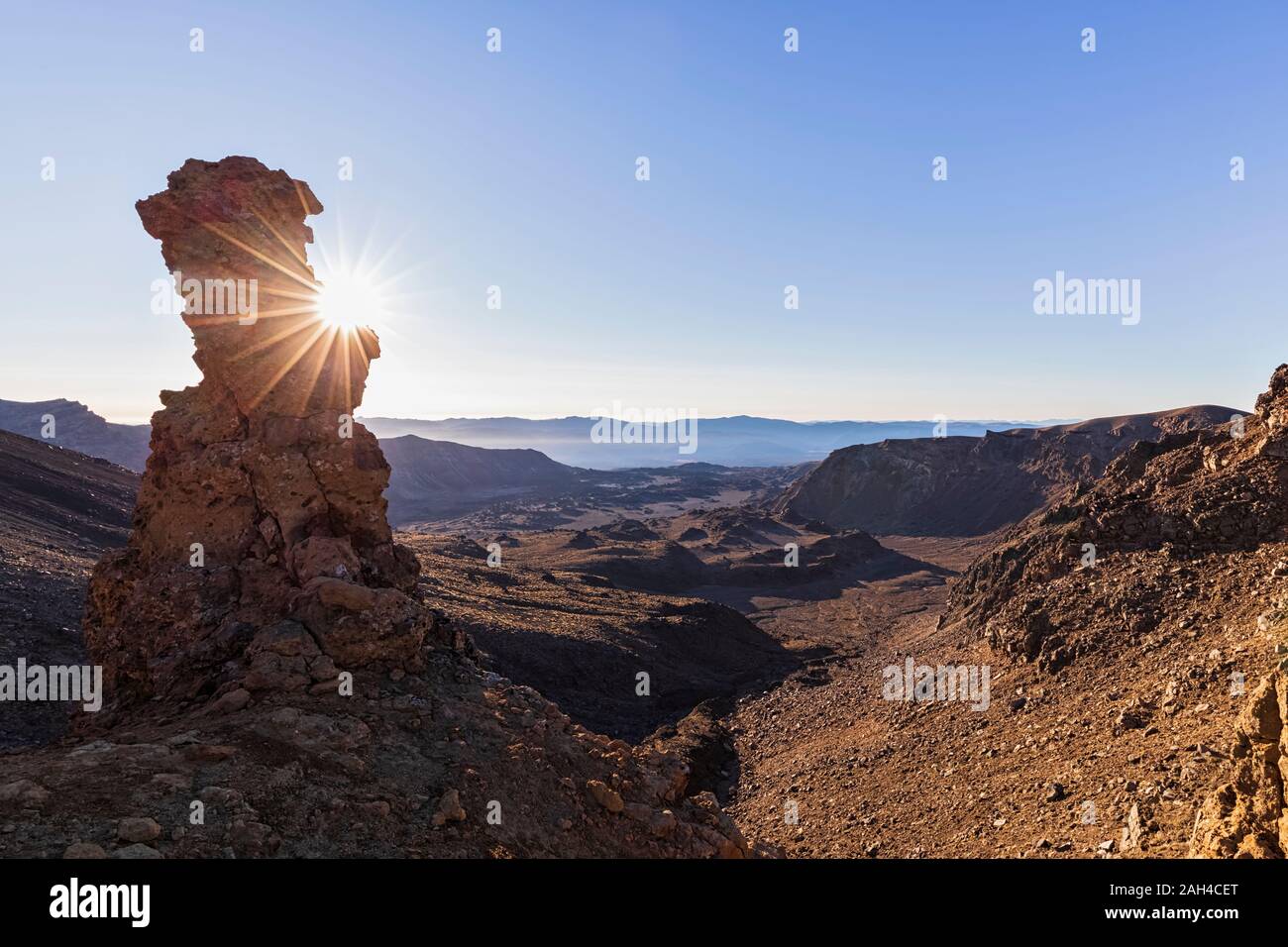 Neuseeland, Ozeanien, North Island, Tongariro National Park, North Insel vulkanischen Plateau, Tongariro Alpine Crossing Trail, Lava Felsen bei Sonnenaufgang Stockfotohttps://www.alamy.de/image-license-details/?v=1https://www.alamy.de/neuseeland-ozeanien-north-island-tongariro-national-park-north-insel-vulkanischen-plateau-tongariro-alpine-crossing-trail-lava-felsen-bei-sonnenaufgang-image337543776.html
RF2AH4CET–Neuseeland, Ozeanien, North Island, Tongariro National Park, North Insel vulkanischen Plateau, Tongariro Alpine Crossing Trail, Lava Felsen bei Sonnenaufgang
 Auf der Laugavegur Trail in Island. Stockfotohttps://www.alamy.de/image-license-details/?v=1https://www.alamy.de/auf-der-laugavegur-trail-in-island-image216485800.html
RMPG5NRM–Auf der Laugavegur Trail in Island.
 Detail aus vulkanischem Gestein auf Geologie Trail Port Victoria Australien Stockfotohttps://www.alamy.de/image-license-details/?v=1https://www.alamy.de/stockfoto-detail-aus-vulkanischem-gestein-auf-geologie-trail-port-victoria-australien-100655605.html
RFFRN771–Detail aus vulkanischem Gestein auf Geologie Trail Port Victoria Australien
 Terry Badlands gesehen von der Calypso-Trail in der Nähe von Terry, montana Stockfotohttps://www.alamy.de/image-license-details/?v=1https://www.alamy.de/stockfoto-terry-badlands-gesehen-von-der-calypso-trail-in-der-nahe-von-terry-montana-145864235.html
RMJD8K8Y–Terry Badlands gesehen von der Calypso-Trail in der Nähe von Terry, montana
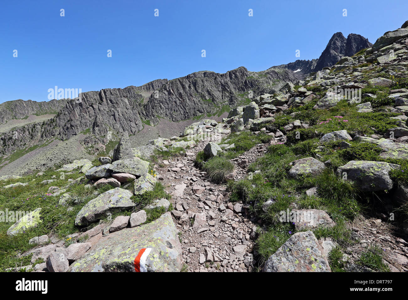 Wanderweg und Porphyrfelsen. Die Lagorai-Berggruppe. Trentino. Italienische Alpen. Europa. Stockfotohttps://www.alamy.de/image-license-details/?v=1https://www.alamy.de/wanderweg-und-porphyrfelsen-die-lagorai-berggruppe-trentino-italienische-alpen-europa-image66300787.html
RFDRT797–Wanderweg und Porphyrfelsen. Die Lagorai-Berggruppe. Trentino. Italienische Alpen. Europa.
 Der Sedgewick Geology Trail entlang des Flusses Clough bei Sedbergh in Cumbria, England. Stockfotohttps://www.alamy.de/image-license-details/?v=1https://www.alamy.de/der-sedgewick-geology-trail-entlang-des-flusses-clough-bei-sedbergh-in-cumbria-england-image631027599.html
RF2YJHP3Y–Der Sedgewick Geology Trail entlang des Flusses Clough bei Sedbergh in Cumbria, England.
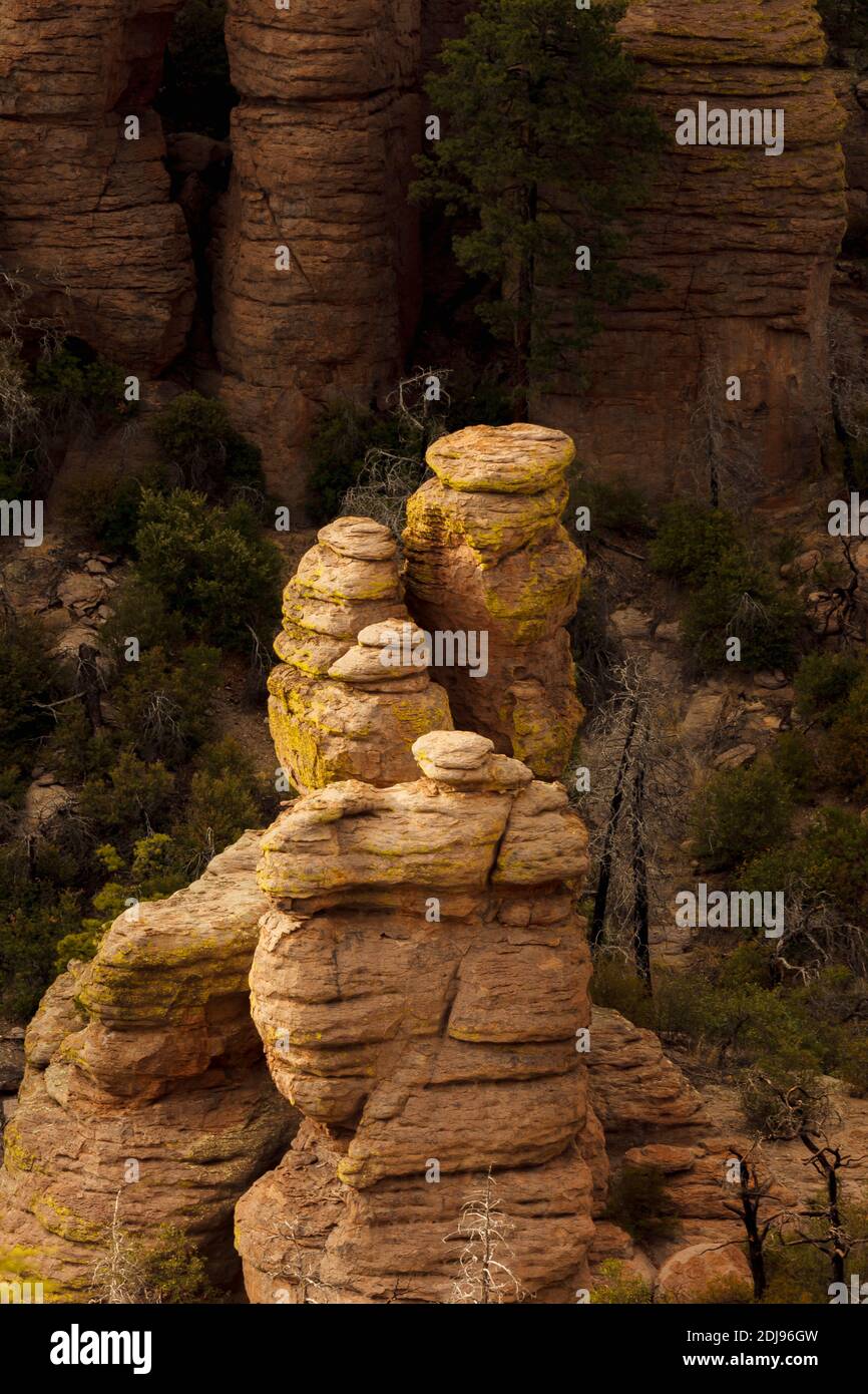 Chiricahua National Monument AZ / APR EINE Tasche aus Sonnenlicht beleuchtet Stapel von Rhyolith-Platten, die vom Echo Canyon Trail aus betrachtet werden. Stockfotohttps://www.alamy.de/image-license-details/?v=1https://www.alamy.de/chiricahua-national-monument-az-apr-eine-tasche-aus-sonnenlicht-beleuchtet-stapel-von-rhyolith-platten-die-vom-echo-canyon-trail-aus-betrachtet-werden-image389894649.html
RM2DJ96GW–Chiricahua National Monument AZ / APR EINE Tasche aus Sonnenlicht beleuchtet Stapel von Rhyolith-Platten, die vom Echo Canyon Trail aus betrachtet werden.
 Valley of Fire, Nevada. Geologische Kräfte; Stein zerbrechen. Weißen Kuppeln Trail. Stockfotohttps://www.alamy.de/image-license-details/?v=1https://www.alamy.de/valley-of-fire-nevada-geologische-krafte-stein-zerbrechen-weissen-kuppeln-trail-image603756774.html
RM2X27DWX–Valley of Fire, Nevada. Geologische Kräfte; Stein zerbrechen. Weißen Kuppeln Trail.
 Informationstafel auf dem Holzkirchen Geologie-Pfad, Holzkirchen Geo-Lehrpfad, Oberbayern, Bayern Stockfotohttps://www.alamy.de/image-license-details/?v=1https://www.alamy.de/informationstafel-auf-dem-holzkirchen-geologie-pfad-holzkirchen-geo-lehrpfad-oberbayern-bayern-image552330812.html
RM2R2GRGC–Informationstafel auf dem Holzkirchen Geologie-Pfad, Holzkirchen Geo-Lehrpfad, Oberbayern, Bayern
![Blue Mesa Trail im Petrified Forest National Park, Arizona, USA [Keine Model-Releases; nur redaktionelle Lizenzierung] Stockfoto Blue Mesa Trail im Petrified Forest National Park, Arizona, USA [Keine Model-Releases; nur redaktionelle Lizenzierung] Stockfoto](https://c8.alamy.com/compde/2kdmkdm/blue-mesa-trail-im-petrified-forest-national-park-arizona-usa-keine-model-releases-nur-redaktionelle-lizenzierung-2kdmkdm.jpg) Blue Mesa Trail im Petrified Forest National Park, Arizona, USA [Keine Model-Releases; nur redaktionelle Lizenzierung] Stockfotohttps://www.alamy.de/image-license-details/?v=1https://www.alamy.de/blue-mesa-trail-im-petrified-forest-national-park-arizona-usa-keine-model-releases-nur-redaktionelle-lizenzierung-image490335152.html
Blue Mesa Trail im Petrified Forest National Park, Arizona, USA [Keine Model-Releases; nur redaktionelle Lizenzierung] Stockfotohttps://www.alamy.de/image-license-details/?v=1https://www.alamy.de/blue-mesa-trail-im-petrified-forest-national-park-arizona-usa-keine-model-releases-nur-redaktionelle-lizenzierung-image490335152.htmlRM2KDMKDM–Blue Mesa Trail im Petrified Forest National Park, Arizona, USA [Keine Model-Releases; nur redaktionelle Lizenzierung]
 Fossil Trail, mit Reproduktion Bradysaurus Skelett, Karoo Nationalpark Rest Camp, Western Cape, Südafrika, September 2017 Stockfotohttps://www.alamy.de/image-license-details/?v=1https://www.alamy.de/stockfoto-fossil-trail-mit-reproduktion-bradysaurus-skelett-karoo-nationalpark-rest-camp-western-cape-sudafrika-september-2017-170422539.html
RMKW7BK7–Fossil Trail, mit Reproduktion Bradysaurus Skelett, Karoo Nationalpark Rest Camp, Western Cape, Südafrika, September 2017
 Die alten Ruinen von Jacobs Pool unter dem Vermilion Cliffs National Monument Arizona. Die Ruinen stammen aus dem Jahr 1951. Stockfotohttps://www.alamy.de/image-license-details/?v=1https://www.alamy.de/die-alten-ruinen-von-jacobs-pool-unter-dem-vermilion-cliffs-national-monument-arizona-die-ruinen-stammen-aus-dem-jahr-1951-image550909884.html
RF2R08350–Die alten Ruinen von Jacobs Pool unter dem Vermilion Cliffs National Monument Arizona. Die Ruinen stammen aus dem Jahr 1951.
 Bryce Canyon National Park, Peekaboo Trail, Utah, USA, Nordamerika Stockfotohttps://www.alamy.de/image-license-details/?v=1https://www.alamy.de/bryce-canyon-national-park-peekaboo-trail-utah-usa-nordamerika-image255706787.html
RMTT0CH7–Bryce Canyon National Park, Peekaboo Trail, Utah, USA, Nordamerika
 Zedern entlang der Niagara-Schichtstufe, Bruce Trail, Ontario Stockfotohttps://www.alamy.de/image-license-details/?v=1https://www.alamy.de/stockfoto-zedern-entlang-der-niagara-schichtstufe-bruce-trail-ontario-37091838.html
RMC49K0E–Zedern entlang der Niagara-Schichtstufe, Bruce Trail, Ontario
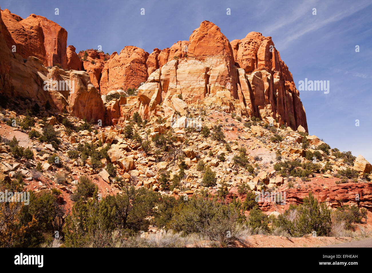 Burr Trail Sandstein Stockfotohttps://www.alamy.de/image-license-details/?v=1https://www.alamy.de/stockfoto-burr-trail-sandstein-78445769.html
RFEFHEAH–Burr Trail Sandstein
 WA 17001-00 ... WASHINGTON - Sunrise entlang der Dead Horse Creek Trail im Paradies der Mount Rainier. Stockfotohttps://www.alamy.de/image-license-details/?v=1https://www.alamy.de/wa-17001-00-washington-sunrise-entlang-der-dead-horse-creek-trail-im-paradies-der-mount-rainier-image223822697.html
RMR0403N–WA 17001-00 ... WASHINGTON - Sunrise entlang der Dead Horse Creek Trail im Paradies der Mount Rainier.
 Grand Canyon National Park, Arizona - ein Wanderer auf dem Rim Trail entlang des South Rim des Grand Canyon. Stockfotohttps://www.alamy.de/image-license-details/?v=1https://www.alamy.de/stockfoto-grand-canyon-national-park-arizona-ein-wanderer-auf-dem-rim-trail-entlang-des-south-rim-des-grand-canyon-141520520.html
RMJ66PT8–Grand Canyon National Park, Arizona - ein Wanderer auf dem Rim Trail entlang des South Rim des Grand Canyon.
 Die tiefe Felsenschlucht von Mascarat mit seinen drei Brücken, in der Nähe von Calpe, Bendorm, Costa Blanca, Spanien Stockfotohttps://www.alamy.de/image-license-details/?v=1https://www.alamy.de/die-tiefe-felsenschlucht-von-mascarat-mit-seinen-drei-brucken-in-der-nahe-von-calpe-bendorm-costa-blanca-spanien-image401357382.html
RF2E8YBC6–Die tiefe Felsenschlucht von Mascarat mit seinen drei Brücken, in der Nähe von Calpe, Bendorm, Costa Blanca, Spanien
 Interpretationboard, Hagerman Fossil Beds National Monument, Idaho Stockfotohttps://www.alamy.de/image-license-details/?v=1https://www.alamy.de/interpretationboard-hagerman-fossil-beds-national-monument-idaho-image468888671.html
RF2J6RM7Y–Interpretationboard, Hagerman Fossil Beds National Monument, Idaho
 Landschaften entlang des Many Pools Trail im Zion-Nationalpark Stockfotohttps://www.alamy.de/image-license-details/?v=1https://www.alamy.de/landschaften-entlang-des-many-pools-trail-im-zion-nationalpark-image557322076.html
RF2RAM5YT–Landschaften entlang des Many Pools Trail im Zion-Nationalpark
 schmalen Wanderweg zwischen Sandsteinfelsen in Bludiste Felsformation in der Nähe von Burg Kokorin in Tschechien Stockfotohttps://www.alamy.de/image-license-details/?v=1https://www.alamy.de/schmalen-wanderweg-zwischen-sandsteinfelsen-in-bludiste-felsformation-in-der-nahe-von-burg-kokorin-in-tschechien-image150265833.html
RFJMD5GW–schmalen Wanderweg zwischen Sandsteinfelsen in Bludiste Felsformation in der Nähe von Burg Kokorin in Tschechien
 vulkanischen Felsen am Strand, Geologie Trail Port Victoria Australien Stockfotohttps://www.alamy.de/image-license-details/?v=1https://www.alamy.de/stockfoto-vulkanischen-felsen-am-strand-geologie-trail-port-victoria-australien-100655596.html
RFFRN76M–vulkanischen Felsen am Strand, Geologie Trail Port Victoria Australien
 Hoodoos in den Badlands von Terry entlang der Calypso-Trail in der Nähe von Terry, montana Stockfotohttps://www.alamy.de/image-license-details/?v=1https://www.alamy.de/stockfoto-hoodoos-in-den-badlands-von-terry-entlang-der-calypso-trail-in-der-nahe-von-terry-montana-145864263.html
RMJD8K9Y–Hoodoos in den Badlands von Terry entlang der Calypso-Trail in der Nähe von Terry, montana
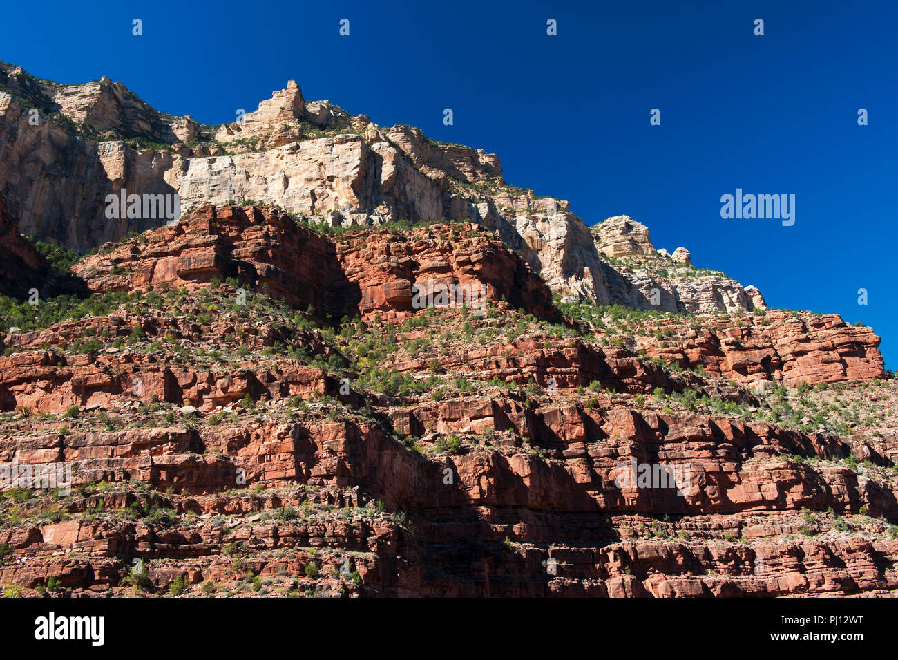 Felsen aus Sandstein und Kalkstein aus dem Bright Angel Trail, Grand Canyon, Arizona, USA. Stockfotohttps://www.alamy.de/image-license-details/?v=1https://www.alamy.de/felsen-aus-sandstein-und-kalkstein-aus-dem-bright-angel-trail-grand-canyon-arizona-usa-image217612468.html
RMPJ12WT–Felsen aus Sandstein und Kalkstein aus dem Bright Angel Trail, Grand Canyon, Arizona, USA.
 Der Sedgewick Geology Trail und Howgill Fells nahe Sedbergh im Südosten von Cumbria, England. Stockfotohttps://www.alamy.de/image-license-details/?v=1https://www.alamy.de/der-sedgewick-geology-trail-und-howgill-fells-nahe-sedbergh-im-sudosten-von-cumbria-england-image631030920.html
RF2YJHXAG–Der Sedgewick Geology Trail und Howgill Fells nahe Sedbergh im Südosten von Cumbria, England.
 Blick auf die Löcher in der Mauer, die sich dem Banshee Canyon im Mojave National Preserve auf dem Rings Loop Trail nähern. Stockfotohttps://www.alamy.de/image-license-details/?v=1https://www.alamy.de/blick-auf-die-locher-in-der-mauer-die-sich-dem-banshee-canyon-im-mojave-national-preserve-auf-dem-rings-loop-trail-nahern-image468070098.html
RM2J5EC56–Blick auf die Löcher in der Mauer, die sich dem Banshee Canyon im Mojave National Preserve auf dem Rings Loop Trail nähern.