Stockfotos & Bilder
(1,087)Stockfotos & Bilder
 RIVER BANN im Winter stromaufwärts von Katesbridge, County Down., Credit:Robert Thompson / Avalon Stockfotohttps://www.alamy.de/image-license-details/?v=1https://www.alamy.de/river-bann-im-winter-stromaufwarts-von-katesbridge-county-down-creditrobert-thompson-avalon-image415030358.html
RM2F367CP–RIVER BANN im Winter stromaufwärts von Katesbridge, County Down., Credit:Robert Thompson / Avalon
 ORANGE SPITZE Anthoccharis cardamine Montiaghs Moss NNR, Aghalee, County Antrim., Credit:Robert Thompson / Avalon Stockfotohttps://www.alamy.de/image-license-details/?v=1https://www.alamy.de/orange-spitze-anthoccharis-cardamine-montiaghs-moss-nnr-aghalee-county-antrim-creditrobert-thompson-avalon-image415029954.html
RM2F366XA–ORANGE SPITZE Anthoccharis cardamine Montiaghs Moss NNR, Aghalee, County Antrim., Credit:Robert Thompson / Avalon
 SPRINGTAIL auf Felsen August Petrobius maritimus Lough Murree, Clare, West Irland, Credit:Robert Thompson / Avalon Stockfotohttps://www.alamy.de/image-license-details/?v=1https://www.alamy.de/springtail-auf-felsen-august-petrobius-maritimus-lough-murree-clare-west-irland-creditrobert-thompson-avalon-image415021369.html
RM2F35RYN–SPRINGTAIL auf Felsen August Petrobius maritimus Lough Murree, Clare, West Irland, Credit:Robert Thompson / Avalon
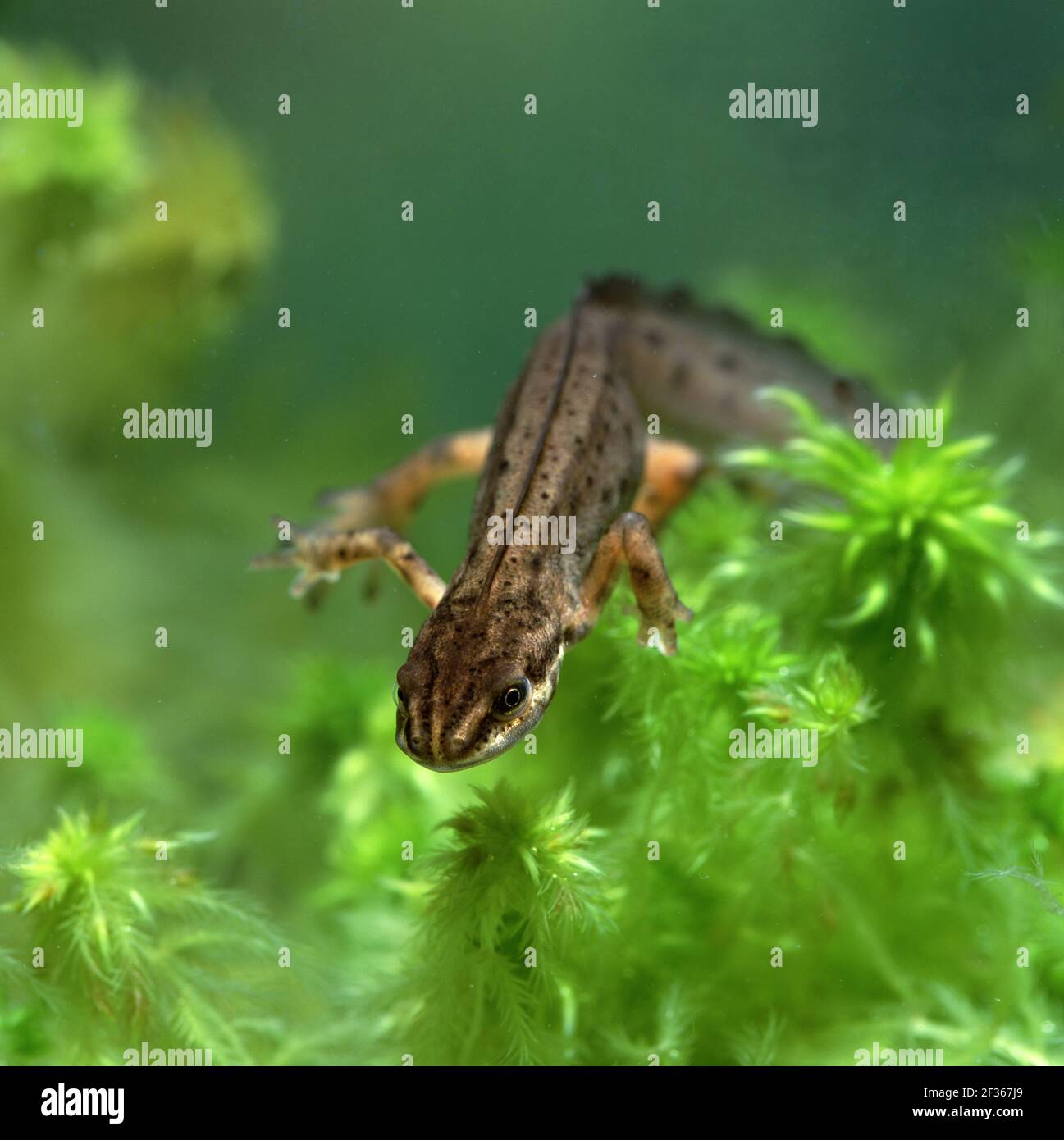 SMOOTH NEWT Triturus vulgaris Selshion Moss, Portadown, County Armagh, Credit:Robert Thompson / Avalon Stockfotohttps://www.alamy.de/image-license-details/?v=1https://www.alamy.de/smooth-newt-triturus-vulgaris-selshion-moss-portadown-county-armagh-creditrobert-thompson-avalon-image415030513.html
RM2F367J9–SMOOTH NEWT Triturus vulgaris Selshion Moss, Portadown, County Armagh, Credit:Robert Thompson / Avalon
 BARN OWL Tyto alba Nordirland, Credit:Robert Thompson / Avalon Stockfotohttps://www.alamy.de/image-license-details/?v=1https://www.alamy.de/barn-owl-tyto-alba-nordirland-creditrobert-thompson-avalon-image415027713.html
RM2F36429–BARN OWL Tyto alba Nordirland, Credit:Robert Thompson / Avalon
 SÜDLICHER SCHWALBENSCHWANZSCHMETTERLING Papilio alexanor in Ruhe, Flügel geöffnet. Hügel über dem Dorf Kassiopi, Insel Korfu, Griechenland, Credit:Robert Tompso Stockfotohttps://www.alamy.de/image-license-details/?v=1https://www.alamy.de/sudlicher-schwalbenschwanzschmetterling-papilio-alexanor-in-ruhe-flugel-geoffnet-hugel-uber-dem-dorf-kassiopi-insel-korfu-griechenland-creditrobert-tompso-image415021304.html
RM2F35RWC–SÜDLICHER SCHWALBENSCHWANZSCHMETTERLING Papilio alexanor in Ruhe, Flügel geöffnet. Hügel über dem Dorf Kassiopi, Insel Korfu, Griechenland, Credit:Robert Tompso
 GEMEINE AGRION DAMSELFLY Agrion virgo Nymphe auf Pondweed, Credit:Robert Thompson / Avalon Stockfotohttps://www.alamy.de/image-license-details/?v=1https://www.alamy.de/gemeine-agrion-damselfly-agrion-virgo-nymphe-auf-pondweed-creditrobert-thompson-avalon-image415020643.html
RM2F35R1R–GEMEINE AGRION DAMSELFLY Agrion virgo Nymphe auf Pondweed, Credit:Robert Thompson / Avalon
 Dünen bei Portstewart, Nordküste, Grafschaft Antrim GPS: Breite: N 55 10,010' (55 10'0,6') GPS: Länge: W 6 44,846' (6 44'50,8') Höhe: 184 Stockfotohttps://www.alamy.de/image-license-details/?v=1https://www.alamy.de/dunen-bei-portstewart-nordkuste-grafschaft-antrim-gps-breite-n-55-10010-55-1006-gps-lange-w-6-44846-6-44508-hohe-184-image415033798.html
RM2F36BRJ–Dünen bei Portstewart, Nordküste, Grafschaft Antrim GPS: Breite: N 55 10,010' (55 10'0,6') GPS: Länge: W 6 44,846' (6 44'50,8') Höhe: 184
 Bastard Balm, Wiesen am Straßenrand zwischen Posada de Valdon und Cordinanes, Credit:Robert Thompson / Avalon Stockfotohttps://www.alamy.de/image-license-details/?v=1https://www.alamy.de/bastard-balm-wiesen-am-strassenrand-zwischen-posada-de-valdon-und-cordinanes-creditrobert-thompson-avalon-image415018321.html
RM2F35M2W–Bastard Balm, Wiesen am Straßenrand zwischen Posada de Valdon und Cordinanes, Credit:Robert Thompson / Avalon
 HAIRY DRAGONFLY Sequence 5/7 Brachytron pratense adult Emerging from Nymph, Credit:Robert Thompson / Avalon Stockfotohttps://www.alamy.de/image-license-details/?v=1https://www.alamy.de/hairy-dragonfly-sequence-57-brachytron-pratense-adult-emerging-from-nymph-creditrobert-thompson-avalon-image415020147.html
RM2F35PC3–HAIRY DRAGONFLY Sequence 5/7 Brachytron pratense adult Emerging from Nymph, Credit:Robert Thompson / Avalon
 Dun Bhaloir, Tory Island, County Donegal, Quelle: Robert Thompson / Avalon Stockfotohttps://www.alamy.de/image-license-details/?v=1https://www.alamy.de/dun-bhaloir-tory-island-county-donegal-quelle-robert-thompson-avalon-image415018626.html
RM2F35MDP–Dun Bhaloir, Tory Island, County Donegal, Quelle: Robert Thompson / Avalon
 HAUBENPILZ Mycena sp. Clare Glen, Tandragee, County Armagh, Credit:Robert Thompson / Avalon Stockfotohttps://www.alamy.de/image-license-details/?v=1https://www.alamy.de/haubenpilz-mycena-sp-clare-glen-tandragee-county-armagh-creditrobert-thompson-avalon-image415027498.html
RM2F363PJ–HAUBENPILZ Mycena sp. Clare Glen, Tandragee, County Armagh, Credit:Robert Thompson / Avalon
 GRÜN-ADERNE WEISSE SCHMETTERLINGE Pieris napi Paarung, Credit:Robert Thompson / Avalon Stockfotohttps://www.alamy.de/image-license-details/?v=1https://www.alamy.de/grun-aderne-weisse-schmetterlinge-pieris-napi-paarung-creditrobert-thompson-avalon-image415022340.html
RM2F35W6C–GRÜN-ADERNE WEISSE SCHMETTERLINGE Pieris napi Paarung, Credit:Robert Thompson / Avalon
 Moor Asphodel, Narthecium assifragum, südlich von Flaggy Faugher östlich von Horn Head, Credit:Robert Thompson / Avalon Stockfotohttps://www.alamy.de/image-license-details/?v=1https://www.alamy.de/moor-asphodel-narthecium-assifragum-sudlich-von-flaggy-faugher-ostlich-von-horn-head-creditrobert-thompson-avalon-image415019232.html
RM2F35N7C–Moor Asphodel, Narthecium assifragum, südlich von Flaggy Faugher östlich von Horn Head, Credit:Robert Thompson / Avalon
 Robuste Sumpforchidee, Dactylorhiza elata, Wiesen und Hügel bei Colio, Picos de Europa, Spanien, Credit:Robert Thompson / Avalon Stockfotohttps://www.alamy.de/image-license-details/?v=1https://www.alamy.de/robuste-sumpforchidee-dactylorhiza-elata-wiesen-und-hugel-bei-colio-picos-de-europa-spanien-creditrobert-thompson-avalon-image415018724.html
RM2F35MH8–Robuste Sumpforchidee, Dactylorhiza elata, Wiesen und Hügel bei Colio, Picos de Europa, Spanien, Credit:Robert Thompson / Avalon
 Inishfree Island, nordwestlich von Cruit Island, Grafschaft Donegal GPS: Breite: Nr. 55 3,181' (55 Nr. 3'10,9') GPS: Länge: W 8 Nr. 22,851' (8 Nr. 22'51,1') Altitu Stockfotohttps://www.alamy.de/image-license-details/?v=1https://www.alamy.de/inishfree-island-nordwestlich-von-cruit-island-grafschaft-donegal-gps-breite-nr-55-3181-55-nr-3109-gps-lange-w-8-nr-22851-8-nr-22511-altitu-image415033005.html
RM2F36AR9–Inishfree Island, nordwestlich von Cruit Island, Grafschaft Donegal GPS: Breite: Nr. 55 3,181' (55 Nr. 3'10,9') GPS: Länge: W 8 Nr. 22,851' (8 Nr. 22'51,1') Altitu
 SPELGA & BUTTER MOUNTAIN Mourne Mountains, County Down., Credit:Robert Thompson / Avalon Stockfotohttps://www.alamy.de/image-license-details/?v=1https://www.alamy.de/spelga-butter-mountain-mourne-mountains-county-down-creditrobert-thompson-avalon-image415032025.html
RM2F369G9–SPELGA & BUTTER MOUNTAIN Mourne Mountains, County Down., Credit:Robert Thompson / Avalon
 NÖRDLICHE SMARAGD LIBELLE Somatochlora arctica auf Heide Irland, Credit:Robert Thompson / Avalon Stockfotohttps://www.alamy.de/image-license-details/?v=1https://www.alamy.de/nordliche-smaragd-libelle-somatochlora-arctica-auf-heide-irland-creditrobert-thompson-avalon-image415023814.html
RM2F35Y32–NÖRDLICHE SMARAGD LIBELLE Somatochlora arctica auf Heide Irland, Credit:Robert Thompson / Avalon
 ERRIGAL MOUNTAIN Derryveagh Mountains, County Donegal, Credit:Robert Thompson / Avalon Stockfotohttps://www.alamy.de/image-license-details/?v=1https://www.alamy.de/errigal-mountain-derryveagh-mountains-county-donegal-creditrobert-thompson-avalon-image415029089.html
RM2F365RD–ERRIGAL MOUNTAIN Derryveagh Mountains, County Donegal, Credit:Robert Thompson / Avalon
 Lough Eske, nördlich von Donegal Town, County Donegal, Credit:Robert Thompson / Avalon Stockfotohttps://www.alamy.de/image-license-details/?v=1https://www.alamy.de/lough-eske-nordlich-von-donegal-town-county-donegal-creditrobert-thompson-avalon-image415019114.html
RM2F35N36–Lough Eske, nördlich von Donegal Town, County Donegal, Credit:Robert Thompson / Avalon
 ZYPERN BIENENORCHIDEE Blume Detail Ophrys kotschyi auf Garigue mit Kiefer. März Saltlake, Akrotiri, Zypern, Credit:Robert Thompson / Avalon Stockfotohttps://www.alamy.de/image-license-details/?v=1https://www.alamy.de/zypern-bienenorchidee-blume-detail-ophrys-kotschyi-auf-garigue-mit-kiefer-marz-saltlake-akrotiri-zypern-creditrobert-thompson-avalon-image415020263.html
RM2F35PG7–ZYPERN BIENENORCHIDEE Blume Detail Ophrys kotschyi auf Garigue mit Kiefer. März Saltlake, Akrotiri, Zypern, Credit:Robert Thompson / Avalon
 WILD GARLIC Allium ursinum, Credit:Robert Thompson / Avalon Stockfotohttps://www.alamy.de/image-license-details/?v=1https://www.alamy.de/wild-garlic-allium-ursinum-creditrobert-thompson-avalon-image415031521.html
RM2F368X9–WILD GARLIC Allium ursinum, Credit:Robert Thompson / Avalon
 Orchidee, Orchis cazorlensis, Cuenca, Spanien, Credit:Robert Thompson / Avalon Stockfotohttps://www.alamy.de/image-license-details/?v=1https://www.alamy.de/orchidee-orchis-cazorlensis-cuenca-spanien-creditrobert-thompson-avalon-image415019389.html
RM2F35ND1–Orchidee, Orchis cazorlensis, Cuenca, Spanien, Credit:Robert Thompson / Avalon
 ARCHER'S DART on heather Agrotis vestigialis Murlough National Nature Reserve, Dundrum, Down, SE Ulster, Credit:Robert Thompson / Avalon Stockfotohttps://www.alamy.de/image-license-details/?v=1https://www.alamy.de/archers-dart-on-heather-agrotis-vestigialis-murlough-national-nature-reserve-dundrum-down-se-ulster-creditrobert-thompson-avalon-image415022550.html
RM2F35WDX–ARCHER'S DART on heather Agrotis vestigialis Murlough National Nature Reserve, Dundrum, Down, SE Ulster, Credit:Robert Thompson / Avalon
 Umfin Island, nördlich von Gola Island, County Donegal GPS: Breite: Nr. 55 5,795' (55 5'47,7') GPS: Länge: W 8 21,557' (8 Nr. 21'33,4') Höhe: 250 Stockfotohttps://www.alamy.de/image-license-details/?v=1https://www.alamy.de/umfin-island-nordlich-von-gola-island-county-donegal-gps-breite-nr-55-5795-55-5477-gps-lange-w-8-21557-8-nr-21334-hohe-250-image415033807.html
RM2F36BRY–Umfin Island, nördlich von Gola Island, County Donegal GPS: Breite: Nr. 55 5,795' (55 5'47,7') GPS: Länge: W 8 21,557' (8 Nr. 21'33,4') Höhe: 250
 ANGLE SHADES MOTTE Phlogophora meticulosa Castlewellan Forest Park, County Down., Credit:Robert Thompson / Avalon Stockfotohttps://www.alamy.de/image-license-details/?v=1https://www.alamy.de/angle-shades-motte-phlogophora-meticulosa-castlewellan-forest-park-county-down-creditrobert-thompson-avalon-image415027143.html
RM2F3639Y–ANGLE SHADES MOTTE Phlogophora meticulosa Castlewellan Forest Park, County Down., Credit:Robert Thompson / Avalon
 GEMEINE BLAUE DAMSELFLIEGE Enallagma cyathigerum, Credit:Robert Thompson / Avalon Stockfotohttps://www.alamy.de/image-license-details/?v=1https://www.alamy.de/gemeine-blaue-damselfliege-enallagma-cyathigerum-creditrobert-thompson-avalon-image415028572.html
RM2F36550–GEMEINE BLAUE DAMSELFLIEGE Enallagma cyathigerum, Credit:Robert Thompson / Avalon
 Dunaff Head, County Donegal GPS: Breitengrad: 55 16,427' (55 16'25,6') GPS: Längengrad: W 7 32,654' (7 32'39,3') Höhenlage: 381,00m Datum fotografiert Stockfotohttps://www.alamy.de/image-license-details/?v=1https://www.alamy.de/dunaff-head-county-donegal-gps-breitengrad-55-16427-55-16256-gps-langengrad-w-7-32654-7-32393-hohenlage-38100m-datum-fotografiert-image415032892.html
RM2F36AK8–Dunaff Head, County Donegal GPS: Breitengrad: 55 16,427' (55 16'25,6') GPS: Längengrad: W 7 32,654' (7 32'39,3') Höhenlage: 381,00m Datum fotografiert
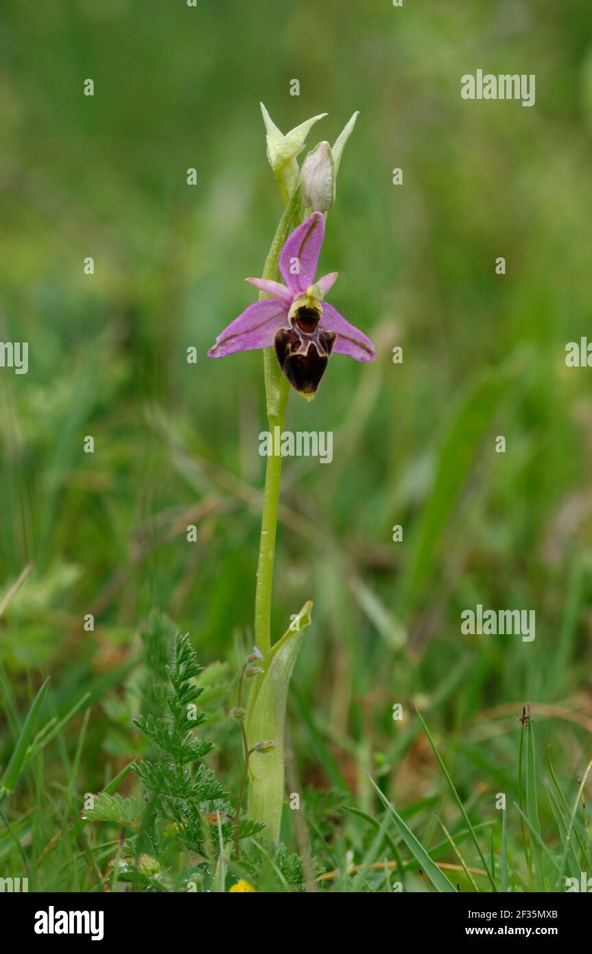 Orchidee, Ophrys scolopax, Cuenca, Spanien, Credit:Robert Thompson / Avalon Stockfotohttps://www.alamy.de/image-license-details/?v=1https://www.alamy.de/orchidee-ophrys-scolopax-cuenca-spanien-creditrobert-thompson-avalon-image415018979.html
RM2F35MXB–Orchidee, Ophrys scolopax, Cuenca, Spanien, Credit:Robert Thompson / Avalon
 Sonnenuntergang auf sechseckigen Basaltsäulen, Giant's Causeway, Nordküste, Grafschaft Antrim, Credit:Robert Thompson / Avalon Stockfotohttps://www.alamy.de/image-license-details/?v=1https://www.alamy.de/sonnenuntergang-auf-sechseckigen-basaltsaulen-giants-causeway-nordkuste-grafschaft-antrim-creditrobert-thompson-avalon-image415020039.html
RM2F35P87–Sonnenuntergang auf sechseckigen Basaltsäulen, Giant's Causeway, Nordküste, Grafschaft Antrim, Credit:Robert Thompson / Avalon
 Strangford Drumlins, County Down Grid Referenz: Datum Fotografiert: 191007 ., Credit:Robert Thompson / Avalon Stockfotohttps://www.alamy.de/image-license-details/?v=1https://www.alamy.de/strangford-drumlins-county-down-grid-referenz-datum-fotografiert-191007-creditrobert-thompson-avalon-image415033788.html
RM2F36BR8–Strangford Drumlins, County Down Grid Referenz: Datum Fotografiert: 191007 ., Credit:Robert Thompson / Avalon
 Ausfahrt PALE EGGAR Trichiura crataegi Lough Navar Forest, County Fermanagh., Quelle: Robert Thompson / Avalon Stockfotohttps://www.alamy.de/image-license-details/?v=1https://www.alamy.de/ausfahrt-pale-eggar-trichiura-crataegi-lough-navar-forest-county-fermanagh-quelle-robert-thompson-avalon-image415029537.html
RM2F366BD–Ausfahrt PALE EGGAR Trichiura crataegi Lough Navar Forest, County Fermanagh., Quelle: Robert Thompson / Avalon
 SELTENER SCHWALBENSCHWANZSCHMETTERLING Iphiclides podalirius Dordogne, Zentralfrankreich, Credit:Robert Thompson / Avalon Stockfotohttps://www.alamy.de/image-license-details/?v=1https://www.alamy.de/seltener-schwalbenschwanzschmetterling-iphiclides-podalirius-dordogne-zentralfrankreich-creditrobert-thompson-avalon-image415023265.html
RM2F35XBD–SELTENER SCHWALBENSCHWANZSCHMETTERLING Iphiclides podalirius Dordogne, Zentralfrankreich, Credit:Robert Thompson / Avalon
 WEISSE SATINMOTTENLARVE Leucoma salicis Nottingham, England. Mai., Credit:Robert Thompson / Avalon Stockfotohttps://www.alamy.de/image-license-details/?v=1https://www.alamy.de/weisse-satinmottenlarve-leucoma-salicis-nottingham-england-mai-creditrobert-thompson-avalon-image415023278.html
RM2F35XBX–WEISSE SATINMOTTENLARVE Leucoma salicis Nottingham, England. Mai., Credit:Robert Thompson / Avalon
 Lighthouse Island und Mew Island, County Down Grid Referenz: Datum Fotografiert: 191007 ., Credit:Robert Thompson / Avalon Stockfotohttps://www.alamy.de/image-license-details/?v=1https://www.alamy.de/lighthouse-island-und-mew-island-county-down-grid-referenz-datum-fotografiert-191007-creditrobert-thompson-avalon-image415032916.html
RM2F36AM4–Lighthouse Island und Mew Island, County Down Grid Referenz: Datum Fotografiert: 191007 ., Credit:Robert Thompson / Avalon
 GRAUER MARE'S SCHWANZWASSERFALL Bule Stack Mountains, County Donegal, Credit:Robert Thompson / Avalon Stockfotohttps://www.alamy.de/image-license-details/?v=1https://www.alamy.de/grauer-mares-schwanzwasserfall-bule-stack-mountains-county-donegal-creditrobert-thompson-avalon-image415028997.html
RM2F365M5–GRAUER MARE'S SCHWANZWASSERFALL Bule Stack Mountains, County Donegal, Credit:Robert Thompson / Avalon
 Orchidee (Dactylorhiza insularis var bartonii) Cuenca, Spanien., Quelle:Robert Thompson / Avalon Stockfotohttps://www.alamy.de/image-license-details/?v=1https://www.alamy.de/orchidee-dactylorhiza-insularis-var-bartonii-cuenca-spanien-quellerobert-thompson-avalon-image415018713.html
RM2F35MGW–Orchidee (Dactylorhiza insularis var bartonii) Cuenca, Spanien., Quelle:Robert Thompson / Avalon
 VARIABLE DAMSELFLY Coenagrion pulchella Brackagh Moss NNR, Portadown, County Down, Credit:Robert Thompson / Avalon Stockfotohttps://www.alamy.de/image-license-details/?v=1https://www.alamy.de/variable-damselfly-coenagrion-pulchella-brackagh-moss-nnr-portadown-county-down-creditrobert-thompson-avalon-image415031859.html
RM2F369AB–VARIABLE DAMSELFLY Coenagrion pulchella Brackagh Moss NNR, Portadown, County Down, Credit:Robert Thompson / Avalon
 BUFF-TIP Phalera bucephala Lackan Bog, Ballyroney, County Down., Credit:Robert Thompson / Avalon Stockfotohttps://www.alamy.de/image-license-details/?v=1https://www.alamy.de/buff-tip-phalera-bucephala-lackan-bog-ballyroney-county-down-creditrobert-thompson-avalon-image415027530.html
RM2F363RP–BUFF-TIP Phalera bucephala Lackan Bog, Ballyroney, County Down., Credit:Robert Thompson / Avalon
 ZITRONENFALTER Gonepteryx rhamni The Burren, County Clare, SW Eire, Credit:Robert Thompson / Avalon Stockfotohttps://www.alamy.de/image-license-details/?v=1https://www.alamy.de/zitronenfalter-gonepteryx-rhamni-the-burren-county-clare-sw-eire-creditrobert-thompson-avalon-image415020432.html
RM2F35PP8–ZITRONENFALTER Gonepteryx rhamni The Burren, County Clare, SW Eire, Credit:Robert Thompson / Avalon
 THRIFT CLEARWING Synansphhecia muscaeformis Cliffs at McDuff, Banffshire Coast, Scotland., Credit:Robert Thompson / Avalon Stockfotohttps://www.alamy.de/image-license-details/?v=1https://www.alamy.de/thrift-clearwing-synansphhecia-muscaeformis-cliffs-at-mcduff-banffshire-coast-scotland-creditrobert-thompson-avalon-image415027062.html
RM2F36372–THRIFT CLEARWING Synansphhecia muscaeformis Cliffs at McDuff, Banffshire Coast, Scotland., Credit:Robert Thompson / Avalon
 Champagner-Orchidee (Anacamptis champagneuxii) N.E. Beteta Cuenca, Spanien, Quelle:Robert Thompson / Avalon Stockfotohttps://www.alamy.de/image-license-details/?v=1https://www.alamy.de/champagner-orchidee-anacamptis-champagneuxii-ne-beteta-cuenca-spanien-quellerobert-thompson-avalon-image415018307.html
RM2F35M2B–Champagner-Orchidee (Anacamptis champagneuxii) N.E. Beteta Cuenca, Spanien, Quelle:Robert Thompson / Avalon
 PYRAMIDENORCHIDEE Anacamptis pyramidalis Cruit Island, County Donegal, Credit:Robert Thompson / Avalon Stockfotohttps://www.alamy.de/image-license-details/?v=1https://www.alamy.de/pyramidenorchidee-anacamptis-pyramidalis-cruit-island-county-donegal-creditrobert-thompson-avalon-image415027194.html
RM2F363BP–PYRAMIDENORCHIDEE Anacamptis pyramidalis Cruit Island, County Donegal, Credit:Robert Thompson / Avalon
 SEA CAMPION Silene uniflora Tullagh Point, Malin Peninsula, County Donegal, Quelle:Robert Thompson / Avalon Stockfotohttps://www.alamy.de/image-license-details/?v=1https://www.alamy.de/sea-campion-silene-uniflora-tullagh-point-malin-peninsula-county-donegal-quellerobert-thompson-avalon-image415030417.html
RM2F367EW–SEA CAMPION Silene uniflora Tullagh Point, Malin Peninsula, County Donegal, Quelle:Robert Thompson / Avalon
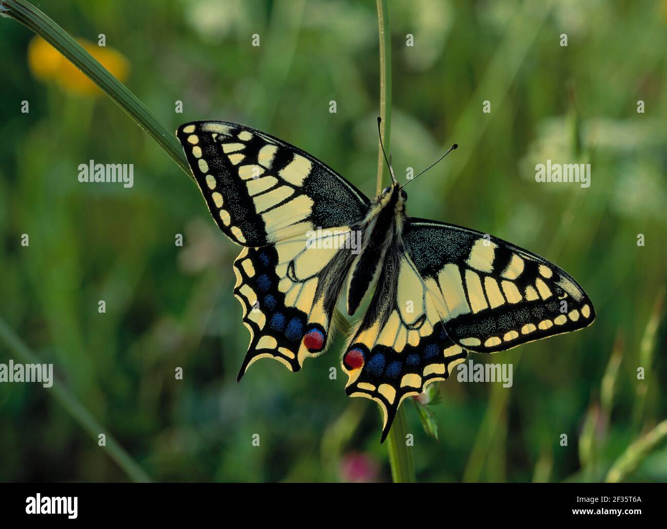 SCHWALBENSCHWANZSCHMETTERLING Papilio machaon gorganus Europäische Rasse, Jura-Gebirge, Ostfrankreich, Credit:Robert Thompson / Avalon Stockfotohttps://www.alamy.de/image-license-details/?v=1https://www.alamy.de/schwalbenschwanzschmetterling-papilio-machaon-gorganus-europaische-rasse-jura-gebirge-ostfrankreich-creditrobert-thompson-avalon-image415021554.html
RM2F35T6A–SCHWALBENSCHWANZSCHMETTERLING Papilio machaon gorganus Europäische Rasse, Jura-Gebirge, Ostfrankreich, Credit:Robert Thompson / Avalon
 Murlough Sand Dune System, County Antrim Grid Referenz: Datum Fotografiert: 19508 Kommentare: ., Kredit: Professionelles Wildlife-Foto Stockfotohttps://www.alamy.de/image-license-details/?v=1https://www.alamy.de/murlough-sand-dune-system-county-antrim-grid-referenz-datum-fotografiert-19508-kommentare-kredit-professionelles-wildlife-foto-image415033785.html
RM2F36BR5–Murlough Sand Dune System, County Antrim Grid Referenz: Datum Fotografiert: 19508 Kommentare: ., Kredit: Professionelles Wildlife-Foto
 LONGHORN KÄFER auf Blatt Rhagium bifasciatum Montiaghs Moss NNNR, Antrim, NE Ulster, Credit:Robert Thompson / Avalon Stockfotohttps://www.alamy.de/image-license-details/?v=1https://www.alamy.de/longhorn-kafer-auf-blatt-rhagium-bifasciatum-montiaghs-moss-nnnr-antrim-ne-ulster-creditrobert-thompson-avalon-image415026480.html
RM2F362E8–LONGHORN KÄFER auf Blatt Rhagium bifasciatum Montiaghs Moss NNNR, Antrim, NE Ulster, Credit:Robert Thompson / Avalon
 DOAGH ISLE CARRICKABRACGHY Blick auf die Five Finger Cliffs, County Donegal, Credit:Robert Thompson / Avalon Stockfotohttps://www.alamy.de/image-license-details/?v=1https://www.alamy.de/doagh-isle-carrickabracghy-blick-auf-die-five-finger-cliffs-county-donegal-creditrobert-thompson-avalon-image415028459.html
RM2F3650Y–DOAGH ISLE CARRICKABRACGHY Blick auf die Five Finger Cliffs, County Donegal, Credit:Robert Thompson / Avalon
 Grand Causeway von Port Ganny, Giant's Causeway, Nordküste, County Antrim, Credit:Robert Thompson / Avalon Stockfotohttps://www.alamy.de/image-license-details/?v=1https://www.alamy.de/grand-causeway-von-port-ganny-giants-causeway-nordkuste-county-antrim-creditrobert-thompson-avalon-image415018798.html
RM2F35MKX–Grand Causeway von Port Ganny, Giant's Causeway, Nordküste, County Antrim, Credit:Robert Thompson / Avalon
 GEWÖHNLICHE LIMPETS Patella vulgata Ballyhenry Point, Strangford Lough, County Down, Credit:Robert Thompson / Avalon Stockfotohttps://www.alamy.de/image-license-details/?v=1https://www.alamy.de/gewohnliche-limpets-patella-vulgata-ballyhenry-point-strangford-lough-county-down-creditrobert-thompson-avalon-image415029728.html
RM2F366J8–GEWÖHNLICHE LIMPETS Patella vulgata Ballyhenry Point, Strangford Lough, County Down, Credit:Robert Thompson / Avalon
 GRISON'S FRITILLARY ruhend, Mellicta Varia Flügel geöffnet. Almwiese, Schweiz. Juni, Credit:Robert Thompson / Avalon Stockfotohttps://www.alamy.de/image-license-details/?v=1https://www.alamy.de/grisons-fritillary-ruhend-mellicta-varia-flugel-geoffnet-almwiese-schweiz-juni-creditrobert-thompson-avalon-image415021155.html
RM2F35RM3–GRISON'S FRITILLARY ruhend, Mellicta Varia Flügel geöffnet. Almwiese, Schweiz. Juni, Credit:Robert Thompson / Avalon
 GROSSER KUPFERSCHMETTERLING Lycaena dispar batavus auf Scabious, Credit:Robert Thompson / Avalon Stockfotohttps://www.alamy.de/image-license-details/?v=1https://www.alamy.de/grosser-kupferschmetterling-lycaena-dispar-batavus-auf-scabious-creditrobert-thompson-avalon-image415021212.html
RM2F35RP4–GROSSER KUPFERSCHMETTERLING Lycaena dispar batavus auf Scabious, Credit:Robert Thompson / Avalon
 ERLE KITTEN Furcula bicuula North Ireland., Credit:Robert Thompson / Avalon Stockfotohttps://www.alamy.de/image-license-details/?v=1https://www.alamy.de/erle-kitten-furcula-bicuula-north-ireland-creditrobert-thompson-avalon-image415027273.html
RM2F363EH–ERLE KITTEN Furcula bicuula North Ireland., Credit:Robert Thompson / Avalon
 SHAG Phalacrocorax aristotelis Saltee Islands, County Wexford, Credit:Robert Thompson / Avalon Stockfotohttps://www.alamy.de/image-license-details/?v=1https://www.alamy.de/shag-phalacrocorax-aristotelis-saltee-islands-county-wexford-creditrobert-thompson-avalon-image415030402.html
RM2F367EA–SHAG Phalacrocorax aristotelis Saltee Islands, County Wexford, Credit:Robert Thompson / Avalon
 Dooey Peninsula & Ballyness Bay nördlich von Gortahork, County Donegal GPS: Breitengrad: N 55 9,877' (55 9'52,6') GPS: Längengrad: W 8 8,377' (8 8'22,6') A Stockfotohttps://www.alamy.de/image-license-details/?v=1https://www.alamy.de/dooey-peninsula-ballyness-bay-nordlich-von-gortahork-county-donegal-gps-breitengrad-n-55-9877-55-9526-gps-langengrad-w-8-8377-8-8226-a-image415032513.html
RM2F36A5N–Dooey Peninsula & Ballyness Bay nördlich von Gortahork, County Donegal GPS: Breitengrad: N 55 9,877' (55 9'52,6') GPS: Längengrad: W 8 8,377' (8 8'22,6') A
 Wave Action, St John's Point, N. Ardglass, County Down, Credit:Robert Thompson / Avalon Stockfotohttps://www.alamy.de/image-license-details/?v=1https://www.alamy.de/wave-action-st-johns-point-n-ardglass-county-down-creditrobert-thompson-avalon-image415020044.html
RM2F35P8C–Wave Action, St John's Point, N. Ardglass, County Down, Credit:Robert Thompson / Avalon
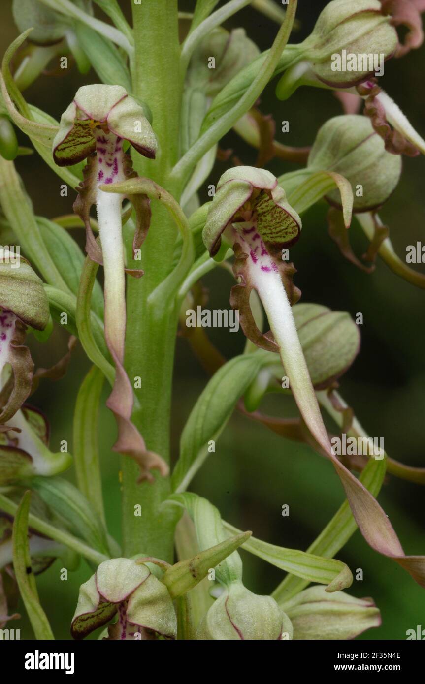 Lizard Orchid (Himantoglossum hircinum) Spanien, Credit:Robert Thompson / Avalon Stockfotohttps://www.alamy.de/image-license-details/?v=1https://www.alamy.de/lizard-orchid-himantoglossum-hircinum-spanien-creditrobert-thompson-avalon-image415019150.html
RM2F35N4E–Lizard Orchid (Himantoglossum hircinum) Spanien, Credit:Robert Thompson / Avalon
 KLEINER ELEFANTENHAWKMOTTE Deilephila porcellus auf Blume, Credit:Robert Thompson / Avalon Stockfotohttps://www.alamy.de/image-license-details/?v=1https://www.alamy.de/kleiner-elefantenhawkmotte-deilephila-porcellus-auf-blume-creditrobert-thompson-avalon-image415022585.html
RM2F35WF5–KLEINER ELEFANTENHAWKMOTTE Deilephila porcellus auf Blume, Credit:Robert Thompson / Avalon
 Orchidee (Anacamptis picta) typisch und Albino, Lefkimmis Palaiochori Straße, Korfu, Credit:Robert Thompson / Avalon Stockfotohttps://www.alamy.de/image-license-details/?v=1https://www.alamy.de/orchidee-anacamptis-picta-typisch-und-albino-lefkimmis-palaiochori-strasse-korfu-creditrobert-thompson-avalon-image415018305.html
RM2F35M29–Orchidee (Anacamptis picta) typisch und Albino, Lefkimmis Palaiochori Straße, Korfu, Credit:Robert Thompson / Avalon
 Hay Meadows am Straßenrand zwischen Posada de Valdon und Cordinanes, Spanien, Credit:Robert Thompson / Avalon Stockfotohttps://www.alamy.de/image-license-details/?v=1https://www.alamy.de/hay-meadows-am-strassenrand-zwischen-posada-de-valdon-und-cordinanes-spanien-creditrobert-thompson-avalon-image415019223.html
RM2F35N73–Hay Meadows am Straßenrand zwischen Posada de Valdon und Cordinanes, Spanien, Credit:Robert Thompson / Avalon
 KLEINE PERLENRANDUNG oder SILBERUMRANDETE FRITILLÄRE Boloria selene oder Clossiana selene Lochaber, Inverness, Schottland., Credit:Robert Thompson / Avalon Stockfotohttps://www.alamy.de/image-license-details/?v=1https://www.alamy.de/kleine-perlenrandung-oder-silberumrandete-fritillare-boloria-selene-oder-clossiana-selene-lochaber-inverness-schottland-creditrobert-thompson-avalon-image415020565.html
RM2F35PY1–KLEINE PERLENRANDUNG oder SILBERUMRANDETE FRITILLÄRE Boloria selene oder Clossiana selene Lochaber, Inverness, Schottland., Credit:Robert Thompson / Avalon
 Brook Neagh in Toome, Bridge County, Londonderry, Credit:Robert Thompson / Avalon Stockfotohttps://www.alamy.de/image-license-details/?v=1https://www.alamy.de/brook-neagh-in-toome-bridge-county-londonderry-creditrobert-thompson-avalon-image415018273.html
RM2F35M15–Brook Neagh in Toome, Bridge County, Londonderry, Credit:Robert Thompson / Avalon
 GARDEN TIGER MOTH Arctia caja, Credit:Robert Thompson / Avalon Stockfotohttps://www.alamy.de/image-license-details/?v=1https://www.alamy.de/garden-tiger-moth-arctia-caja-creditrobert-thompson-avalon-image415026875.html
RM2F3630B–GARDEN TIGER MOTH Arctia caja, Credit:Robert Thompson / Avalon
 GARTEN TIGER MOTTE auf Stamm Arctia caja, Credit:Robert Thompson / Avalon Stockfotohttps://www.alamy.de/image-license-details/?v=1https://www.alamy.de/garten-tiger-motte-auf-stamm-arctia-caja-creditrobert-thompson-avalon-image415023209.html
RM2F35X9D–GARTEN TIGER MOTTE auf Stamm Arctia caja, Credit:Robert Thompson / Avalon
 RIESE ATLAS SEIDENMOTTE Attacus Atlas auf Silberbirke August, Credit:Robert Thompson / Avalon Stockfotohttps://www.alamy.de/image-license-details/?v=1https://www.alamy.de/riese-atlas-seidenmotte-attacus-atlas-auf-silberbirke-august-creditrobert-thompson-avalon-image415020129.html
RM2F35PBD–RIESE ATLAS SEIDENMOTTE Attacus Atlas auf Silberbirke August, Credit:Robert Thompson / Avalon
 GELBE BIENENORCHIDEE in Blüte Ophrys lutea bei carcassonne, Südfrankreich., Credit:Robert Thompson / Avalon Stockfotohttps://www.alamy.de/image-license-details/?v=1https://www.alamy.de/gelbe-bienenorchidee-in-blute-ophrys-lutea-bei-carcassonne-sudfrankreich-creditrobert-thompson-avalon-image415026729.html
RM2F362R5–GELBE BIENENORCHIDEE in Blüte Ophrys lutea bei carcassonne, Südfrankreich., Credit:Robert Thompson / Avalon
 Rotäugiger Baumfrosch, Agalychnis callidyas, Nicaragua, Zentralamerika., Quelle: Robert Thompson / Avalon Stockfotohttps://www.alamy.de/image-license-details/?v=1https://www.alamy.de/rotaugiger-baumfrosch-agalychnis-callidyas-nicaragua-zentralamerika-quelle-robert-thompson-avalon-image415019703.html
RM2F35NT7–Rotäugiger Baumfrosch, Agalychnis callidyas, Nicaragua, Zentralamerika., Quelle: Robert Thompson / Avalon
 LADY ORCHIDEE Orchis purpurea Bugarach, Südfrankreich., Credit:Robert Thompson / Avalon Stockfotohttps://www.alamy.de/image-license-details/?v=1https://www.alamy.de/lady-orchidee-orchis-purpurea-bugarach-sudfrankreich-creditrobert-thompson-avalon-image415026742.html
RM2F362RJ–LADY ORCHIDEE Orchis purpurea Bugarach, Südfrankreich., Credit:Robert Thompson / Avalon
 GRISON'S FRITILLARY ruhend, Mellicta Varia Flügel geschlossen. Juni Almwiese, Schweiz, Credit:Robert Thompson / Avalon Stockfotohttps://www.alamy.de/image-license-details/?v=1https://www.alamy.de/grisons-fritillary-ruhend-mellicta-varia-flugel-geschlossen-juni-almwiese-schweiz-creditrobert-thompson-avalon-image415021222.html
RM2F35RPE–GRISON'S FRITILLARY ruhend, Mellicta Varia Flügel geschlossen. Juni Almwiese, Schweiz, Credit:Robert Thompson / Avalon
 GARTEN ORB-NETZ oder KREUZ SPIDER Araneus diadematus auf Netz mit Beute, Credit:Robert Thompson / Avalon Stockfotohttps://www.alamy.de/image-license-details/?v=1https://www.alamy.de/garten-orb-netz-oder-kreuz-spider-araneus-diadematus-auf-netz-mit-beute-creditrobert-thompson-avalon-image415026672.html
RM2F362N4–GARTEN ORB-NETZ oder KREUZ SPIDER Araneus diadematus auf Netz mit Beute, Credit:Robert Thompson / Avalon
 CHITON Lepidochitona cinerea and Barnacles (Elminius modestus) Ballyhenry Point, Strangford Lough, County Down, Credit:Robert Thompson / Avalon Stockfotohttps://www.alamy.de/image-license-details/?v=1https://www.alamy.de/chiton-lepidochitona-cinerea-and-barnacles-elminius-modestus-ballyhenry-point-strangford-lough-county-down-creditrobert-thompson-avalon-image415029318.html
RM2F3663J–CHITON Lepidochitona cinerea and Barnacles (Elminius modestus) Ballyhenry Point, Strangford Lough, County Down, Credit:Robert Thompson / Avalon
 Orchidee (Orchis cazorlensis) Cuenca, Spanien., Credit:Robert Thompson / Avalon Stockfotohttps://www.alamy.de/image-license-details/?v=1https://www.alamy.de/orchidee-orchis-cazorlensis-cuenca-spanien-creditrobert-thompson-avalon-image415018400.html
RM2F35M5M–Orchidee (Orchis cazorlensis) Cuenca, Spanien., Credit:Robert Thompson / Avalon
 GLANVILLE FRITILLARY SCHMETTERLING Mellitaea cinxia auf Blume, Flügel geschlossen. Juni, Credit:Robert Thompson / Avalon Stockfotohttps://www.alamy.de/image-license-details/?v=1https://www.alamy.de/glanville-fritillary-schmetterling-mellitaea-cinxia-auf-blume-flugel-geschlossen-juni-creditrobert-thompson-avalon-image415021302.html
RM2F35RWA–GLANVILLE FRITILLARY SCHMETTERLING Mellitaea cinxia auf Blume, Flügel geschlossen. Juni, Credit:Robert Thompson / Avalon
 KIES-HAKENFALTER in Ruhe, Drepana falcataria Flügel offen Lackan Bog ASSI, Co. Down, Irland, Credit:Robert Thompson / Avalon Stockfotohttps://www.alamy.de/image-license-details/?v=1https://www.alamy.de/kies-hakenfalter-in-ruhe-drepana-falcataria-flugel-offen-lackan-bog-assi-co-down-irland-creditrobert-thompson-avalon-image415023303.html
RM2F35XCR–KIES-HAKENFALTER in Ruhe, Drepana falcataria Flügel offen Lackan Bog ASSI, Co. Down, Irland, Credit:Robert Thompson / Avalon
 Die Mädchen, der Küste von Larne County Antrim GPS: Breite: N 54 55,234' (54 55'14,0') GPS: Länge: W 5 42,829' (5 42'49,7') Höhe: 238,00 Stockfotohttps://www.alamy.de/image-license-details/?v=1https://www.alamy.de/die-madchen-der-kuste-von-larne-county-antrim-gps-breite-n-54-55234-54-55140-gps-lange-w-5-42829-5-42497-hohe-23800-image415033167.html
RM2F36B13–Die Mädchen, der Küste von Larne County Antrim GPS: Breite: N 54 55,234' (54 55'14,0') GPS: Länge: W 5 42,829' (5 42'49,7') Höhe: 238,00
 POLYPHEMUS MOTH Antheraea polyphemus Verbreitung: Nordamerika - Kanada nach Yucatan., Quelle: Robert Thompson / Avalon Stockfotohttps://www.alamy.de/image-license-details/?v=1https://www.alamy.de/polyphemus-moth-antheraea-polyphemus-verbreitung-nordamerika-kanada-nach-yucatan-quelle-robert-thompson-avalon-image415026806.html
RM2F362WX–POLYPHEMUS MOTH Antheraea polyphemus Verbreitung: Nordamerika - Kanada nach Yucatan., Quelle: Robert Thompson / Avalon
 KARTE SCHMETTERLING in Ruhe, Flügel geschlossen Araschnia levana Petite Camargue, Frankreich. Juni, Credit:Robert Thompson / Avalon Stockfotohttps://www.alamy.de/image-license-details/?v=1https://www.alamy.de/karte-schmetterling-in-ruhe-flugel-geschlossen-araschnia-levana-petite-camargue-frankreich-juni-creditrobert-thompson-avalon-image415023685.html
RM2F35XXD–KARTE SCHMETTERLING in Ruhe, Flügel geschlossen Araschnia levana Petite Camargue, Frankreich. Juni, Credit:Robert Thompson / Avalon
 Felsformationen Dun Bhaloir, Tory Island, County Donegal, Credit:Robert Thompson / Avalon Stockfotohttps://www.alamy.de/image-license-details/?v=1https://www.alamy.de/felsformationen-dun-bhaloir-tory-island-county-donegal-creditrobert-thompson-avalon-image415019476.html
RM2F35NG4–Felsformationen Dun Bhaloir, Tory Island, County Donegal, Credit:Robert Thompson / Avalon
 FOUR-SPOTTED CHASER (Libellula quadrimaculata) Brackagh Moss Nature Reserve, Co. Armagh, Nordirland. *** Ortsüberschrift ***, Quelle:Robert Thomps Stockfotohttps://www.alamy.de/image-license-details/?v=1https://www.alamy.de/four-spotted-chaser-libellula-quadrimaculata-brackagh-moss-nature-reserve-co-armagh-nordirland-ortsuberschrift-quellerobert-thomps-image415018256.html
RM2F35M0G–FOUR-SPOTTED CHASER (Libellula quadrimaculata) Brackagh Moss Nature Reserve, Co. Armagh, Nordirland. *** Ortsüberschrift ***, Quelle:Robert Thomps
 Torfhirsche, Derryveagh Mountains, County Donegal GPS: Breite: N 55 5,209' (55 5'12,6') GPS: Länge: W 8 1,074' (8 1'4,4') Aufnahmedatum: 20 Stockfotohttps://www.alamy.de/image-license-details/?v=1https://www.alamy.de/torfhirsche-derryveagh-mountains-county-donegal-gps-breite-n-55-5209-55-5126-gps-lange-w-8-1074-8-144-aufnahmedatum-20-image415033540.html
RM2F36BEC–Torfhirsche, Derryveagh Mountains, County Donegal GPS: Breite: N 55 5,209' (55 5'12,6') GPS: Länge: W 8 1,074' (8 1'4,4') Aufnahmedatum: 20
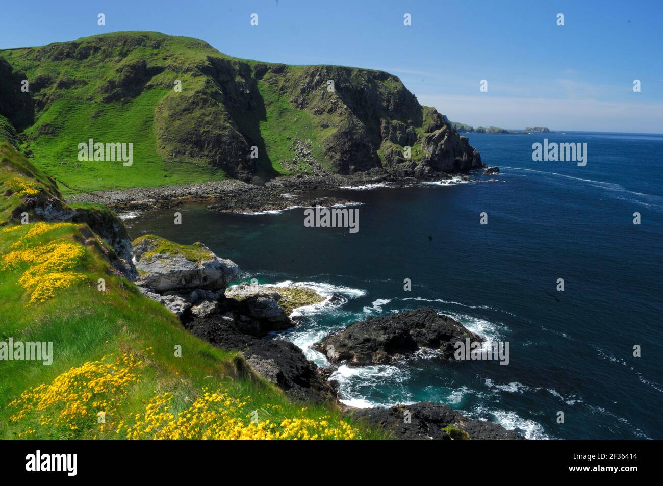 KÜSTENVORLAND von Kinbane Nordirland, Credit:Robert Thompson / Avalon Stockfotohttps://www.alamy.de/image-license-details/?v=1https://www.alamy.de/kustenvorland-von-kinbane-nordirland-creditrobert-thompson-avalon-image415027680.html
RM2F36414–KÜSTENVORLAND von Kinbane Nordirland, Credit:Robert Thompson / Avalon
 WINTERMOTTE Operophtera brumata Rehaghy Mountain, County Tyrone., Credit:Robert Thompson / Avalon Stockfotohttps://www.alamy.de/image-license-details/?v=1https://www.alamy.de/wintermotte-operophtera-brumata-rehaghy-mountain-county-tyrone-creditrobert-thompson-avalon-image415030758.html
RM2F367Y2–WINTERMOTTE Operophtera brumata Rehaghy Mountain, County Tyrone., Credit:Robert Thompson / Avalon
 Blick auf die Insel von Dun Bhaloir, Tory Island, County Donegal, Credit:Robert Thompson / Avalon Stockfotohttps://www.alamy.de/image-license-details/?v=1https://www.alamy.de/blick-auf-die-insel-von-dun-bhaloir-tory-island-county-donegal-creditrobert-thompson-avalon-image415019988.html
RM2F35P6C–Blick auf die Insel von Dun Bhaloir, Tory Island, County Donegal, Credit:Robert Thompson / Avalon
 ARCHER'S DART Agrotis vestigialis N. Ireland., Credit:Robert Thompson / Avalon Stockfotohttps://www.alamy.de/image-license-details/?v=1https://www.alamy.de/archers-dart-agrotis-vestigialis-n-ireland-creditrobert-thompson-avalon-image415027480.html
RM2F363P0–ARCHER'S DART Agrotis vestigialis N. Ireland., Credit:Robert Thompson / Avalon
 BRACKAGH MOOS NATURE RESERVE Portadown, Co. Armagh, Nordirland., Credit:Robert Thompson / Avalon Stockfotohttps://www.alamy.de/image-license-details/?v=1https://www.alamy.de/brackagh-moos-nature-reserve-portadown-co-armagh-nordirland-creditrobert-thompson-avalon-image415026822.html
RM2F362XE–BRACKAGH MOOS NATURE RESERVE Portadown, Co. Armagh, Nordirland., Credit:Robert Thompson / Avalon
 ANTRIM GLENS County Antrim, Nordirland., Quelle: Robert Thompson / Avalon Stockfotohttps://www.alamy.de/image-license-details/?v=1https://www.alamy.de/antrim-glens-county-antrim-nordirland-quelle-robert-thompson-avalon-image415027121.html
RM2F36395–ANTRIM GLENS County Antrim, Nordirland., Quelle: Robert Thompson / Avalon
 LANGOHRIGE OWL ASIO otus Action Lake, County Down, Credit:Robert Thompson / Avalon Stockfotohttps://www.alamy.de/image-license-details/?v=1https://www.alamy.de/langohrige-owl-asio-otus-action-lake-county-down-creditrobert-thompson-avalon-image415029839.html
RM2F366P7–LANGOHRIGE OWL ASIO otus Action Lake, County Down, Credit:Robert Thompson / Avalon
 GANNET thront auf Felsen Sula Bassana Saltee Islands, Co.Wexford, Irland, Credit: Robert Thompson / Avalon Stockfotohttps://www.alamy.de/image-license-details/?v=1https://www.alamy.de/gannet-thront-auf-felsen-sula-bassana-saltee-islands-cowexford-irland-credit-robert-thompson-avalon-image415020080.html
RM2F35P9M–GANNET thront auf Felsen Sula Bassana Saltee Islands, Co.Wexford, Irland, Credit: Robert Thompson / Avalon
 SILKMOTH Rothschildia erycina Südamerika, Credit:Robert Thompson / Avalon Stockfotohttps://www.alamy.de/image-license-details/?v=1https://www.alamy.de/silkmoth-rothschildia-erycina-sudamerika-creditrobert-thompson-avalon-image415027404.html
RM2F363K8–SILKMOTH Rothschildia erycina Südamerika, Credit:Robert Thompson / Avalon
 BLACKENING WAXCAP Hygrocybe nigrescens Peatlands, County Armagh., Credit:Robert Thompson / Avalon Stockfotohttps://www.alamy.de/image-license-details/?v=1https://www.alamy.de/blackening-waxcap-hygrocybe-nigrescens-peatlands-county-armagh-creditrobert-thompson-avalon-image415027744.html
RM2F3643C–BLACKENING WAXCAP Hygrocybe nigrescens Peatlands, County Armagh., Credit:Robert Thompson / Avalon
 FAHRGASTMOTTE Dysgonia algiraItalien, Credit:Robert Thompson / Avalon Stockfotohttps://www.alamy.de/image-license-details/?v=1https://www.alamy.de/fahrgastmotte-dysgonia-algiraitalien-creditrobert-thompson-avalon-image415027127.html
RM2F3639B–FAHRGASTMOTTE Dysgonia algiraItalien, Credit:Robert Thompson / Avalon
 FRÜHE MARSH ORCHIDEE Dactylorhiza incarnata coccinea Bull Island Natural Nature Reserve, Dublin. Pflanzen entlang der Wege und in Dünenschlacken., Credit:Robert Th Stockfotohttps://www.alamy.de/image-license-details/?v=1https://www.alamy.de/fruhe-marsh-orchidee-dactylorhiza-incarnata-coccinea-bull-island-natural-nature-reserve-dublin-pflanzen-entlang-der-wege-und-in-dunenschlacken-creditrobert-th-image415026925.html
RM2F36325–FRÜHE MARSH ORCHIDEE Dactylorhiza incarnata coccinea Bull Island Natural Nature Reserve, Dublin. Pflanzen entlang der Wege und in Dünenschlacken., Credit:Robert Th
 Port Challa, Tory Island, County Donegal, Quelle: Robert Thompson / Avalon Stockfotohttps://www.alamy.de/image-license-details/?v=1https://www.alamy.de/port-challa-tory-island-county-donegal-quelle-robert-thompson-avalon-image415020036.html
RM2F35P84–Port Challa, Tory Island, County Donegal, Quelle: Robert Thompson / Avalon
 Orchidee, Ophrys castellana, Cuenca, Spanien, Quelle:Robert Thompson / Avalon Stockfotohttps://www.alamy.de/image-license-details/?v=1https://www.alamy.de/orchidee-ophrys-castellana-cuenca-spanien-quellerobert-thompson-avalon-image415019032.html
RM2F35N08–Orchidee, Ophrys castellana, Cuenca, Spanien, Quelle:Robert Thompson / Avalon
 Sandmuster, Nordende von Tyrella Beach, Grafschaft Down, Credit:Robert Thompson / Avalon Stockfotohttps://www.alamy.de/image-license-details/?v=1https://www.alamy.de/sandmuster-nordende-von-tyrella-beach-grafschaft-down-creditrobert-thompson-avalon-image415019710.html
RM2F35NTE–Sandmuster, Nordende von Tyrella Beach, Grafschaft Down, Credit:Robert Thompson / Avalon
 GEBÄNDERTE AGRION DAMSELFLY oder GEBÄNDERTE DEMOISELLE auf Blatt Calopteryx splendens, Credit:Robert Thompson / Avalon Stockfotohttps://www.alamy.de/image-license-details/?v=1https://www.alamy.de/gebanderte-agrion-damselfly-oder-gebanderte-demoiselle-auf-blatt-calopteryx-splendens-creditrobert-thompson-avalon-image415022194.html
RM2F35W16–GEBÄNDERTE AGRION DAMSELFLY oder GEBÄNDERTE DEMOISELLE auf Blatt Calopteryx splendens, Credit:Robert Thompson / Avalon
 Kokoe Dart Frosch (Phyllobates aurotaenia) Costa Rica, Mittelamerika, Credit:Robert Thompson / Avalon Stockfotohttps://www.alamy.de/image-license-details/?v=1https://www.alamy.de/kokoe-dart-frosch-phyllobates-aurotaenia-costa-rica-mittelamerika-creditrobert-thompson-avalon-image415019889.html
RM2F35P2W–Kokoe Dart Frosch (Phyllobates aurotaenia) Costa Rica, Mittelamerika, Credit:Robert Thompson / Avalon
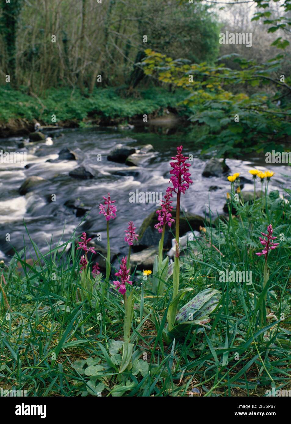 FRÜHE PURPURNE ORCHIDEE Orchis mascula Gruppe in der Blume durch Strom April Clare Glen, Clare, Südwest-Irland, Credit:Robert Thompson / Avalon Stockfotohttps://www.alamy.de/image-license-details/?v=1https://www.alamy.de/fruhe-purpurne-orchidee-orchis-mascula-gruppe-in-der-blume-durch-strom-april-clare-glen-clare-sudwest-irland-creditrobert-thompson-avalon-image415020123.html
RM2F35PB7–FRÜHE PURPURNE ORCHIDEE Orchis mascula Gruppe in der Blume durch Strom April Clare Glen, Clare, Südwest-Irland, Credit:Robert Thompson / Avalon
 GELBE oder GEMEINE MORREL Morchella esculenta var vulgaris Glenarm Nature Reserve, (UWT) Lower Deer Park. County Antrim, Credit:Robert Thompson / Avalon Stockfotohttps://www.alamy.de/image-license-details/?v=1https://www.alamy.de/gelbe-oder-gemeine-morrel-morchella-esculenta-var-vulgaris-glenarm-nature-reserve-uwt-lower-deer-park-county-antrim-creditrobert-thompson-avalon-image415029344.html
RM2F3664G–GELBE oder GEMEINE MORREL Morchella esculenta var vulgaris Glenarm Nature Reserve, (UWT) Lower Deer Park. County Antrim, Credit:Robert Thompson / Avalon
 HAIRY DRAGONFLY Sequence 2/7 Brachytron pratense adult Emerging from Nymph. Montiaghs Bog, Lough Neagh, Antrim, Ulster, Credit:Robert Thompson / Aval Stockfotohttps://www.alamy.de/image-license-details/?v=1https://www.alamy.de/hairy-dragonfly-sequence-27-brachytron-pratense-adult-emerging-from-nymph-montiaghs-bog-lough-neagh-antrim-ulster-creditrobert-thompson-aval-image415020143.html
RM2F35PBY–HAIRY DRAGONFLY Sequence 2/7 Brachytron pratense adult Emerging from Nymph. Montiaghs Bog, Lough Neagh, Antrim, Ulster, Credit:Robert Thompson / Aval