Stockfotos & Bilder
(1,797)Stockfotos & Bilder
 Methow Valley Wildblumen, Balsamwurzel (Balsamorhiza Deltoidea), North-Cascades-Washington Stockfotohttps://www.alamy.de/image-license-details/?v=1https://www.alamy.de/stockfoto-methow-valley-wildblumen-balsamwurzel-balsamorhiza-deltoidea-north-cascades-washington-84987439.html
RFEX7E9K–Methow Valley Wildblumen, Balsamwurzel (Balsamorhiza Deltoidea), North-Cascades-Washington
 Mount Shuksan von Baker Lake, North Cascades Washington gesehen Stockfotohttps://www.alamy.de/image-license-details/?v=1https://www.alamy.de/stockfoto-mount-shuksan-von-baker-lake-north-cascades-washington-gesehen-84839381.html
RFEX0NDW–Mount Shuksan von Baker Lake, North Cascades Washington gesehen
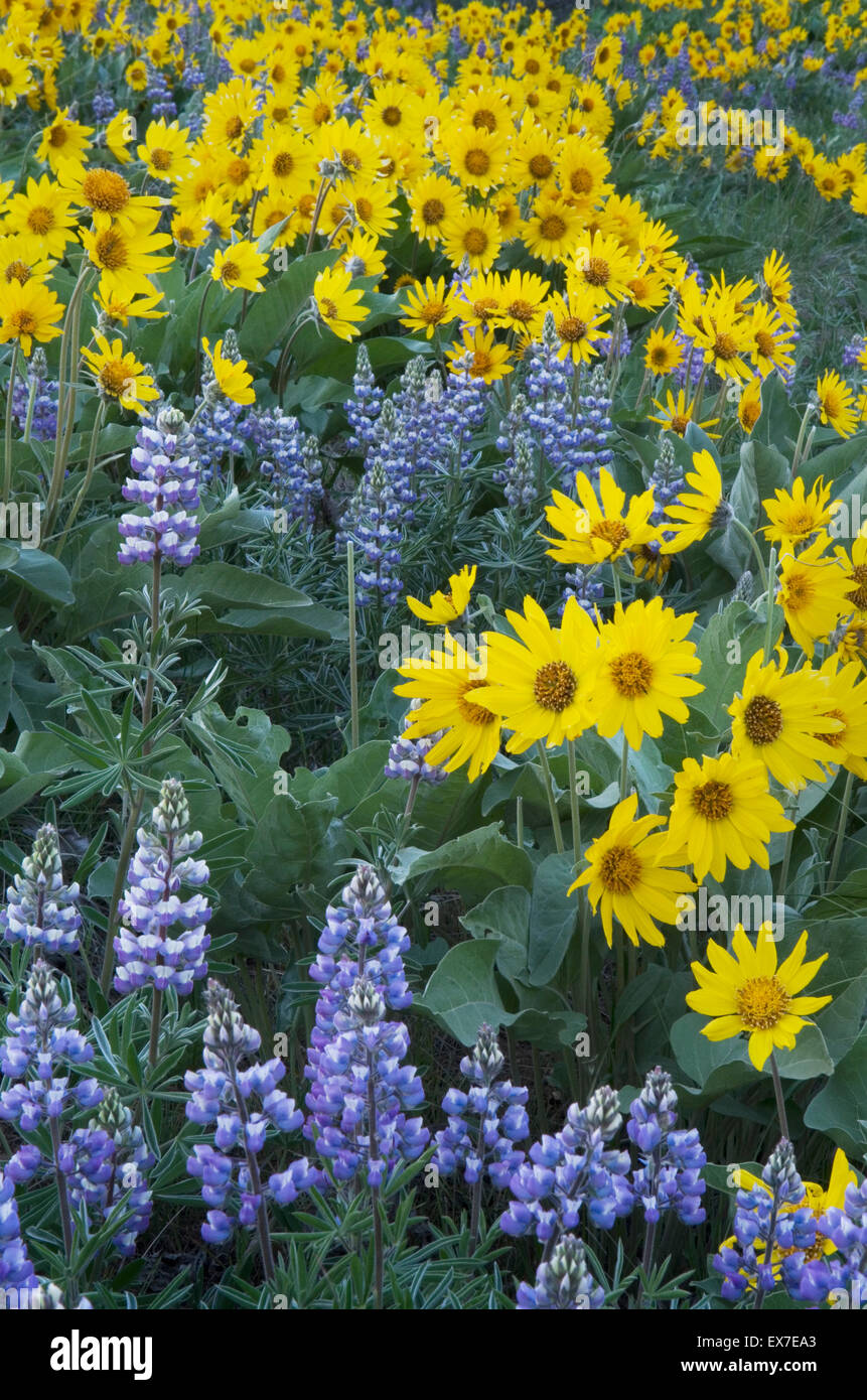 Methow Valley Wildblumen, Balsamwurzel (Balsamorhiza Deltoidea) und Lupinen (Lupinus Latifolius X sericeus var. Latifolius), Nort Stockfotohttps://www.alamy.de/image-license-details/?v=1https://www.alamy.de/stockfoto-methow-valley-wildblumen-balsamwurzel-balsamorhiza-deltoidea-und-lupinen-lupinus-latifolius-x-sericeus-var-latifolius-nort-84987451.html
RFEX7EA3–Methow Valley Wildblumen, Balsamwurzel (Balsamorhiza Deltoidea) und Lupinen (Lupinus Latifolius X sericeus var. Latifolius), Nort
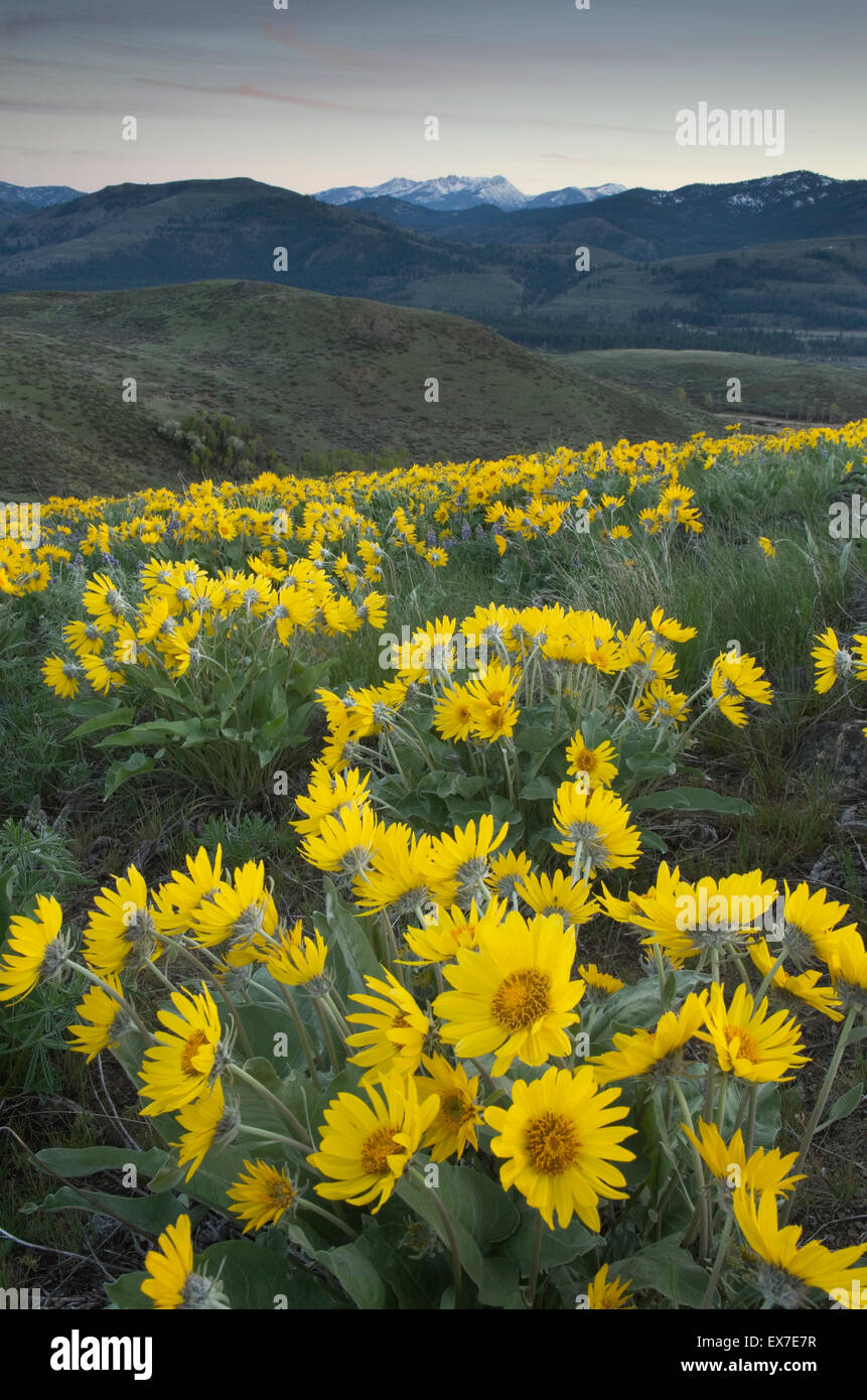 Methow Valley Wildblumen, Balsamwurzel (Balsamorhiza Deltoidea), North-Cascades-Washington Stockfotohttps://www.alamy.de/image-license-details/?v=1https://www.alamy.de/stockfoto-methow-valley-wildblumen-balsamwurzel-balsamorhiza-deltoidea-north-cascades-washington-84987387.html
RFEX7E7R–Methow Valley Wildblumen, Balsamwurzel (Balsamorhiza Deltoidea), North-Cascades-Washington
 Sun Lakes-Dry Falls State Park, Columbia Plateau Washington Stockfotohttps://www.alamy.de/image-license-details/?v=1https://www.alamy.de/stockfoto-sun-lakes-dry-falls-state-park-columbia-plateau-washington-84987174.html
RFEX7E06–Sun Lakes-Dry Falls State Park, Columbia Plateau Washington
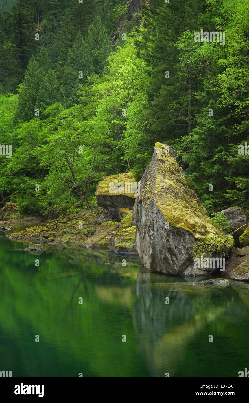 Skagit River Gorge, Ross Lake National Recreation Area, North-Cascades-Washington Stockfotohttps://www.alamy.de/image-license-details/?v=1https://www.alamy.de/stockfoto-skagit-river-gorge-ross-lake-national-recreation-area-north-cascades-washington-84987463.html
RFEX7EAF–Skagit River Gorge, Ross Lake National Recreation Area, North-Cascades-Washington
 Bauernhöfe, eingebettet in den sanften Hügeln des grünen Weizen-Felder in der Palouse Region Inland Empire of Washington Stockfotohttps://www.alamy.de/image-license-details/?v=1https://www.alamy.de/stockfoto-bauernhofe-eingebettet-in-den-sanften-hugeln-des-grunen-weizen-felder-in-der-palouse-region-inland-empire-of-washington-85247743.html
RFEXKAA7–Bauernhöfe, eingebettet in den sanften Hügeln des grünen Weizen-Felder in der Palouse Region Inland Empire of Washington
 Gewitterwolken deaktivieren im Abend über eine Wiese in der Palouse Region Inland Empire of Washington Stockfotohttps://www.alamy.de/image-license-details/?v=1https://www.alamy.de/stockfoto-gewitterwolken-deaktivieren-im-abend-uber-eine-wiese-in-der-palouse-region-inland-empire-of-washington-85247750.html
RFEXKAAE–Gewitterwolken deaktivieren im Abend über eine Wiese in der Palouse Region Inland Empire of Washington
 Klassische Ansicht der zerklüfteten Küste Landzungen von Big Sur, Kalifornien Stockfotohttps://www.alamy.de/image-license-details/?v=1https://www.alamy.de/stockfoto-klassische-ansicht-der-zerklufteten-kuste-landzungen-von-big-sur-kalifornien-84839363.html
RFEX0ND7–Klassische Ansicht der zerklüfteten Küste Landzungen von Big Sur, Kalifornien
 Bauernhof inmitten der sanften Hügel der grüne Weizenfelder in der Palouse Region Inland Empire of Washington Stockfotohttps://www.alamy.de/image-license-details/?v=1https://www.alamy.de/stockfoto-bauernhof-inmitten-der-sanften-hugel-der-grune-weizenfelder-in-der-palouse-region-inland-empire-of-washington-85247754.html
RFEXKAAJ–Bauernhof inmitten der sanften Hügel der grüne Weizenfelder in der Palouse Region Inland Empire of Washington
 Geschwollene weiße Wolken über grüne Weizenfelder der Palouse Region Inland Empire of Washington Stockfotohttps://www.alamy.de/image-license-details/?v=1https://www.alamy.de/stockfoto-geschwollene-weisse-wolken-uber-grune-weizenfelder-der-palouse-region-inland-empire-of-washington-85247723.html
RFEXKA9F–Geschwollene weiße Wolken über grüne Weizenfelder der Palouse Region Inland Empire of Washington
 Wagen und Gebäuden, historischen Geist Stadt Bannack Staatspark Montana Stockfotohttps://www.alamy.de/image-license-details/?v=1https://www.alamy.de/stockfoto-wagen-und-gebauden-historischen-geist-stadt-bannack-staatspark-montana-85470630.html
RFEY1EJE–Wagen und Gebäuden, historischen Geist Stadt Bannack Staatspark Montana
 Bergbau-Ausrüstung von Historic Bannack State Park Montana Stockfotohttps://www.alamy.de/image-license-details/?v=1https://www.alamy.de/stockfoto-bergbau-ausrustung-von-historic-bannack-state-park-montana-85470662.html
RFEY1EKJ–Bergbau-Ausrüstung von Historic Bannack State Park Montana
 Sanften Hügeln der grüne Weizenfelder von Steptoe Butte, der Palouse Region Inland Empire of Washington gesehen Stockfotohttps://www.alamy.de/image-license-details/?v=1https://www.alamy.de/stockfoto-sanften-hugeln-der-grune-weizenfelder-von-steptoe-butte-der-palouse-region-inland-empire-of-washington-gesehen-85071814.html
RFEXB9Y2–Sanften Hügeln der grüne Weizenfelder von Steptoe Butte, der Palouse Region Inland Empire of Washington gesehen
 Sanfte Hügel des grünen Weizen-Felder in der Palouse Region Inland Empire of Washington Stockfotohttps://www.alamy.de/image-license-details/?v=1https://www.alamy.de/stockfoto-sanfte-hugel-des-grunen-weizen-felder-in-der-palouse-region-inland-empire-of-washington-85071822.html
RFEXB9YA–Sanfte Hügel des grünen Weizen-Felder in der Palouse Region Inland Empire of Washington
 Sanfte Hügel des grünen Weizen-Felder in der Palouse Region Inland Empire of Washington Stockfotohttps://www.alamy.de/image-license-details/?v=1https://www.alamy.de/stockfoto-sanfte-hugel-des-grunen-weizen-felder-in-der-palouse-region-inland-empire-of-washington-85071836.html
RFEXB9YT–Sanfte Hügel des grünen Weizen-Felder in der Palouse Region Inland Empire of Washington
 Sanften Hügeln der grüne Weizenfelder von Steptoe Butte, der Palouse Region Inland Empire of Washington gesehen Stockfotohttps://www.alamy.de/image-license-details/?v=1https://www.alamy.de/stockfoto-sanften-hugeln-der-grune-weizenfelder-von-steptoe-butte-der-palouse-region-inland-empire-of-washington-gesehen-85071808.html
RFEXB9XT–Sanften Hügeln der grüne Weizenfelder von Steptoe Butte, der Palouse Region Inland Empire of Washington gesehen
 Sanfte Hügel des grünen Weizen-Felder in der Palouse Region Inland Empire of Washington Stockfotohttps://www.alamy.de/image-license-details/?v=1https://www.alamy.de/stockfoto-sanfte-hugel-des-grunen-weizen-felder-in-der-palouse-region-inland-empire-of-washington-85071830.html
RFEXB9YJ–Sanfte Hügel des grünen Weizen-Felder in der Palouse Region Inland Empire of Washington
 Bergbau-Ausrüstung von Historic Bannack State Park Montana Stockfotohttps://www.alamy.de/image-license-details/?v=1https://www.alamy.de/stockfoto-bergbau-ausrustung-von-historic-bannack-state-park-montana-85470651.html
RFEY1EK7–Bergbau-Ausrüstung von Historic Bannack State Park Montana
 Sanfte Hügel des grünen Weizen-Felder in der Palouse Region Inland Empire of Washington Stockfotohttps://www.alamy.de/image-license-details/?v=1https://www.alamy.de/stockfoto-sanfte-hugel-des-grunen-weizen-felder-in-der-palouse-region-inland-empire-of-washington-84987167.html
RFEX7DYY–Sanfte Hügel des grünen Weizen-Felder in der Palouse Region Inland Empire of Washington
 Klassische Ansicht der zerklüfteten Küste Landzungen von Big Sur und die Bixby Bridge, Kalifornien Stockfotohttps://www.alamy.de/image-license-details/?v=1https://www.alamy.de/stockfoto-klassische-ansicht-der-zerklufteten-kuste-landzungen-von-big-sur-und-die-bixby-bridge-kalifornien-73239754.html
RFE74A1E–Klassische Ansicht der zerklüfteten Küste Landzungen von Big Sur und die Bixby Bridge, Kalifornien
 Roten Kanus auf Dock, Lake Louise, Banff Nationalpark Stockfotohttps://www.alamy.de/image-license-details/?v=1https://www.alamy.de/stockfoto-roten-kanus-auf-dock-lake-louise-banff-nationalpark-108431294.html
RFG8BD66–Roten Kanus auf Dock, Lake Louise, Banff Nationalpark
 Sonnenaufgang am Cirque der Türme von einsamen See, Popo Agie Wildnis, Wind River Range Wyoming Stockfotohttps://www.alamy.de/image-license-details/?v=1https://www.alamy.de/stockfoto-sonnenaufgang-am-cirque-der-turme-von-einsamen-see-popo-agie-wildnis-wind-river-range-wyoming-54283966.html
RFD48RN2–Sonnenaufgang am Cirque der Türme von einsamen See, Popo Agie Wildnis, Wind River Range Wyoming
 Bunte Winter Sonnenuntergang über Marriott Becken, Coast Mountains in British Columbia Kanada Stockfotohttps://www.alamy.de/image-license-details/?v=1https://www.alamy.de/stockfoto-bunte-winter-sonnenuntergang-uber-marriott-becken-coast-mountains-in-british-columbia-kanada-73334819.html
RFE78K8K–Bunte Winter Sonnenuntergang über Marriott Becken, Coast Mountains in British Columbia Kanada
 Südlichen Schwester und nahen Green Lake, drei Schwestern Wildnis, Oregon Stockfotohttps://www.alamy.de/image-license-details/?v=1https://www.alamy.de/stockfoto-sudlichen-schwester-und-nahen-green-lake-drei-schwestern-wildnis-oregon-51325240.html
RFCYE1T8–Südlichen Schwester und nahen Green Lake, drei Schwestern Wildnis, Oregon
 Balsamwurzel (Balsamorhiza Deltoidea) und Lupinen (Lupinus Latifolius X sericeus var. Latifolius), Columbia River Gorge Stockfotohttps://www.alamy.de/image-license-details/?v=1https://www.alamy.de/stockfoto-balsamwurzel-balsamorhiza-deltoidea-und-lupinen-lupinus-latifolius-x-sericeus-var-latifolius-columbia-river-gorge-51158868.html
RFCY6DJC–Balsamwurzel (Balsamorhiza Deltoidea) und Lupinen (Lupinus Latifolius X sericeus var. Latifolius), Columbia River Gorge
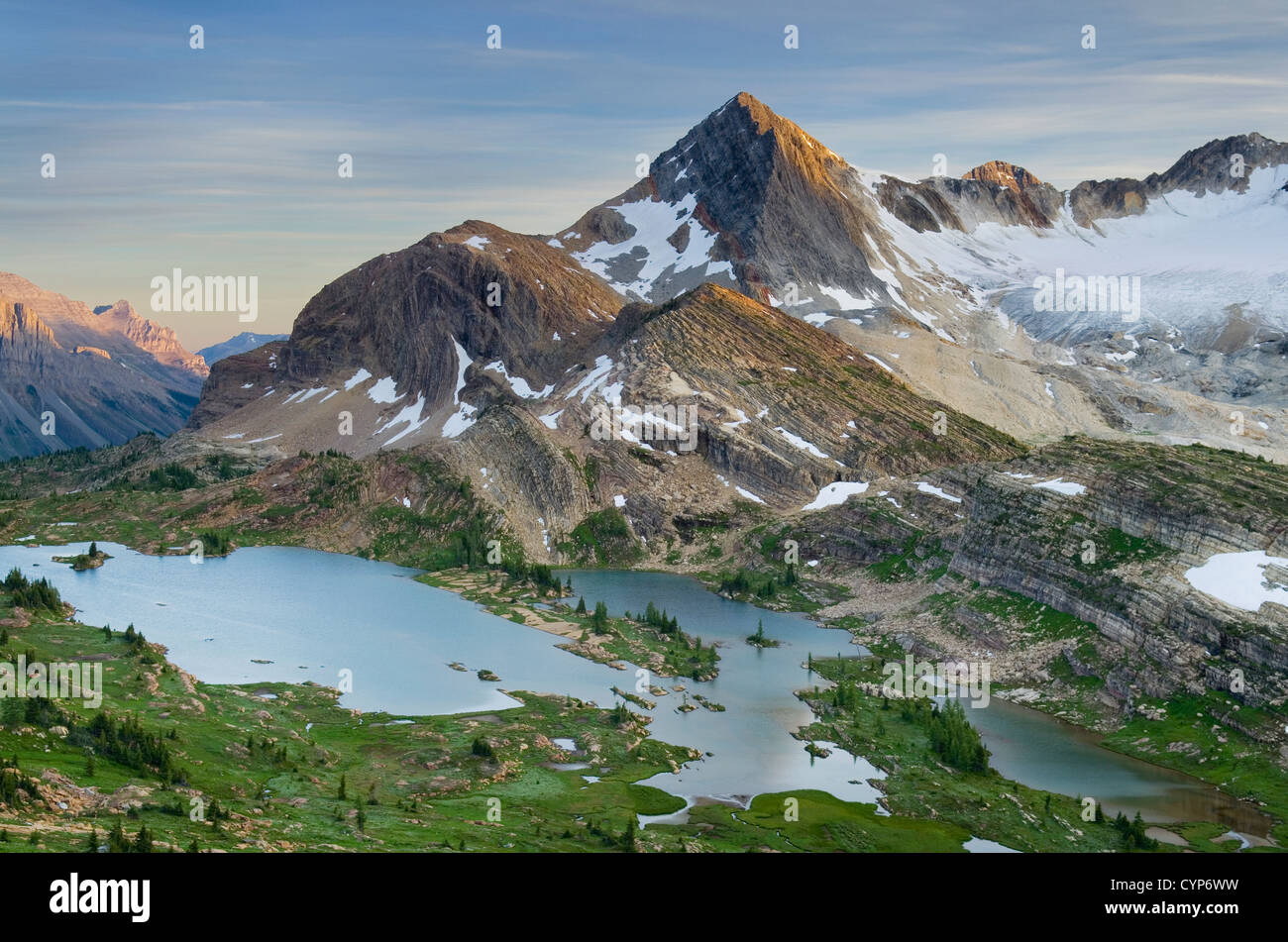 Eveing Licht über Russell Peak und Kalkstein Seen Becken, Höhe der Rockies Provincial Park-British Columbia-Kanada Stockfotohttps://www.alamy.de/image-license-details/?v=1https://www.alamy.de/stockfoto-eveing-licht-uber-russell-peak-und-kalkstein-seen-becken-hohe-der-rockies-provincial-park-british-columbia-kanada-51504821.html
RFCYP6WW–Eveing Licht über Russell Peak und Kalkstein Seen Becken, Höhe der Rockies Provincial Park-British Columbia-Kanada
 Klassische rote Scheune im Wallowa Valley des nordöstlichen Oregon Stockfotohttps://www.alamy.de/image-license-details/?v=1https://www.alamy.de/stockfoto-klassische-rote-scheune-im-wallowa-valley-des-nordostlichen-oregon-51699376.html
RFD03328–Klassische rote Scheune im Wallowa Valley des nordöstlichen Oregon
 Üppige Frühling Laub entlang der North Fork Smith River Oregon Stockfotohttps://www.alamy.de/image-license-details/?v=1https://www.alamy.de/stockfoto-uppige-fruhling-laub-entlang-der-north-fork-smith-river-oregon-51505130.html
RFCYP78X–Üppige Frühling Laub entlang der North Fork Smith River Oregon
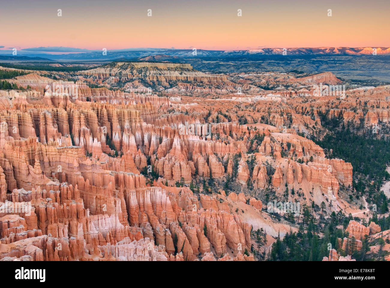 Alpenglühen über Bryce Canyon von Bryce Point, Utah Bryce-Canyon-Nationalpark Stockfotohttps://www.alamy.de/image-license-details/?v=1https://www.alamy.de/stockfoto-alpengluhen-uber-bryce-canyon-von-bryce-point-utah-bryce-canyon-nationalpark-73334824.html
RFE78K8T–Alpenglühen über Bryce Canyon von Bryce Point, Utah Bryce-Canyon-Nationalpark
 Große Haufen von Hummer Bojen Bristol Maine USA Stockfotohttps://www.alamy.de/image-license-details/?v=1https://www.alamy.de/stockfoto-grosse-haufen-von-hummer-bojen-bristol-maine-usa-25381099.html
RFBD85RR–Große Haufen von Hummer Bojen Bristol Maine USA
 Pemaquid Point Lighthouse, Bristol Maine USA Stockfotohttps://www.alamy.de/image-license-details/?v=1https://www.alamy.de/stockfoto-pemaquid-point-lighthouse-bristol-maine-usa-35879846.html
RFC2AD32–Pemaquid Point Lighthouse, Bristol Maine USA
 Berg Hemlocktannen (Tsuga Mertensiana) Enscrusted in Schnee und Eis auf Kulshan Ridge, Heather Wiesen Recreation Area North Cascade Stockfotohttps://www.alamy.de/image-license-details/?v=1https://www.alamy.de/stockfoto-berg-hemlocktannen-tsuga-mertensiana-enscrusted-in-schnee-und-eis-auf-kulshan-ridge-heather-wiesen-recreation-area-north-cascade-35879669.html
RFC2ACTN–Berg Hemlocktannen (Tsuga Mertensiana) Enscrusted in Schnee und Eis auf Kulshan Ridge, Heather Wiesen Recreation Area North Cascade
 Winter auf Kulshan Ridge Heather Wiesen Recreation Area North Kaskaden Washington USA Stockfotohttps://www.alamy.de/image-license-details/?v=1https://www.alamy.de/stockfoto-winter-auf-kulshan-ridge-heather-wiesen-recreation-area-north-kaskaden-washington-usa-35797112.html
RFC26KG8–Winter auf Kulshan Ridge Heather Wiesen Recreation Area North Kaskaden Washington USA
 Abendlicht am Sandstein-Formationen der Larrabee State Park Washington. In der Ferne sind die San Juan Islands. Stockfotohttps://www.alamy.de/image-license-details/?v=1https://www.alamy.de/stockfoto-abendlicht-am-sandstein-formationen-der-larrabee-state-park-washington-in-der-ferne-sind-die-san-juan-islands-35859938.html
RFC29FM2–Abendlicht am Sandstein-Formationen der Larrabee State Park Washington. In der Ferne sind die San Juan Islands.
 Schneebedeckte Scheunen in den oberen Methow Valley-Washington-USA Stockfotohttps://www.alamy.de/image-license-details/?v=1https://www.alamy.de/stockfoto-schneebedeckte-scheunen-in-den-oberen-methow-valley-washington-usa-35914471.html
RFC2C17K–Schneebedeckte Scheunen in den oberen Methow Valley-Washington-USA
 Schneebedeckte Scheunen in den oberen Methow Valley-Washington-USA Stockfotohttps://www.alamy.de/image-license-details/?v=1https://www.alamy.de/stockfoto-schneebedeckte-scheunen-in-den-oberen-methow-valley-washington-usa-35914363.html
RFC2C13R–Schneebedeckte Scheunen in den oberen Methow Valley-Washington-USA
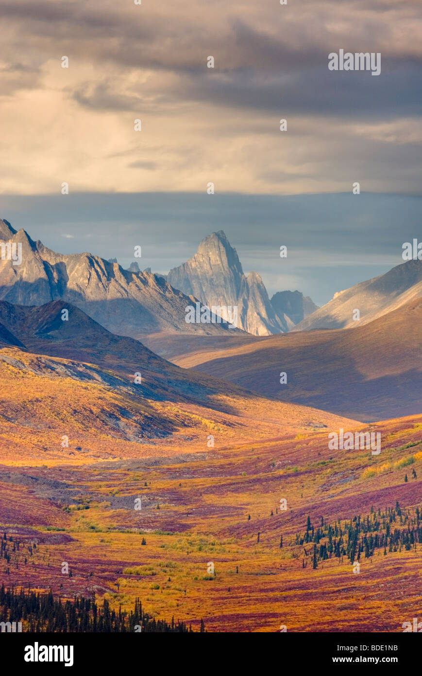 Norden Klondike River Valley mit lebendigen Farben von Herbstlaub, Tombstone Territorial Park Yukon Kanada Stockfotohttps://www.alamy.de/image-license-details/?v=1https://www.alamy.de/stockfoto-norden-klondike-river-valley-mit-lebendigen-farben-von-herbstlaub-tombstone-territorial-park-yukon-kanada-25509607.html
RFBDE1NB–Norden Klondike River Valley mit lebendigen Farben von Herbstlaub, Tombstone Territorial Park Yukon Kanada
 Norden Klondike River Valley mit lebendigen Farben von Herbstlaub, Tombstone Territorial Park Yukon Kanada Stockfotohttps://www.alamy.de/image-license-details/?v=1https://www.alamy.de/stockfoto-norden-klondike-river-valley-mit-lebendigen-farben-von-herbstlaub-tombstone-territorial-park-yukon-kanada-25509623.html
RFBDE1NY–Norden Klondike River Valley mit lebendigen Farben von Herbstlaub, Tombstone Territorial Park Yukon Kanada
 Bove-Insel in Taglish Lake, Yukon Kanada Stockfotohttps://www.alamy.de/image-license-details/?v=1https://www.alamy.de/stockfoto-bove-insel-in-taglish-lake-yukon-kanada-25931210.html
RFBE57EJ–Bove-Insel in Taglish Lake, Yukon Kanada
 Wolken und Berge spiegeln sich in kleinen Tundra-See der Ogilvie Mountains, Tombstone Territorial Park Yukon Kanada Stockfotohttps://www.alamy.de/image-license-details/?v=1https://www.alamy.de/stockfoto-wolken-und-berge-spiegeln-sich-in-kleinen-tundra-see-der-ogilvie-mountains-tombstone-territorial-park-yukon-kanada-25935862.html
RFBE5DCP–Wolken und Berge spiegeln sich in kleinen Tundra-See der Ogilvie Mountains, Tombstone Territorial Park Yukon Kanada
 Wolken und Berge spiegeln sich in kleinen Tundra-See der Ogilvie Mountains, Tombstone Territorial Park Yukon Kanada Stockfotohttps://www.alamy.de/image-license-details/?v=1https://www.alamy.de/stockfoto-wolken-und-berge-spiegeln-sich-in-kleinen-tundra-see-der-ogilvie-mountains-tombstone-territorial-park-yukon-kanada-25929045.html
RFBE54N9–Wolken und Berge spiegeln sich in kleinen Tundra-See der Ogilvie Mountains, Tombstone Territorial Park Yukon Kanada
 Wolken und Berge spiegeln sich in kleinen Tundra-See der Ogilvie Mountains, Tombstone Territorial Park Yukon Kanada Stockfotohttps://www.alamy.de/image-license-details/?v=1https://www.alamy.de/stockfoto-wolken-und-berge-spiegeln-sich-in-kleinen-tundra-see-der-ogilvie-mountains-tombstone-territorial-park-yukon-kanada-25935744.html
RFBE5D8G–Wolken und Berge spiegeln sich in kleinen Tundra-See der Ogilvie Mountains, Tombstone Territorial Park Yukon Kanada
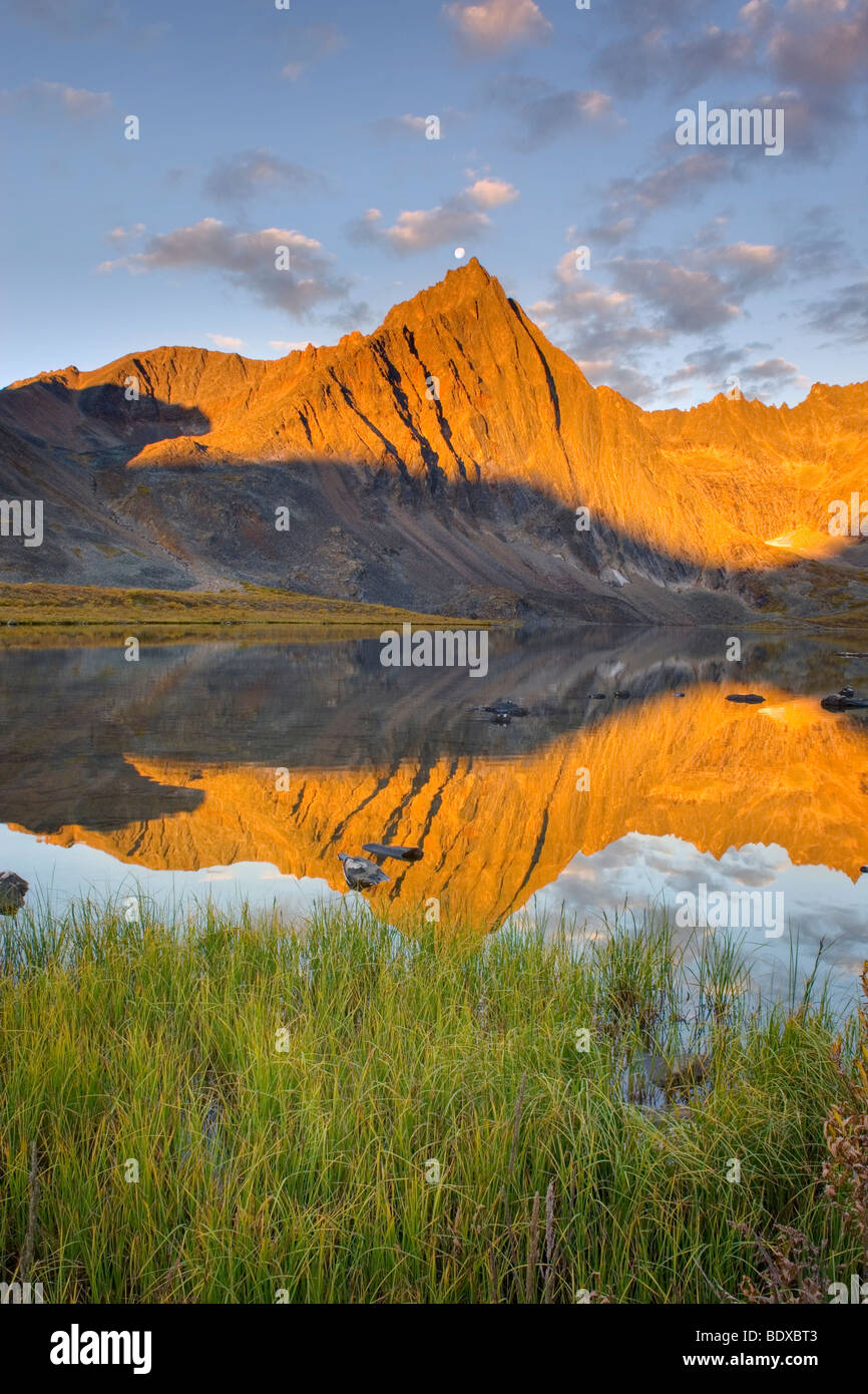 Gipfel der Grabstein spiegelt sich in Grizzly Lake, Tombstone territorial Park Yukon Kanada Stockfotohttps://www.alamy.de/image-license-details/?v=1https://www.alamy.de/stockfoto-gipfel-der-grabstein-spiegelt-sich-in-grizzly-lake-tombstone-territorial-park-yukon-kanada-25780947.html
RFBDXBT3–Gipfel der Grabstein spiegelt sich in Grizzly Lake, Tombstone territorial Park Yukon Kanada
 Rucksacktouristen durchqueren Bergrücken oberhalb Grizzly Creek Valley, Tombstone Territorial Park Yukon Kanada Stockfotohttps://www.alamy.de/image-license-details/?v=1https://www.alamy.de/stockfoto-rucksacktouristen-durchqueren-bergrucken-oberhalb-grizzly-creek-valley-tombstone-territorial-park-yukon-kanada-26670028.html
RFBFAWW0–Rucksacktouristen durchqueren Bergrücken oberhalb Grizzly Creek Valley, Tombstone Territorial Park Yukon Kanada
 Tundra des Grizzly Creek Valley anzeigen lebendigen Herbstfarben, Tombstone Territorial Park Yukon Kanada Stockfotohttps://www.alamy.de/image-license-details/?v=1https://www.alamy.de/stockfoto-tundra-des-grizzly-creek-valley-anzeigen-lebendigen-herbstfarben-tombstone-territorial-park-yukon-kanada-26670475.html
RFBFAXCY–Tundra des Grizzly Creek Valley anzeigen lebendigen Herbstfarben, Tombstone Territorial Park Yukon Kanada
 Gipfel der Grabstein aus Glissade Pass Tombstone Territorial Park Yukon Kanada Stockfotohttps://www.alamy.de/image-license-details/?v=1https://www.alamy.de/stockfoto-gipfel-der-grabstein-aus-glissade-pass-tombstone-territorial-park-yukon-kanada-24728432.html
RFBC6DA8–Gipfel der Grabstein aus Glissade Pass Tombstone Territorial Park Yukon Kanada
 Gipfel der Grabstein von Glissade Pass, Tombstone Territorial Park Yukon Kanada Stockfotohttps://www.alamy.de/image-license-details/?v=1https://www.alamy.de/stockfoto-gipfel-der-grabstein-von-glissade-pass-tombstone-territorial-park-yukon-kanada-26669646.html
RFBFAWBA–Gipfel der Grabstein von Glissade Pass, Tombstone Territorial Park Yukon Kanada
 Backcountry-Camp am Grizzly Lake Tombstone Territorial Park Yukon Kanada Stockfotohttps://www.alamy.de/image-license-details/?v=1https://www.alamy.de/stockfoto-backcountry-camp-am-grizzly-lake-tombstone-territorial-park-yukon-kanada-25479874.html
RFBDCKRE–Backcountry-Camp am Grizzly Lake Tombstone Territorial Park Yukon Kanada
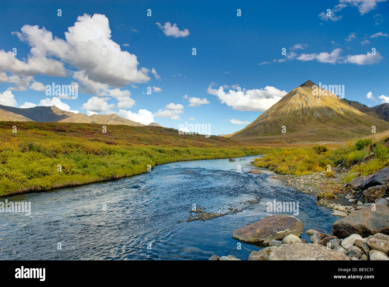 Blackstone River Tombstone Territorial Park Yukon Kanada Stockfotohttps://www.alamy.de/image-license-details/?v=1https://www.alamy.de/stockfoto-blackstone-river-tombstone-territorial-park-yukon-kanada-25934805.html
RFBE5C31–Blackstone River Tombstone Territorial Park Yukon Kanada
 Blackstone River Tombstone Territorial Park Yukon Kanada Stockfotohttps://www.alamy.de/image-license-details/?v=1https://www.alamy.de/stockfoto-blackstone-river-tombstone-territorial-park-yukon-kanada-25928444.html
RFBE53YT–Blackstone River Tombstone Territorial Park Yukon Kanada
 Tundra, die Anzeige seiner Herbstfarben Ogilvie Mountains Tombstone Territorial Park Yukon Kanada Stockfotohttps://www.alamy.de/image-license-details/?v=1https://www.alamy.de/stockfoto-tundra-die-anzeige-seiner-herbstfarben-ogilvie-mountains-tombstone-territorial-park-yukon-kanada-26672147.html
RFBFB0GK–Tundra, die Anzeige seiner Herbstfarben Ogilvie Mountains Tombstone Territorial Park Yukon Kanada
 Aussicht vom Top Of The World Highway Yukon Kanada Stockfotohttps://www.alamy.de/image-license-details/?v=1https://www.alamy.de/stockfoto-aussicht-vom-top-of-the-world-highway-yukon-kanada-24675857.html
RFBC428H–Aussicht vom Top Of The World Highway Yukon Kanada
 Alaska-Erdöl-Pipeline durch die zentralen Alaska Range Stockfotohttps://www.alamy.de/image-license-details/?v=1https://www.alamy.de/stockfoto-alaska-erdol-pipeline-durch-die-zentralen-alaska-range-24675609.html
RFBC41YN–Alaska-Erdöl-Pipeline durch die zentralen Alaska Range
 Talkeetna Berge im See entlang der Denali Highway Alaska widerspiegelt Stockfotohttps://www.alamy.de/image-license-details/?v=1https://www.alamy.de/stockfoto-talkeetna-berge-im-see-entlang-der-denali-highway-alaska-widerspiegelt-24675258.html
RFBC41F6–Talkeetna Berge im See entlang der Denali Highway Alaska widerspiegelt
 Zwerg-Birke Betula Nana Blätter Stockfotohttps://www.alamy.de/image-license-details/?v=1https://www.alamy.de/stockfoto-zwerg-birke-betula-nana-blatter-24675984.html
RFBC42D4–Zwerg-Birke Betula Nana Blätter
 Denali Mount McKinley 6 193 6 m 20 320 ft vom Backcountry Camp auf Kesugi Ridge Denali State Park Alaska Stockfotohttps://www.alamy.de/image-license-details/?v=1https://www.alamy.de/stockfoto-denali-mount-mckinley-6-193-6-m-20-320-ft-vom-backcountry-camp-auf-kesugi-ridge-denali-state-park-alaska-24674594.html
RFBC40KE–Denali Mount McKinley 6 193 6 m 20 320 ft vom Backcountry Camp auf Kesugi Ridge Denali State Park Alaska
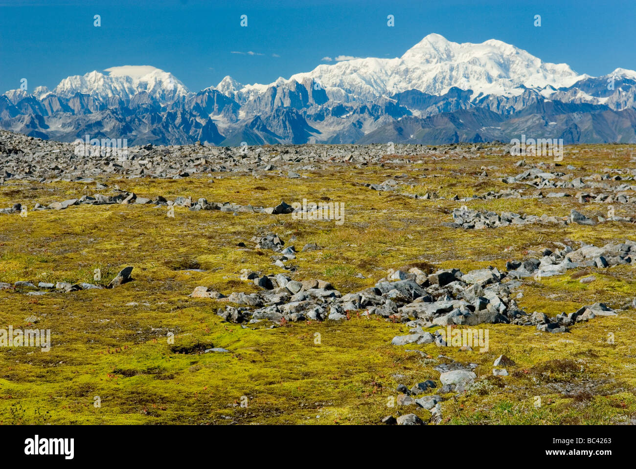 Alaska Range von Kesugi Ridge Denali State Park Alaska Stockfotohttps://www.alamy.de/image-license-details/?v=1https://www.alamy.de/stockfoto-alaska-range-von-kesugi-ridge-denali-state-park-alaska-24675787.html
RFBC4263–Alaska Range von Kesugi Ridge Denali State Park Alaska
 Blick von Kesugi Ridge, Denali State Park Alaska Stockfotohttps://www.alamy.de/image-license-details/?v=1https://www.alamy.de/stockfoto-blick-von-kesugi-ridge-denali-state-park-alaska-25807958.html
RFBDYJ8P–Blick von Kesugi Ridge, Denali State Park Alaska
 Kleiner See am Kesugi Ridge Denali State Park Alaska Stockfotohttps://www.alamy.de/image-license-details/?v=1https://www.alamy.de/stockfoto-kleiner-see-am-kesugi-ridge-denali-state-park-alaska-24675663.html
RFBC421K–Kleiner See am Kesugi Ridge Denali State Park Alaska
 Bunchberry Cornus canadensis Stockfotohttps://www.alamy.de/image-license-details/?v=1https://www.alamy.de/stockfoto-bunchberry-cornus-canadensis-24667602.html
RFBC3KNP–Bunchberry Cornus canadensis
 Iglu-Dorf-Tankstelle-Alaska Stockfotohttps://www.alamy.de/image-license-details/?v=1https://www.alamy.de/stockfoto-iglu-dorf-tankstelle-alaska-24667688.html
RFBC3KTT–Iglu-Dorf-Tankstelle-Alaska
 Denali Mount McKinley 6 193 6 m 20 320 ft Stockfotohttps://www.alamy.de/image-license-details/?v=1https://www.alamy.de/stockfoto-denali-mount-mckinley-6-193-6-m-20-320-ft-24667529.html
RFBC3KK5–Denali Mount McKinley 6 193 6 m 20 320 ft
 Gemeinsamen Bärentraube oder Kinnikinnick Arctostaphylos Uva ursi Stockfotohttps://www.alamy.de/image-license-details/?v=1https://www.alamy.de/stockfoto-gemeinsamen-barentraube-oder-kinnikinnick-arctostaphylos-uva-ursi-24667356.html
RFBC3KD0–Gemeinsamen Bärentraube oder Kinnikinnick Arctostaphylos Uva ursi
 Mount Sanford 16 237 ft 4 949 m Wrangell St. Elias Nationalpark Alaska Stockfotohttps://www.alamy.de/image-license-details/?v=1https://www.alamy.de/stockfoto-mount-sanford-16-237-ft-4-949-m-wrangell-st-elias-nationalpark-alaska-24667334.html
RFBC3KC6–Mount Sanford 16 237 ft 4 949 m Wrangell St. Elias Nationalpark Alaska
 Warnschild am Ende der McCarthy-Straße Wrangell-St.-Elias-Nationalpark-Alaska zu tragen Stockfotohttps://www.alamy.de/image-license-details/?v=1https://www.alamy.de/stockfoto-warnschild-am-ende-der-mccarthy-strasse-wrangell-st-elias-nationalpark-alaska-zu-tragen-24667165.html
RFBC3K65–Warnschild am Ende der McCarthy-Straße Wrangell-St.-Elias-Nationalpark-Alaska zu tragen
 Luftaufnahme des Bereichs Saint Elias, Wrangell-St.-Elias-Nationalpark Alaska Stockfotohttps://www.alamy.de/image-license-details/?v=1https://www.alamy.de/stockfoto-luftaufnahme-des-bereichs-saint-elias-wrangell-st-elias-nationalpark-alaska-25807741.html
RFBDYJ11–Luftaufnahme des Bereichs Saint Elias, Wrangell-St.-Elias-Nationalpark Alaska
 Luftaufnahme des Gletscher-Endstation in der Nähe von Skolai Pass Wrangell St. Elias Nationalpark Alaska Stockfotohttps://www.alamy.de/image-license-details/?v=1https://www.alamy.de/stockfoto-luftaufnahme-des-gletscher-endstation-in-der-nahe-von-skolai-pass-wrangell-st-elias-nationalpark-alaska-24667203.html
RFBC3K7F–Luftaufnahme des Gletscher-Endstation in der Nähe von Skolai Pass Wrangell St. Elias Nationalpark Alaska
 Gletscher Gletscherspalte Detail Wrangell-St.-Elias-Nationalpark-Alaska Stockfotohttps://www.alamy.de/image-license-details/?v=1https://www.alamy.de/stockfoto-gletscher-gletscherspalte-detail-wrangell-st-elias-nationalpark-alaska-24667188.html
RFBC3K70–Gletscher Gletscherspalte Detail Wrangell-St.-Elias-Nationalpark-Alaska
 Historische Gebäude der Kennecott Copper Mine Townsite. Wrangell-St.-Elias-Nationalpark Alaska Stockfotohttps://www.alamy.de/image-license-details/?v=1https://www.alamy.de/stockfoto-historische-gebaude-der-kennecott-copper-mine-townsite-wrangell-st-elias-nationalpark-alaska-25928011.html
RFBE53CB–Historische Gebäude der Kennecott Copper Mine Townsite. Wrangell-St.-Elias-Nationalpark Alaska
 Verfallene Blatt Verlegung auf dem Eis die Kennecott Gletscher Wrangell St. Elias Nationalpark Alaskas Stockfotohttps://www.alamy.de/image-license-details/?v=1https://www.alamy.de/stockfoto-verfallene-blatt-verlegung-auf-dem-eis-die-kennecott-gletscher-wrangell-st-elias-nationalpark-alaskas-24667129.html
RFBC3K4W–Verfallene Blatt Verlegung auf dem Eis die Kennecott Gletscher Wrangell St. Elias Nationalpark Alaskas
 Auf der Kennecott Gletscher Wrangell St. Elias Nationalpark Alaskas fließenden Strom Stockfotohttps://www.alamy.de/image-license-details/?v=1https://www.alamy.de/stockfoto-auf-der-kennecott-gletscher-wrangell-st-elias-nationalpark-alaskas-fliessenden-strom-24667134.html
RFBC3K52–Auf der Kennecott Gletscher Wrangell St. Elias Nationalpark Alaskas fließenden Strom
 Richardson Highway Alaska windet sich Thompson Pass. Im Hintergrund ist der Worthington Gletscher. Stockfotohttps://www.alamy.de/image-license-details/?v=1https://www.alamy.de/stockfoto-richardson-highway-alaska-windet-sich-thompson-pass-im-hintergrund-ist-der-worthington-gletscher-25927656.html
RFBE52YM–Richardson Highway Alaska windet sich Thompson Pass. Im Hintergrund ist der Worthington Gletscher.
 Gletscherbach bei Thompson Pass Chugach Mountains Alaska Stockfotohttps://www.alamy.de/image-license-details/?v=1https://www.alamy.de/stockfoto-gletscherbach-bei-thompson-pass-chugach-mountains-alaska-25807701.html
RFBDYHYH–Gletscherbach bei Thompson Pass Chugach Mountains Alaska
 Blumenwiesen in den Chugach Mountains in der Nähe von Thompson Pass Alaska USA Stockfotohttps://www.alamy.de/image-license-details/?v=1https://www.alamy.de/stockfoto-blumenwiesen-in-den-chugach-mountains-in-der-nahe-von-thompson-pass-alaska-usa-24701316.html
RFBC56NT–Blumenwiesen in den Chugach Mountains in der Nähe von Thompson Pass Alaska USA
 Tarn in der Chugach Mountains von Alaska in der Nähe von Thompson Pass. Stockfotohttps://www.alamy.de/image-license-details/?v=1https://www.alamy.de/stockfoto-tarn-in-der-chugach-mountains-von-alaska-in-der-nahe-von-thompson-pass-25807516.html
RFBDYHN0–Tarn in der Chugach Mountains von Alaska in der Nähe von Thompson Pass.
 Laichen Lachse flussaufwärts in der Nähe von Solomon Gulch Fischaufzucht Prince William Sound, Alaska zu bewegen versucht Stockfotohttps://www.alamy.de/image-license-details/?v=1https://www.alamy.de/stockfoto-laichen-lachse-flussaufwarts-in-der-nahe-von-solomon-gulch-fischaufzucht-prince-william-sound-alaska-zu-bewegen-versucht-24701304.html
RFBC56NC–Laichen Lachse flussaufwärts in der Nähe von Solomon Gulch Fischaufzucht Prince William Sound, Alaska zu bewegen versucht
 Blumenwiesen in den Chugach Mountains in der Nähe von Thompson Pass Alaska USA Stockfotohttps://www.alamy.de/image-license-details/?v=1https://www.alamy.de/stockfoto-blumenwiesen-in-den-chugach-mountains-in-der-nahe-von-thompson-pass-alaska-usa-25807390.html
RFBDYHGE–Blumenwiesen in den Chugach Mountains in der Nähe von Thompson Pass Alaska USA
 Richardson Highway Alaska windet sich bis Thompson Pass im Hintergrund ist der Worthington Gletscher Stockfotohttps://www.alamy.de/image-license-details/?v=1https://www.alamy.de/stockfoto-richardson-highway-alaska-windet-sich-bis-thompson-pass-im-hintergrund-ist-der-worthington-gletscher-24701291.html
RFBC56MY–Richardson Highway Alaska windet sich bis Thompson Pass im Hintergrund ist der Worthington Gletscher
 Angelboot/Fischerboot Segeln durch Prinz-William-Sund Alaska der Alaska Pipeline Terminal ist im Hintergrund Stockfotohttps://www.alamy.de/image-license-details/?v=1https://www.alamy.de/stockfoto-angelbootfischerboot-segeln-durch-prinz-william-sund-alaska-der-alaska-pipeline-terminal-ist-im-hintergrund-24701299.html
RFBC56N7–Angelboot/Fischerboot Segeln durch Prinz-William-Sund Alaska der Alaska Pipeline Terminal ist im Hintergrund
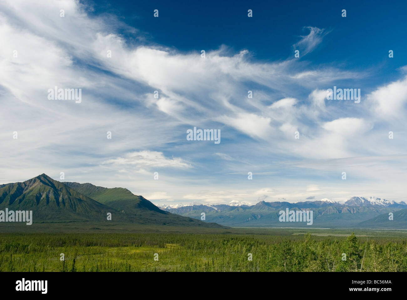 Cirruswolken über dem Kluane National Park Yukon Kanada Stockfotohttps://www.alamy.de/image-license-details/?v=1https://www.alamy.de/stockfoto-cirruswolken-uber-dem-kluane-national-park-yukon-kanada-24701274.html
RFBC56MA–Cirruswolken über dem Kluane National Park Yukon Kanada
 Fuchsschwanz Gerste Hordeum Jubatum L Stockfotohttps://www.alamy.de/image-license-details/?v=1https://www.alamy.de/stockfoto-fuchsschwanz-gerste-hordeum-jubatum-l-24701270.html
RFBC56M6–Fuchsschwanz Gerste Hordeum Jubatum L
 Blick talaufwärts Slims River, Kluane National Park Yukon Kanada Stockfotohttps://www.alamy.de/image-license-details/?v=1https://www.alamy.de/stockfoto-blick-talaufwarts-slims-river-kluane-national-park-yukon-kanada-25807454.html
RFBDYHJP–Blick talaufwärts Slims River, Kluane National Park Yukon Kanada
 Glazial-Sander Stream Kluane National Park Yukon Kanada Stockfotohttps://www.alamy.de/image-license-details/?v=1https://www.alamy.de/stockfoto-glazial-sander-stream-kluane-national-park-yukon-kanada-24701227.html
RFBC56JK–Glazial-Sander Stream Kluane National Park Yukon Kanada
 Ansicht von Kathleen Lake vom Könige Thron Berg, Kluane National Park Yukon Kanada Stockfotohttps://www.alamy.de/image-license-details/?v=1https://www.alamy.de/stockfoto-ansicht-von-kathleen-lake-vom-konige-thron-berg-kluane-national-park-yukon-kanada-25774996.html
RFBDX47G–Ansicht von Kathleen Lake vom Könige Thron Berg, Kluane National Park Yukon Kanada
 Ansicht von Kathleen Lake vom Könige Thron Berg Kluane National Park Yukon Kanada Stockfotohttps://www.alamy.de/image-license-details/?v=1https://www.alamy.de/stockfoto-ansicht-von-kathleen-lake-vom-konige-thron-berg-kluane-national-park-yukon-kanada-24701208.html
RFBC56J0–Ansicht von Kathleen Lake vom Könige Thron Berg Kluane National Park Yukon Kanada
 Wolken bei Sonnenuntergang Stockfotohttps://www.alamy.de/image-license-details/?v=1https://www.alamy.de/stockfoto-wolken-bei-sonnenuntergang-24701187.html
RFBC56H7–Wolken bei Sonnenuntergang
 Alpine Teich InTrophy Wiesen Wells Gray Provincial Park-British Columbia-Kanada Stockfotohttps://www.alamy.de/image-license-details/?v=1https://www.alamy.de/stockfoto-alpine-teich-introphy-wiesen-wells-gray-provincial-park-british-columbia-kanada-24701137.html
RFBC56FD–Alpine Teich InTrophy Wiesen Wells Gray Provincial Park-British Columbia-Kanada
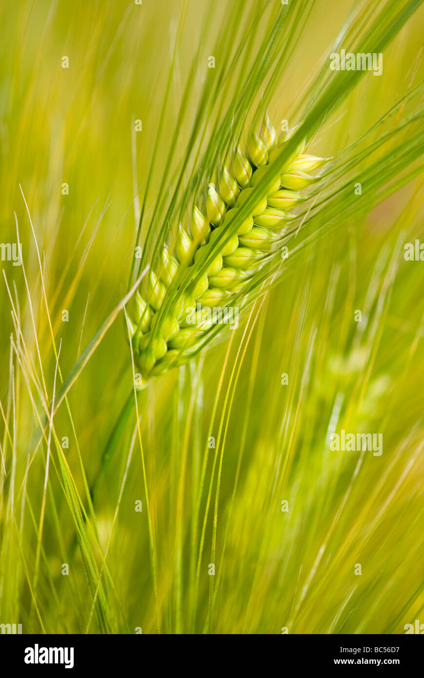 Gerste Hordeum vulgare Stockfotohttps://www.alamy.de/image-license-details/?v=1https://www.alamy.de/stockfoto-gerste-hordeum-vulgare-24701075.html
RFBC56D7–Gerste Hordeum vulgare
 Penn Cove aus Coupville Whidbey Island Washington USA Stockfotohttps://www.alamy.de/image-license-details/?v=1https://www.alamy.de/stockfoto-penn-cove-aus-coupville-whidbey-island-washington-usa-24701057.html
RFBC56CH–Penn Cove aus Coupville Whidbey Island Washington USA
 Oxeye Daisy (Chrysanthemum Leucanthemum) Stockfotohttps://www.alamy.de/image-license-details/?v=1https://www.alamy.de/stockfoto-oxeye-daisy-chrysanthemum-leucanthemum-24701047.html
RFBC56C7–Oxeye Daisy (Chrysanthemum Leucanthemum)
 Oxeye Daisy (Chrysanthemum Leucanthemum) Stockfotohttps://www.alamy.de/image-license-details/?v=1https://www.alamy.de/stockfoto-oxeye-daisy-chrysanthemum-leucanthemum-24701054.html
RFBC56CE–Oxeye Daisy (Chrysanthemum Leucanthemum)
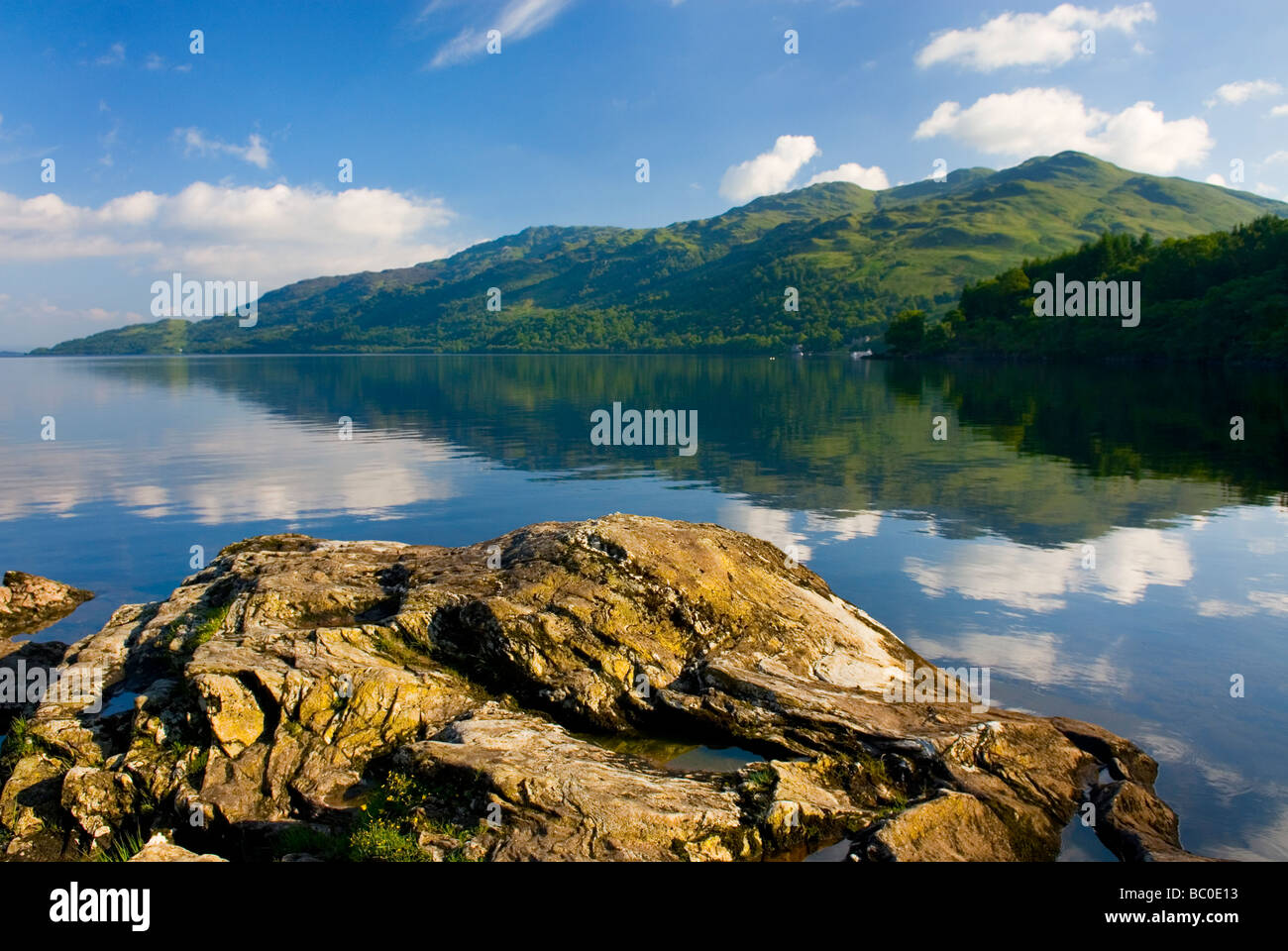 Loch Lomond, Schottland Stockfotohttps://www.alamy.de/image-license-details/?v=1https://www.alamy.de/stockfoto-loch-lomond-schottland-24597247.html
RFBC0E13–Loch Lomond, Schottland
 Wälder, entlang der Ufer von Loch Awe-Schottland Stockfotohttps://www.alamy.de/image-license-details/?v=1https://www.alamy.de/stockfoto-walder-entlang-der-ufer-von-loch-awe-schottland-24609080.html
RFBC113M–Wälder, entlang der Ufer von Loch Awe-Schottland
 Kilchurn Castle an der Spitze der Loch Awe-Schottland Stockfotohttps://www.alamy.de/image-license-details/?v=1https://www.alamy.de/stockfoto-kilchurn-castle-an-der-spitze-der-loch-awe-schottland-24597239.html
RFBC0E0R–Kilchurn Castle an der Spitze der Loch Awe-Schottland
 Kunstvolle Gärten von Dunrobin Castle Schottland Stockfotohttps://www.alamy.de/image-license-details/?v=1https://www.alamy.de/stockfoto-kunstvolle-garten-von-dunrobin-castle-schottland-24597218.html
RFBC0E02–Kunstvolle Gärten von Dunrobin Castle Schottland
 Kunstvolle Gärten von Dunrobin Castle Schottland Stockfotohttps://www.alamy.de/image-license-details/?v=1https://www.alamy.de/stockfoto-kunstvolle-garten-von-dunrobin-castle-schottland-24626305.html
RFBC1R2W–Kunstvolle Gärten von Dunrobin Castle Schottland
 Stehenden Steinen Steness eine neolithischen Stein Kreis aus 3100BC-Orkney Islands-Schottland Stockfotohttps://www.alamy.de/image-license-details/?v=1https://www.alamy.de/stockfoto-stehenden-steinen-steness-eine-neolithischen-stein-kreis-aus-3100bc-orkney-islands-schottland-24604137.html
RFBC0PR5–Stehenden Steinen Steness eine neolithischen Stein Kreis aus 3100BC-Orkney Islands-Schottland
 Sonnenuntergang am Brough von Birsay Nordküste der Orkney-Inseln Festland Schottland Stockfotohttps://www.alamy.de/image-license-details/?v=1https://www.alamy.de/stockfoto-sonnenuntergang-am-brough-von-birsay-nordkuste-der-orkney-inseln-festland-schottland-24597152.html
RFBC0DWM–Sonnenuntergang am Brough von Birsay Nordküste der Orkney-Inseln Festland Schottland
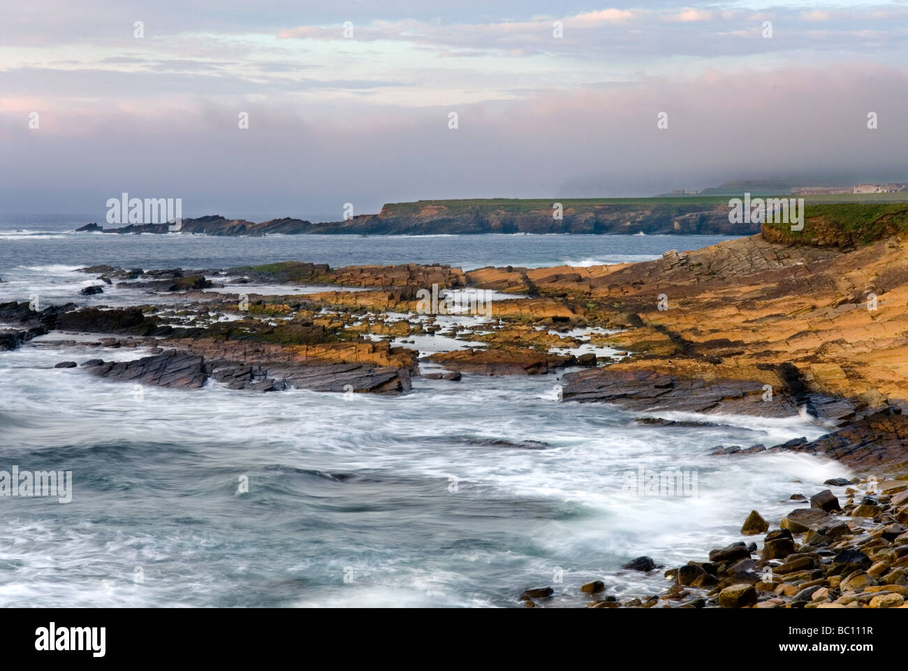 Sonnenuntergang am Brough von Birsay Nordküste der Orkney-Inseln Festland Schottland Stockfotohttps://www.alamy.de/image-license-details/?v=1https://www.alamy.de/stockfoto-sonnenuntergang-am-brough-von-birsay-nordkuste-der-orkney-inseln-festland-schottland-24609027.html
RFBC111R–Sonnenuntergang am Brough von Birsay Nordküste der Orkney-Inseln Festland Schottland